Peach Valley OHV Staging Area
Facility · Colorado ·
Managed by the Bureau of Land Management
Gunnison Gorge National Conservation Area (BLM_NCA) · Open Access
- 5,609 ft
- Elevation
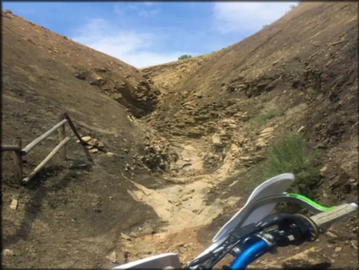
The Flat Top-Peach Valley OHV Recreation Area (9,700 acres) is managed by the Bureau of Land Management for responsible motorized recreation. The area offers 2,500+ acres of designated open play areas and over 75 miles of multiple use trails.
Open Play Area Regulations
- Off-route travel is allowed ONLY for ATVs and UTVs 50" or less (dirt bikes, mountain bikes, horses and hikers can go off-route as well). No full size vehicles are allowed off a road.
- Know the boundaries of the Open Play Areas by looking at a map at trailhead kiosks.
Other Regulations
- Outside of the Open Area, riders must stay on signed, designated trails. Riding off-trail is subject to a citation.
- Camping is allowed at the Peach Valley Staging Area for 7 days/6 nights.
- No open wood fires are allowed. Use gas stoves or the provided grills with charcoal.
- Pack out all trash!
- All OHV users must have a valid Colorado State Parks OHV sticker visibly displayed on their equipment. Registration fees support trail maintenance and funded the construction of the Skills Course at Peach Valley!
COTrex provides up-to-date trails information and georeferenced location as you explore the National Conservation Area. Download it for free at: https://trails.colorado.gov/
Report Illegal Dumping by calling: 970-240-5300.
Getting there
From Montrose: Head northwest out of town on N Townsend Ave/US-50 W approximately 9.2 miles to Falcon Rd. Turn east at Falcon Rd and follow approximately 3.8 miles where it curves slightly left into Peach Valley Rd. Continue approximately 0.7 miles to trail access.
38.59579, -107.89249 · 38°35'44.8"N 107°53'33.0"W
Typical weather
| Jan | Feb | Mar | Apr | May | Jun | Jul | Aug | Sep | Oct | Nov | Dec | |
|---|---|---|---|---|---|---|---|---|---|---|---|---|
| High °F | — | — | — | — | — | — | — | — | — | — | — | — |
| Low °F | — | — | — | — | — | — | — | — | — | — | — | — |
| Precip in | 0.6 | 0.7 | 0.7 | 0.9 | 1.1 | 0.6 | 1.1 | 1.1 | 1.3 | 1.1 | 0.7 | 0.6 |
1991–2020 averages from the nearest NOAA station, 5.1 mi away — not measured at the facility itself, and elevation can make a real difference over that distance.
Map
Fees and stay limits
OHV registration is required. Out of state visitors are required to obtain a Non-resident registration. Visitors to the Gunnison Gorge Wilderness Area will be charged the following user fees: Day Use Only (in and out the same day) = $3 per person. Day Use & Camping = $5 per person per calendar day. 1 night = $10. 2 nights = $15 (maximum allowable stay). Annual Pass for Day Use - $15 per /year. Fees apply to all users, 16 years of age and older, within the river canyon from the down-stream boundary of the Black Canyon of the Gunnison National Monument (2 miles upstream of the Chukar Put-In) down to, but not including, the Smith Fork confluence (10 miles downstream of the Chukar Put-In).
From Recreation.gov, which is not always current. The operator's own page is the authority on what you will be charged.
More photos
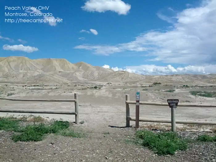
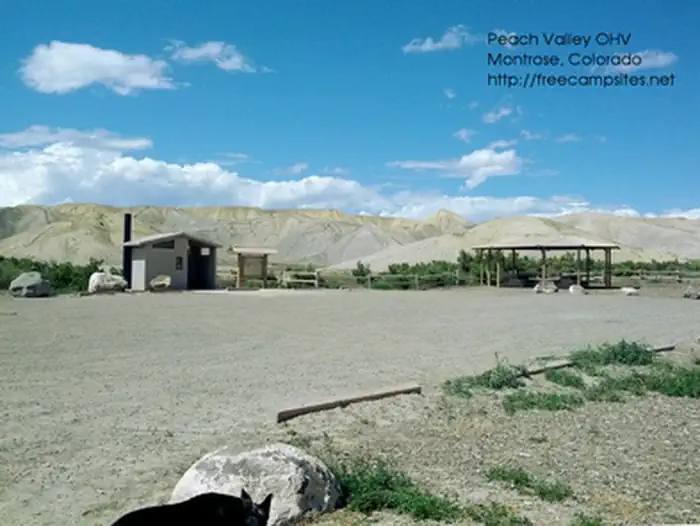
Member photos
Common questions about Peach Valley OHV Staging Area
- Can you reserve a site at Peach Valley OHV Staging Area?
- No. Peach Valley OHV Staging Area is not reservable through Recreation.gov, so sites are first-come, first-served or booked elsewhere.
Camping near Peach Valley OHV Staging Area
- Black Canyon Of The Gunnison North Rim Campground 9.9 mi · Campground · we watch it
- Black Canyon Of The Gunnison South Rim Campground 11.5 mi · Campground · we watch it
- Eagle Valley Trailhead 0.7 mi · Facility
- Bobcat Trailhead 2.6 mi · Facility
- Duncan Trailhead 3.9 mi · Facility
- Flat Top OHV Staging Area 5.5 mi · Facility
- Ute Trailhead- Gunnison Gorge 6.2 mi · Facility
- North Rim Ranger Station 10.2 mi · Visitor Center
- South Rim Visitor Center 11.5 mi · Visitor Center
- Orchard Boat Ramp 11.9 mi · Facility
- Rimrocker Trailhead 12.5 mi · Facility
- Cottonwood Grove Campground 12.8 mi · Campground
Contact
- Phone 970-240-5300
- Info Recreation.gov
Recreation.gov last updated this record on 2026-02-25.
Facility information and photographs from Recreation.gov (RIDB). SpotOpened is not affiliated with Recreation.gov or any federal agency.
Comments