Black Canyon Of The Gunnison North Rim Campground
Campground · 13 bookable sites ·
Managed by the National Park Service
Black Canyon of the Gunnison National Park (National Park) · Open Access
- 13
- Bookable sites
- 22 ft
- Max rig length
- up to 8
- People per site
- 7,757 ft
- Elevation
Overview
Official NPS North Rim Website
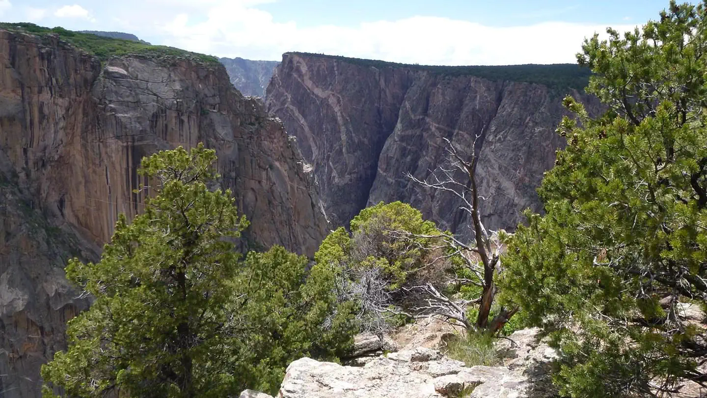
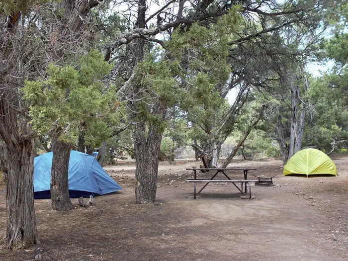
The North Rim campground is remote and has 13 sites dispersed among pinyon and juniper trees. Sites available on a first-come, first-served basis. Elevation: 7767 ft (2367.4 m). The ranger station is open intermittently in the summer and closed in the winter. In the summer, maps and newspapers are available on the ranger station porch. The ranger station also has a self-pay station for the park entrance fee and a self-registration kiosk for wilderness permits.
The facts
- 13 bookable sites
- 14 sites in total, including non-bookable
- Vehicles up to 22 ft
- Up to 8 people per site
- Loops: North Rim Campground Scan and Pay
Site types
- 13 Standard Nonelectric
- 1 Management
Amenities
- Campfires allowed
- Fire pits
- Picnic tables
- Grills
- Shade
- Pets allowed
- Water hookups — not available
Not recorded upstream: electric hookups, sewer hookups.
14 campsites at Black Canyon Of The Gunnison North Rim Campground
Check-in 01:00 PM · Check-out 11:00 AM
| Site | Loop | Type | Entry | Surface | Max rig | People | |
|---|---|---|---|---|---|---|---|
| 001 | — | Standard Nonelectric | Back In | Gravel | — | 8 | 🐾 |
| 002 | — | Standard Nonelectric | Back In | Gravel | — | 8 | 🐾 |
| 003 | — | Standard Nonelectric | Back In | Gravel | — | 8 | 🐾 |
| 004 | — | Standard Nonelectric | Back In | Gravel | — | 8 | 🐾 |
| 005 | — | Standard Nonelectric | Back In | Gravel | — | 8 | 🐾 |
| 006 | — | Standard Nonelectric | Back In | Gravel | — | 8 | 🐾 |
| 007 | — | Standard Nonelectric | Back In | Gravel | — | 8 | 🐾 |
| 008 | — | Standard Nonelectric | Back In | Gravel | — | 8 | 🐾 |
| 009 | — | Standard Nonelectric | Back In | Gravel | — | 8 | 🐾 |
| 010 | — | Standard Nonelectric | Back In | Gravel | — | 8 | 🐾 |
| 011 | — | Standard Nonelectric | Back In | Gravel | — | 8 | 🐾 |
| 012 | — | Standard Nonelectric | Back In | Gravel | — | 8 | 🐾 |
| 013 | — | Standard Nonelectric | Back In | Gravel | — | 8 | 🐾 |
| North Rim Campground Scan and Pay | North Rim Campground Scan and Pay | Management | — | Gravel | 22 ft | 8 | 🐾 |
Getting there
The North Rim is 11 miles southwest of Crawford, Colorado. From CO Highway 92, turn west on Black Canyon Road approximately 3 miles south of Crawford. Follow the road signs to the park. The last 7 miles of the park access road and the entire North Rim Drive road are unpaved gravel. Typically, the roads are in good condition and passable for most vehicles. In winter and early spring, these roads are unplowed and the North Rim is closed to vehicles.
38.58518, -107.70943 · 38°35'6.7"N 107°42'33.9"W
Typical weather
Typically 82°F in Jul, down to 36°F in Dec.
| Jan | Feb | Mar | Apr | May | Jun | Jul | Aug | Sep | Oct | Nov | Dec | |
|---|---|---|---|---|---|---|---|---|---|---|---|---|
| High °F | 37 | 40 | 49 | 56 | 66 | 76 | 82 | 81 | 72 | 60 | 47 | 36 |
| Low °F | 13 | 16 | 23 | 29 | 38 | 46 | 53 | 52 | 44 | 33 | 23 | 13 |
| Precip in | 1.7 | 1.7 | 2.0 | 1.8 | 1.6 | 0.7 | 1.6 | 1.7 | 2.1 | 1.9 | 1.5 | 1.5 |
1991–2020 averages from the nearest NOAA station, 2.4 mi away — not measured at the facility itself, and elevation can make a real difference over that distance.
Map
Fees and stay limits
All campsites at North Rim are first-come, first-served. This campground uses Scan & Pay to accept on-site payment through the Recreation.gov mobile app. Download the app ahead of your visit to arrive ready!
From Recreation.gov, which is not always current. The operator's own page is the authority on what you will be charged.
More photos
Member photos
Common questions about Black Canyon Of The Gunnison North Rim Campground
- Can you reserve a site at Black Canyon Of The Gunnison North Rim Campground?
- Yes, Black Canyon Of The Gunnison North Rim Campground is reservable through Recreation.gov.
- How many campsites does Black Canyon Of The Gunnison North Rim Campground have?
- 14 sites in total, of which 13 can be booked.
- What is the maximum RV length at Black Canyon Of The Gunnison North Rim Campground?
- 22 ft. That is the longest vehicle the sites here are recorded as taking; individual sites may be shorter.
- Are pets allowed at Black Canyon Of The Gunnison North Rim Campground?
- Yes, pets are allowed at Black Canyon Of The Gunnison North Rim Campground.
- Does Black Canyon Of The Gunnison North Rim Campground have hookups?
- No hookups are recorded here.
- Are campfires allowed at Black Canyon Of The Gunnison North Rim Campground?
- Campfires are allowed at Black Canyon Of The Gunnison North Rim Campground. Check for a current fire restriction before you go.
Camping near Black Canyon Of The Gunnison North Rim Campground
- Black Canyon Of The Gunnison South Rim Campground 2.7 mi · Campground · we watch it
- East Portal Campground 5.2 mi · Campground · we watch it
- North Rim Ranger Station 0.3 mi · Visitor Center
- South Rim Visitor Center 2.4 mi · Visitor Center
- East Portal Campground 5.2 mi · Campground
- Flat Top OHV Staging Area 9.2 mi · Facility
- Bobcat Trailhead 9.2 mi · Facility
- Eagle Valley Trailhead 9.5 mi · Facility
- Duncan Trailhead 9.6 mi · Facility
- Peach Valley OHV Staging Area 9.9 mi · Facility
- Ute Trailhead- Gunnison Gorge 10.7 mi · Facility
- Cimarron Campground 12.8 mi · Campground
Contact
- Phone 970.641.2337
- Email blca_info@nps.gov
- Book Recreation.gov
Recreation.gov last updated this record on 2026-02-25.
Facility information and photographs from Recreation.gov (RIDB). SpotOpened is not affiliated with Recreation.gov or any federal agency.
Comments