Porum Landing
Campground · Oklahoma · 47 bookable sites ·
Managed by the US Army Corps of Engineers
Cherokee Oklahoma Tribal Statistical Area (D6)
- 47
- Bookable sites
- 50 ft
- Max rig length
- up to 100
- People per site
- 3
- Accessible sites
- 691 ft
- Elevation

Overview
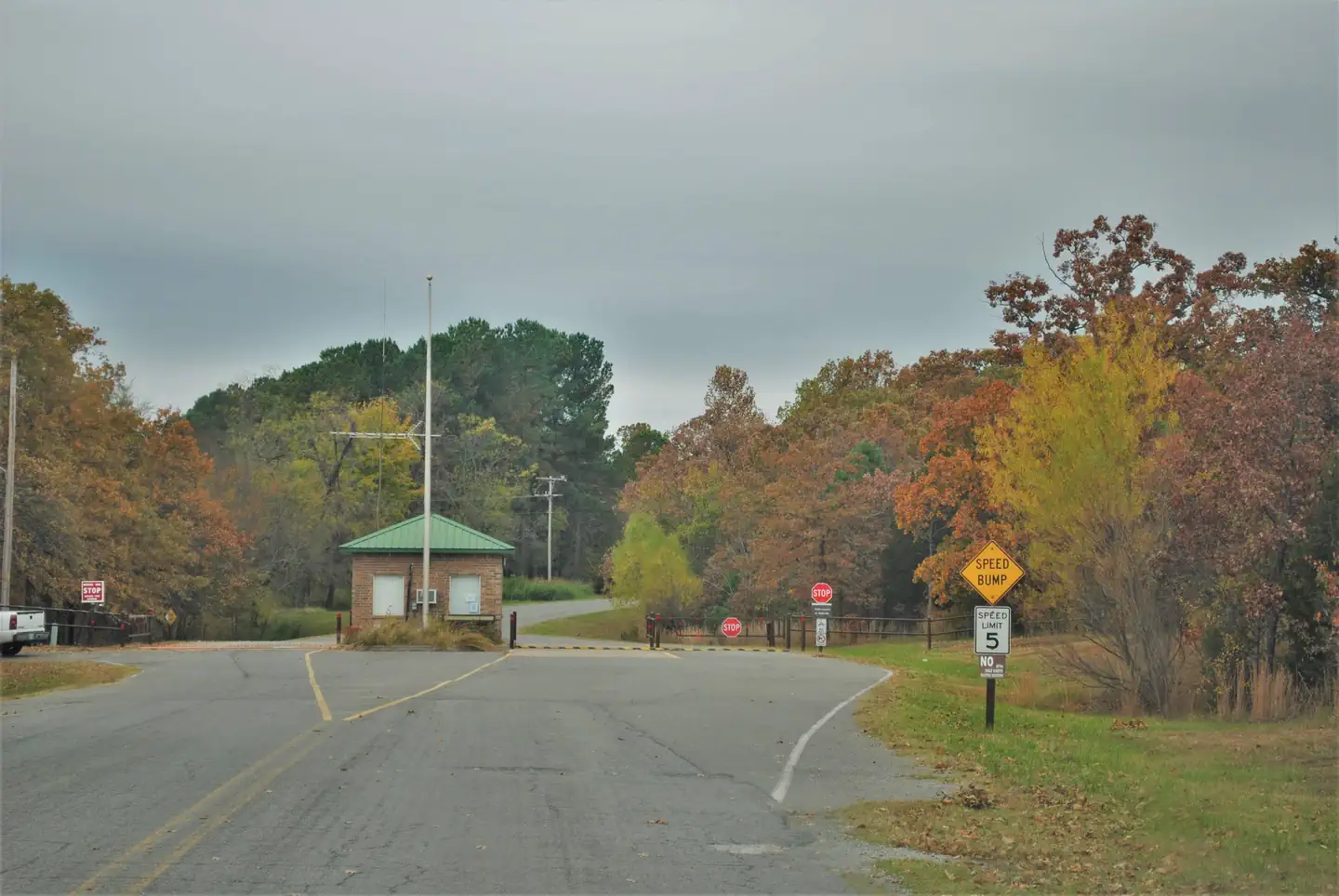
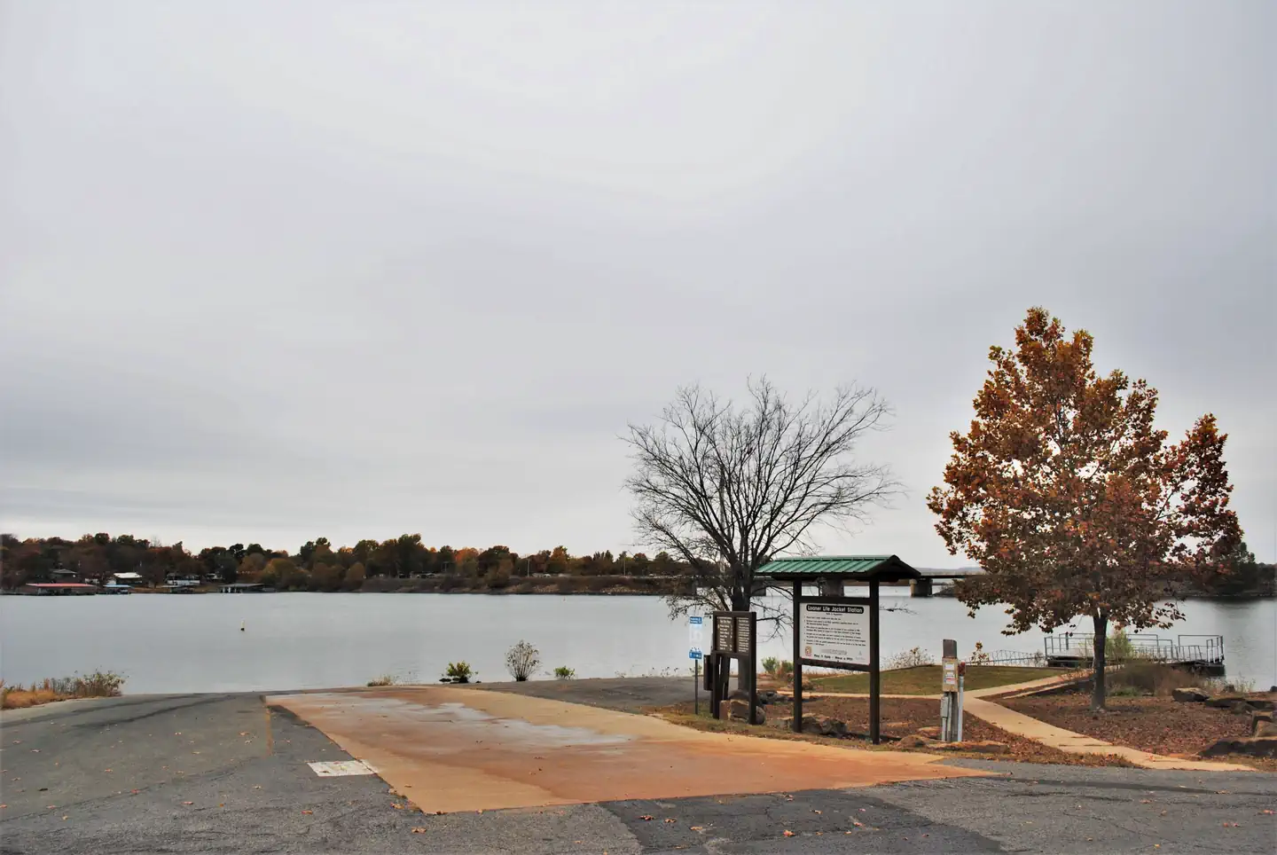
Porum Landing Campground sits along the beaches of Eufaula Lake in the green hills of Oklahoma.Recreation
Eufaula Lake has long been recognized for its outstanding fishing. Crappie, sand bass, catfish, and black bass in the lake reach record size. Below the dam, striped bass reaching over 40 pounds have been caught in the tailwaters.Boating and Kayaking are also popular activities, and a boat ramp is provided at the campground for easy lake access.
A variety of hiking trails wind throughout the hills and along the shoreline, offering additional activities for campers.
Facilities
Porum Landing Campground offers 49 campsites spread out along the lake shore, along with one large reservable group picnic shelter that can accommodate up to 100 guests. A boat ramp, playground and nearby marina help visitors enjoy the lake.Natural Features
Eufaula Lake is the largest lake located entirely in the state of Oklahoma. It is located on the Canadian River, 27 miles upstream from its confluence with the Arkansas River. The dam, completed in 1964 and dedicated by President Lyndon B. Johnson, was originally built for flood control.
With over 800 miles of shoreline and 105,000 surface acres of water, Eufaula Lake offers a variety of recreational opportunities. The shoreline ranges from vast expanses of sandy beaches to rocky bluffs, and the scenery is especially beautiful during the fall months, when visitors are treated to an array of vivid autumn colors.
Nearby Attractions
Robber's Cave State Park and two other state parks located on Eufaula Lake offer a variety of recreational experiences, including golf courses, swimming pools and hiking trails.The historic town of Eufaula offers an array of antique shops and restaurants.
The facts
- 47 bookable sites
- 50 sites in total, including non-bookable
- 1 site for day use only
- 3 accessible sites
- Vehicles up to 50 ft
- Up to 100 people per site
- Loops: PLAN
Site types
- 44 Standard Electric
- 3 Management
- 2 Standard Nonelectric
- 1 Group Shelter Electric
Amenities
- Electric hookups
- Water hookups
- Picnic tables
- Grills
- Shade
- Pets allowed
Not recorded upstream: sewer hookups, campfires allowed, fire pits.
50 campsites at Porum Landing
| Site | Loop | Type | Entry | Surface | Grade | Max rig | People | |
|---|---|---|---|---|---|---|---|---|
| 03 | PLAN | Management | Back In | Paved | — | 14 ft | 8 | 🐾 |
| 04 | PLAN | Management | Back In | Paved | — | 16 ft | 8 | 🐾 |
| 06 | PLAN | Standard Electric | Back In | Paved | — | 30 ft | 8 | 🐾 |
| 07 | PLAN | Standard Electric | Back In | Paved | — | 32 ft | 8 | 🐾 |
| 08 | PLAN | Standard Electric | Back In | Paved | — | 28 ft | 8 | 🐾 |
| 09 | PLAN | Standard Electric | Back In | Paved | — | 20 ft | 8 | 🐾 |
| 10 | PLAN | Standard Electric | Back In | Paved | — | 25 ft | 8 | 🐾 |
| 11 | PLAN | Standard Electric | Back In | Paved | — | 35 ft | 8 | 🐾 |
| 12 | PLAN | Standard Electric | Back In | Paved | Severe | 28 ft | 8 | 🐾 |
| 13 | PLAN | Standard Electric | Back In | Gravel | — | 23 ft | 8 | 🐾 |
| 14 | PLAN | Standard Electric | Pull Through | Paved | — | 35 ft | 8 | 🐾 |
| 15 | PLAN | Standard Electric | Back In | Paved | — | 25 ft | 8 | 🐾 |
| 16 | PLAN | Standard Electric | Back In | Paved | — | 40 ft | 8 | 🐾 |
| 17 | PLAN | Standard Electric | Back In | Paved | — | 18 ft | 8 | 🐾 |
| 18 | PLAN | Standard Electric | Back In | Paved | — | 25 ft | 8 | 🐾 |
| 19 | PLAN | Standard Electric | Back In | Paved | — | 25 ft | 8 | 🐾 |
| 20 | PLAN | Standard Electric | Back In | Paved | — | 33 ft | 8 | 🐾 |
| 21 | PLAN | Standard Electric | Back In | Paved | — | 20 ft | 8 | 🐾 |
| 22 | PLAN | Standard Electric | Back In | Paved | — | 35 ft | 8 | ♿ 🐾 |
| 23 | PLAN | Standard Electric | Back In | Paved | — | 20 ft | 8 | ♿ 🐾 |
| 24 | PLAN | Standard Electric | Back In | Paved | Slight | 40 ft | 8 | 🐾 |
| 25 | PLAN | Standard Electric | Back In | Paved | — | 12 ft | 8 | 🐾 |
| 26 | PLAN | Standard Electric | Back In | Paved | Severe | 12 ft | 8 | 🐾 |
| 27 | PLAN | Standard Electric | Back In | Paved | — | 18 ft | 8 | 🐾 |
| 28 | PLAN | Standard Electric | Back In | Paved | — | 12 ft | 8 | 🐾 |
| 29 | PLAN | Standard Electric | Back In | Paved | — | 23 ft | 8 | 🐾 |
| 30 | PLAN | Standard Electric | Back In | Paved | — | 22 ft | 8 | 🐾 |
| 31 | PLAN | Standard Electric | Back In | Paved | — | 20 ft | 8 | 🐾 |
| 32 | PLAN | Standard Electric | Back In | Paved | — | 20 ft | 8 | 🐾 |
| 33 | PLAN | Standard Electric | Pull Through | Paved | — | 35 ft | 8 | 🐾 |
| 34 | PLAN | Standard Electric | Back In | Paved | — | 40 ft | 8 | 🐾 |
| 35 | PLAN | Management | Back In | Paved | — | 24 ft | 8 | 🐾 |
| 36 | PLAN | Standard Electric | Back In | Paved | — | 45 ft | 8 | 🐾 |
| 37 | PLAN | Standard Electric | Back In | Paved | — | 30 ft | 8 | 🐾 |
| 38 | PLAN | Standard Electric | Back In | Paved | — | 25 ft | 8 | 🐾 |
| 39 | PLAN | Standard Electric | Back In | Paved | — | 30 ft | 8 | 🐾 |
| 40 | PLAN | Standard Electric | Back In | Paved | — | 25 ft | 8 | 🐾 |
| 41 | PLAN | Standard Electric | Back In | Paved | — | 20 ft | 8 | 🐾 |
| 42 | PLAN | Standard Nonelectric | Back In | Paved | — | — | 8 | 🐾 |
| 44 | PLAN | Standard Nonelectric | Back In | Paved | — | 50 ft | 8 | 🐾 |
| 45 | PLAN | Standard Electric | Back In | Paved | — | 35 ft | 8 | 🐾 |
| 46 | PLAN | Standard Electric | Back In | Paved | — | 18 ft | 8 | 🐾 |
| 47 | PLAN | Standard Electric | Back In | Paved | — | 25 ft | 8 | 🐾 |
| 48 | PLAN | Standard Electric | Back In | Paved | — | 20 ft | 8 | 🐾 |
| 49 | PLAN | Standard Electric | Back In | Paved | — | 22 ft | 8 | 🐾 |
| 50 | PLAN | Standard Electric | Pull Through | Paved | — | 40 ft | 8 | 🐾 |
| 51 | PLAN | Standard Electric | Back In | Paved | — | 35 ft | 8 | 🐾 |
| 52 | PLAN | Standard Electric | Back In | Paved | — | 22 ft | 8 | 🐾 |
| 53 | PLAN | Standard Electric | Back In | Paved | — | 28 ft | 8 | 🐾 |
| PS1 | PLAN | Group Shelter Electric | — | Gravel | — | 20 ft | 100 | ♿ 🐾 |
Getting there
From Porum, Oklahoma: take Texanna Road west for 7 miles, turn left after Sinclair towards Duchess Creel Marina, follow signs to campground.
From Highway 69: Travel east 13 miles on Texanna Rd. After you cross the bridge the campground is your second entrance on the right before the Sinclair gas station. Follow signs for Porum Landing campground
35.35083, -95.38306 · 35°21'3.0"N 95°22'59.0"W
Typical weather
| Jan | Feb | Mar | Apr | May | Jun | Jul | Aug | Sep | Oct | Nov | Dec | |
|---|---|---|---|---|---|---|---|---|---|---|---|---|
| High °F | — | — | — | — | — | — | — | — | — | — | — | — |
| Low °F | — | — | — | — | — | — | — | — | — | — | — | — |
| Precip in | 2.8 | 3.0 | 3.8 | 4.8 | 5.9 | 5.6 | 3.5 | 4.0 | 4.9 | 4.1 | 3.3 | 3.1 |
1991–2020 averages from the nearest NOAA station, 7.7 mi away — not measured at the facility itself, and elevation can make a real difference over that distance.
Map
More photos
Member photos
Common questions about Porum Landing
- Can you reserve a site at Porum Landing?
- Yes, Porum Landing is reservable through Recreation.gov.
- How many campsites does Porum Landing have?
- 50 sites in total, of which 47 can be booked.
- What is the maximum RV length at Porum Landing?
- 50 ft. That is the longest vehicle the sites here are recorded as taking; individual sites may be shorter.
- Are pets allowed at Porum Landing?
- Yes, pets are allowed at Porum Landing.
- Does Porum Landing have hookups?
- Electric, Water.
Camping near Porum Landing
- Ladybird Landing 4 mi · Campground · we watch it
- Brooken Cove 4.2 mi · Campground · we watch it
- Belle Starr 8.9 mi · Campground · we watch it
- Highway 9 Landing 9.8 mi · Campground · we watch it
- Gentry Creek 18.9 mi · Campground · we watch it
- Mill Creek (OK) 19 mi · Campground · we watch it
- Strayhorn Landing 25.9 mi · Campground · we watch it
- Snake Creek 30.9 mi · Campground · we watch it
- Chicken Creek 32.9 mi · Campground · we watch it
- Cookson Bend 34.2 mi · Campground · we watch it
- Dam Site (Fort Gibson Lake) 36.7 mi · Campground · we watch it
- Pettit Bay 37.1 mi · Campground · we watch it
Contact
- Phone 918-799-5843
- Book Recreation.gov
Recreation.gov last updated this record on 2026-02-25.
Facility information and photographs from Recreation.gov (RIDB). SpotOpened is not affiliated with Recreation.gov or any federal agency.
Comments