PINE FLAT PICNIC SITES - A and B
Campground · New Mexico · 2 bookable sites ·
Managed by the USDA Forest Service
Cibola National Forest (NF) · Open Access
- 2
- Bookable sites
- up to 50
- People per site
- 2
- Accessible sites
- 7,248 ft
- Elevation
Overview
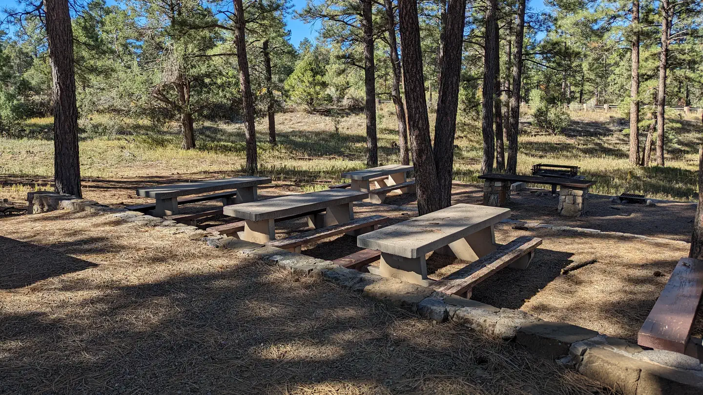
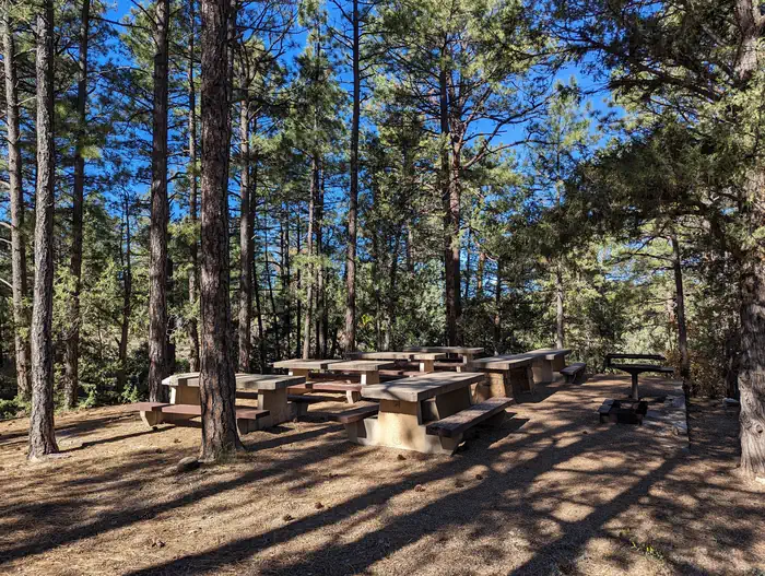
Pine Flat picnic sites A & B are accessible picnic areas. They are located on State Highway 337 (James McGrane Memorial Highway or Old South 14) approximately 7 miles from I-40. State Hwy 337 runs parallel to Pine Flat picnic area making it easy to identify and enter. From the entry way to your left you will find two reserve only sites. The area is surrounded by pinon, juniper, scrub oak and ponderosa pine that lend shade to both reservation areas. Cool mountain breezes are common here. The sound of rustling foliage render Pine Flat picnic sites an excellent place to lean back, relax and maybe even take a nap. Each site can accommodate fifty people.
Pine Flat Trailhead has pull through trailer parking in addition to regular vehicle parking, which is located to the right as you enter the gate. Follow the road south to the trailhead that leads into the Manzanita Mountains Trail system.
You will also find dispersed picnic tables throughout the Pine Flat sites, which are available on a first-come, first-served basis. Pine Flat Sites A & B were built in 1956 by the Forest Service with the intent to provide picnic sites for large group use. Please take care of your public land by using Leave No Trace ethics. There is no overnight camping at this site.
Recreation
Pine Flat connector trail leads to a multiuse motorized trail system. The trail system has loops and straightaways to satisfy just about any recreationist. For more information on OHV use, consult the District Motor Vehicle Use Map.Facilities
Please note: You must make two separate bookings for site A and B if you want to reserve both. Please verify the site you have reserved when checking out.
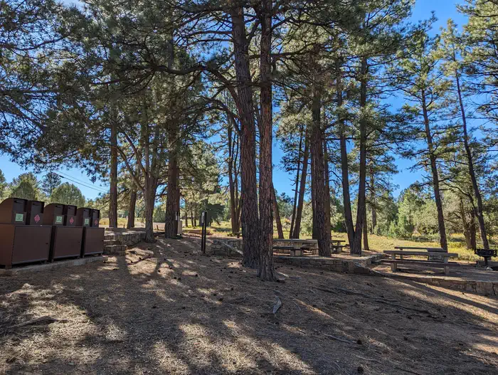
As you enter the area, to the left you will find two reserve only sites, A and B. Both sites have grills, tables, vault toilets and bear proof trash containers.
The trailering area for horse and motorcycle trailers is located to the right as you enter the gate. Follow the road south to the trailhead that leads into the Manzanita Mountains Trail system.
Dispersed picnic tables are available on a first-come, first-served basis. They are located throughout the area along the east side of the Pine Flat site.
Water and electricity, firewood/charcoal are not available at the site. Accessible vault toilets and bear proof trash receptacles are provided. Bears frequent the area; More about Bears and Food.
Have questions? (505) 281-3304.
Natural Features
Pine Flat picnic ground is 7,240 feet in elevation. It is fairly flat which makes it easy to park a trailer and unload your OHVs or horses. Hikes in the surrounding area can vary in elevation by approximately 50-120 feet.Nearby Attractions
The historic Cedro Cemetery and the town of Tijeras are about five miles from the picnic area.The facts
- 2 bookable sites
- 2 sites for day use only
- 2 accessible sites
- Up to 50 people per site
- Loops: PINE FLAT
Site types
- 2 Group Picnic Area
2 campsites at PINE FLAT PICNIC SITES - A and B
Check-in 11:00 AM · Check-out 10:00 PM
| Site | Loop | Type | Entry | Surface | Max rig | People | |
|---|---|---|---|---|---|---|---|
| 01A | PINE FLAT | Group Picnic Area | — | Paved | — | 50 | ♿ |
| 01B | PINE FLAT | Group Picnic Area | — | Paved | — | 50 | ♿ |
Getting there
35.01333, -106.33556 · 35°0'48.0"N 106°20'8.0"W
Typical weather
| Jan | Feb | Mar | Apr | May | Jun | Jul | Aug | Sep | Oct | Nov | Dec | |
|---|---|---|---|---|---|---|---|---|---|---|---|---|
| High °F | — | — | — | — | — | — | — | — | — | — | — | — |
| Low °F | — | — | — | — | — | — | — | — | — | — | — | — |
| Precip in | 0.9 | 0.8 | 1.1 | 1.0 | 1.1 | 0.8 | 3.3 | 2.5 | 1.5 | 1.6 | 1.1 | 1.6 |
1991–2020 averages from the nearest NOAA station, 1.8 mi away — not measured at the facility itself, and elevation can make a real difference over that distance.
Map
Fees and stay limits
Contact recreation.gov or 877-444-6777.
From Recreation.gov, which is not always current. The operator's own page is the authority on what you will be charged.
More photos
Member photos
Common questions about PINE FLAT PICNIC SITES - A and B
- Can you reserve a site at PINE FLAT PICNIC SITES - A and B?
- Yes, PINE FLAT PICNIC SITES - A and B is reservable through Recreation.gov.
- How many campsites does PINE FLAT PICNIC SITES - A and B have?
- 2 sites.
Camping near PINE FLAT PICNIC SITES - A and B
- Oak Yucca and Locust Group Picnic Sites 1.3 mi · Campground · we watch it
- Cedro Peak Camping Sites - Robin and Jay 1.6 mi · Campground · we watch it
- Cienega Picnic Site 11.1 mi · Campground · we watch it
- DOC LONG PICNIC SITES - A and B 11.6 mi · Campground · we watch it
- Balsam Glade Picnic Site 14.4 mi · Campground · we watch it
- Nine Mile Picnic Site 14.7 mi · Campground · we watch it
- Capulin Spring Picnic Site 14.8 mi · Campground · we watch it
- Las Huertas Picnic Site 15.9 mi · Campground · we watch it
- Capilla Peak 22 mi · Campground · we watch it
- Cedro Peak Camping Sites - Robin and Jay 2.5 mi · Campground
- Tajique Campground 16.4 mi · Campground
- Enchantment Pass- Cibola NF & NG 18.2 mi · Activity pass
Contact
- Phone 505-281-3304
- Book Recreation.gov
Recreation.gov last updated this record on 2026-02-25.
Facility information and photographs from Recreation.gov (RIDB). SpotOpened is not affiliated with Recreation.gov or any federal agency.
Comments