Oak Yucca and Locust Group Picnic Sites
Campground · New Mexico · 3 bookable sites ·
Managed by the USDA Forest Service
Cibola National Forest (NF) · Open Access
- 3
- Bookable sites
- up to 500
- People per site
- 3
- Accessible sites
- 7,678 ft
- Elevation
Overview
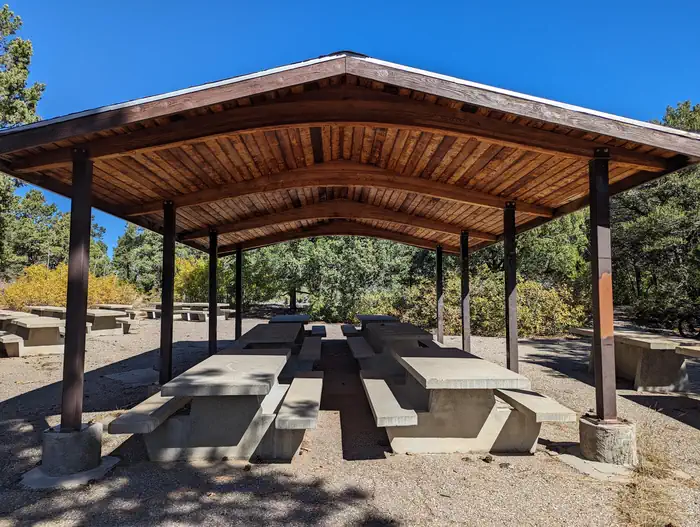
The Oak Flat Group picnic site includes a combination of three different picnic sites and a trailhead, that border four communal playing fields suitable for all sorts of outdoor games. The site is paved and accessible. It is a great place for play, rest and recreation. The picnic sites are surrounded by ponderosa pine forest, mixed with oak, pinon, juniper, and plenty of yucca plants -- New Mexico's state flower. You can look at the day use map, to choose your reserved picnic site, by clicking on the tab above this overview. There is no overnight camping at this site. The sheltered sites are replicas of the mid-1930s Civilian Conservation Corps design. The Civilian Conservation Corps (CCC) has a rich history and lasting presence throughout the Sandias and Manzanitas. In their honor, we ask that you take extra care to leave no trace when you visit.
The three picnic areas are available for reservation Friday through Sunday.
Recreation
There are four large, shared playing fields perfect for outdoor activities. Want to hike? Oak Flat Trailhead leads into a widespread, multiuser trail system shared by mountain bikers, hikers, horseback riders and dirt bikes. The parking lot is small, but is able to accommodate small trailers for horses and motorcycles. However, we suggest horseback riders use the Pine Flat picnic site for trailering. It is located on State Hwy 337. The trail from Pine Flat connects to the Oak Flat site trail system, has larger trailering parking slots and is a shorter drive from I-40 and Historic Route 66/333. Pine Flat also has two reservation sites for picnicking.If you stay into the evening, the stars will dazzle you. Once a month from May to September, the Albuquerque Astronomical Association has a STAR PARTY. You can find the link to info, in the Know Before You Go section.
Facilities
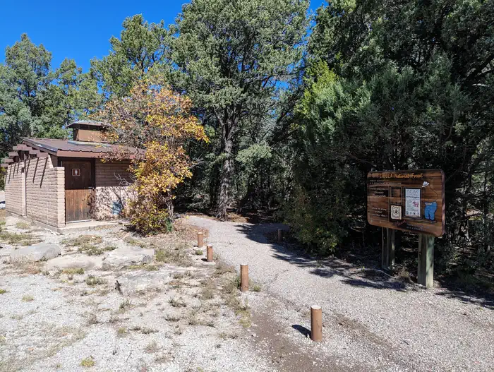
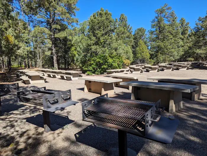
The Oak Flat Group picnic site features three picnic sites and a trailhead. The trailhead connects to an extensive trail system plus four big playing fields. -Oak Flat- Oak Picnic site is the largest of the three sites in the Oak Flat Picnic Loop. It has a huge paved area with enough tables and grills to handle 1 to 500 people. -Locust Picnic site has a shelter and can handle 1-125 people. -Yucca Picnic site has a shelter and can accommodate 1-60 people. -Oak Flat Trailhead is located past Locust picnic site, which is to your left when you enter the Oak, Yucca and Locust Group Picnic Site. Water and electricity, firewood/charcoal are not available at these sites. Accessible vault toilets and bear proof trash receptacles are provided. More about Bears and FoodNatural Features
The Oak Flat Group picnic site is just that. It is 7,660 feet above sea level, and as flat as a pancake. The Oak Flat Trailhead leads to a trail system with a variance in elevation of 50-200 feet as the trails amble through the forest. You can find a link to the Manzanita Mountain Trail map in the Know Before You Go section.Nearby Attractions
The Manzanita trail system is second to none. See map links in Know Before You Go.The facts
- 3 bookable sites
- 3 sites for day use only
- 3 accessible sites
- Up to 500 people per site
- Loops: LOCU, OAKL, YUCA
Site types
- 3 Group Picnic Area
3 campsites at Oak Yucca and Locust Group Picnic Sites
Check-in 11:00 AM · Check-out 10:00 PM
| Site | Loop | Type | Entry | Surface | Max rig | People | |
|---|---|---|---|---|---|---|---|
| 001LOC | LOCU | Group Picnic Area | — | — | — | 125 | ♿ |
| 001OAK | OAKL | Group Picnic Area | — | — | — | 500 | ♿ |
| 001YUC | YUCA | Group Picnic Area | — | Paved | — | 60 | ♿ |
Getting there
34.99889, -106.32000 · 34°59'56.0"N 106°19'12.0"W
Typical weather
| Jan | Feb | Mar | Apr | May | Jun | Jul | Aug | Sep | Oct | Nov | Dec | |
|---|---|---|---|---|---|---|---|---|---|---|---|---|
| High °F | — | — | — | — | — | — | — | — | — | — | — | — |
| Low °F | — | — | — | — | — | — | — | — | — | — | — | — |
| Precip in | 0.9 | 0.8 | 1.1 | 1.0 | 1.1 | 0.8 | 3.3 | 2.5 | 1.5 | 1.6 | 1.1 | 1.6 |
1991–2020 averages from the nearest NOAA station, 1.5 mi away — not measured at the facility itself, and elevation can make a real difference over that distance.
Map
Fees and stay limits
Contact recreation.gov or 877-444-6777
From Recreation.gov, which is not always current. The operator's own page is the authority on what you will be charged.
More photos
Member photos
Common questions about Oak Yucca and Locust Group Picnic Sites
- Can you reserve a site at Oak Yucca and Locust Group Picnic Sites?
- Yes, Oak Yucca and Locust Group Picnic Sites is reservable through Recreation.gov.
- How many campsites does Oak Yucca and Locust Group Picnic Sites have?
- 3 sites.
Camping near Oak Yucca and Locust Group Picnic Sites
- PINE FLAT PICNIC SITES - A and B 1.3 mi · Campground · we watch it
- Cedro Peak Camping Sites - Robin and Jay 2.9 mi · Campground · we watch it
- Cienega Picnic Site 12.3 mi · Campground · we watch it
- DOC LONG PICNIC SITES - A and B 12.8 mi · Campground · we watch it
- Balsam Glade Picnic Site 15.6 mi · Campground · we watch it
- Nine Mile Picnic Site 16 mi · Campground · we watch it
- Capulin Spring Picnic Site 16 mi · Campground · we watch it
- Las Huertas Picnic Site 17.1 mi · Campground · we watch it
- Capilla Peak 21.2 mi · Campground · we watch it
- Cedro Peak Camping Sites - Robin and Jay 3.8 mi · Campground
- Tajique Campground 15.3 mi · Campground
- Enchantment Pass- Cibola NF & NG 19.5 mi · Activity pass
Contact
- Phone 505-281-3304
- Book Recreation.gov
Recreation.gov last updated this record on 2026-02-25.
Facility information and photographs from Recreation.gov (RIDB). SpotOpened is not affiliated with Recreation.gov or any federal agency.
Comments