Moutardier Day Use
Campground · Kentucky · 1 bookable site ·
Managed by the US Army Corps of Engineers
Nolin Rv Recreation Area (Recreation Area) · Open Access
- 1
- Bookable site
- up to 80
- People per site
- 541 ft
- Elevation
Overview
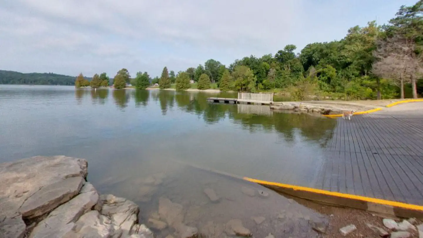
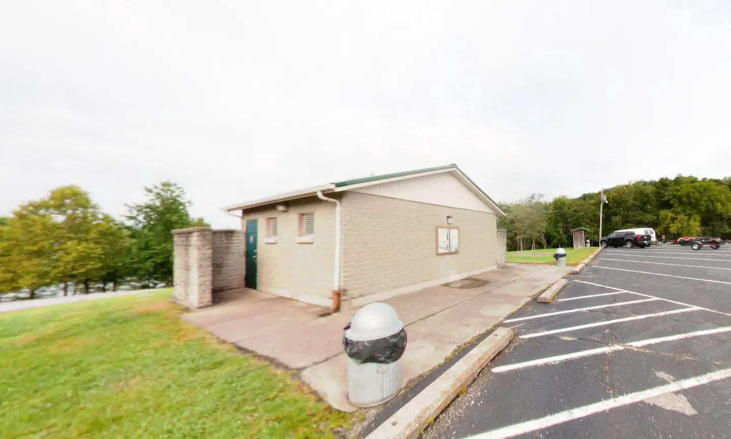
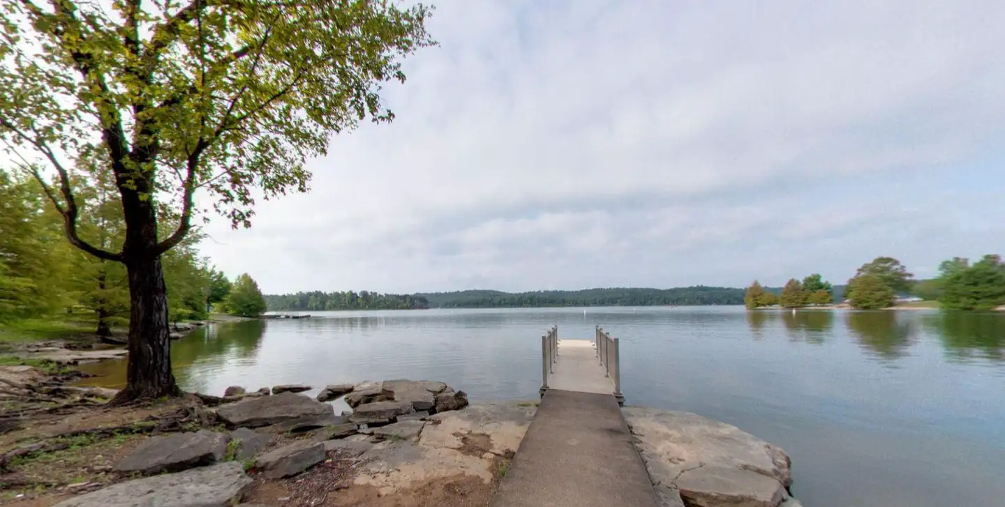
Moutardier Day Use area is located adjacent to Moutardier Campground and Moutardier Marina on Nolin River Lake. The Day use area has restrooms, playgrounds, picnic tables, boat ramp, courtesy docks, fishing piers, and a reservable group shelter.
Recreation
Known for its unique blue/green water, Nolin Lake is one of the top lakes in Kentucky for catfish, bass, crappie and walleye fishing.
Visitors can enjoy scenic canoe and boat trips along the river, part of which is located within Mammoth Cave National Park. Boat ramps are provided around the lake for campers' convenience.
The Moutardier, Ponderosa and Wax Marinas are located around the lake and offer pontoon and john boat rentals, as well as boat slips and groceries, bait, gas and more.
Several hiking trails also wind along the shoreline and into the surrounding forest. Shady Creek Trail, located in the Moutardier Recreation Area, is known for its array of wildflowers and greenery.
Natural Features
Nolin Dam creates a 5,795-acre lake that draws more than two million visitors each year to enjoy water sports and camping in the surrounding expanse of rolling forest.
Contact Info
For facility specific information, please call (270) 286-4511.The facts
- 1 bookable site
- 1 site for day use only
- Up to 80 people per site
Site types
- 1 Group Shelter Electric
Amenities
- Electric hookups
- Water hookups
- Picnic tables
- Grills
- Pets allowed
Not recorded upstream: sewer hookups, campfires allowed, fire pits, shade.
1 campsite at Moutardier Day Use
Check-in 06:00 AM · Check-out 10:00 PM
| Site | Loop | Type | Entry | Surface | Water | Max rig | People | |
|---|---|---|---|---|---|---|---|---|
| Moutardier Shelter | — | Group Shelter Electric | — | Paved | Lakefront | — | 80 | 🐾 |
Getting there
From Bowling Green, KY
Follow US 31W North from Bowling Green for approximately 14 miles then turn left onto KY 101. In appriximately 6 miles, Hwy 101 becomes Hwy 259 North. Follow Hwy259 North for 16 miles before turning right on KY 2067. Drive approximately 2 miles and you'll see signs for the Moutardier. Go past Moutardier Campground. Total driving distance from Bowling Green is about 37 miles; driving time is around 55 minutes.
From Louisville, KY
Take I-65 south from Louisville for approximately 45 miles. Take exit 91, Follow WK Pkwy for 29 miles to exit 107(Hwy 259) Follow 259 South for 12 miles. Turn left on KY 2067. Drive approximately 2 miles and you'll see signs for the Moutardier. Go past Moutardier Campground. Total dricing distance from Louisville is about 88 miles; driving time is around 1 hour and 40 minutes.
From Nashville, TN
Take I65 North for approximately 66 miles. Merge onto KY 446 via exit 28 (towards Hwy 31W) Follow 31W North for approximately 10 miles, then turn left on KY 101. In appriximately 6 miles, Hwy 101 becomes Hwy 259 North. Follow Hwy259 North for 16 miles before turning right on KY 2067. Drive approximately 2 miles and you'll see signs for the Moutardier. Go past Moutardier Campground. Total driving distance from Nashville is about 100 miles; driving time is around 1 hour, 45 minutes.
37.31440, -86.22846 · 37°18'51.8"N 86°13'42.5"W
Typical weather
Typically 91°F in Jul, down to 46°F in Jan.
| Jan | Feb | Mar | Apr | May | Jun | Jul | Aug | Sep | Oct | Nov | Dec | |
|---|---|---|---|---|---|---|---|---|---|---|---|---|
| High °F | 46 | 51 | 60 | 71 | 79 | 88 | 91 | 91 | 85 | 73 | 60 | 50 |
| Low °F | 24 | 26 | 33 | 42 | 52 | 61 | 64 | 63 | 56 | 44 | 34 | 28 |
| Precip in | 4.1 | 4.3 | 5.0 | 5.1 | 5.6 | 4.9 | 4.6 | 3.5 | 3.9 | 3.9 | 4.0 | 5.1 |
1991–2020 averages from the nearest NOAA station, 2.6 mi away — not measured at the facility itself, and elevation can make a real difference over that distance.
Map
More photos
Member photos
Common questions about Moutardier Day Use
- Can you reserve a site at Moutardier Day Use?
- Yes, Moutardier Day Use is reservable through Recreation.gov.
- How many campsites does Moutardier Day Use have?
- 1 site.
- Are pets allowed at Moutardier Day Use?
- Yes, pets are allowed at Moutardier Day Use.
- Does Moutardier Day Use have hookups?
- Electric, Water.
Camping near Moutardier Day Use
- Moutardier 0.3 mi · Campground · we watch it
- Tailwater Day Use (Nolin River Lake) 3 mi · Campground · we watch it
- Dog Creek Day Use (KY) 5.3 mi · Campground · we watch it
- Dog Creek (Ky) 5.5 mi · Campground · we watch it
- Maple Springs 9.1 mi · Campground · we watch it
- Mammoth Picnic Shelters 10 mi · Campground · we watch it
- Mammoth Cave National Park presents Teddy Abrams and the Louisville Orchestra with special guest Yo-Yo Ma 11.2 mi · Tickets · we watch it
- Mammoth Cave National Park Floyd Collins History Tour 11.2 mi · Tickets · we watch it
- Mammoth Cave National Park Tours 11.2 mi · Tickets · we watch it
- Mammoth Cave Campground 11.4 mi · Campground · we watch it
- Wax 5.8 mi · Campground
- Mammoth Cave Visitor Center 11.2 mi · Facility
Contact
- Phone 270-286-4511
- Email lrl-pagemaster-grn@usace.army.mil
- Book Recreation.gov
Recreation.gov last updated this record on 2026-02-25.
Facility information and photographs from Recreation.gov (RIDB). SpotOpened is not affiliated with Recreation.gov or any federal agency.
Comments