North Fork Primitive Camp
Facility · California ·
Managed by the Bureau of Land Management
Merced River Area of Critical Environmental Concern (Sierra) · Open Access
- 948 ft
- Elevation
Remember your OUTDOOR ETHICS when enjoying your public lands. Please RECREATE RESPONSIBLY.
Overview
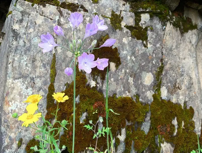
The North Fork Merced River joins the main stem Merced River 7 miles downstream from Briceburg. This is a lovely stream that is perfect for swimming in the early summer when the main Merced is too high. Springtime comes early around here (late February — April) and the wildflowers on the slopes of the North Fork Merced can be spectacular. There is a beautiful cascade about 3/4 of a mile upstream from the confluence that makes a great destination for a cool dip on a hot day.
Although most people explore the North Fork as a day outing, it makes a great short or introductory backpacking adventure. The North Fork Merced is approximately a one-hour (2.5 mile) walk from the Railroad Flat campground along the old Yosemite Valley Railroad Grade (also known as the Merced River Trail). Access is by trail or river only. Bring plenty of water or, better yet, pack a water filter.
Permits, Fees and Limitations:
Campfire permits are required for all fires. Fire restrictions that prohibit all fires go into effect each summer (exact dates unknown). Please check for current conditions at: BLM California Fire Restrictions webpage. No overnight permit is required. Please follow Leave No Trace practices. Pack it in, pack it out. No glass bottles allowed within 1/4 mile of the Merced River.
Please Note: The old Yosemite railroad grade is accessible by vehicles up to the Railroad Flat Campground. Only equestrian, pedestrians, and bicycles are permitted beyond the Railroad Flat Campground.
Helpful Links:
- River flow is posted on-line at: www.dreamflows.com
- Back To: Merced River Recreation Management Area
- Visit: Briceburg Visitor Center
- Return To: BLM, Mother Lode Field Office
Getting there
The North Fork Merced is located seven (7) miles downstream from the Briceburg Visitor Center where it joins the Merced Wild & Scenic River. It can be accessed by trail or river only.
37.61342, -120.05697 · 37°36'48.3"N 120°3'25.1"W
Typical weather
| Jan | Feb | Mar | Apr | May | Jun | Jul | Aug | Sep | Oct | Nov | Dec | |
|---|---|---|---|---|---|---|---|---|---|---|---|---|
| High °F | — | — | — | — | — | — | — | — | — | — | — | — |
| Low °F | — | — | — | — | — | — | — | — | — | — | — | — |
| Precip in | 6.0 | 5.6 | 5.6 | 2.5 | 1.8 | 0.3 | 0.1 | 0.0 | 0.3 | 1.4 | 3.0 | 6.0 |
1991–2020 averages from the nearest NOAA station, 6.4 mi away — not measured at the facility itself, and elevation can make a real difference over that distance.
Map
Member photos
Common questions about North Fork Primitive Camp
- Can you reserve a site at North Fork Primitive Camp?
- No. North Fork Primitive Camp is not reservable through Recreation.gov, so sites are first-come, first-served or booked elsewhere.
Camping near North Fork Primitive Camp
- Railroad Flat Campground 2.1 mi · Campground · we watch it
- Willow Placer Campground 2.6 mi · Campground · we watch it
- McCabe Flat Campground 3.1 mi · Campground · we watch it
- Dirt Flat 12.5 mi · Campground · we watch it
- Dry Gulch 12.7 mi · Campground · we watch it
- Pines Group Stanislaus 14.3 mi · Campground · we watch it
- Pines Stanislaus 14.3 mi · Campground · we watch it
- Cable Rock Day Use Site 4 mi · Facility
- Briceburg Put-in 5 mi · Facility
- Briceburg Visitor Center 5 mi · Facility
- Jerseydale Campground 12.8 mi · Campground
- Pines Campground 14.3 mi · Campground
Contact
- Phone BLM Mother Lode Field Office: (916) 941-3101 or Briceburg Visitor Center: (209) 379-9414
- Email BLM_CA_Web_ML@blm.gov
- Info Recreation.gov
Recreation.gov last updated this record on 2026-02-25.
Facility information and photographs from Recreation.gov (RIDB). SpotOpened is not affiliated with Recreation.gov or any federal agency.
Comments