Cable Rock Day Use Site
Facility · California ·
Managed by the Bureau of Land Management
Merced River Area of Critical Environmental Concern (Sierra) · Open Access
- 1,140 ft
- Elevation
Remember your OUTDOOR ETHICS when enjoying your public lands. Please RECREATE RESPONSIBLY.
Overview
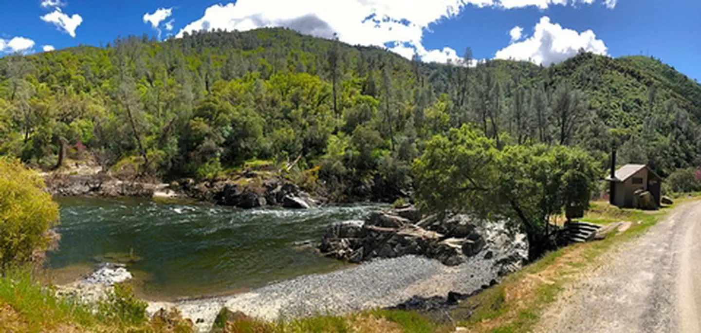
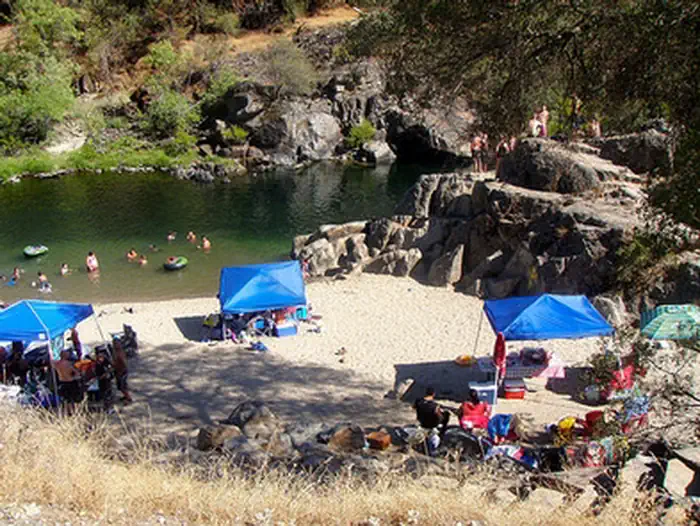
Within the BLM, Merced River Recreation Management Area you may also enjoy Cable Rock Day Use Site. Located 1.4 miles downstream from the Briceburg Visitor Center along the Wild & Scenic Merced River. This day use area is a very popular swimming hole! Summer weekends can be crowded, so come early to set-up for the day. There is no shade on the beach and summer temperatures are well over 100 degrees so bring a shade device if you plan on hanging out very long.
Swimming is the most popular activity here. There is a jumping rock for adventurous swimmers. The beach may consist of sand or cobbles depending on how the un-damned Wild & Scenic Merced River has left the site on a particular year. Fishing is also popular here and can be good mid-week and during non-summer time frames. Gold panning is popular all along the Merced River including here at Cable Rock.
Facilities:
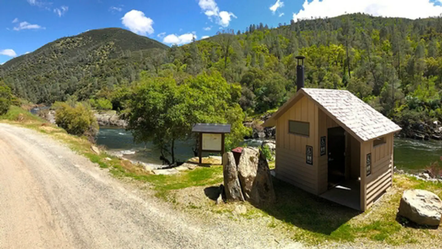
This site has a vault toilet, information kiosk, trash and recycling containers. Stone steps down to the beach. Parallel parking is available along the Briceburg River Road.
What you need to know:
Camping and campfires are not allowed anytime. Charcoal BBQ's are not allowed. It is best to bring your own propane BBQ or stove for cooking any time of year.
WARNING:
No lifeguard on duty. Drownings have originated from this site! Swimming is dangerous any time of year, but especially during spring and early summer. The Merced River is un-damned and the flow changes dramatically from year to year and season to season. Please wear a life jacket. SWIMMING IS ONLY RECOMMENDED BELOW 700 CFS.
Helpful Links:
- River flow is posted on-line at: www.dreamflows.com
- Back To: Merced River Recreation Management Area
- Visit: Briceburg Visitor Center
- Return To: BLM, Mother Lode Field Office
LM Mother Lode Field Office: (916) 941-3101 or Briceburg Visitor Center: (209) 379-9414
Getting there
37.59429, -119.98800 · 37°35'39.4"N 119°59'16.8"W
Typical weather
| Jan | Feb | Mar | Apr | May | Jun | Jul | Aug | Sep | Oct | Nov | Dec | |
|---|---|---|---|---|---|---|---|---|---|---|---|---|
| High °F | — | — | — | — | — | — | — | — | — | — | — | — |
| Low °F | — | — | — | — | — | — | — | — | — | — | — | — |
| Precip in | 6.0 | 5.6 | 5.6 | 2.5 | 1.8 | 0.3 | 0.1 | 0.0 | 0.3 | 1.4 | 3.0 | 6.0 |
1991–2020 averages from the nearest NOAA station, 3.8 mi away — not measured at the facility itself, and elevation can make a real difference over that distance.
Map
More photos
Member photos
Common questions about Cable Rock Day Use Site
- Can you reserve a site at Cable Rock Day Use Site?
- No. Cable Rock Day Use Site is not reservable through Recreation.gov, so sites are first-come, first-served or booked elsewhere.
Camping near Cable Rock Day Use Site
- McCabe Flat Campground 0.9 mi · Campground · we watch it
- Willow Placer Campground 1.6 mi · Campground · we watch it
- Railroad Flat Campground 2.4 mi · Campground · we watch it
- Dirt Flat 9.6 mi · Campground · we watch it
- Dry Gulch 9.9 mi · Campground · we watch it
- Crane Flat Campground 14.1 mi · Campground · we watch it
- Hodgdon Meadow Campground 15.6 mi · Campground · we watch it
- Briceburg Visitor Center 1.4 mi · Facility
- Briceburg Put-in 1.4 mi · Facility
- North Fork Primitive Camp 4 mi · Facility
- Jerseydale Campground 8.8 mi · Campground
- Big Oak Flat Information Station 15.5 mi · Visitor Center
Contact
- Phone (209) 379-9414
- Email BLM_CA_Web_ML@blm.gov
- Info Recreation.gov
Recreation.gov last updated this record on 2026-02-25.
Facility information and photographs from Recreation.gov (RIDB). SpotOpened is not affiliated with Recreation.gov or any federal agency.
Comments