Half Dome Permits
Permit · California ·
Managed by the National Park Service
Yosemite Wilderness Area (Wilderness Area) · Restricted Access
- 7,988 ft
- Elevation
Overview:
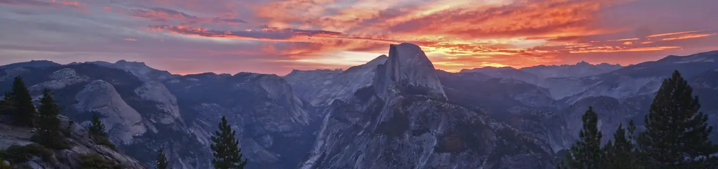
Rising nearly 5,000 feet above Yosemite Valley and 8,800 feet above sea level, Half Dome is a Yosemite icon and a great challenge to many hikers. Despite an 1865 report declaring it was "perfectly inaccessible, being probably the only one of the prominent points about the Yosemite which never has been, and never will be, trodden by human foot," George Anderson reached the summit in 1875, and in the process created the predecessor for today's cable route.Today, thousands of people reach the summit. For most, it is an exciting, arduous hike; for a few, it becomes more adventure than they bargained for. Every summer park rangers must assist hundreds of people on the Half Dome trail.
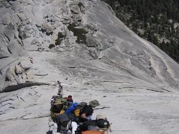
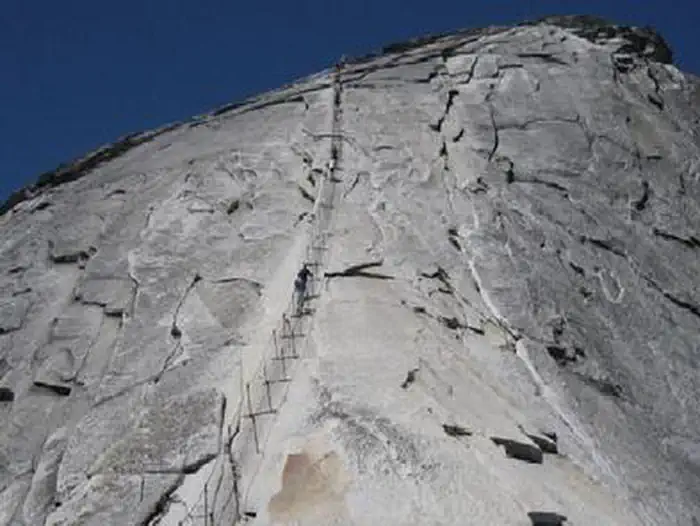
The most famous--or infamous--part of the hike is the ascent up the cables. The two metal cables allow hikers to climb the last 400 feet to the summit without rock climbing equipment. Since 1919, relatively few people have fallen and died on the cables. However, injuries are not uncommon for those acting irresponsibly.
The 14 to 16-mile round-trip hike to Half Dome is not for the out of shape or unprepared visitor. Hikers gain an elevation of 4,800 feet on their way to the top of Half Dome, but the reward is worth the effort. Along the way, you'll encounter outstanding views of Vernal and Nevada Falls, Liberty Cap, Half Dome, and - from the subdome and summit - panoramic views of Yosemite Valley and the High Sierra.
It takes most people 10 to 12 hours to hike to Half Dome and back. If you plan on hiking during the day, it's smart to leave before or at sunrise, with a non-negotiable turn-around time. Check sunrise and sunset times before you embark on your hike, and always bring a flashlight or headlamp with good batteries. Although the trail is well marked, you should be prepared with a good topographic map and compass, with the ability to use them.
Much of the hike to Half Dome is an unpredictable adventure into Wilderness, but preparation is paramount. Use the links in the Know Before You Go section and Information from associated websites (on the right-hand-side of the page), for tips to help reduce your risk of injury.
The Half Dome Cables are put up each spring and taken down each fall. Traditionally, the first day the cables are up is the Friday before Memorial Day, and the last day the cables are up is the Tuesday after Columbus Day. Environment conditions dictate the actual date the cables are put up, maintained, and taken down for the season.
A permit is required to ascend the subdome steps and Half Dome Cables. Permits are distributed through two lottery processes. A preseason lottery held during the month of March allows hikers the opportunity to plan their trip well in advance. Results of the preseason lottery are announced mid-April. Approximately 225 permits are available each day through the preseason lottery.
Daily lotteries are held throughout the Half Dome hiking season. These lotteries are run two days prior to any day that the cables are up. The results of the lottery are announced the following day. The application period for each daily lottery is from midnight to 1 pm Pacific time. Approximately 50 permits will be available each day. The actual number of permits available during a daily lottery varies due to the preseason lottery results and cancellations.
A person may apply as a trip leader only once per lottery. People applying multiple times as trip leader will have all their lottery applications cancelled. For the preseason lottery, each application allows for up to seven date choices. The maximum group size for a permit application is 6. The person applying is the designated trip leader, and they may identify a single alternate trip leader. For a group to pass beyond the Subdome Check Point, the trip leader or alternate trip leader must be present with government issued photo identification and a copy of the permit.
Getting there
From Wawona to Curry Village Parking
Drive time: 45 minutes
Total distance: 27 miles
Directions:
Follow the Wawona Rd (CA 41 North) to Yosemite Valley.
Continue right onto Southside Drive (one way road) to Curry Village.
Take the first right on to Yosemite National Park Rd into Curry Village and follow signs to guest parking.
From El Portal to Curry Village Parking
Drive time: 35 minutes
Total distance: 17 miles
Directions:
Take CA 140 east into Yosemite Valley.
Turn right over bridge onto Southside Drive.
Follow Southside Drive (one way road) to Curry Village.
Take the first right on to Yosemite National Park Rd into Curry Village and follow signs to guest parking.
From Big Oak Flat Entrance to Curry Village Parking
Drive time: 40 minutes
Total distance: 25 miles
Directions:
Follow the Big Oak Flat Rd (CA 120 E) to CA 140 junction.
Turn left onto CA 140 to Yosemite Valley.
Turn right over bridge onto Southside Drive.
Follow Southside Drive (one way road) to Curry Village.
Take the first right on to Yosemite National Park Rd into Curry Village and follow signs to guest parking.
From Tuolumne Meadows to Curry Village Parking (SUMMER ONLY)
Drive time: 1 hour and 30 minutes
Total distance: 55 miles
Directions:
Follow the Tioga Rd (CA 120) West to the Big Oak Flat Rd.
Turn left onto the Big Oak Flat Rd.
Follow the Big Oak Flat Rd to CA 140 junction.
Turn left onto CA 140 to Yosemite Valley.
Turn right over bridge onto Southside Drive.
Follow Southside Drive (one way road) to Curry Village.
Take the first right on to Yosemite National Park Rd into Curry Village and follow signs to guest parking.
37.74833, -119.52750 · 37°44'54.0"N 119°31'39.0"W
Typical weather
Typically 89°F in Jul, down to 46°F in Dec.
| Jan | Feb | Mar | Apr | May | Jun | Jul | Aug | Sep | Oct | Nov | Dec | |
|---|---|---|---|---|---|---|---|---|---|---|---|---|
| High °F | 48 | 51 | 57 | 63 | 71 | 81 | 89 | 89 | 83 | 71 | 56 | 46 |
| Low °F | 29 | 30 | 34 | 38 | 45 | 51 | 57 | 57 | 51 | 41 | 33 | 28 |
| Precip in | 7.0 | 6.5 | 5.5 | 3.2 | 1.9 | 0.5 | 0.3 | 0.2 | 0.4 | 1.6 | 4.0 | 5.6 |
1991–2020 averages from the nearest NOAA station, 3.4 mi away — not measured at the facility itself, and elevation can make a real difference over that distance.
Map
Ways in
Showing 1 of 1.
- Half Dome Cables — Entry Point · Yosemite Wilderness
More photos
Member photos
Common questions about Half Dome Permits
- Can you reserve a site at Half Dome Permits?
- Yes, Half Dome Permits is reservable through Recreation.gov.
Camping near Half Dome Permits
- Upper Pines Campground 2.1 mi · Campground · we watch it
- North Pines Campground 2.1 mi · Campground · we watch it
- Lower Pines Campground 2.2 mi · Campground · we watch it
- Camp 4 4.2 mi · Campground · we watch it
- Porcupine Flat Campground 4.6 mi · Campground · we watch it
- Yosemite Creek Campground 6.6 mi · Campground · we watch it
- Bridalveil Creek Campground 7.8 mi · Campground · we watch it
- White Wolf Campground 10.7 mi · Campground · we watch it
- Tamarack Flat Campground 11.4 mi · Campground · we watch it
- Tuolumne Meadows Campground 12.5 mi · Campground · we watch it
- Yosemite Valley Welcome Center 3.1 mi · Visitor Center
- Tuolumne Meadows Visitor Center 11.9 mi · Visitor Center
Contact
- Email YOSE_Web_Manager@NPS.gov
- Book Recreation.gov
Recreation.gov last updated this record on 2026-02-25.
Facility information and photographs from Recreation.gov (RIDB). SpotOpened is not affiliated with Recreation.gov or any federal agency.
Comments