Adobetown WSA
Facility · Wyoming ·
Managed by the Bureau of Land Management
Rock Springs Field Office (Bureau of Land Management WY) · Open Access
- 6,761 ft
- Elevation
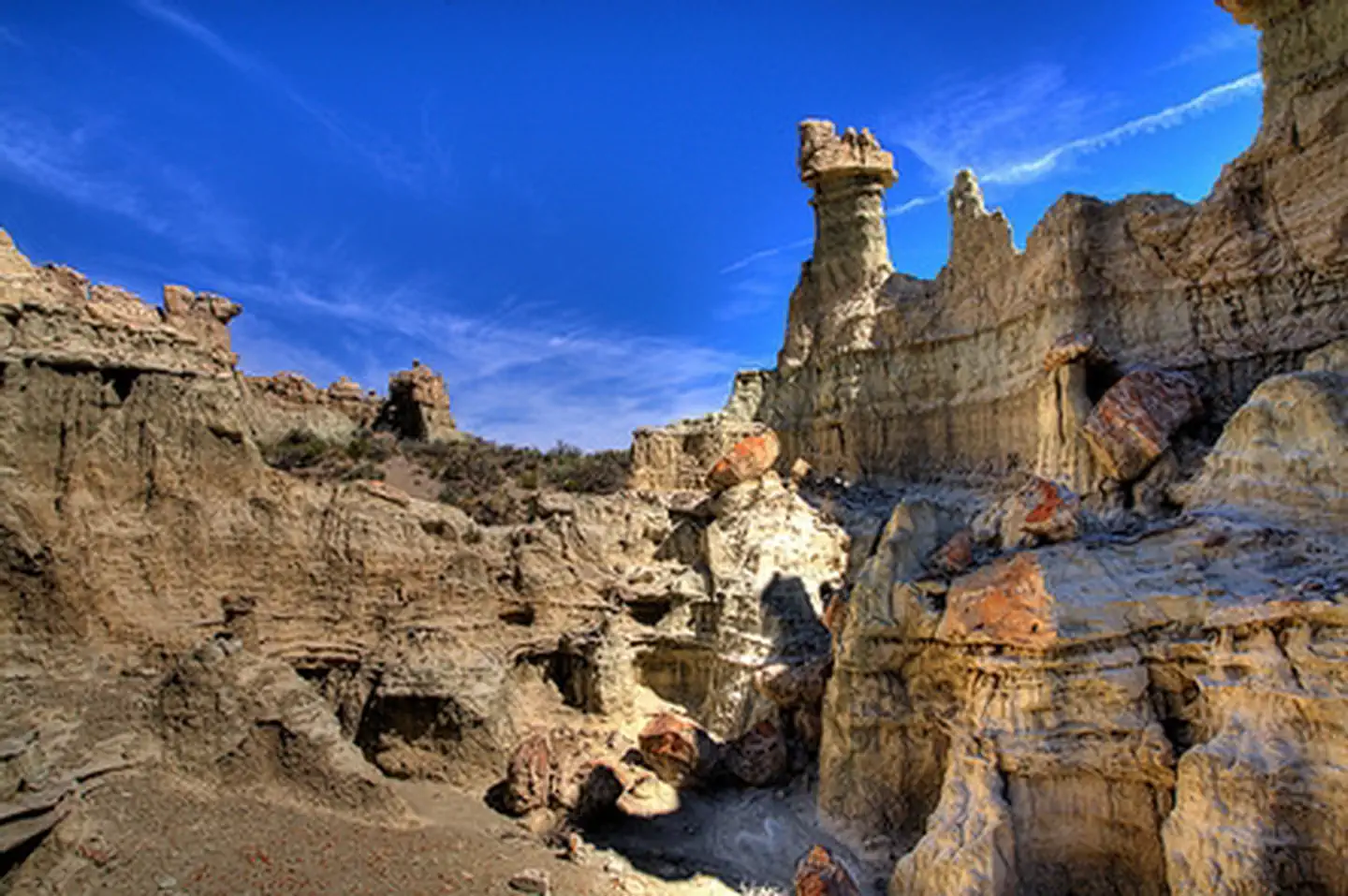
Almost 11,000 acres of this WSA were recommended as suitable for wilderness status in the 1992 report to Congress. The majority of the WSA provides opportunities for unconfined freedom of movement due to the open rolling hills and numerous drainages. Opportunities for hiking, backpacking, sightseeing, horseback riding, hunting, nature study, scientific study and photography are available to the visitor. The outstanding scenic quality of this WSA enhances the recreational values.
The area is predominantly natural with some human imprints. Skull Creek Rim, in the core of the recommended area, is a very colorful and rugged badland area which consists of a series of highly eroded drainages and colorful badland rims. To the north of Skull Creek Rim is Monument Valley and Adobe Town Rim. These areas also contain badlands and formations similar to Skull Creek, but are more dispersed. To the east (the majority of the non-suitable area) is a broad, relatively undisturbed plain that is covered with stabilized sand dunes and alluvium. Use of a high clearance vehicle is recommended.
Getting there
From the southeast - From Rock Springs take I-80 east 29 miles to The Bitter Creek Road exit 134. Go south 24 miles and turn east on The Manual Gap road (BLM 4409). Turn east onto the Manual Gap road 13 miles to the WSA north boundary.
It is in Sweetwater County. The nearest towns are Wamsutter (25 miles) and Rawlins (80 miles).
41.25153, -108.28559 · 41°15'5.5"N 108°17'8.1"W
Typical weather
Typically 86°F in Jul, down to 33°F in Jan.
| Jan | Feb | Mar | Apr | May | Jun | Jul | Aug | Sep | Oct | Nov | Dec | |
|---|---|---|---|---|---|---|---|---|---|---|---|---|
| High °F | 33 | 36 | 46 | 55 | 65 | 77 | 86 | 83 | 73 | 58 | 44 | 33 |
| Low °F | 11 | 14 | 23 | 29 | 37 | 44 | 51 | 49 | 41 | 30 | 20 | 11 |
| Precip in | 0.4 | 0.4 | 0.5 | 0.6 | 1.2 | 0.7 | 0.5 | 0.7 | 0.7 | 0.7 | 0.4 | 0.5 |
1991–2020 averages from the nearest NOAA station, 26.1 mi away — not measured at the facility itself, and elevation can make a real difference over that distance.
Map
Member photos
Common questions about Adobetown WSA
- Can you reserve a site at Adobetown WSA?
- No. Adobetown WSA is not reservable through Recreation.gov, so sites are first-come, first-served or booked elsewhere.
Camping near Adobetown WSA
- Gates of Lodore Campground 48 mi · Campground · we watch it
- Dinosaur Green And Yampa River Permits 48.2 mi · Permit · we watch it
- Bridge Hollow Campground 52.1 mi · Campground · we watch it
- Indian Crossing Campground 52.7 mi · Campground · we watch it
- Point of Rocks Cemetery 39.5 mi · Facility
- Superior Mail Arrow 44.7 mi · Facility
- Red Creek Badlands WSA 45.1 mi · Facility
- Three Patches Picnic Area 45.1 mi · Facility
- Gates of Lodore Campground 48.1 mi · Campground
- Red Lake WSA 50 mi · Facility
- East Sand Dunes WSA 50.7 mi · Facility
- Overland School Interp Site 52.9 mi · Facility
Contact
- Phone 307-352-0256
- Email BLM_WY_Rock_Springs_WYmail@blm.gov
- Info Recreation.gov
Recreation.gov last updated this record on 2026-02-25.
Facility information and photographs from Recreation.gov (RIDB). SpotOpened is not affiliated with Recreation.gov or any federal agency.
Comments