Gates of Lodore Campground
Campground · 19 bookable sites ·
Managed by the National Park Service
Dinosaur National Monument (National Monument) · Open Access
- 19
- Bookable sites
- up to 8
- People per site
- 5,349 ft
- Elevation
Overview
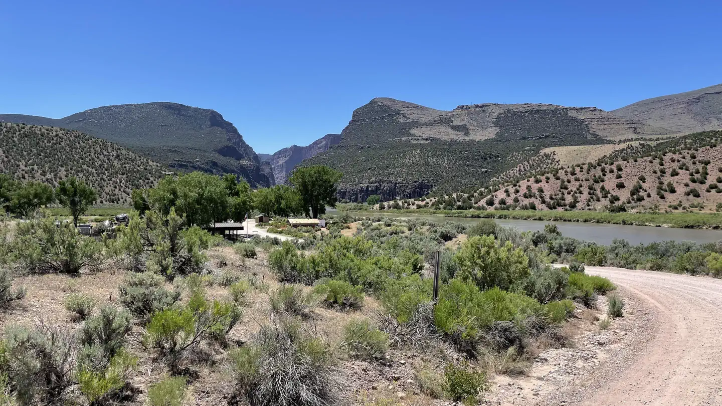
Gates of Lodore Campground is located on the Green River, near the boat ramp at the head of Lodore Canyon. It is at the north end of the monument, 137 miles (220 km) from the Quarry Visitor Center and 106 miles (170 km) from the Canyon Visitor Center. It is a long drive to the area and the wild, remote country adds to its sense of isolation. The campground is popular with river rafters who often stay here before launching on the Green River.
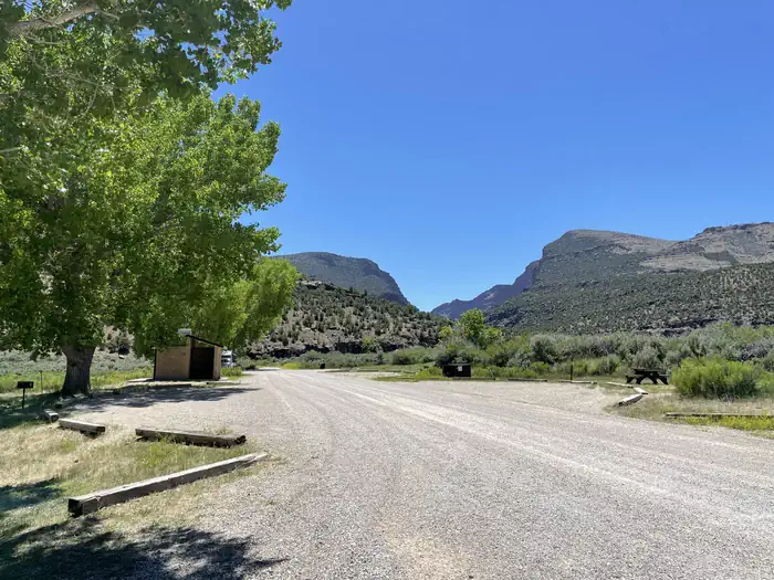
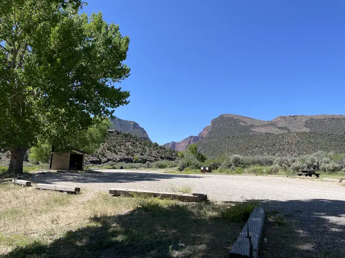
There are 19 sites, some with shade. The sites have tables and some sites have grills while others have fire pits. During the summer, there is running water and vault toilets, but no showers. The campsites can accommodate tents and RVs (no hook-ups). Access in winter may be difficult due to snow and road conditions.
Recreation
Dinosaur National Monument covers over 210,000 acres (84984 ha).
- Visitor Centers. The monument features two visitor centers - one in Colorado and one in Utah.
- Quarry Exhibit Hall. You can see over 1,500 dinosaur fossils still in the rock inside the Quarry Exhibit Hall (Jensen, Utah).
- History & Culture. Numerous cultural sites reveal stories of the people who lived here before and include Fremont petroglyphs, homestead cabins and former ranches. Hiking trails allow in-depth exploration.
- Hiking. There are miles of trails for hiking and cross-country travel.
- River Rafting & Boating. Whitewater rafting, both commercial and private, are is popular on the Green and Yampa Rivers. The Yampa River multi-day rafting trips begin at Deerlodge Park. The Yampa rushes downstream 44-miles (71 km) to join the Green River at Echo Park. Boaters continue downstream on the Green River to the take-out at the Split Mountain boat ramp. The Yampa is the largest free-flowing tributary within the Colorado River system. As such, it has a shorter season marked by fluctuations in water level resulting from snow received in the winter. It is characterized by famous rapids such as Teepee, Big Joe and Warm Springs. Raft trips must be arranged in advance. For more information, visit Dinosaur's Commercial Guided River Trips page . Private River Trips require a permit.
- Scenic Drives. Several roads provide access to key destinations and scenic sites. Scenic drives allow the windshield visitor to see spectacular geology.
Facilities
Gates of Lodore campground has vault toilets and drinking water spigots (seasonal). All campsites have picnic tables, some have a grill and others a campfire ring
Natural Features
Just south of the campground, the Green River slices into the mountains and enters the steep-walled Canyon of the Lodore. A short trail provides a scenic view of the river as it enters the gates.
Nearby Attractions
Charges & Cancellations
This is a Scan & Pay campground. No refunds, changes, cancellations, or other fee changes are allowed with Scan & Pay payments.
The facts
- 19 bookable sites
- 21 sites in total, including non-bookable
- Up to 8 people per site
- Loops: Scan and Pay
Site types
- 19 Standard Nonelectric
- 2 Management
Amenities
- Campfires allowed
- Fire pits
- Picnic tables
- Shade
- Pets allowed
- Water hookups — not available
Not recorded upstream: electric hookups, sewer hookups, grills.
21 campsites at Gates of Lodore Campground
| Site | Loop | Type | Entry | Surface | Grade | Water | Max rig | People | |
|---|---|---|---|---|---|---|---|---|---|
| 1 | — | Standard Nonelectric | Parallel | Gravel | Slight | Riverfront | — | 8 | 🐾 |
| 10 | — | Management | Parallel | Gravel | Slight | Riverfront | — | 8 | 🐾 |
| 11 | — | Standard Nonelectric | Parallel | Gravel | Slight | Riverfront | — | 8 | 🐾 |
| 12 | — | Standard Nonelectric | Parallel | Gravel | Slight | Riverfront | — | 8 | 🐾 |
| 13 | — | Standard Nonelectric | Parallel | Gravel | Slight | Riverfront | — | 8 | 🐾 |
| 14 | — | Standard Nonelectric | Parallel | Gravel | Slight | Riverfront | — | 8 | 🐾 |
| 15 | — | Standard Nonelectric | Parallel | Gravel | Slight | Riverfront | — | 8 | 🐾 |
| 16 | — | Standard Nonelectric | Parallel | Gravel | Slight | Riverfront | — | 8 | 🐾 |
| 17 | — | Standard Nonelectric | Parallel | Gravel | Slight | Riverfront | — | 8 | 🐾 |
| 18 | — | Standard Nonelectric | Parallel | Gravel | Slight | Riverfront | — | 8 | 🐾 |
| 19 | — | Standard Nonelectric | Parallel | Gravel | Slight | Riverfront | — | 8 | 🐾 |
| 2 | — | Standard Nonelectric | Parallel | Gravel | Slight | Riverfront | — | 8 | 🐾 |
| 20 | — | Standard Nonelectric | Parallel | Gravel | Slight | Riverfront | — | 8 | 🐾 |
| 3 | — | Standard Nonelectric | Parallel | Gravel | Slight | Riverfront | — | 8 | 🐾 |
| 4 | — | Standard Nonelectric | Parallel | Gravel | Slight | Riverfront | — | 8 | 🐾 |
| 5 | — | Standard Nonelectric | Parallel | Gravel | Slight | Riverfront | — | 8 | 🐾 |
| 6 | — | Standard Nonelectric | Parallel | Gravel | Slight | Riverfront | — | 8 | 🐾 |
| 7 | — | Standard Nonelectric | Parallel | Gravel | Slight | Riverfront | — | 8 | 🐾 |
| 8 | — | Standard Nonelectric | Parallel | Gravel | Slight | Riverfront | — | 8 | 🐾 |
| 9 | — | Standard Nonelectric | Parallel | Gravel | Slight | Riverfront | — | 8 | 🐾 |
| Gates of Lodore Scan and Pay | Scan and Pay | Management | Parallel | Gravel | Slight | Riverfront | — | 8 | 🐾 |
Getting there
From Maybell, Colorado, follow US Highway 40 west for approximately 0.4 mile (.6 km) west. Turn right onto CO 318. Follow 318 west or 46.2 miles (74 km). Turn left onto Moffat County Road 34N. Follow 34N for 1.7 miles (2.7 km). Turn right onto Moffat County Road 34. Follow 34 for 4.5 miles (7.2 km) until you arrive at the ranger station and campground.
40.72719, -108.88801 · 40°43'37.9"N 108°53'16.8"W
Typical weather
Typically 91°F in Jul, down to 40°F in Dec.
| Jan | Feb | Mar | Apr | May | Jun | Jul | Aug | Sep | Oct | Nov | Dec | |
|---|---|---|---|---|---|---|---|---|---|---|---|---|
| High °F | 40 | 44 | 55 | 62 | 72 | 83 | 91 | 88 | 79 | 65 | 50 | 40 |
| Low °F | 13 | 18 | 25 | 31 | 39 | 47 | 54 | 51 | 43 | 32 | 22 | 13 |
| Precip in | 0.6 | 0.5 | 0.5 | 1.0 | 1.6 | 0.8 | 0.7 | 1.1 | 1.1 | 1.3 | 0.6 | 0.5 |
1991–2020 averages from the nearest NOAA station, 19.3 mi away — not measured at the facility itself, and elevation can make a real difference over that distance.
Map
More photos
Member photos
Common questions about Gates of Lodore Campground
- Can you reserve a site at Gates of Lodore Campground?
- Yes, Gates of Lodore Campground is reservable through Recreation.gov.
- How many campsites does Gates of Lodore Campground have?
- 21 sites in total, of which 19 can be booked.
- Are pets allowed at Gates of Lodore Campground?
- Yes, pets are allowed at Gates of Lodore Campground.
- Does Gates of Lodore Campground have hookups?
- No hookups are recorded here.
- Are campfires allowed at Gates of Lodore Campground?
- Campfires are allowed at Gates of Lodore Campground. Check for a current fire restriction before you go.
Camping near Gates of Lodore Campground
- Dinosaur Green And Yampa River Permits 0.2 mi · Permit · we watch it
- Echo Park Campground 15.3 mi · Campground · we watch it
- Bridge Hollow Campground 18.9 mi · Campground · we watch it
- Indian Crossing Campground 19.5 mi · Campground · we watch it
- Gates of Lodore Campground 0.2 mi · Campground
- Jones Hole National Fish Hatchery 13.7 mi · Facility
- Big Pine I River Camp 19.1 mi · Campground
- Cottonwood River Camp 19.5 mi · Campground
- Cats Paw River Camp 19.6 mi · Campground
- Bootleg River Camp 19.6 mi · Campground
- Sand River Camp 19.6 mi · Campground
- Stonefly II River Camp 19.7 mi · Facility
Contact
- Phone 435-781-7700
- Email dino_information@nps.gov
- Book Recreation.gov
Recreation.gov last updated this record on 2026-02-25.
Facility information and photographs from Recreation.gov (RIDB). SpotOpened is not affiliated with Recreation.gov or any federal agency.
Comments