Ohanapecosh Visitor Center
Facility · Washington ·
Managed by the National Park Service
Mount Rainier National Park (National Park) · Open Access
- 1,892 ft
- Elevation
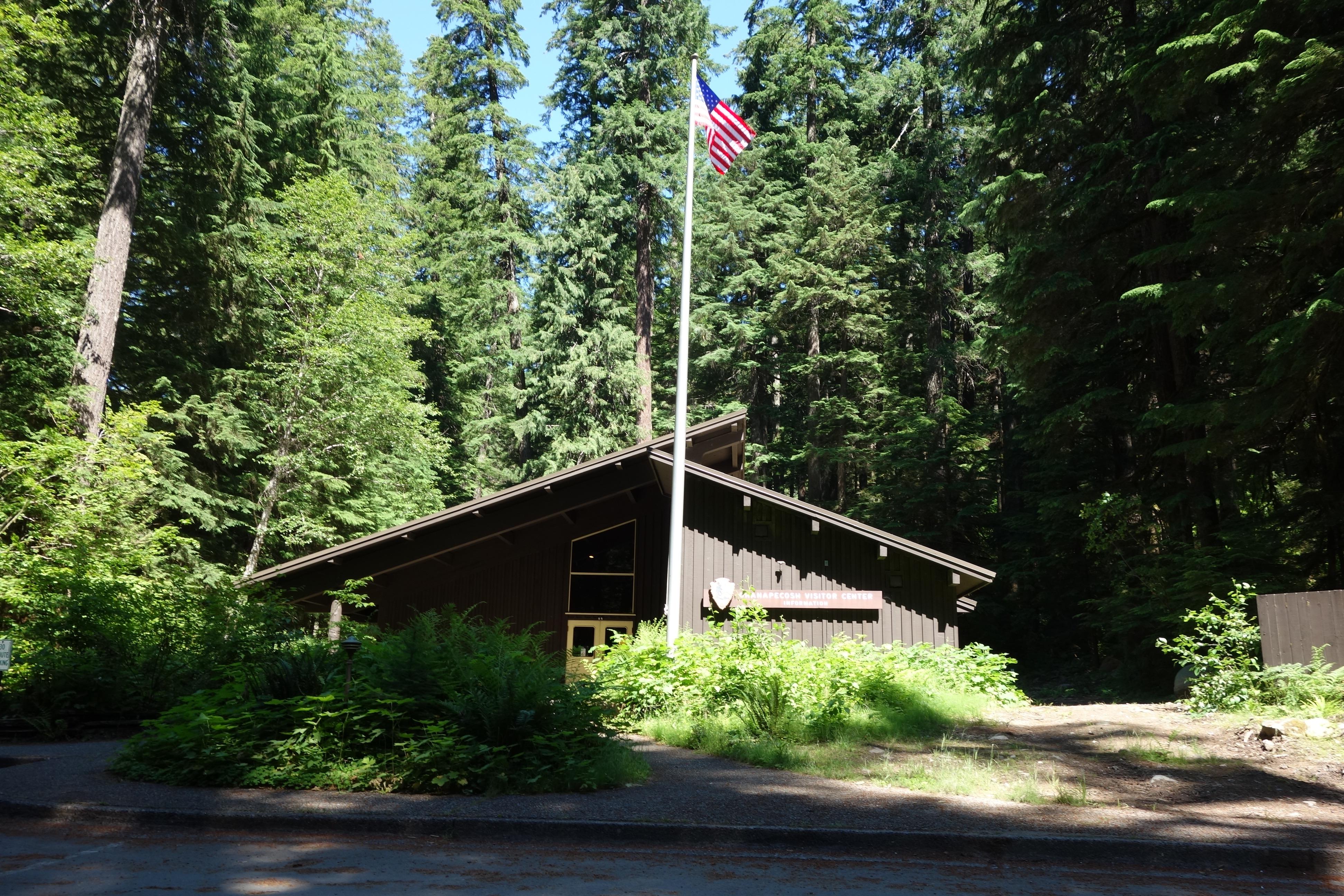
NOTE: The Ohanapecosh Visitor Center is CLOSED for the summer of 2026 as part of the Ohanapecosh Campground rehabilitation project. This visitor center is located in the southeast corner of the park on State Route 123, 12 miles north of the town of Packwood. It is next to the Ohanapecosh Campground and near the trailhead for the natural Hot Springs and Silver Falls Trails. There are restrooms, exhibits, and a ranger or volunteer on duty to answer questions when it is open for the summer season.
Getting there
Ohanapecosh Visitor Center is on State Route 123, 12 miles north of the town of Packwood. It has no physical address. GPS users can enter 46.914466,-121.643404 for its location.
46.73596, -121.56593 · 46°44'9.5"N 121°33'57.3"W
Typical weather
Typically 64°F in Aug, down to 33°F in Dec.
| Jan | Feb | Mar | Apr | May | Jun | Jul | Aug | Sep | Oct | Nov | Dec | |
|---|---|---|---|---|---|---|---|---|---|---|---|---|
| High °F | 35 | 34 | 36 | 40 | 48 | 54 | 62 | 64 | 57 | 46 | 37 | 33 |
| Low °F | 24 | 23 | 24 | 26 | 33 | 37 | 44 | 45 | 41 | 33 | 26 | 22 |
| Precip in | 17.2 | 12.9 | 13.2 | 8.3 | 5.1 | 3.8 | 1.4 | 1.6 | 4.4 | 11.3 | 18.2 | 18.9 |
1991–2020 averages from the nearest NOAA station, 9 mi away — not measured at the facility itself, and elevation can make a real difference over that distance.
Map
Member photos
Common questions about Ohanapecosh Visitor Center
- Can you reserve a site at Ohanapecosh Visitor Center?
- No. Ohanapecosh Visitor Center is not reservable through Recreation.gov, so sites are first-come, first-served or booked elsewhere.
Camping near Ohanapecosh Visitor Center
- Ohanapecosh Campground 0.4 mi · Campground · we watch it
- Ohanapecosh Group Campground 0.4 mi · Campground · we watch it
- La Wis Wis Campground 4.4 mi · Campground · we watch it
- Cougar Rock Campground 11 mi · Campground · we watch it
- Cougar Rock Group Campground 11 mi · Campground · we watch it
- Campground: Coho Group Camp 4.1 mi · Campground
- Campground: La Wis Wis 4.1 mi · Campground
- Paradise Wilderness Information Center 8.7 mi · Visitor Center
- Henry M Jackson Memorial Visitor Center 8.8 mi · Facility
- Trailhead: Packwood Lake 9.3 mi · Facility
- Deep Creek Trailhead - Naches RD 9.8 mi · Campground
- White Pass Lake (Leech Lake) Campground 10.7 mi · Campground
Contact
- Phone (360) 569-2211
- Email morainfo@nps.gov
- Info Recreation.gov
Recreation.gov last updated this record on 2026-04-15.
Facility information and photographs from Recreation.gov (RIDB). SpotOpened is not affiliated with Recreation.gov or any federal agency.
Comments