Ohanapecosh Group Campground
Campground · Washington · 2 bookable sites ·
Managed by the National Park Service
Mount Rainier National Park (National Park) · Open Access
- 2
- Bookable sites
- up to 25
- People per site
- 1,931 ft
- Elevation
Overview
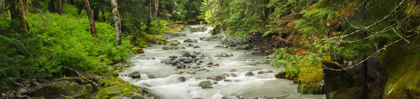
This facility is the group site at Ohanapecosh Campground. Ohanapecosh, on the southeast side of Mount Rainier National Park, is surrounded by old growth forest and crossed by an exceptionally beautiful snow-fed river. Close to Ohanapecosh are popular hikes to Silver Falls. The Grove of the Patriarchs trail is closed to public access until the bridge accessing the Grove is replaced.
The main attraction at Mount Rainier National Park is the mountain itself, a glacier-clad volcano of immense proportions. At 14,411 ft., it dominates the skyline for hundreds of miles. Visitors travel through majestic old-growth forests, past tumbling waterfalls and historic buildings to reach sub-alpine meadows, where world-famous wildflower displays are seen in July and August. Popular activities in the park include sight-seeing, hiking, climbing and camping.
Ohanapecosh campground has an elevation of 1,914 feet. Weather is dry, cool and sunny in the summer with daytime temperatures in the 60 to 80-degree range. Even though the eastern side of the park can be sunnier than other areas, weather can be variable and visitors should come prepared.
Recreation
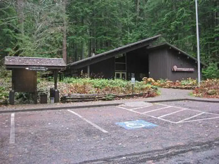
The most popular campground in the park, Ohanapecosh is convenient to both the Paradise and Sunrise areas. Numerous hiking trails originate both in and nearby the facility, including the several trails that lead to Silver Falls waterfall. For visitors who would like to learn more about natural and cultural history, the Ohanapecosh Visitor Center is close by as well.
Grove of the Patriarchs - The Grove of the Patriarchs is CLOSED to all public entry due to flooding in November 2021 which caused significant damage to the suspension bridge that provides the only safe access to the area (News Release, 11/17/21). See the attached emergency regulation signed by the Deputy Superintendent. The Grove of the Patriarchs Trail will remain closed until the bridge can be replaced. During the closure, the Grove of the Patriarchs parking lot and restrooms have normal seasonal access, along with the Eastside and Silver Falls Trails. Construction to replace the bridge is scheduled to begin summer 2027. In addition to site clearing, the project will require supplies transport, bridge construction, trail reconstruction to meet the new bridge. This process is expected to take several years and construction work is limited to the summer season. Summers represent the only viable construction season in the park due to the heavy snow that blankets the park from roughly November through May.
Facilities
There are two group sites. Both have tent-only camping, and each can fit up to 25 people. Drinking water is provided. Visitors must use extra caution with food storage, as bear and other animals inhabit the area around the campground.Natural Features
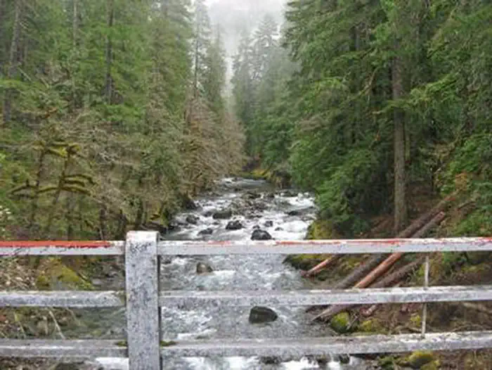
Ohanapecosh is thought to be a Taidnapam Indian word for "standing on the edge" of the Ohanapecosh River. The river itself is lined with mossy boulders and drains cold, clear water from higher elevations. Its banks are lined with thick, old growth Douglas fir trees and other evergreens. There is no direct view of Mt. Rainier from the campground, but the mountain dominates the landscape in nearby areas of the park.The facts
- 2 bookable sites
- Up to 25 people per site
- Loops: Group 2 C Loop, Loop A
Site types
- 2 Group Tent Only Area Nonelectric
Amenities
- Campfires allowed
- Fire pits
- Picnic tables
- Grills
- Shade
- Pets allowed
Not recorded upstream: electric hookups, water hookups, sewer hookups.
2 campsites at Ohanapecosh Group Campground
Check-in 12:00 PM · Check-out 12:00 PM
| Site | Loop | Type | Entry | Surface | Max rig | People | |
|---|---|---|---|---|---|---|---|
| GRP 2 | Group 2 C Loop | Group Tent Only Area Nonelectric | — | — | — | 25 | 🐾 |
| GRP1 | Loop A | Group Tent Only Area Nonelectric | — | Paved | — | 25 | 🐾 |
Getting there
46.73111, -121.57028 · 46°43'52.0"N 121°34'13.0"W
Typical weather
Typically 64°F in Aug, down to 33°F in Dec.
| Jan | Feb | Mar | Apr | May | Jun | Jul | Aug | Sep | Oct | Nov | Dec | |
|---|---|---|---|---|---|---|---|---|---|---|---|---|
| High °F | 35 | 34 | 36 | 40 | 48 | 54 | 62 | 64 | 57 | 46 | 37 | 33 |
| Low °F | 24 | 23 | 24 | 26 | 33 | 37 | 44 | 45 | 41 | 33 | 26 | 22 |
| Precip in | 17.2 | 12.9 | 13.2 | 8.3 | 5.1 | 3.8 | 1.4 | 1.6 | 4.4 | 11.3 | 18.2 | 18.9 |
1991–2020 averages from the nearest NOAA station, 9 mi away — not measured at the facility itself, and elevation can make a real difference over that distance.
Map
More photos
Member photos
Common questions about Ohanapecosh Group Campground
- Can you reserve a site at Ohanapecosh Group Campground?
- Yes, Ohanapecosh Group Campground is reservable through Recreation.gov.
- How many campsites does Ohanapecosh Group Campground have?
- 2 sites.
- Are pets allowed at Ohanapecosh Group Campground?
- Yes, pets are allowed at Ohanapecosh Group Campground.
- Are campfires allowed at Ohanapecosh Group Campground?
- Campfires are allowed at Ohanapecosh Group Campground. Check for a current fire restriction before you go.
Camping near Ohanapecosh Group Campground
- Ohanapecosh Campground less than 0.1 mi · Campground · we watch it
- La Wis Wis Campground 4 mi · Campground · we watch it
- Cougar Rock Campground 10.9 mi · Campground · we watch it
- Cougar Rock Group Campground 10.9 mi · Campground · we watch it
- Ohanapecosh Visitor Center 0.4 mi · Facility
- Campground: Coho Group Camp 3.7 mi · Campground
- Campground: La Wis Wis 3.7 mi · Campground
- Paradise Wilderness Information Center 8.7 mi · Visitor Center
- Henry M Jackson Memorial Visitor Center 8.7 mi · Facility
- Trailhead: Packwood Lake 8.9 mi · Facility
- Deep Creek Trailhead - Naches RD 10 mi · Campground
- White Pass Lake (Leech Lake) Campground 10.6 mi · Campground
Contact
- Phone 360-569-2211 x6627
- Email rene_ellis@nps.gov
- Book Recreation.gov
Recreation.gov last updated this record on 2026-02-25.
Facility information and photographs from Recreation.gov (RIDB). SpotOpened is not affiliated with Recreation.gov or any federal agency.
Comments