American Ridge Lodge
Campground · Washington · 1 bookable site ·
Managed by the USDA Forest Service
Mather Memorial Parkway Memorial Area (Administrative) (Memorial Area (Administrative)) · Restricted Access
- 1
- Bookable site
- 20 ft
- Max rig length
- up to 60
- People per site
- 3,060 ft
- Elevation
Overview
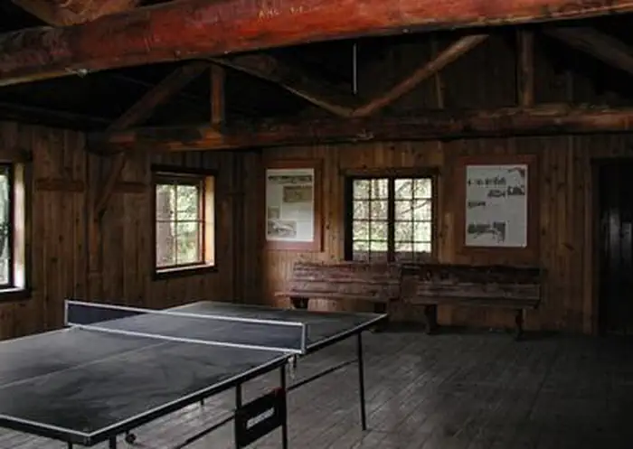
American Ridge Lodge is located approximately 38 miles west of Naches, Washington in the foothills of the East Cascades mountain range. The lodge is available for reservation year-round, offering visitors a glimpse into the unique ski history of the area. Larger groups and gatherings will find this spacious facility to be an ideal setting for recreation and relaxation. In the 1930s, the Yakima Valley Ski Club worked with the U.S. Forest Service to construct the American River Ski Bowl, one of the first downhill ski areas in Washington State. The rustic ski lodge and unique 20-seater outhouse were built by the Civilian Conservation Corps in connection with the ski area, which was operated into the 1950s. By the late 1950s, White Pass Ski Area was built, offering deeper snow, a longer ski season and steeper slopes. American Ridge Ski Bowl lay vacant for years, until the lodge and outhouse were carefully restored and made available to the public for reservation.Recreation
In the summer and early fall, guests will find excellent hiking, fishing, horseback riding, and mountain biking opportunities in the area. Skiing, snowshoeing, sledding and snowmobiling are available in the winter months.Additionally, hundreds of small pools, ponds, rivers and lakes are home to populations of brook, rainbow and cutthroat trout, as well as salmon, drawing anglers from all over.
Facilities
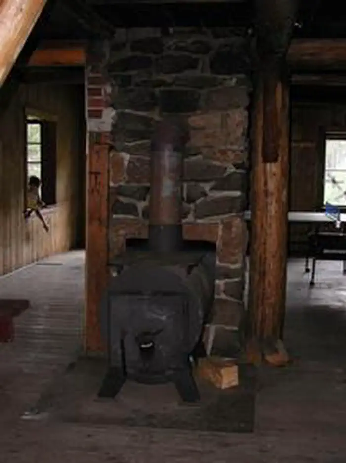
The rustic and spacious 43 x 48 foot lodge, although largely unfurnished, is equipped with a kitchen area, counter space and benches, several closets and cabinets, and a wood stove.Outside, there is a fire ring and picnic tables, as well as plenty of room on the grounds for dispersed camping, making it an ideal location for groups. There are no beds at this facility. Visitors must supply their own wood for the wood stove and fire ring.
The lodge does not have water or electricity on site, but pitcher pump water is available during the summer months from Cedar Springs Campground located approximately 1.5 miles from the site. In the fall, winter and spring, visitors must bring plenty of their own water for drinking, cooking and washing.
Visitors must also bring their own light source. Battery powered lanterns are suggested and guests are asked to respect the facility's open flame policy, which prohibits the use of all open flame devises such as propane stoves, gas lanterns and candles, while inside the lodge.
Sleeping bags, sleeping pads, towels, dish soap, matches, a first aid kit, toilet paper and garbage bags are not available at the lodge, and must be brought by guests to the lodge.
Natural Features
The lodge is located just outside the boundary of the William O. Douglas Wilderness, at an elevation of 3,041 feet. Defined by 166,000 acres of snow-capped peaks, rocky ridges, steep slopes and hundreds of pools and lakes, this magnificent region pays tribute to wilderness advocate and Supreme Court justice, William Orville Douglas, who often explored the area on foot. Wildlife viewing is plentiful in the areas surrounding the lodge. Large herds of elk and mule deer may cross the landscape, sharing forest habitat with black bear, squirrels and grouse.Nearby Attractions
Boulder Cave Trail is one of the most popular places in the Naches District. Visitors can walk the accessible trail along the river or explore Boulder Cave. Interpretive signs along the trail explain the geology, plants, animals and history of the area. Horseback riding trails are within 1 mile of the lodge, and opportunities for group picnicking, hiking, mountain biking, hunting and fishing are within 10 miles.
Hikers may want to traverse a portion of the spectacular Pacific Crest Trail (PCT) , one of the world's premier National Scenic Trails. Enjoy some of North America's most fantastic scenery, as the trail winds from Mexico to Canada through Washington state.
The facts
- 1 bookable site
- Vehicles up to 20 ft
- Up to 60 people per site
- Loops: AREA AMERICAN RIDGE LODGE
Site types
- 1 Cabin Nonelectric
Amenities
- Fire pits
- Shade
Not recorded upstream: electric hookups, water hookups, sewer hookups, campfires allowed, picnic tables, grills, pets allowed.
1 campsite at American Ridge Lodge
Check-in 1:00 PM · Check-out 11:00 AM
| Site | Loop | Type | Entry | Surface | Max rig | People | |
|---|---|---|---|---|---|---|---|
| 001 | AREA AMERICAN RIDGE LODGE | Cabin Nonelectric | Pull Through | Gravel | 20 ft | 60 |
Getting there
Please contact the Naches Ranger District at 509-653-1401 prior to your arrival to check any restrictions or conditions, such as fire or road closures, or weather. Access to the lodge is through a locked gate. The combination to the gate lock will be included in your confirmation letter.
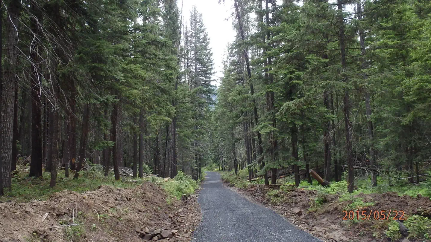
From Naches, travel west on US Highway 12 for 4.4 miles. Continue straight onto State Route (SR) 410 W for 27.5 miles. Turn left onto Bumping River Rd / Forest Road 1800. Continue ¼ mile to Forest Road 381, the access road for the lodge. Turn right on Road 381 and follow it approximately ¾ of a mile to the end.
From Enumclaw, depart SR 164/Griffin Ave toward Wells St. After ½ mile turn left onto SR 410/Roosevelt Ave. Follow SR 410 approximately 66 miles east to the intersection with Bumping River Road (FR 1800). Turn right and continue ¼ mile to Forest Road 381, the access road for the lodge. Turn right on Road 381 and follow it approximately ¾ of a mile to the end.
During winter months, visitors may park in the plowed pullout on Bumping Lake Road and either walk or snowmobile just under a mile to the lodge.
46.97300, -121.17300 · 46°58'22.8"N 121°10'22.8"W
Typical weather
| Jan | Feb | Mar | Apr | May | Jun | Jul | Aug | Sep | Oct | Nov | Dec | |
|---|---|---|---|---|---|---|---|---|---|---|---|---|
| High °F | — | — | — | — | — | — | — | — | — | — | — | — |
| Low °F | — | — | — | — | — | — | — | — | — | — | — | — |
| Precip in | 10.4 | 7.1 | 7.1 | 4.1 | 2.9 | 1.9 | 0.8 | 0.8 | 1.9 | 6.3 | 10.6 | 10.5 |
1991–2020 averages from the nearest NOAA station, 13.5 mi away — not measured at the facility itself, and elevation can make a real difference over that distance.
Map
More photos
Member photos
Common questions about American Ridge Lodge
- Can you reserve a site at American Ridge Lodge?
- Yes, American Ridge Lodge is reservable through Recreation.gov.
- How many campsites does American Ridge Lodge have?
- 1 site.
- What is the maximum RV length at American Ridge Lodge?
- 20 ft. That is the longest vehicle the sites here are recorded as taking; individual sites may be shorter.
Also listed by
American Ridge Lodge also appears in other federal recreation data. Facts below are matched by name and location, not confirmed by American Ridge Lodge's operator.
USDA Forest Service — data as of Aug 24, 2026
Restrictions:
- Maximum stay is 14 consecutive nights.
Camping near American Ridge Lodge
- American River Guard Station 0.4 mi · Campground · we watch it
- American Forks Campground 0.4 mi · Campground · we watch it
- Cedar Springs Campground (Wa) 0.5 mi · Campground · we watch it
- Indian Flat Group Site 1.2 mi · Campground · we watch it
- Pine Needle Group Site 1.8 mi · Campground · we watch it
- Kaner Flat Group Site 3.3 mi · Campground · we watch it
- Kaner Flat Campground 3.3 mi · Campground · we watch it
- Sawmill Flat Campground 3.7 mi · Campground · we watch it
- Halfway Flat Campground 3.7 mi · Campground · we watch it
- Little Naches Campground 3.7 mi · Campground · we watch it
- Soda Springs Campground (Bumping River, WA) 3.8 mi · Campground · we watch it
- Crow Creek Campground 3.4 mi · Campground
Contact
- Phone (509) 653-1401
- Book Recreation.gov
Recreation.gov last updated this record on 2026-03-11.
Facility information and photographs from Recreation.gov (RIDB). SpotOpened is not affiliated with Recreation.gov or any federal agency.
Comments