Kaner Flat Group Site
Campground · Washington · 1 bookable site ·
Managed by the USDA Forest Service
Snoqualmie National Forest (NF) · Open Access
- 1
- Bookable site
- 30 ft
- Max rig length
- up to 60
- People per site
- 2,691 ft
- Elevation
Overview
Kaner Flat Group Campground is situated in the foothills on the east side of the Cascades mountain range in the Okanogan-Wenatchee National Forest.Recreation
Kaner Flat Group Campground offers outdoor enthusiasts the opportunity to hike, fish, ski, raft and enjoy a multitude of outdoor recreational activities throughout the year. Nearby American Ridge Trail offers hikers, overnight backpackers and horseback riders fantastic opportunities to absorb some of the area's stunning beauty. Extending from Bumping River to the notable Pacific Crest trail, the American Ridge Trail offers over 26 miles of towering forests, stretches of meadows, alpine lakes and ridge line views. Trails for off-road, motorized recreation abound in this area, although some only allow specific types of vehicles. Visitors should be sure to check area maps. Backpacking in the nearby Goat Rocks Wilderness is also a popular pastime. The peaks within the area are remnants of an extinct volcano, taking the name "Goat Rocks," in honor of the numerous mountain goats traversing this isolated region. Gilbert Peak is the highest summit in this area, at an elevation of 8,184 feet.Facilities
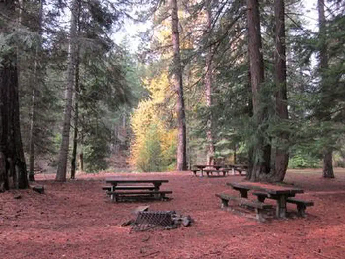
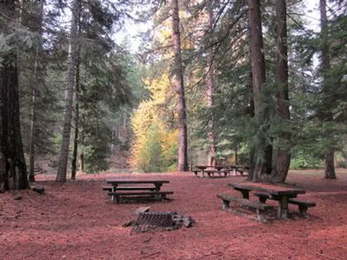
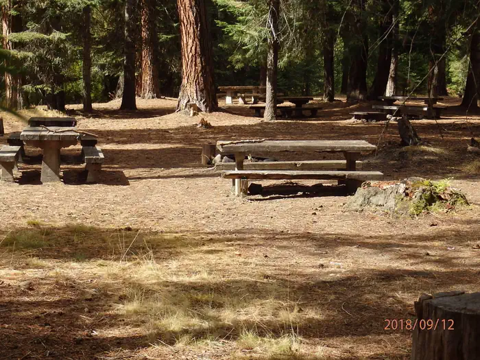
Kaner Flat Group Campground has one large site with multiple tenting locations, which can accommodate up to 60 guests. The site is equipped with picnic tables, campfire rings and vault toilets. Entrance to the campground is through a locked gate. The combination to the lock will be included in the confirmation letter. Access to drinking water can be found across the street at Kaner Flat campground.Natural Features
Okanogan-Wenatchee National Forest offers stunning scenic views, with high, glaciated alpine peaks, valleys of old growth forest and rugged shrub-steppe country making up the diverse landscape. Elevations range from below 1,000 feet to more than 9,000 feet. Precipitation varies greatly throughout the area, ranging from approximately 140 inches along the Cascade Crest to only 10 inches along the eastern edge. Visitors can expect many days of warm, sunny weather in the summer, and winters with clear skies and plenty of snow. The area supports wildlife such as deer, squirrels, native fish, black bear and migratory birds.Nearby Attractions
Boulder Cave National Recreation Trail is one of the most popular places in the Naches District. Visitors can walk the accessible trail along the river or explore Boulder Cave. Interpretive signs along the trail explain the geology, plants, animals and fire history of the area. Visitors will also enjoy traversing the Chinook Scenic Byway, considered one of Washington's premier driving excursions. Spectacular views of Mount Rainier, old-growth forests, alpine peaks, jagged ridges and river canyons dominate this 92-mile journey. Off-road vehicle trails are within 1 mile of the camp, and more hiking opportunities are within 5 miles.The facts
- 1 bookable site
- Vehicles up to 30 ft
- Up to 60 people per site
- Loops: AREA KANER FLAT GROUP SITE
Site types
- 1 Group Standard Area Nonelectric
Amenities
- Shade
Not recorded upstream: electric hookups, water hookups, sewer hookups, campfires allowed, fire pits, picnic tables, grills, pets allowed.
1 campsite at Kaner Flat Group Site
Check-in 1:00 PM · Check-out 11:00 AM
| Site | Loop | Type | Entry | Surface | Max rig | People | |
|---|---|---|---|---|---|---|---|
| 001 | AREA KANER FLAT GROUP SITE | Group Standard Area Nonelectric | Pull Through | Gravel | 30 ft | 60 |
Getting there
From Naches, WA travel west on US Highway 12 for 4.4 miles. Continue straight onto State Route (SR) 410 W for 24.2 miles. Turn north (right) on Little Naches Road / Forest Road 19 and follow for 2.5 miles. The site is on the left side of the road, parallel to the river.
From Enumclaw, WA depart SR 164/Griffin Ave toward Wells St. After ½ mile turn left onto SR 410/Roosevelt Ave. Follow SR 410 approximately 76 miles east to the intersection with Little Naches Road/Forest Road 19. Turn north on FR 19 and follow for 2.5 miles.
47.01040, -121.13100 · 47°0'37.4"N 121°7'51.6"W
Typical weather
| Jan | Feb | Mar | Apr | May | Jun | Jul | Aug | Sep | Oct | Nov | Dec | |
|---|---|---|---|---|---|---|---|---|---|---|---|---|
| High °F | — | — | — | — | — | — | — | — | — | — | — | — |
| Low °F | — | — | — | — | — | — | — | — | — | — | — | — |
| Precip in | 8.4 | 6.9 | 7.0 | 5.3 | 4.0 | 3.0 | 1.2 | 1.1 | 2.0 | 5.0 | 8.5 | 8.8 |
1991–2020 averages from the nearest NOAA station, 15.5 mi away — not measured at the facility itself, and elevation can make a real difference over that distance.
Map
More photos
Member photos
Common questions about Kaner Flat Group Site
- Can you reserve a site at Kaner Flat Group Site?
- Yes, Kaner Flat Group Site is reservable through Recreation.gov.
- How many campsites does Kaner Flat Group Site have?
- 1 site.
- What is the maximum RV length at Kaner Flat Group Site?
- 30 ft. That is the longest vehicle the sites here are recorded as taking; individual sites may be shorter.
Also listed by
Kaner Flat Group Site also appears in other federal recreation data. Facts below are matched by name and location, not confirmed by Kaner Flat Group Site's operator.
USDA Forest Service — data as of Aug 24, 2026
- Daily Fee $60 plus Recreation.gov registration fee - $10
Camping near Kaner Flat Group Site
- Kaner Flat Campground 0.1 mi · Campground · we watch it
- Little Naches Campground 2.1 mi · Campground · we watch it
- Indian Flat Group Site 2.3 mi · Campground · we watch it
- Halfway Flat Campground 2.7 mi · Campground · we watch it
- American River Guard Station 2.9 mi · Campground · we watch it
- American Forks Campground 2.9 mi · Campground · we watch it
- Cedar Springs Campground (Wa) 3 mi · Campground · we watch it
- Sawmill Flat Campground 3 mi · Campground · we watch it
- American Ridge Lodge 3.3 mi · Campground · we watch it
- Crow Creek Campground 0.6 mi · Campground
- Ponderosa Camp 0.6 mi · Campground
- Longmire Meadow 1.6 mi · Campground
Contact
- Phone 509-653-1401
- Book Recreation.gov
Recreation.gov last updated this record on 2026-03-11.
Facility information and photographs from Recreation.gov (RIDB). SpotOpened is not affiliated with Recreation.gov or any federal agency.
Comments