Nizhoni
Campground · Utah · 23 bookable sites ·
Managed by the USDA Forest Service
Manti-La Sal National Forest (NF) · Open Access
- 23
- Bookable sites
- 53 ft
- Max rig length
- up to 50
- People per site
- 7,805 ft
- Elevation
Overview
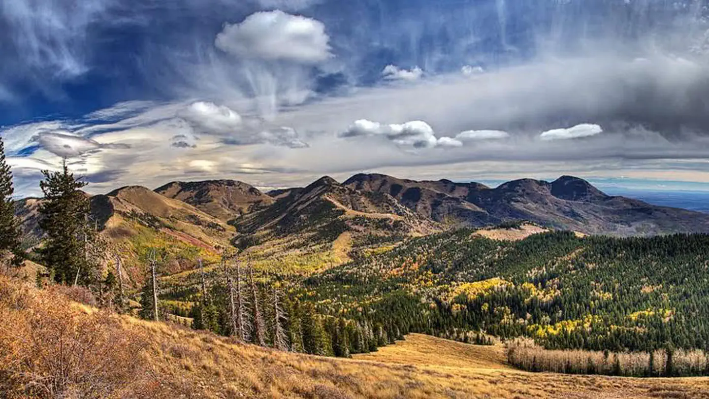
Nizhoni Campground sits in the Manti-LaSal National Forest in southeast Utah, at the foot of the Abajo Mountains.
Recreation
Popular activities include hiking, wildlife viewing and off-road vehicle riding. Several trailheads are nearby, including Shay Ridge, Aspen Flat and Red Ledges.The Abajo Loop State Scenic Backway passes by the campground. It leads from the desert floor and red rock canyons to steep mountains over 10,000 feet high, with overlooks and panoramic views. The byway is suitable for passenger vehicles from late spring through fall but is not recommended for large RVs.
Facilities
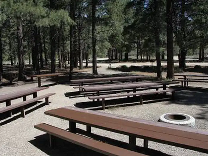
The campground contains two group sites that each accommodate up to 50 guests. Several single-family sites are available as well. Picnic tables and fire rings are provided, as are vault toilets and drinking water seasonally. Firewood may be collected in and around the campground. Roads and parking spurs are gravel. There is a 14 day stay limit at this campground.
Natural Features
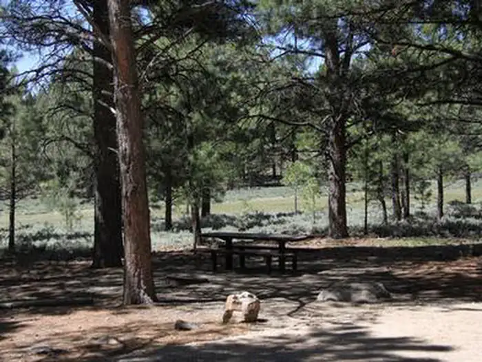
Towering Ponderosa pines forest the site, offering partial shade. Gambel oaks and sagebrush dot the landscape. The campground sits at an elevation of 7,000 feet, and summer temperatures range from 80-90 degrees during the day and 55-65 degrees at night.Mule deer, wild turkeys, Abert's squirrels and the occasional black bear may be seen in the area.
Nearby Attractions
Other attractions in the area include Canyonlands, Arches and Mesa Verde National Parks, Dark Canyon Wilderness, Edge of the Cedars State Park, Lake Powell and numerous archaeological sites.The facts
- Season: May 15 – September 30 — USDA Forest Service, Aug 24, 2026
- 23 bookable sites
- 29 sites in total, including non-bookable
- Vehicles up to 53 ft
- Up to 50 people per site
- Loops: GROUP SITES, MAIN, MANAGEMENT SITES
Site types
- 21 Standard Nonelectric
- 6 Management
- 2 Group Standard Area Nonelectric
Amenities
- Campfires allowed
- Fire pits
- Picnic tables
- Shade
- Pets allowed
Not recorded upstream: electric hookups, water hookups, sewer hookups, grills.
29 campsites at Nizhoni
Check-in 1:00 PM · Check-out 11:00 AM
| Site | Loop | Type | Entry | Surface | Max rig | People | |
|---|---|---|---|---|---|---|---|
| NORTH GROUP | GROUP SITES | Group Standard Area Nonelectric | — | Gravel | 35 ft | 50 | 🐾 |
| SOUTH GROUP | GROUP SITES | Group Standard Area Nonelectric | — | Gravel | 50 ft | 50 | 🐾 |
| 1 | MAIN | Standard Nonelectric | Back In | Gravel | 45 ft | 8 | 🐾 |
| 10 | MAIN | Standard Nonelectric | Back In | Gravel | 52 ft | 8 | 🐾 |
| 11 | MAIN | Standard Nonelectric | Back In | Gravel | 51 ft | 8 | 🐾 |
| 12 | MAIN | Standard Nonelectric | Back In | Gravel | 53 ft | 8 | 🐾 |
| 13 | MAIN | Standard Nonelectric | Back In | Gravel | 52 ft | 8 | 🐾 |
| 14 | MAIN | Standard Nonelectric | Back In | Gravel | 49 ft | 8 | 🐾 |
| 15 | MAIN | Standard Nonelectric | Back In | Gravel | 29 ft | 8 | 🐾 |
| 16 | MAIN | Standard Nonelectric | Back In | Gravel | 43 ft | 8 | 🐾 |
| 17 | MAIN | Standard Nonelectric | Back In | Gravel | 50 ft | 8 | 🐾 |
| 18 | MAIN | Standard Nonelectric | Back In | Gravel | 50 ft | 8 | 🐾 |
| 19 | MAIN | Standard Nonelectric | Back In | Gravel | 51 ft | 8 | 🐾 |
| 2 | MAIN | Standard Nonelectric | Back In | Gravel | 47 ft | 8 | 🐾 |
| 20 | MAIN | Standard Nonelectric | Back In | Gravel | 46 ft | 8 | 🐾 |
| 21 | MAIN | Standard Nonelectric | Back In | Gravel | 39 ft | 8 | 🐾 |
| 3 | MAIN | Standard Nonelectric | Back In | Gravel | 47 ft | 8 | 🐾 |
| 4 | MAIN | Standard Nonelectric | Back In | Gravel | 42 ft | 8 | 🐾 |
| 5 | MAIN | Standard Nonelectric | Back In | Gravel | 45 ft | 8 | 🐾 |
| 6 | MAIN | Standard Nonelectric | Back In | Gravel | 25 ft | 8 | 🐾 |
| 7 | MAIN | Standard Nonelectric | Back In | Gravel | 51 ft | 8 | 🐾 |
| 8 | MAIN | Standard Nonelectric | Back In | Gravel | 40 ft | 8 | 🐾 |
| 9 | MAIN | Standard Nonelectric | Back In | Gravel | 53 ft | 8 | 🐾 |
| XXX1 | MANAGEMENT SITES | Management | — | — | — | — | |
| XXX2 | MANAGEMENT SITES | Management | — | — | — | — | |
| XXX3 | MANAGEMENT SITES | Management | — | — | — | — | |
| XXX4 | MANAGEMENT SITES | Management | — | — | — | — | |
| XXX5 | MANAGEMENT SITES | Management | — | — | — | — | |
| XXX6 | MANAGEMENT SITES | Management | — | — | — | — |
Getting there
37.78174, -109.53966 · 37°46'54.3"N 109°32'22.8"W
Typical weather
| Jan | Feb | Mar | Apr | May | Jun | Jul | Aug | Sep | Oct | Nov | Dec | |
|---|---|---|---|---|---|---|---|---|---|---|---|---|
| High °F | — | — | — | — | — | — | — | — | — | — | — | — |
| Low °F | — | — | — | — | — | — | — | — | — | — | — | — |
| Precip in | 3.6 | 3.0 | 2.5 | 1.8 | 1.7 | 0.8 | 2.6 | 3.0 | 2.3 | 2.6 | 2.3 | 3.1 |
1991–2020 averages from the nearest NOAA station, 3.3 mi away — not measured at the facility itself, and elevation can make a real difference over that distance.
Map
More photos
Member photos
Common questions about Nizhoni
- Can you reserve a site at Nizhoni?
- Yes, Nizhoni is reservable through Recreation.gov.
- How many campsites does Nizhoni have?
- 29 sites in total, of which 23 can be booked.
- What is the maximum RV length at Nizhoni?
- 53 ft. That is the longest vehicle the sites here are recorded as taking; individual sites may be shorter.
- Are pets allowed at Nizhoni?
- Yes, pets are allowed at Nizhoni.
- Are campfires allowed at Nizhoni?
- Campfires are allowed at Nizhoni. Check for a current fire restriction before you go.
Also listed by
Nizhoni also appears in other federal recreation data. Facts below are matched by name and location, not confirmed by Nizhoni's operator.
USDA Forest Service — data as of Aug 24, 2026
- $20 per night for each campsite. $50 per night for each group site.
Accessibility:
- Three to five wheelchair accessible sites
Camping near Nizhoni
- Devils Canyon 7.7 mi · Campground · we watch it
- Buckboard 8.4 mi · Campground · we watch it
- Superbowl Group Site 25.5 mi · Campground · we watch it
- Superbowl Campground 25.6 mi · Campground · we watch it
- Foy Lake Fishing/Camping Site 8.5 mi · Campground
- Dalton Springs Campground 8.6 mi · Campground
- Monticello Lake Fishing Site 8.7 mi · Facility
- Newspaper Rock 14.3 mi · Facility
- Butler Wash Interpretive Trail 18.6 mi · Facility
- Mule Canyon Interpretive Site 20 mi · Facility
- Dark Canyon Wilderness Recreation Area 21.1 mi · Facility
- Kane Gulch Ranger Station 26.4 mi · Facility
Contact
- Phone 435-587-2041
- Book Recreation.gov
Recreation.gov last updated this record on 2026-02-25.
Facility information and photographs from Recreation.gov (RIDB). SpotOpened is not affiliated with Recreation.gov or any federal agency.
Comments