Creek Pasture Campground
Campground · Utah · 32 bookable sites ·
Managed by the Bureau of Land Management
Bears Ears National Monument · Open Access
- 32
- Bookable sites
- up to 10
- People per site
- 4,852 ft
- Elevation
Overview
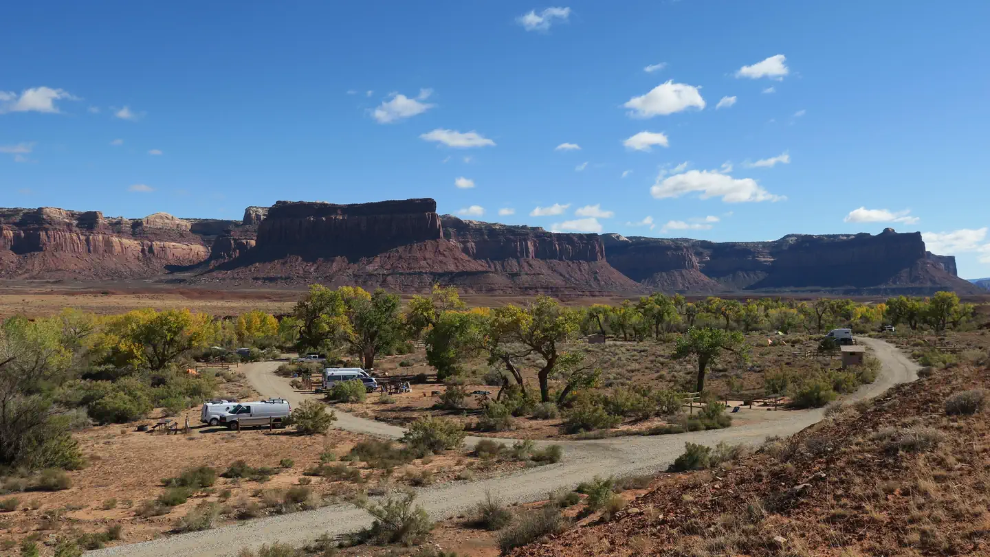
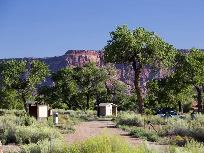
Creek Pasture Campground is a good option for visitors wishing to recreate in the Indian Creek area of Bears Ears National Monument or be close to the Needles District of Canyonlands National Park. The campground is located north off the Needles Highway (accessed from Utah State Route 211), approximately 5 miles southeast of Canyonlands National Park and 15 miles northwest of Newspaper Rock. The campground provides 32 campsites that each feature a tent/trailer space, a picnic table, a fire ring, and vault toilets. Each campsite can hold 10 people and 2 vehicles. There is no drinking water at the campground. Reservations are not available for camping at this location. Individual campsites are available on a first come, first served basis upon arrival at the self-register kiosk at the site. The Creek Pasture Group Site is available for larger groups, and may be reserved here. The Indian Creek area is generally primitive and undeveloped, with few services.
Recreation
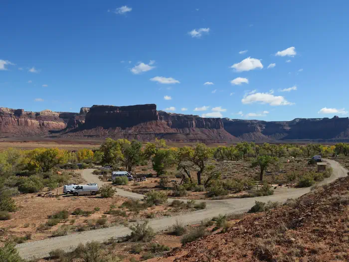
The Indian Creek area of Bears Ears National Monument has gained international recognition for its extraordinary natural beauty and recreational opportunities. The Indian Creek canyon opens to a broad valley rimmed by Wingate Sandstone cliffs known for world-class rock climbing. Prominent geologic features include Lavender Mesa, Bridger Jack Mesa, and North and South Six Shooter Peaks. This spectacular setting and rich archeological resources provide visitors with recreational opportunities such as rock climbing, camping, cultural resource viewing, scenic photography, and off-highway vehicle (OHV) touring on designated routes.
Facilities
Natural Features
The campground is located along the banks of Indian Creek. Creek flow is intermittent, and except for spring or immediately after precipitation, the creek bed is typically dry. Cottonwood trees line the banks of the creek and provide shade at some campsites. A small sandstone cliff lines the west side of the campground.
Nearby Attractions
- Newspaper Rock
- Needles District of Canyonlands National Park
Contact Info
For facility specific information, please call (435) 587-1500.Charges & Cancellations
No refunds are available.
The facts
- 32 bookable sites
- Up to 10 people per site
Site types
- 32 Standard Nonelectric
Amenities
- Campfires allowed
- Pets allowed
- Water hookups — not available
Not recorded upstream: electric hookups, sewer hookups, fire pits, picnic tables, grills, shade.
32 campsites at Creek Pasture Campground
Check-in 00:00 PM · Check-out 11:00 AM
| Site | Loop | Type | Entry | Surface | Max rig | People | |
|---|---|---|---|---|---|---|---|
| 1 | — | Standard Nonelectric | — | — | — | 10 | 🐾 |
| 10 | — | Standard Nonelectric | — | — | — | 10 | 🐾 |
| 11 | — | Standard Nonelectric | — | — | — | 10 | 🐾 |
| 12 | — | Standard Nonelectric | — | — | — | 10 | 🐾 |
| 13 | — | Standard Nonelectric | — | — | — | 10 | 🐾 |
| 14 | — | Standard Nonelectric | — | — | — | 10 | 🐾 |
| 15 | — | Standard Nonelectric | — | — | — | 10 | 🐾 |
| 16 | — | Standard Nonelectric | — | — | — | 10 | 🐾 |
| 17 | — | Standard Nonelectric | — | — | — | 10 | 🐾 |
| 18 | — | Standard Nonelectric | — | — | — | 10 | 🐾 |
| 19 | — | Standard Nonelectric | — | — | — | 10 | 🐾 |
| 2 | — | Standard Nonelectric | — | — | — | 10 | 🐾 |
| 20 | — | Standard Nonelectric | — | — | — | 10 | 🐾 |
| 21 | — | Standard Nonelectric | — | — | — | 10 | 🐾 |
| 22 | — | Standard Nonelectric | — | — | — | 10 | 🐾 |
| 23 | — | Standard Nonelectric | — | — | — | 10 | 🐾 |
| 24 | — | Standard Nonelectric | — | — | — | 10 | 🐾 |
| 25 | — | Standard Nonelectric | — | — | — | 10 | 🐾 |
| 26 | — | Standard Nonelectric | — | — | — | 10 | 🐾 |
| 27 | — | Standard Nonelectric | — | — | — | 10 | 🐾 |
| 28 | — | Standard Nonelectric | — | — | — | 10 | 🐾 |
| 29 | — | Standard Nonelectric | — | — | — | 10 | 🐾 |
| 3 | — | Standard Nonelectric | — | — | — | 10 | 🐾 |
| 30 | — | Standard Nonelectric | — | — | — | 10 | 🐾 |
| 31 | — | Standard Nonelectric | — | — | — | 10 | 🐾 |
| 32 | — | Standard Nonelectric | — | — | — | 10 | 🐾 |
| 4 | — | Standard Nonelectric | — | — | — | 10 | 🐾 |
| 5 | — | Standard Nonelectric | — | — | — | 10 | 🐾 |
| 6 | — | Standard Nonelectric | — | — | — | 10 | 🐾 |
| 7 | — | Standard Nonelectric | — | — | — | 10 | 🐾 |
| 8 | — | Standard Nonelectric | — | — | — | 10 | 🐾 |
| 9 | — | Standard Nonelectric | — | — | — | 10 | 🐾 |
Getting there
Turn west off U.S. Route 191 onto Utah State Route 211 and travel approximately 27.2 miles. Turn onto County Road 2382 on the north side of the highway. The campground is located 0.4 miles down the natural surface road.
38.16608, -109.63180 · 38°9'57.9"N 109°37'54.5"W
Typical weather
Typically 95°F in Jul, down to 42°F in Jan.
| Jan | Feb | Mar | Apr | May | Jun | Jul | Aug | Sep | Oct | Nov | Dec | |
|---|---|---|---|---|---|---|---|---|---|---|---|---|
| High °F | 42 | 49 | 59 | 67 | 77 | 89 | 95 | 92 | 84 | 70 | 55 | 42 |
| Low °F | 17 | 23 | 30 | 36 | 46 | 56 | 63 | 61 | 51 | 38 | 26 | 18 |
| Precip in | 0.4 | 0.6 | 0.6 | 0.7 | 0.7 | 0.3 | 0.9 | 1.0 | 0.8 | 1.1 | 0.6 | 0.6 |
1991–2020 averages from the nearest NOAA station, 6.9 mi away — not measured at the facility itself, and elevation can make a real difference over that distance.
Map
Fees and stay limits
Creek Pasture Campground is first come, first served and payment must be made upon arrival at the self-register kiosk at the campground using cash, check, or the Scan & Pay feature on the Recreation.gov mobile app. You must have the Recreation.gov app installed on your mobile device prior to arrival to use the Scan & Pay payment method.
From Recreation.gov, which is not always current. The operator's own page is the authority on what you will be charged.
More photos
Member photos
Common questions about Creek Pasture Campground
- Can you reserve a site at Creek Pasture Campground?
- Yes, Creek Pasture Campground is reservable through Recreation.gov.
- How many campsites does Creek Pasture Campground have?
- 32 sites.
- Are pets allowed at Creek Pasture Campground?
- Yes, pets are allowed at Creek Pasture Campground.
- Does Creek Pasture Campground have hookups?
- No hookups are recorded here.
- Are campfires allowed at Creek Pasture Campground?
- Campfires are allowed at Creek Pasture Campground. Check for a current fire restriction before you go.
Camping near Creek Pasture Campground
- Creek Pasture Group Site 0.3 mi · Campground · we watch it
- Superbowl Campground 1.5 mi · Campground · we watch it
- Superbowl Group Site 1.6 mi · Campground · we watch it
- Hamburger Rock Campground 2.7 mi · Campground · we watch it
- Indian Creek Falls Group Site 3.6 mi · Campground · we watch it
- Canyonlands National Park Needles District Campground 7 mi · Campground · we watch it
- Windwhistle Group Site 9.2 mi · Campground · we watch it
- The Needles Visitor Center 6.9 mi · Facility
- Windwhistle Campground 9.2 mi · Campground
- Newspaper Rock 13.7 mi · Facility
- Hatch Point Campground 14.8 mi · Campground
- Wilson Arch 15.9 mi · Facility
Contact
- Email blm_ut_mt_mail@blm.gov
- Book Recreation.gov
Recreation.gov last updated this record on 2026-02-25.
Facility information and photographs from Recreation.gov (RIDB). SpotOpened is not affiliated with Recreation.gov or any federal agency.
Comments