Clear Lake Cabin Lookout
Campground · 1 bookable site ·
Managed by the USDA Forest Service
Mt. Hood National Forest (NF) · Open Access
- 1
- Bookable site
- up to 4
- People per site
- 4,453 ft
- Elevation
Overview
Clear Lake Cabin Lookout is situated on the southern slope of Mt. Hood, providing spectacular panorama views of snow-covered treetops, alpine lakes and rugged Cascade peaks. It also provides access to a variety of recreational opportunities, including fishing, hiking and wildlife viewing, as well as winter sports.
From December 1st through April 30th, and during winter driving conditions, the lookout can only be accessed by skiing, snowmobiling or snowshoeing 3.5 miles one way from a parking area at Skyline Sno-park. Winter driving conditions can occur in early fall and persist late into the spring. An ODOT Sno-Park permit is required to park at Skyline Sno-park and the trek takes about three to four hours. Guests are responsible for their own travel arrangements and safety, and must bring several of their own amenities.
Recreation
The surrounding area is popular among winter sports enthusiasts, as it offers access to miles of great cross country skiing, snowshoeing and snowmobiling. A ski tour is available around the spring-fed Little Crater Lake. Fishing is available in the various mountain lakes and streams, however, many may be frozen.Facilities
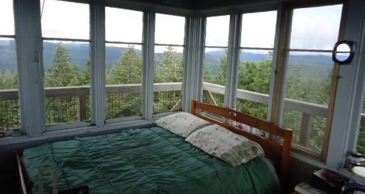
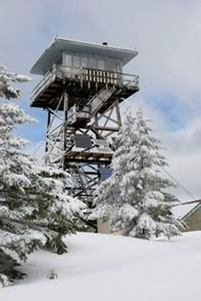
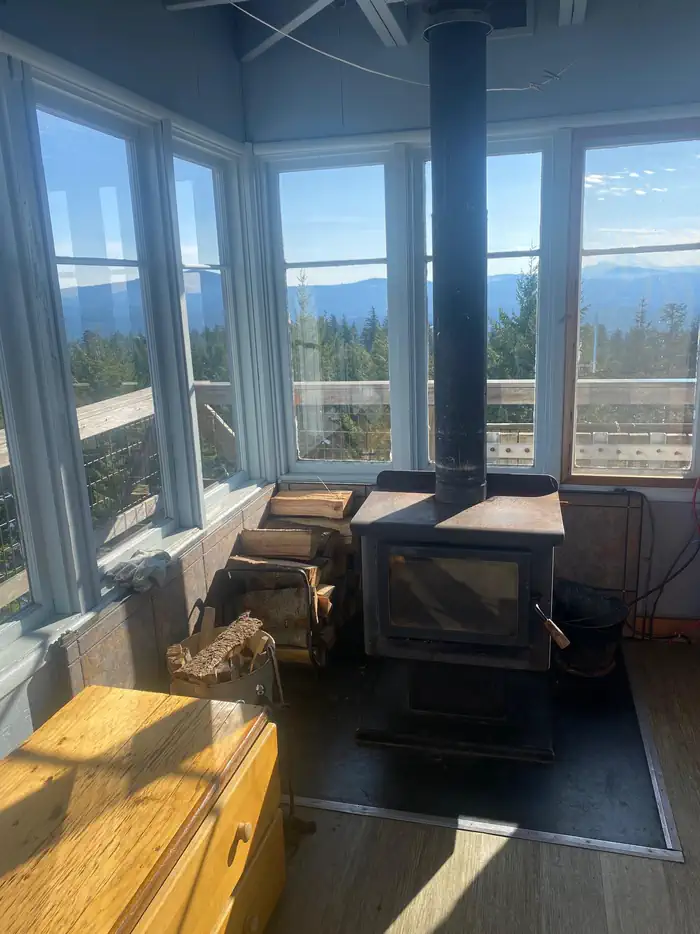
The cabin is atop a 40-foot tower and is surrounded by a wooden catwalk. The 14-by-14 room is furnished with a small bed, a wood stove for heating and a table and chairs. It has a propane cook stove and solar-powered lights. There is no water on-site.An outhouse with vault toilets is located on the ground, as well as a shed stocked with firewood. A rope and pulley system is available to transport gear, as well as firewood, up and down the tower with ease.
Guests will need to bring their own water for drinking, cooking and cleaning purposes, as well as their own bedding, food and clothing, towels, toilet paper, among other necessities. Garbage bags are also not supplied and guests will need to carry out all trash and clean the facility prior to leaving.
Natural Features
The tower sits on Clear Lake Butte, a 4,454-foot gently sloped hillside covered with fir trees, on the south side of Mt. Hood. Of the nine peaks in Oregon's Cascade Mountain Range, Mt. Hood stands the tallest, at 11,239 feet. It is thickly forested and capped with glaciers and snow.The lookout tower is perched on the mountainside, near the northwest corner of the Warm Springs Indian Reservation. It is one of three Forest Service watchtowers on Mt. Hood and it is still used to spot fires during summertime each year.
Originally 100 feet tall when it was built in 1932, the tower was replaced with the current 40-foot building in 1962. It overlooks Clear Lake and Timothy Lake in the distance. A variety of wildlife make its home in the area.
Contact Info
This location is unstaffed. To speak with our main office for general information, please call: (541) 352-6002.The facts
- Season: November 1 – May 31 — USDA Forest Service, Aug 24, 2026
- 1 bookable site
- Up to 4 people per site
- Loops: AREA CLEAR LAKE CABIN LOOKOUT
Site types
- 1 Cabin Nonelectric
Amenities
- Shade
Not recorded upstream: electric hookups, water hookups, sewer hookups, campfires allowed, fire pits, picnic tables, grills, pets allowed.
1 campsite at Clear Lake Cabin Lookout
Check-in 12:00 PM · Check-out 11:00 AM
| Site | Loop | Type | Entry | Surface | Max rig | People | |
|---|---|---|---|---|---|---|---|
| 001 | AREA CLEAR LAKE CABIN LOOKOUT | Cabin Nonelectric | — | — | — | 4 |
Getting there
Access begins at the junction of Highway 26 and Forest Service Road 42, 12 miles south of Government Camp, Oregon, at the Skyline Sno-Park. Between 12/1 and 04/30, guests must park at the Sno-Park and ski, snowshoe or snowmobile to the facility. From the parking area, proceed on Forest Service Road 42 to the 240 spur road and continue to the lookout, approximately 3.2 miles with an elevation climb of 900 feet. It is a good path for moderate skiers and will take three-and-a-half to four hours to complete. Maps are available online or for purchase by calling the Barlow Ranger District.
Guests will need to purchase a Sno-Park permit to park at Skyline Sno-Park. Permits can be purchased at several locations in the Portland area, or at CJ's on Highway 26, west of the intersection of Highway 26 and Forest Service Road 42.
45.15650, -121.71851 · 45°9'23.4"N 121°43'6.6"W
Typical weather
| Jan | Feb | Mar | Apr | May | Jun | Jul | Aug | Sep | Oct | Nov | Dec | |
|---|---|---|---|---|---|---|---|---|---|---|---|---|
| High °F | — | — | — | — | — | — | — | — | — | — | — | — |
| Low °F | — | — | — | — | — | — | — | — | — | — | — | — |
| Precip in | 6.7 | 4.4 | 4.1 | 3.1 | 2.6 | 1.9 | 0.4 | 0.6 | 1.5 | 3.9 | 6.1 | 7.5 |
1991–2020 averages from the nearest NOAA station, 2.7 mi away — not measured at the facility itself, and elevation can make a real difference over that distance.
Map
Fees and stay limits
The lookout is available during winter months, from Nov. 1 to May 31. The maximum length stay is seven consecutive nights. Fees are used for the maintenance and preservation of the lookout.
From Recreation.gov, which is not always current. The operator's own page is the authority on what you will be charged.
More photos
Member photos
Common questions about Clear Lake Cabin Lookout
- Can you reserve a site at Clear Lake Cabin Lookout?
- Yes, Clear Lake Cabin Lookout is reservable through Recreation.gov.
- How many campsites does Clear Lake Cabin Lookout have?
- 1 site.
Also listed by
Clear Lake Cabin Lookout also appears in other federal recreation data. Facts below are matched by name and location, not confirmed by Clear Lake Cabin Lookout's operator.
USDA Forest Service — data as of Aug 24, 2026
- Overnight use : $85/night. Fees are used directly for the maintenance and preservation of the lookout. Day use : Sno-Park permit required Nov. 1 through Apr. 30 at Skyline Sno-Park .
Restrictions:
- From December 1 through April 30, the lookout can only be accessed by skiing, snowmobiling or snowshoeing 3.5 miles one way from Skyline Sno-Park. (Winter gate closure.)
Camping near Clear Lake Cabin Lookout
- Little Crater Lake 1.4 mi · Campground · we watch it
- Clear Lake (Or) 1.9 mi · Campground · we watch it
- North Arm Campground (Timothy Lake, OR) 2.8 mi · Campground · we watch it
- Oak Fork Campground (Timothy Lake, OR) 3.8 mi · Campground · we watch it
- Joe Graham Horse Campground 4.1 mi · Campground · we watch it
- Gone Creek Campground (Timothy Lake, OR) 4.1 mi · Campground · we watch it
- Clackamas Lake Historic Cabin 4.3 mi · Campground · we watch it
- Clackamas Lake 4.4 mi · Campground · we watch it
- Stone Creek Campground (Timothy Lake, OR) 4.7 mi · Campground · we watch it
- Frog Lake 4.8 mi · Campground · we watch it
- Clear Lake Overflow Camping Area 2 mi · Campground
- Timothy Lake - Meditation Point Campground 4.2 mi · Campground
Contact
- Phone 541-467-2291
- Book Recreation.gov
Recreation.gov last updated this record on 2026-02-25.
Facility information and photographs from Recreation.gov (RIDB). SpotOpened is not affiliated with Recreation.gov or any federal agency.
Comments