Twin Bridges Group Shelter
Campground · Texas · 1 bookable site ·
Managed by the US Army Corps of Engineers
Waco Recreation Area (Recreation Area) · Open Access
- 1
- Bookable site
- up to 225
- People per site
- 1
- Accessible site
- 482 ft
- Elevation
Overview
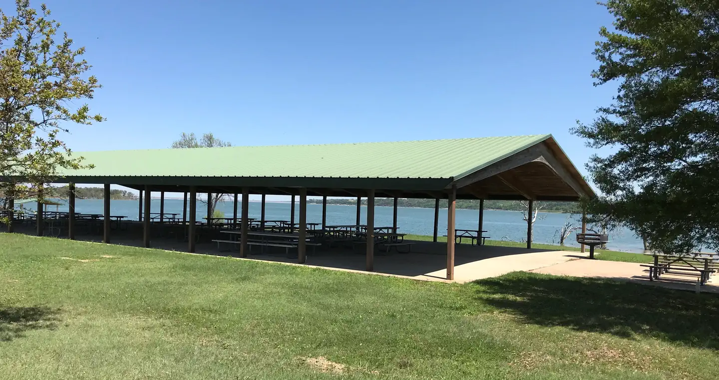
Twin Bridges, located on one of Waco Lake's sandy beaches, is ideal for families and friends to enjoy picnicking, sightseeing and water activities, all while staying within the Waco city limits.Recreation
The main lake shoreline has a large amount of submerged timber, which typically holds fish year-round. Anglers will find plenty of catfish, crappie, large and smallmouth bass as well as sunfish. Swimming beaches, boat ramp and dock all help visitors enjoy the lake.Facilities
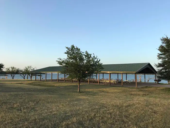
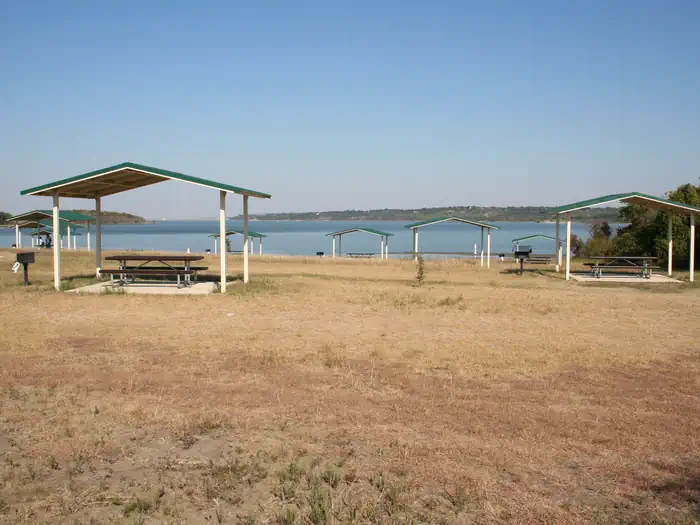
Twin Bridges has two swimming beaches, horseshoe pits, a covered playground and a sand volleyball court. The group shelters can accommodate up to 225 guests.Natural Features
The shelter is located on the west shore of the Waco Lake. The lake is primarily fed by the Bosque River, which runs for 115 miles through central Texas.Nearby Attractions
Horseback riding, hiking and biking can be done on the 20-mile Lacy Point Hiking and Biking Trail. The trail is accessible from the Lacy Point boat ramp or Reynolds Creek Park.The facts
- 1 bookable site
- 1 site for day use only
- 1 accessible site
- Up to 225 people per site
- Loops: TWIN BRIDGES GROUP SHELTER
Site types
- 1 Group Shelter Electric
Amenities
- Water hookups
- Picnic tables
- Grills
- Shade
- Pets allowed
- Campfires allowed — not available
Not recorded upstream: electric hookups, sewer hookups, fire pits.
1 campsite at Twin Bridges Group Shelter
Check-in 6:00 AM · Check-out 8:30 PM
| Site | Loop | Type | Entry | Surface | Water | Max rig | People | |
|---|---|---|---|---|---|---|---|---|
| 1 | TWIN BRIDGES GROUP SHELTER | Group Shelter Electric | — | Paved | Lakefront | — | 225 | ♿ 🐾 |
Getting there
From I-35, take exit 330B Hwy 6 N toward Meridian for about 6 miles. After passing over the lake on the Twin Bridges, take the first exit toward Lake Waco/Speegleville Park. Turn left on the access road and the park entrance will be on the right.
31.53525, -97.24682 · 31°32'6.9"N 97°14'48.5"W
Typical weather
| Jan | Feb | Mar | Apr | May | Jun | Jul | Aug | Sep | Oct | Nov | Dec | |
|---|---|---|---|---|---|---|---|---|---|---|---|---|
| High °F | — | — | — | — | — | — | — | — | — | — | — | — |
| Low °F | — | — | — | — | — | — | — | — | — | — | — | — |
| Precip in | 2.6 | 2.6 | 3.5 | 3.4 | 4.5 | 3.5 | 2.1 | 2.2 | 3.1 | 5.1 | 2.8 | 3.0 |
1991–2020 averages from the nearest NOAA station, 2.6 mi away — not measured at the facility itself, and elevation can make a real difference over that distance.
Map
More photos
Member photos
Common questions about Twin Bridges Group Shelter
- Can you reserve a site at Twin Bridges Group Shelter?
- Yes, Twin Bridges Group Shelter is reservable through Recreation.gov.
- How many campsites does Twin Bridges Group Shelter have?
- 1 site.
- Are pets allowed at Twin Bridges Group Shelter?
- Yes, pets are allowed at Twin Bridges Group Shelter.
- Does Twin Bridges Group Shelter have hookups?
- Water.
- Are campfires allowed at Twin Bridges Group Shelter?
- Campfires are not allowed at Twin Bridges Group Shelter.
Camping near Twin Bridges Group Shelter
- Speegleville Park 1.3 mi · Campground · we watch it
- Midway 1.4 mi · Campground · we watch it
- Reynolds Creek 3.4 mi · Campground · we watch it
- Airport Beach Shelter 5 mi · Campground · we watch it
- Airport Park 5.2 mi · Campground · we watch it
- Winkler Park 23.7 mi · Campground · we watch it
- Lofers Bend Day Use (TX) 24.6 mi · Campground · we watch it
- White Flint Park 24.9 mi · Campground · we watch it
- Lofers Bend East 25.1 mi · Campground · we watch it
- Lofers Bend West 25.1 mi · Campground · we watch it
- Cedar Ridge (TX) 27.8 mi · Campground · we watch it
- Welcome Center 6.5 mi · Facility
Contact
- Phone 254-756-5359
- Book Recreation.gov
Recreation.gov last updated this record on 2026-02-25.
Facility information and photographs from Recreation.gov (RIDB). SpotOpened is not affiliated with Recreation.gov or any federal agency.
Comments