Lone Pine Group Campground
Campground · Oregon · 13 bookable sites ·
Managed by the Bureau of Land Management
Roseburg District Swiftwater Field Office (Bureau of Land Management OR) · Open Access
- 13
- Bookable sites
- 100 ft
- Max rig length
- up to 110
- People per site
- 1,083 ft
- Elevation
Overview
THIS LOCATION IS AVAILABLE FOR INDIVIDUAL SITE RENTALS FOR THE SUMMER AND FALL OF THE 2026 SEASON.
Reservations must be made 1-day prior to arrival
Lone Pine Group Campground is adjacent to Rock Creek, a tributary of the North Umpqua River. Lone Pine is situated at the site of the old Rock Creek sawmill that once operated in the 1930s thru the 1950s. The campground is a short drive from the Umpqua National Forest, which boasts incredible glacier-cut mountain slopes across 984,602 acres of forest. The name, Umpqua, is a surviving term of the Native American Umpqua language, and is believed to mean "thundering waters," "across the waters" or "satisfied."
Recreation
Hiking picnicking and relaxing are the primary activities at the campground. In summer, swimming in the cool creek is a refreshing treat. In spring and fall, salmon and steelheads come upriver to spawn.To protect valuable native runs of salmon and steelhead, Rock Creek is closed to anglers. Instead, head to the North Umpqua River for abundant fishing opportunities.
A drive along the Rogue-Umpqua Scenic Byway yields gorgeous views of mountain peaksforested canyons and alpine lakes.
Facilities
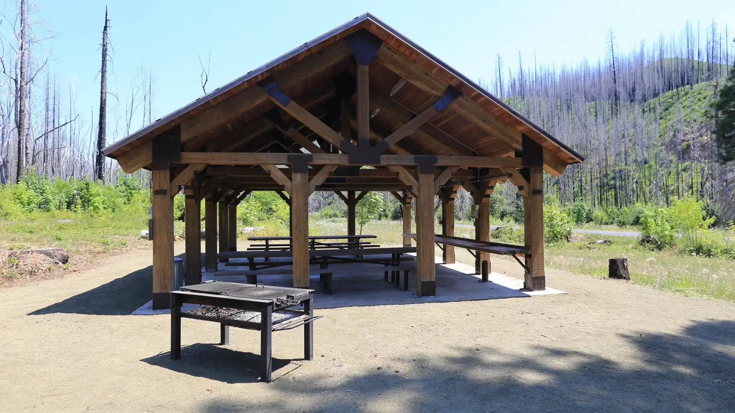
The campground is built on a loop with eleven separate sites. The volleyball court and horseshoe pits are currently under construction. Use of a pavilion and ballfield is allowed for campers and day-use recreationists parking in the overflow area across Rock Creek Road.
Natural Features
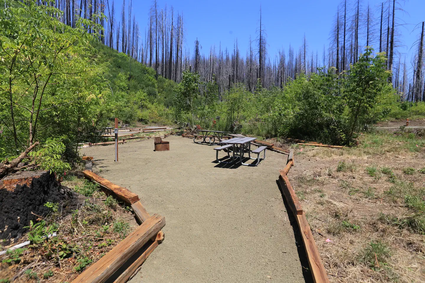
Lone Pine is on the western edge of the Cascade Mountains, set along Rock Creek, which eventually flows into the North Umpqua River. Lone Pine Campground was heavily affected by the Archie Creek Fire in 2020, creating significant differences from its previous condition.
Nearby Attractions
Visitors can get their adventure-fix with whitewater rafting/kayaking and angling in the North Umpqua River just five miles away. A trip to nearby Crater Lake National Park is another "can't miss" destination or visiting several of the waterfalls in the surrounding area.
The facts
- 13 bookable sites
- 1 site for day use only
- Vehicles up to 100 ft
- Up to 110 people per site
- Loops: Lone Pine Campground (Reservation), Lone Pine Group Campground (Reservation)
Site types
- 11 Standard Nonelectric
- 2 Group Picnic Area
Amenities
- Shade
- Pets allowed
Not recorded upstream: electric hookups, water hookups, sewer hookups, campfires allowed, fire pits, picnic tables, grills.
13 campsites at Lone Pine Group Campground
Check-in 1:00 PM · Check-out 11:00 AM
| Site | Loop | Type | Entry | Surface | Max rig | People | |
|---|---|---|---|---|---|---|---|
| C001 | Lone Pine Campground (Reservation) | Standard Nonelectric | — | — | 44 ft | 8 | 🐾 |
| C002 | Lone Pine Campground (Reservation) | Standard Nonelectric | — | — | 58 ft | 8 | 🐾 |
| C003 | Lone Pine Campground (Reservation) | Standard Nonelectric | Pull Through | — | 58 ft | 8 | 🐾 |
| C004 | Lone Pine Campground (Reservation) | Standard Nonelectric | — | — | 60 ft | 8 | 🐾 |
| C005 | Lone Pine Campground (Reservation) | Standard Nonelectric | — | — | 49 ft | 8 | 🐾 |
| C006 | Lone Pine Campground (Reservation) | Standard Nonelectric | — | — | 100 ft | 8 | 🐾 |
| C007 | Lone Pine Campground (Reservation) | Standard Nonelectric | — | — | 51 ft | 8 | 🐾 |
| C008 | Lone Pine Campground (Reservation) | Standard Nonelectric | — | — | 70 ft | 8 | 🐾 |
| C009 | Lone Pine Campground (Reservation) | Standard Nonelectric | — | — | 35 ft | 8 | 🐾 |
| C010 | Lone Pine Campground (Reservation) | Standard Nonelectric | — | — | 63 ft | 10 | 🐾 |
| C011 | Lone Pine Campground (Reservation) | Standard Nonelectric | — | — | 70 ft | 10 | 🐾 |
| Group Area | Lone Pine Group Campground (Reservation) | Group Picnic Area | — | — | — | 110 | |
| Pavilion | Lone Pine Group Campground (Reservation) | Group Picnic Area | — | — | 42 ft | 50 |
Getting there
43.38361, -122.94639 · 43°23'1.0"N 122°56'47.0"W
Typical weather
Typically 84°F in Jul, down to 44°F in Dec.
| Jan | Feb | Mar | Apr | May | Jun | Jul | Aug | Sep | Oct | Nov | Dec | |
|---|---|---|---|---|---|---|---|---|---|---|---|---|
| High °F | 46 | 50 | 56 | 62 | 70 | 75 | 84 | 84 | 78 | 64 | 51 | 44 |
| Low °F | 34 | 35 | 36 | 39 | 43 | 47 | 51 | 50 | 46 | 41 | 38 | 33 |
| Precip in | 8.7 | 6.1 | 7.0 | 5.6 | 3.7 | 1.9 | 0.5 | 0.5 | 1.6 | 5.0 | 9.3 | 10.7 |
1991–2020 averages from the nearest NOAA station, 1.3 mi away — not measured at the facility itself, and elevation can make a real difference over that distance.
Map
More photos

Member photos
Common questions about Lone Pine Group Campground
- Can you reserve a site at Lone Pine Group Campground?
- Yes, Lone Pine Group Campground is reservable through Recreation.gov.
- How many campsites does Lone Pine Group Campground have?
- 13 sites.
- What is the maximum RV length at Lone Pine Group Campground?
- 100 ft. That is the longest vehicle the sites here are recorded as taking; individual sites may be shorter.
- Are pets allowed at Lone Pine Group Campground?
- Yes, pets are allowed at Lone Pine Group Campground.
Camping near Lone Pine Group Campground
- Millpond Pavilion 0.2 mi · Campground · we watch it
- Millpond Recreation Site 0.2 mi · Campground · we watch it
- Rock Creek Pavilion 1.4 mi · Campground · we watch it
- Susan Creek Campground 6.6 mi · Campground · we watch it
- Bogus Creek Campground 8.4 mi · Campground · we watch it
- Scaredman Recreation Site 9.3 mi · Campground · we watch it
- Wolf Creek Group Site 10 mi · Campground · we watch it
- Canton Creek Campground 11.1 mi · Campground · we watch it
- Steamboat Ball Field Group Site 11.4 mi · Campground · we watch it
- Rock Creek Recreation Site 1.3 mi · Facility
- Steamboat Inn 10.7 mi · Facility
- Coolwater Campground 11.1 mi · Campground
Contact
- Phone 541-440-4930
- Email BLM_OR_RB_Mail@blm.gov
- Book Recreation.gov
Recreation.gov last updated this record on 2026-07-22.
Facility information and photographs from Recreation.gov (RIDB). SpotOpened is not affiliated with Recreation.gov or any federal agency.
Comments