Peoples Creek
Campground · Missouri · 54 bookable sites ·
Managed by the US Army Corps of Engineers
- 54
- Bookable sites
- 59 ft
- Max rig length
- up to 40
- People per site
- 5
- Accessible sites
- 437 ft
- Elevation
Overview
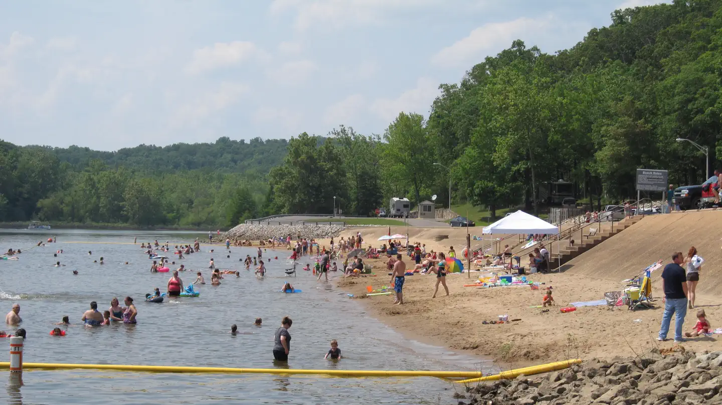
People's Creek Recreation Area, located in the southeastern Ozark foothills of Missouri, is a great launchpad for boating, fishing, swimming, hiking or simply exploring the Wappapello Lake area.
Completed in 1941, Wappapello Lake provides an estimated $3.9 million in annual flood protection to agricultural lands and developed areas along the St. Francis River. A peaceful cove offers endless recreation opportunities with 57 campsites, a picnic shelter, beach, accessible fishing pier, and Lake View Trail.
Click here to take a virtual tour of the facilities at Wappapello Lake.
Recreation
People's Creek is ideally suited for swimming and boating activities. The lake is home to some of Missouri's most sought after game fish, including largemouth bass, crappie, bluegill, white bass and channel catfish. Hunting, fishing and kayaking are popular activities year-round. Hiking and biking on one of the Lake's 9 trail systems provides opportunities for all ages and abilities. The new accessible Shell Lake Archery Trail is a unique destination for achery enthusiasts.
Facilities
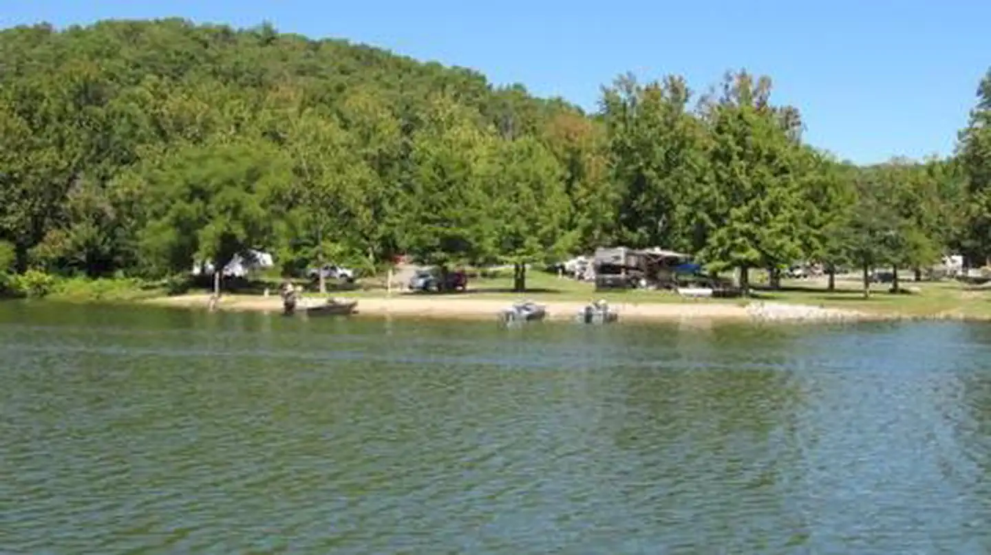
The day-use portion of People's Creek includes a two-lane boat ramp with courtesy dock, an accessible fishing pier, swimming beach and large picnic shelter. The campground portion has an upper and lower campground. The lower area offers 38 sites with 50-amp electric and water hookups. Peoples Creek Lower section is the only campground at Wappapepello Lake with waterfront campsites. A large sandy mooring area is available for campers. The upper area has 19 full-service campsites with 50-amp electric, water and sewer hookups.
Natural Features
Wappapello Lake stretches 8,400 acres on 45,000 acres of public land. Lightly wooded shorelines add shade to the scenic landscape.Nearby Attractions
Explore the nearby Pine Ridge Nature trail, Shell Lake Archery Trail and Wappapllo Wildflower Trail and Greenhouse areas or St. Francis River. The Mingo Wildlife Refuge is approximately 11.5 miles from Peoples Creek Recreation Area. The Lake Wappapello State Park is approximately 18.2 miles away, and the Sam A. Baker State park is 33.4 miles away from Peoples Creek Recreation Area.
Contact Info
Between 05/06/2026 and 09/28/2026 this location is staffed. Please call (573) 222-8234 to speak with local staff. From 09/02/2025 to 05/05/2026 this location is unstaffed. Please call (573) 778-5404 for general information.The facts
- 54 bookable sites
- 57 sites in total, including non-bookable
- 1 site for day use only
- 5 accessible sites
- Vehicles up to 59 ft
- Up to 40 people per site
- Loops: PCRL, PCRU, PEOPLES CREEK
Site types
- 50 Standard Electric
- 3 Management
- 3 Tent Only Electric
- 1 Group Shelter Electric
Amenities
- Electric hookups
- Water hookups
- Sewer hookups
- Campfires allowed
- Picnic tables
- Grills
- Shade
- Pets allowed
Not recorded upstream: fire pits.
57 campsites at Peoples Creek
| Site | Loop | Type | Entry | Surface | Access | Water | Max rig | People | |
|---|---|---|---|---|---|---|---|---|---|
| 01 | PCRL | Standard Electric | Back In | Paved | Drive In | — | — | 8 | 🐾 |
| 02 | PCRL | Standard Electric | Back In | Paved | Drive In | — | — | 8 | 🐾 |
| 03 | PCRL | Standard Electric | Back In | Paved | Drive In | — | — | 8 | ♿ 🐾 |
| 04 | PCRL | Standard Electric | Back In | Paved | Drive In | — | — | 8 | 🐾 |
| 05 | PCRL | Standard Electric | Back In | Paved | Drive In | — | — | 8 | 🐾 |
| 06 | PCRL | Standard Electric | Back In | Paved | Drive In | — | 50 ft | 8 | 🐾 |
| 07 | PCRL | Standard Electric | Back In | Paved | Drive In | — | 59 ft | 8 | 🐾 |
| 08 | PCRL | Standard Electric | Back In | Paved | Drive In | — | — | 8 | 🐾 |
| 09 | PCRL | Standard Electric | Back In | Paved | Drive In | — | — | 8 | 🐾 |
| 10 | PCRL | Standard Electric | Back In | Paved | Drive In | — | — | 8 | 🐾 |
| 11 | PCRL | Standard Electric | Back In | Paved | Drive In | — | 55 ft | 8 | 🐾 |
| 12 | PCRL | Standard Electric | Back In | Paved | Drive In | — | — | 8 | 🐾 |
| 13 | PCRL | Standard Electric | Back In | Paved | Drive In | — | — | 8 | 🐾 |
| 14 | PCRL | Standard Electric | Back In | Paved | Drive In | — | — | 8 | 🐾 |
| 15 | PCRL | Standard Electric | Back In | Paved | Drive In | — | — | 8 | 🐾 |
| 16 | PCRL | Standard Electric | Back In | Paved | Drive In | — | — | 8 | 🐾 |
| 17 | PCRL | Standard Electric | Back In | Paved | Drive In | — | — | 8 | 🐾 |
| 18 | PCRL | Standard Electric | Back In | Paved | Drive In | — | — | 8 | 🐾 |
| 19 | PCRL | Standard Electric | Back In | Paved | Drive In | — | — | 8 | 🐾 |
| 20 | PCRL | Standard Electric | Back In | Paved | Drive In | — | — | 8 | 🐾 |
| 21 | PCRL | Standard Electric | Back In | Paved | Drive In | — | — | 8 | 🐾 |
| 22 | PCRL | Standard Electric | Back In | Paved | Drive In | — | — | 8 | 🐾 |
| 23 | PCRL | Standard Electric | Back In | Paved | Drive In | — | — | 8 | 🐾 |
| 24 | PCRL | Standard Electric | Back In | Paved | Drive In | — | — | 8 | 🐾 |
| 25 | PCRL | Standard Electric | Back In | Paved | Drive In | — | — | 8 | ♿ 🐾 |
| 26 | PCRL | Standard Electric | Back In | Paved | Drive In | — | — | 8 | 🐾 |
| 27 | PCRL | Standard Electric | Back In | Paved | Drive In | — | — | 8 | 🐾 |
| 28 | PCRL | Standard Electric | Back In | Paved | Drive In | — | — | 8 | 🐾 |
| 29 | PCRL | Standard Electric | Back In | Paved | Drive In | — | — | 8 | 🐾 |
| 30 | PCRL | Standard Electric | Back In | Paved | Drive In | — | — | 8 | ♿ 🐾 |
| 31 | PCRL | Standard Electric | Back In | Paved | Drive In | — | — | 8 | 🐾 |
| 32/33 | PCRL | Standard Electric | Back In | Paved | Drive In | — | — | 10 | 🐾 |
| 34 | PCRL | Standard Electric | Back In | Paved | Drive In | — | 5 ft | 8 | 🐾 |
| 35 | PCRL | Standard Electric | Back In | Paved | Drive In | — | — | 8 | 🐾 |
| 36 | PCRL | Tent Only Electric | — | — | Hike In | Lakefront | — | 8 | 🐾 |
| 37 | PCRL | Tent Only Electric | — | — | Hike In | Lakefront | — | 8 | 🐾 |
| 38 | PCRL | Tent Only Electric | — | — | Hike In | Lakefront | — | 8 | 🐾 |
| 39 | PCRU | Standard Electric | Back In | Paved | — | — | — | 8 | 🐾 |
| 40 | PCRU | Standard Electric | Back In | Paved | — | — | — | 8 | 🐾 |
| 41 | PCRU | Standard Electric | Back In | Paved | — | — | — | 8 | ♿ 🐾 |
| 42 | PCRU | Standard Electric | Back In | Paved | — | — | — | 8 | 🐾 |
| 43 | PCRU | Standard Electric | Back In | Paved | — | — | — | 8 | 🐾 |
| 44 | PCRU | Standard Electric | Back In | Paved | — | — | — | 8 | 🐾 |
| 45 | PCRU | Management | Back In | Paved | — | — | — | 8 | 🐾 |
| 46 | PCRU | Standard Electric | Back In | Paved | — | — | — | 8 | 🐾 |
| 47 | PCRU | Management | Back In | Paved | — | — | — | 8 | 🐾 |
| 48 | PCRU | Standard Electric | Back In | Paved | — | — | — | 8 | 🐾 |
| 49 | PCRU | Management | Back In | Paved | — | — | — | 8 | 🐾 |
| 50 | PCRU | Standard Electric | Back In | Paved | — | — | — | 8 | 🐾 |
| 51 | PCRU | Standard Electric | Pull Through | Paved | Drive In | — | — | 8 | 🐾 |
| 52 | PCRU | Standard Electric | Back In | Paved | — | — | — | 8 | 🐾 |
| 53 | PCRU | Standard Electric | Back In | Paved | — | — | — | 8 | 🐾 |
| 54 | PCRU | Standard Electric | Back In | Paved | — | — | — | 8 | 🐾 |
| 55 | PCRU | Standard Electric | Back In | Paved | — | — | — | 8 | 🐾 |
| 56 | PCRU | Standard Electric | Back In | Paved | — | — | — | 8 | 🐾 |
| 57 | PCRU | Standard Electric | Back In | Paved | — | — | — | 8 | 🐾 |
| S07 | PEOPLES CREEK | Group Shelter Electric | — | Paved | Drive In | Lakefront | — | 40 | ♿ 🐾 |
Getting there
From Poplar Bluff: Take Hwy 60 East to Highway T. Then take Highway T North and look for signs.
36.94644, -90.27525 · 36°56'47.2"N 90°16'30.9"W
Typical weather
Typically 88°F in Jul, down to 42°F in Jan.
| Jan | Feb | Mar | Apr | May | Jun | Jul | Aug | Sep | Oct | Nov | Dec | |
|---|---|---|---|---|---|---|---|---|---|---|---|---|
| High °F | 42 | 47 | 56 | 68 | 76 | 85 | 88 | 87 | 81 | 69 | 56 | 45 |
| Low °F | 24 | 28 | 37 | 46 | 57 | 65 | 69 | 67 | 60 | 47 | 36 | 28 |
| Precip in | 3.8 | 3.5 | 5.0 | 5.4 | 5.6 | 4.0 | 4.4 | 3.5 | 3.6 | 3.8 | 4.7 | 4.2 |
1991–2020 averages from the nearest NOAA station, 1.7 mi away — not measured at the facility itself, and elevation can make a real difference over that distance.
Map
Fees and stay limits
Site Type: Full Service (50 Amp, Water, Sewer) $28.00 Limited Service (50 Amp, Water) $24.00 Walk-in Tent Sites (50 Amp, Water) $16.00
From Recreation.gov, which is not always current. The operator's own page is the authority on what you will be charged.
More photos

Member photos
Common questions about Peoples Creek
- Can you reserve a site at Peoples Creek?
- Yes, Peoples Creek is reservable through Recreation.gov.
- How many campsites does Peoples Creek have?
- 57 sites in total, of which 54 can be booked.
- What is the maximum RV length at Peoples Creek?
- 59 ft. That is the longest vehicle the sites here are recorded as taking; individual sites may be shorter.
- Are pets allowed at Peoples Creek?
- Yes, pets are allowed at Peoples Creek.
- Does Peoples Creek have hookups?
- Electric, Water, Sewer.
- Are campfires allowed at Peoples Creek?
- Campfires are allowed at Peoples Creek. Check for a current fire restriction before you go.
Camping near Peoples Creek
- Eagle Point Recreation Area 0.8 mi · Campground · we watch it
- Redman Creek Recreation Area 1.4 mi · Campground · we watch it
- Spillway Recreation Area 1.5 mi · Campground · we watch it
- Snow Creek Campground 4.9 mi · Campground · we watch it
- Greenville Recreation Area 14.6 mi · Campground · we watch it
- Markham Springs 18.1 mi · Campground · we watch it
- Fuchs House 18.2 mi · Campground · we watch it
- Pinewoods Lake Rec Area 28.2 mi · Campground · we watch it
- Mingo Wilderness 7.1 mi · Facility
- Hendrickson Boat Launch 11.4 mi · Facility
- Markham Springs Recreation Area 18.4 mi · Campground
- Pinewoods Lake Recreation Area 27.6 mi · Campground
Contact
- Phone 573-222-8234
- Email wappapellolake@usace.army.mil
- Book Recreation.gov
Recreation.gov last updated this record on 2026-02-25.
Facility information and photographs from Recreation.gov (RIDB). SpotOpened is not affiliated with Recreation.gov or any federal agency.
Comments