Markham Springs
Campground · Missouri · 33 bookable sites ·
Managed by the USDA Forest Service
- 33
- Bookable sites
- up to 50
- People per site
- 11
- Accessible sites
- 483 ft
- Elevation
Overview
Markham Springs Campground is set on the Black River in a scenic and historic recreation area in the southwestern corner of Missouri's Mark Twain National Forest. The area provides access to multiple trails and recreational opportunities.Markham Springs Recreation Area gets its name from former owner, M. J. Markham, who acquired the property in 1901 and operated a lumber mill at the site until the 1930s.
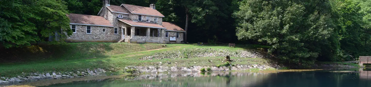
The Fuchs House, a five-bedroom concrete and native stone home, also sits on the property, along with a neighboring mill. At times, it is also available for rent.
Recreation
River and stream fishing are popular activities near the campground. The Black River boasts bass, sunfish, walleye and catfish. Many anglers fish from boats, but others fish from the riverbanks. Canoeing and kayaking is also possible on the river.Various day hikes within the Markham Springs Trail System are accessible from the campground. Eagle Bluff Trail is a 1.5-mile loop along the river, where birding and wildlife viewing are favorite pastimes.
Facilities
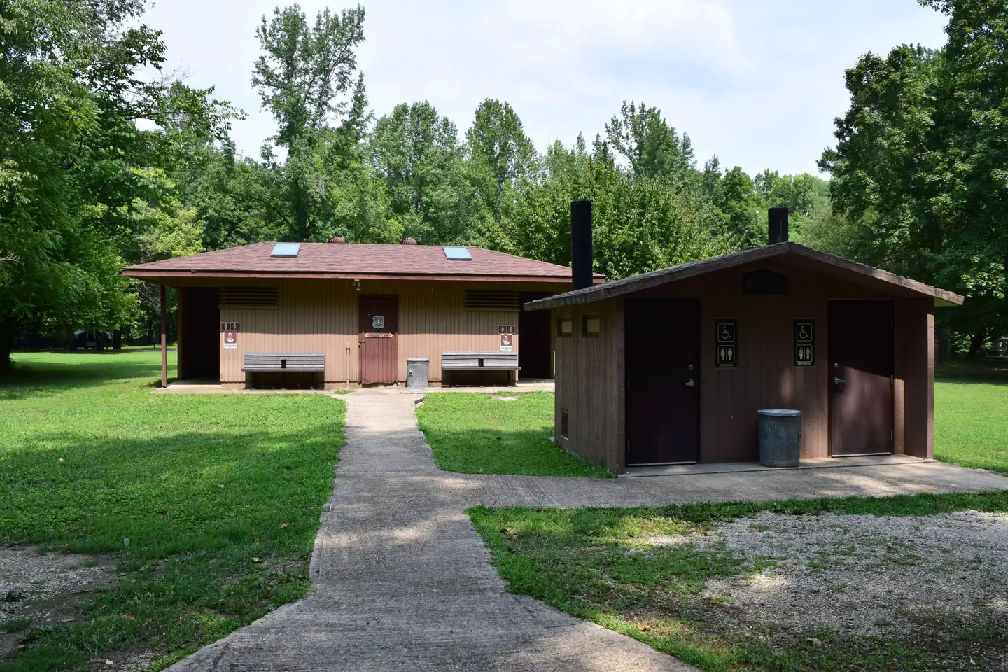
The campground offers single and double sites for tent and RV camping. Some rather primitive sites are located in a wooded setting near the river.Electric hookups are provided, as well as tables and campfire rings with grills. Lantern posts are also available. Accessible vault toilets, drinking water, showers and trash collection are provided.
Natural Features
Located adjacent to the Black River, the recreation area contains a small pond that dates back to the 1800s. The area is covered by a dense forest of colorful trees, including ash, elm, maple and poplar.Nearby Attractions
The small town of Williamsville is just 3 miles from the campground, offering a general store and fuel station.The facts
- 33 bookable sites
- 1 site for day use only
- 11 accessible sites
- Up to 50 people per site
- Loops: Birch, PINE, River, Sycamore
Site types
- 20 Standard Nonelectric
- 12 RV Electric
- 1 Group Shelter Electric
Amenities
- Electric hookups
- Campfires allowed
- Picnic tables
- Grills
- Shade
- Pets allowed
Not recorded upstream: water hookups, sewer hookups, fire pits.
33 campsites at Markham Springs
Check-in 2:00 PM · Check-out 12:00 PM
| Site | Loop | Type | Entry | Surface | Grade | Max rig | People | |
|---|---|---|---|---|---|---|---|---|
| Pavilion | — | Group Shelter Electric | — | — | — | — | 50 | |
| 21 | Birch | Rv Electric | Pull Through | Gravel | Slight | — | 8 | ♿ 🐾 |
| 22 | Birch | Rv Electric | Pull Through | Gravel | Slight | — | 16 | ♿ 🐾 |
| 23 | Birch | Rv Electric | Back In | Gravel | Slight | — | 8 | ♿ 🐾 |
| 24 | Birch | Rv Electric | Back In | Gravel | Slight | — | 8 | 🐾 |
| 25 | Birch | Rv Electric | Pull Through | Gravel | Slight | — | 8 | ♿ 🐾 |
| 26 | Birch | Rv Electric | Back In | Gravel | Slight | — | 8 | ♿ 🐾 |
| 27 | Birch | Rv Electric | Pull Through | Gravel | Slight | — | 16 | ♿ 🐾 |
| 28 | Birch | Rv Electric | Back In | Gravel | Slight | — | 8 | ♿ 🐾 |
| 29 | Birch | Rv Electric | Back In | Gravel | Slight | — | 16 | ♿ 🐾 |
| 30 | Birch | Rv Electric | Pull Through | Gravel | Slight | — | 16 | ♿ 🐾 |
| 31 | Birch | Rv Electric | Pull Through | Gravel | Slight | — | 8 | ♿ 🐾 |
| 32 | Birch | Rv Electric | Back In | Gravel | Slight | — | 16 | ♿ 🐾 |
| 01 | PINE | Standard Nonelectric | Back In | Gravel | Slight | — | 8 | 🐾 |
| 02 | PINE | Standard Nonelectric | Back In | Gravel | Slight | — | 8 | 🐾 |
| 03 | PINE | Standard Nonelectric | Back In | Gravel | Slight | — | 16 | 🐾 |
| 04 | PINE | Standard Nonelectric | Back In | Gravel | Slight | — | 8 | 🐾 |
| 05 | PINE | Standard Nonelectric | Back In | Gravel | Slight | — | 8 | 🐾 |
| 12 | River | Standard Nonelectric | Back In | Gravel | Slight | — | 16 | 🐾 |
| 13 | River | Standard Nonelectric | Back In | Gravel | Slight | — | 8 | 🐾 |
| 14 | River | Standard Nonelectric | Back In | Gravel | Slight | — | 8 | 🐾 |
| 15 | River | Standard Nonelectric | Back In | Gravel | Slight | — | 8 | 🐾 |
| 16 | River | Standard Nonelectric | Back In | Gravel | Slight | — | 8 | 🐾 |
| 17 | River | Standard Nonelectric | Back In | Gravel | Slight | — | 8 | 🐾 |
| 18 | River | Standard Nonelectric | Back In | Gravel | Slight | — | 8 | 🐾 |
| 19 | River | Standard Nonelectric | Back In | Gravel | Slight | — | 8 | 🐾 |
| 20 | River | Standard Nonelectric | Back In | Gravel | Slight | — | 8 | 🐾 |
| 06 | Sycamore | Standard Nonelectric | Back In | Gravel | Slight | — | 8 | 🐾 |
| 07 | Sycamore | Standard Nonelectric | Back In | Gravel | Slight | — | 8 | 🐾 |
| 08 | Sycamore | Standard Nonelectric | Back In | Gravel | Slight | — | 8 | 🐾 |
| 09 | Sycamore | Standard Nonelectric | Back In | Gravel | Slight | — | 8 | 🐾 |
| 10 | Sycamore | Standard Nonelectric | Back In | Gravel | Slight | — | 8 | 🐾 |
| 11 | Sycamore | Standard Nonelectric | Back In | Gravel | Slight | — | 16 | 🐾 |
Getting there
From Poplar Bluff, take Highway 67 north for 14 miles, then drive west on Highway 49 for 9 miles (about 3 miles past the town of Williamsville). Take the first right after crossing the Black River to enter Markham Springs Recreation Area.
36.97333, -90.60167 · 36°58'24.0"N 90°36'6.0"W
Typical weather
| Jan | Feb | Mar | Apr | May | Jun | Jul | Aug | Sep | Oct | Nov | Dec | |
|---|---|---|---|---|---|---|---|---|---|---|---|---|
| High °F | — | — | — | — | — | — | — | — | — | — | — | — |
| Low °F | — | — | — | — | — | — | — | — | — | — | — | — |
| Precip in | 3.3 | 3.6 | 4.8 | 5.6 | 5.3 | 4.5 | 4.4 | 4.9 | 3.6 | 3.6 | 4.6 | 4.0 |
1991–2020 averages from the nearest NOAA station, 2.4 mi away — not measured at the facility itself, and elevation can make a real difference over that distance.
Map
More photos
Member photos
Common questions about Markham Springs
- Can you reserve a site at Markham Springs?
- Yes, Markham Springs is reservable through Recreation.gov.
- How many campsites does Markham Springs have?
- 33 sites.
- Are pets allowed at Markham Springs?
- Yes, pets are allowed at Markham Springs.
- Does Markham Springs have hookups?
- Electric.
- Are campfires allowed at Markham Springs?
- Campfires are allowed at Markham Springs. Check for a current fire restriction before you go.
Camping near Markham Springs
- Fuchs House 0.3 mi · Campground · we watch it
- Pinewoods Lake Rec Area 10.7 mi · Campground · we watch it
- Greenville Recreation Area 11.9 mi · Campground · we watch it
- Snow Creek Campground 13.5 mi · Campground · we watch it
- River Road Park 14.3 mi · Campground · we watch it
- Piedmont Park 14.9 mi · Campground · we watch it
- Webb Creek Park 16.7 mi · Campground · we watch it
- Bluff View(clearwater Lake) 17.7 mi · Campground · we watch it
- Redman Creek Recreation Area 17.8 mi · Campground · we watch it
- Markham Springs Recreation Area 0.6 mi · Campground
- Hendrickson Boat Launch 8.6 mi · Facility
- Pinewoods Lake Recreation Area 10.1 mi · Campground
Contact
- Book Recreation.gov
Recreation.gov last updated this record on 2026-05-22.
Facility information and photographs from Recreation.gov (RIDB). SpotOpened is not affiliated with Recreation.gov or any federal agency.
Comments