Black Rock
Campground · Idaho · 11 bookable sites ·
Managed by the USDA Forest Service
Boise National Forest (NF) · Open Access
- 11
- Bookable sites
- 99 ft
- Max rig length
- up to 6
- People per site
- 4,031 ft
- Elevation
Overview
Black Rock Campground is located approximately 20 miles from Idaho City, on the North Fork Boise River, at an elevation of 4,300 feet. Visitors enjoy fishing, swimming and exploring local trails.
Recreation
The North Fork Boise River offers rainbow trout fishing in a beautiful natural setting. Many swimming holes can be found within a short distance of the campground.Numerous trail opportunities for hiking, mountain biking, horseback riding and dirt biking can be found in the vicinity.
Facilities
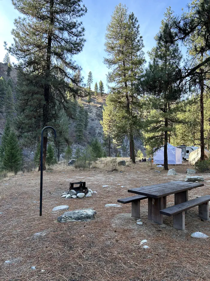
The campground contains 11 single campsites, each equipped with a picnic table, campfire ring, and lantern hook. Vault toilets, and drinking water are provided within the campground. Roads and parking spurs are dirt. Garbage Collection is not provided.
Natural Features
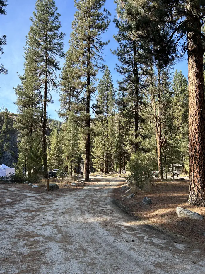
The campground sits on the banks of the North Fork Boise River, where Ponderosa Pines tower over the area. Most campsites have partial shade, but little privacy from other campers. A variety of wildlife makes its home around the campground.
Contact Info
This location is unstaffed. To speak with our main office for general information, please call: (208) 392-3700.The facts
- Season: Mid-May – Mid-October — USDA Forest Service, Aug 24, 2026
- 11 bookable sites
- Vehicles up to 99 ft
- Up to 6 people per site
- Loops: BLACK ROCK
Site types
- 11 Standard Nonelectric
Amenities
- Campfires allowed
- Fire pits
- Picnic tables
- Shade
- Pets allowed
- Water hookups — not available
- Sewer hookups — not available
Not recorded upstream: electric hookups, grills.
11 campsites at Black Rock
| Site | Loop | Type | Entry | Surface | Water | Max rig | People | |
|---|---|---|---|---|---|---|---|---|
| 001 | BLACK ROCK | Standard Nonelectric | Back In | — | Riverfront | 99 ft | 6 | 🐾 |
| 002 | BLACK ROCK | Standard Nonelectric | Back In | — | Riverfront | 52 ft | 6 | 🐾 |
| 003 | BLACK ROCK | Standard Nonelectric | Back In | — | — | 61 ft | 6 | 🐾 |
| 004 | BLACK ROCK | Standard Nonelectric | Back In | Gravel | — | 59 ft | 6 | 🐾 |
| 005 | BLACK ROCK | Standard Nonelectric | Back In | — | — | 39 ft | 6 | 🐾 |
| 006 | BLACK ROCK | Standard Nonelectric | Back In | — | — | 51 ft | 6 | 🐾 |
| 007 | BLACK ROCK | Standard Nonelectric | Back In | Gravel | Riverfront | 50 ft | 6 | 🐾 |
| 008 | BLACK ROCK | Standard Nonelectric | Back In | — | Riverfront | 50 ft | 6 | 🐾 |
| 009 | BLACK ROCK | Standard Nonelectric | Back In | — | Riverfront | 59 ft | 6 | 🐾 |
| 010 | BLACK ROCK | Standard Nonelectric | Back In | — | — | 46 ft | 6 | 🐾 |
| 011 | BLACK ROCK | Standard Nonelectric | Back In | — | Riverfront | 54 ft | 6 | 🐾 |
Getting there
From Idaho City, travel north on State Highway 21 for about two miles, to the Granite Creek/Rabbit Creek Road No. 327. Turn right and travel east for 18 miles on Road No. 327, to the campground. Be advised- FS road 327 is a dirt road that is only graded a couple of times a year. It can get very rough with washboarding and potholes.
43.79528, -115.58722 · 43°47'43.0"N 115°35'14.0"W
Typical weather
| Jan | Feb | Mar | Apr | May | Jun | Jul | Aug | Sep | Oct | Nov | Dec | |
|---|---|---|---|---|---|---|---|---|---|---|---|---|
| High °F | — | — | — | — | — | — | — | — | — | — | — | — |
| Low °F | — | — | — | — | — | — | — | — | — | — | — | — |
| Precip in | 7.6 | 5.5 | 5.5 | 3.6 | 2.9 | 1.9 | 0.5 | 0.6 | 1.1 | 2.8 | 5.7 | 8.5 |
1991–2020 averages from the nearest NOAA station, 10.2 mi away — not measured at the facility itself, and elevation can make a real difference over that distance.
Map
More photos

Member photos
Common questions about Black Rock
- Can you reserve a site at Black Rock?
- Yes, Black Rock is reservable through Recreation.gov.
- How many campsites does Black Rock have?
- 11 sites.
- What is the maximum RV length at Black Rock?
- 99 ft. That is the longest vehicle the sites here are recorded as taking; individual sites may be shorter.
- Are pets allowed at Black Rock?
- Yes, pets are allowed at Black Rock.
- Does Black Rock have hookups?
- No hookups are recorded here.
- Are campfires allowed at Black Rock?
- Campfires are allowed at Black Rock. Check for a current fire restriction before you go.
Camping near Black Rock
- Barber Flat Cabin (Boise National Forest, ID) 3.1 mi · Campground · we watch it
- Ten Mile Campground 9.5 mi · Campground · we watch it
- Hayfork Group CG 9.5 mi · Campground · we watch it
- Edna Creek Campground 9.5 mi · Campground · we watch it
- Bad Bear Campground 9.5 mi · Campground · we watch it
- Barber Flat Rental Cabin 2.8 mi · Campground
- Ninemeyer Campground 2.9 mi · Campground
- Troutdale Campground 5.8 mi · Campground
- William H. Pogue National Recreation Trailhead 7.3 mi · Facility
- Bald Mountain Campground 8.2 mi · Campground
- Bad Bear Campground 9.5 mi · Campground
- Hayfork Campground (Group Only) 9.6 mi · Campground
Contact
- Phone 208-392-6681
- Email matthew.nance@usda.gov
- Book Recreation.gov
Recreation.gov last updated this record on 2026-03-11.
Facility information and photographs from Recreation.gov (RIDB). SpotOpened is not affiliated with Recreation.gov or any federal agency.
Comments