Ten Mile Campground
Campground · 15 bookable sites ·
Managed by the USDA Forest Service
Boise National Forest (NF) · Open Access
- 15
- Bookable sites
- 71 ft
- Max rig length
- up to 6
- People per site
- 4,879 ft
- Elevation
Overview
Ten Mile is small campground, a quick 48 mile drive from Boise, Idaho, along State Highway 21 on the Idaho City Ranger District of the Boise National Forest. The campground is about 10 miles past the Historic Idaho City and is split into two sections (Upper and Lower) by the highway. This area is known for its beautiful old forest of Ponderosa Pine. Wildflowers abound in the summer months. Fishing opportunities in Mores Creek and some campsites have creek access.
Recreation
There are numerous opportunities to go hiking, biking, horseback rising and ride off-road vehicles within a short car ride away. In the winter the area is a playgound for winter sports including cross-country skiing and snowmobiling.
Facilities
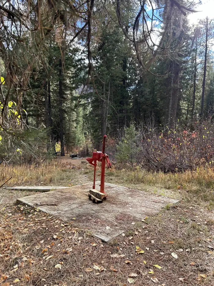
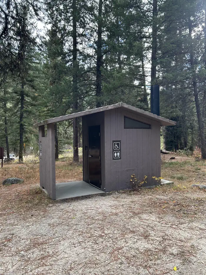
The campground sites have campfire rings, picnic tables and a vault toilet, and a hand pump for potable water.
Contact Info
This location is unstaffed. To speak with our main office for general information, please call: (208) 392-6681.The facts
- Season: Mid-May – Mid-October — USDA Forest Service, Aug 24, 2026
- 15 bookable sites
- Vehicles up to 71 ft
- Up to 6 people per site
- Loops: Lower Ten Mile, Upper Ten Mile
Site types
- 15 Standard Nonelectric
Amenities
- Campfires allowed
- Fire pits
- Picnic tables
- Shade
- Pets allowed
- Water hookups — not available
- Sewer hookups — not available
Not recorded upstream: electric hookups, grills.
15 campsites at Ten Mile Campground
| Site | Loop | Type | Entry | Surface | Grade | Water | Max rig | People | |
|---|---|---|---|---|---|---|---|---|---|
| 001 | Lower Ten Mile | Standard Nonelectric | Back In | Paved | Slight | Springs | 38 ft | 6 | 🐾 |
| 002 | Lower Ten Mile | Standard Nonelectric | Back In | Paved | — | Springs | 32 ft | 6 | 🐾 |
| 003 | Lower Ten Mile | Standard Nonelectric | Back In | Paved | Slight | — | 32 ft | 6 | 🐾 |
| 004 | Lower Ten Mile | Standard Nonelectric | Back In | Paved | Slight | — | 40 ft | 6 | 🐾 |
| 005 | Lower Ten Mile | Standard Nonelectric | Back In | Paved | Slight | Springs | 71 ft | 6 | 🐾 |
| 006 | Lower Ten Mile | Standard Nonelectric | Back In | Paved | Slight | Springs | 27 ft | 6 | 🐾 |
| 007 | Lower Ten Mile | Standard Nonelectric | Pull Through | Paved | — | Springs | 50 ft | 6 | 🐾 |
| 008 | Lower Ten Mile | Standard Nonelectric | Back In | Paved | Slight | — | 41 ft | 6 | 🐾 |
| 009 | Lower Ten Mile | Standard Nonelectric | Back In | Paved | Slight | — | 34 ft | 6 | 🐾 |
| 010 | Upper Ten Mile | Standard Nonelectric | Back In | Paved | Slight | — | 53 ft | 6 | 🐾 |
| 011 | Upper Ten Mile | Standard Nonelectric | Back In | Paved | Slight | — | 60 ft | 6 | 🐾 |
| 012 | Upper Ten Mile | Standard Nonelectric | Back In | Paved | Slight | Springs | 35 ft | 6 | 🐾 |
| 013 | Upper Ten Mile | Standard Nonelectric | Back In | Paved | Slight | Springs | 58 ft | 6 | 🐾 |
| 014 | Upper Ten Mile | Standard Nonelectric | Back In | Paved | Slight | Springs | 46 ft | 6 | 🐾 |
| 015 | Upper Ten Mile | Standard Nonelectric | Back In | — | Slight | Springs | 67 ft | 6 | 🐾 |
Getting there
From Idaho City travel State Highway 21 north for about 10 miles to the campground. There are signed entrances on the left and right sides of the road, as this campground is divided on either side of the highway.
43.89856, -115.71272 · 43°53'54.8"N 115°42'45.8"W
Typical weather
| Jan | Feb | Mar | Apr | May | Jun | Jul | Aug | Sep | Oct | Nov | Dec | |
|---|---|---|---|---|---|---|---|---|---|---|---|---|
| High °F | — | — | — | — | — | — | — | — | — | — | — | — |
| Low °F | — | — | — | — | — | — | — | — | — | — | — | — |
| Precip in | 7.6 | 5.5 | 5.5 | 3.6 | 2.9 | 1.9 | 0.5 | 0.6 | 1.1 | 2.8 | 5.7 | 8.5 |
1991–2020 averages from the nearest NOAA station, 3 mi away — not measured at the facility itself, and elevation can make a real difference over that distance.
Map
More photos

Member photos
Common questions about Ten Mile Campground
- Can you reserve a site at Ten Mile Campground?
- Yes, Ten Mile Campground is reservable through Recreation.gov.
- How many campsites does Ten Mile Campground have?
- 15 sites.
- What is the maximum RV length at Ten Mile Campground?
- 71 ft. That is the longest vehicle the sites here are recorded as taking; individual sites may be shorter.
- Are pets allowed at Ten Mile Campground?
- Yes, pets are allowed at Ten Mile Campground.
- Does Ten Mile Campground have hookups?
- No hookups are recorded here.
- Are campfires allowed at Ten Mile Campground?
- Campfires are allowed at Ten Mile Campground. Check for a current fire restriction before you go.
Camping near Ten Mile Campground
- Hayfork Group CG 1.1 mi · Campground · we watch it
- Edna Creek Campground 1.1 mi · Campground · we watch it
- Bad Bear Campground 1.1 mi · Campground · we watch it
- Beaver Creek Cabin (Id) 6.9 mi · Campground · we watch it
- Black Rock 9.5 mi · Campground · we watch it
- Bad Bear Campground 0.3 mi · Campground
- Hayfork Campground (Group Only) 1 mi · Campground
- Whoop Um Up Park N' Ski 6.1 mi · Facility
- Whoop Um Up Trailhead 6.1 mi · Facility
- Edna Creek Campground 6.3 mi · Campground
- Upper Crooked River Trailhead 6.6 mi · Facility
- Buena Vista Trailhead 8.1 mi · Facility
Contact
- Phone 208-392-6681
- Email matthew.nance@usda.gov
- Book Recreation.gov
Recreation.gov last updated this record on 2026-03-11.
Facility information and photographs from Recreation.gov (RIDB). SpotOpened is not affiliated with Recreation.gov or any federal agency.
Comments