Little Hall Shelter (Ga)
Campground · Georgia · 1 bookable site ·
Managed by the US Army Corps of Engineers
Sidney Lanier Recreation Area (Recreation Area) · Open Access
- 1
- Bookable site
- up to 80
- People per site
- 1
- Accessible site
- 1,101 ft
- Elevation
Overview
Little Hall Park lies approximately 30 miles north of Buford Dam on Lake Sidney Lanier. The site features beautiful views of the lake as well as excellent access to swimming, picnicking, and boating. The lake, named for the poet, Sidney Lanier, is well known for its aqua-blue colored water, spectacular scenery and variety of recreational activities. Each year, approximately 11.8 million people come to visit.Recreation
Facilities
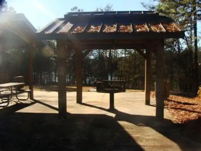
Little Hall Park offers access to a designated swim beach, picnic areas and restrooms.
Natural Features
Lake Lanier boasts 38,000 surface acres, 690 miles of shoreline and over 100 small islands. Its location in the forested foothills of the Georgia Blue Ridge Mountains, makes for a beautiful backdrop to any activity.
Nearby Attractions
Nearby attractions include boat ramps and other USACE parks.
The facts
- 1 bookable site
- 1 site for day use only
- 1 accessible site
- Up to 80 people per site
- Loops: LITTLE HALL SHELTER (GA)
Site types
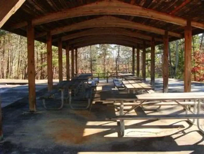
- 1 Group Picnic Area
Amenities
- Picnic tables
- Grills
- Shade
Not recorded upstream: electric hookups, water hookups, sewer hookups, campfires allowed, fire pits, pets allowed.
1 campsite at Little Hall Shelter (Ga)
Check-in 8:00 AM · Check-out 10:00 PM
| Site | Loop | Type | Entry | Surface | Water | Max rig | People | |
|---|---|---|---|---|---|---|---|---|
| SL4604 | LITTLE HALL SHELTER (GA) | Group Picnic Area | — | — | Lakefront | — | 80 | ♿ |
Getting there
Physical address is 3501 Dawsonville Hwy., Gainesville, GA 30504.
From Georgia Highway 400, take exit 17, turn right onto Hwy. 306 and follow signs for Hwy. 53, turn right onto Hwy. 53, turn right into Little Hall Park.
From Interstate 985, take exit 16 and turn left onto Hwy. 53. Follow signs for Hwy. 53 west, turn left into Little Hall Park.
34.31398, -83.94444 · 34°18'50.3"N 83°56'40.0"W
Typical weather
Typically 88°F in Jul, down to 51°F in Jan.
| Jan | Feb | Mar | Apr | May | Jun | Jul | Aug | Sep | Oct | Nov | Dec | |
|---|---|---|---|---|---|---|---|---|---|---|---|---|
| High °F | 51 | 55 | 63 | 71 | 78 | 85 | 88 | 86 | 81 | 72 | 62 | 54 |
| Low °F | 31 | 34 | 40 | 47 | 56 | 64 | 68 | 67 | 61 | 50 | 40 | 34 |
| Precip in | 5.3 | 5.2 | 5.3 | 4.2 | 4.2 | 4.5 | 3.9 | 5.1 | 4.1 | 4.2 | 4.4 | 5.2 |
1991–2020 averages from the nearest NOAA station, 4.9 mi away — not measured at the facility itself, and elevation can make a real difference over that distance.
Map
More photos
Member photos
Common questions about Little Hall Shelter (Ga)
- Can you reserve a site at Little Hall Shelter (Ga)?
- Yes, Little Hall Shelter (Ga) is reservable through Recreation.gov.
- How many campsites does Little Hall Shelter (Ga) have?
- 1 site.
Camping near Little Hall Shelter (Ga)
- Duckett Mill 0.9 mi · Campground · we watch it
- Bolding Mill 1.7 mi · Campground · we watch it
- Bolding Mill Shelters (Ga) 1.7 mi · Campground · we watch it
- Thompson Creek Park Shelter (Ga) 5.1 mi · Campground · we watch it
- Toto Creek Campground 6.1 mi · Campground · we watch it
- Old Federal 6.3 mi · Campground · we watch it
- Van Pugh North Park Shelter (Ga) 9 mi · Campground · we watch it
- Van Pugh South Day Use Facility 9.3 mi · Campground · we watch it
- Bald Ridge Creek 10.9 mi · Campground · we watch it
- Sawnee 12.2 mi · Campground · we watch it
- West Bank Park Shelters (Ga) 12.5 mi · Campground · we watch it
- Lanier Park Shelter (Ga) 12.8 mi · Campground · we watch it
Contact
- Phone 770-945-9531
- Book Recreation.gov
Recreation.gov last updated this record on 2026-02-25.
Facility information and photographs from Recreation.gov (RIDB). SpotOpened is not affiliated with Recreation.gov or any federal agency.
Comments