Red Feather California
Campground · California · 59 bookable sites ·
Managed by the USDA Forest Service
- 59
- Bookable sites
- 20 ft
- Max rig length
- up to 6
- People per site
- 5,485 ft
- Elevation
Overview
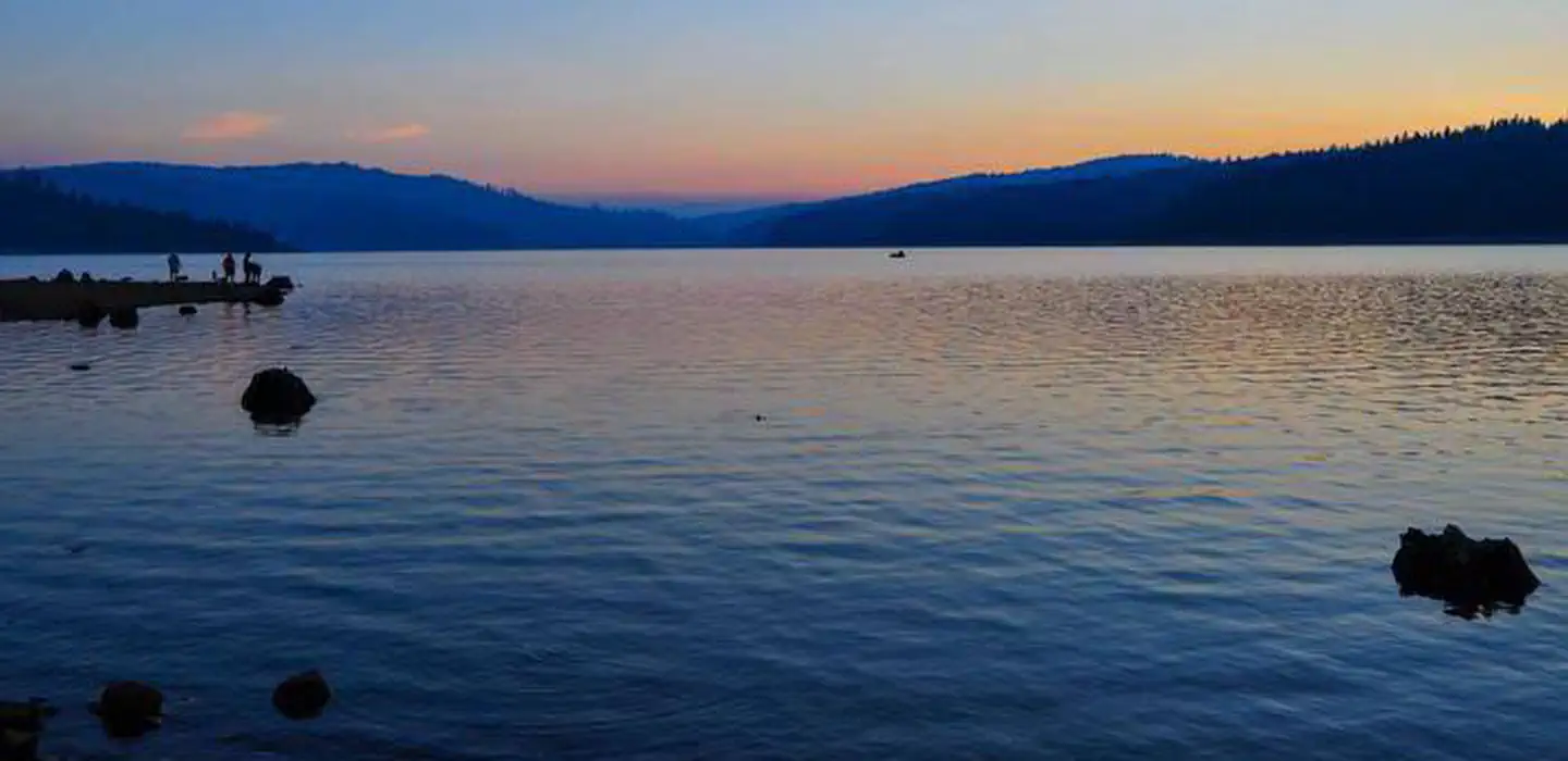
Red Feather Campground is located on the eastern shore of Little Grass Valley Reservoir, providing visitors with ample opportunity to fish, swim, boat, and enjoy nature. It is one of eight campgrounds in the area, providing access to a beautiful mountain lake and various hiking trails that meander through the scenic hills and valleys.Recreation
The 1,615-acre lake provides ample opportunities for visitors to fish, boat, swim, and water ski. Anglers can expect a catch of a variety of trout and kokanee salmon, among other species of fish. Fishing licenses are required. The Lakeshore Trail, which loops 13.5 miles around the lake, is available for hiking, mountain biking and horseback riding. The trail connects to the Pacific Crest National Scenic Trail, which stretches from 2,650 miles, across three states from Canada to Mexico. The Lakeshore Trail is popular among day hikers.Facilities
The campground offers dozens of single-family campsites, available for tent and RV camping. More than a handful of the sites overlook the beautiful lake, while others are surrounded by characteristic mixed-conifer forest and alpine meadows. The Maidu boat launch ramp is located nearby, adjacent to Little Beaver Campground and the Maidu Amphitheater. Campsites are equipped with tables and campfire rings with grills. Flush toilets and drinking water are provided. Utility hookups are not available. All sites have paved parking spurs. Bear-resistant trash collection bins are located throughout the campground.Natural Features
The campground is located in the Northern Sierra Nevada Mountains of northern California at an elevation of about 5,100 feet. It is on the eastern shore of the Little Grass Valley Reservoir, which was formed by dam construction and subsequent flooding of the valley in the 1960s. The campground and the lake are surrounded by thick stands of pine and fir trees. Several public campgrounds are located around the lake, as well as private cabins on the south side.Nearby Attractions
About 12 miles northeast of the lake at an elevation of 5,446 feet lies a small, natural lily pond, called Fowler Lake. This beautiful site is perfect for day hikes and picnics.The facts
- 59 bookable sites
- Vehicles up to 20 ft
- Up to 6 people per site
- Loops: LP1, LP2
Site types
- 59 Standard Nonelectric
Amenities
- Campfires allowed
- Fire pits
- Picnic tables
- Grills
- Shade
- Pets allowed
Not recorded upstream: electric hookups, water hookups, sewer hookups.
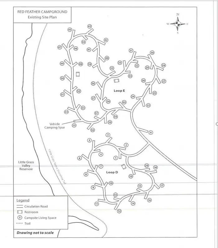
59 campsites at Red Feather California
| Site | Loop | Type | Entry | Surface | Grade | Water | Max rig | People | |
|---|---|---|---|---|---|---|---|---|---|
| 001 | LP1 | Standard Nonelectric | Back In | Paved | — | — | — | 6 | 🐾 |
| 002 | LP1 | Standard Nonelectric | Back In | Paved | — | — | — | 6 | 🐾 |
| 003 | LP1 | Standard Nonelectric | Back In | Paved | — | — | — | 6 | 🐾 |
| 004 | LP1 | Standard Nonelectric | Back In | Paved | Slight | — | — | 6 | 🐾 |
| 005 | LP1 | Standard Nonelectric | Back In | Paved | — | — | — | 6 | 🐾 |
| 006 | LP1 | Standard Nonelectric | Back In | Paved | — | Lakefront | — | 6 | 🐾 |
| 007 | LP1 | Standard Nonelectric | Back In | Paved | — | — | — | 6 | 🐾 |
| 008 | LP1 | Standard Nonelectric | Back In | Paved | — | Lakefront | — | 6 | 🐾 |
| 009 | LP1 | Standard Nonelectric | Back In | Paved | — | Lakefront | — | 6 | 🐾 |
| 010 | LP1 | Standard Nonelectric | Back In | Paved | — | — | — | 6 | 🐾 |
| 011 | LP1 | Standard Nonelectric | Back In | Paved | — | Lakefront | — | 6 | 🐾 |
| 012 | LP1 | Standard Nonelectric | Back In | Paved | — | Lakefront | — | 6 | 🐾 |
| 013 | LP1 | Standard Nonelectric | Back In | Paved | — | — | — | 6 | 🐾 |
| 014 | LP1 | Standard Nonelectric | Back In | Paved | — | — | — | 6 | 🐾 |
| 015 | LP1 | Standard Nonelectric | Back In | Paved | — | — | — | 6 | 🐾 |
| 016 | LP1 | Standard Nonelectric | Back In | Paved | — | — | — | 6 | 🐾 |
| 017 | LP1 | Standard Nonelectric | Back In | Paved | — | — | — | 6 | 🐾 |
| 018 | LP1 | Standard Nonelectric | Back In | Paved | Slight | — | — | 6 | 🐾 |
| 019 | LP1 | Standard Nonelectric | Back In | Paved | — | — | — | 6 | 🐾 |
| 020 | LP1 | Standard Nonelectric | Back In | Paved | Slight | — | — | 6 | 🐾 |
| 022 | LP1 | Standard Nonelectric | Back In | Paved | Slight | — | — | 6 | 🐾 |
| 023 | LP2 | Standard Nonelectric | Back In | Paved | — | — | — | 6 | 🐾 |
| 024 | LP2 | Standard Nonelectric | Back In | Paved | — | — | — | 6 | 🐾 |
| 025 | LP2 | Standard Nonelectric | Back In | Paved | — | — | — | 6 | 🐾 |
| 026 | LP2 | Standard Nonelectric | — | Paved | — | — | — | 6 | 🐾 |
| 027 | LP2 | Standard Nonelectric | Back In | Paved | Severe | — | — | 6 | 🐾 |
| 028 | LP2 | Standard Nonelectric | Back In | Paved | Severe | — | — | 6 | 🐾 |
| 029 | LP2 | Standard Nonelectric | Back In | Paved | — | — | — | 6 | 🐾 |
| 030 | LP2 | Standard Nonelectric | — | Paved | Moderate | — | — | 6 | 🐾 |
| 031 | LP2 | Standard Nonelectric | Back In | Paved | — | — | 20 ft | 6 | 🐾 |
| 032 | LP2 | Standard Nonelectric | — | Paved | — | — | — | 6 | 🐾 |
| 033 | LP2 | Standard Nonelectric | Back In | Paved | — | — | — | 6 | 🐾 |
| 034 | LP2 | Standard Nonelectric | — | Paved | — | — | — | 6 | 🐾 |
| 035 | LP2 | Standard Nonelectric | Back In | Paved | — | — | — | 6 | 🐾 |
| 036 | LP2 | Standard Nonelectric | Back In | Paved | — | — | — | 6 | 🐾 |
| 037 | LP2 | Standard Nonelectric | Back In | Paved | — | — | — | 6 | 🐾 |
| 038 | LP2 | Standard Nonelectric | Back In | Paved | Slight | — | — | 6 | 🐾 |
| 039 | LP2 | Standard Nonelectric | Back In | Paved | — | — | — | 6 | 🐾 |
| 040 | LP2 | Standard Nonelectric | Back In | Paved | Slight | — | — | 6 | 🐾 |
| 041 | LP2 | Standard Nonelectric | Back In | Paved | — | — | — | 6 | 🐾 |
| 042 | LP2 | Standard Nonelectric | Back In | Paved | — | — | — | 6 | 🐾 |
| 043 | LP2 | Standard Nonelectric | Back In | Paved | Slight | — | — | 6 | 🐾 |
| 044 | LP2 | Standard Nonelectric | Back In | Paved | — | — | — | 6 | 🐾 |
| 045 | LP2 | Standard Nonelectric | Back In | Paved | — | — | — | 6 | 🐾 |
| 046 | LP2 | Standard Nonelectric | Back In | Paved | — | — | — | 6 | 🐾 |
| 047 | LP2 | Standard Nonelectric | Back In | Paved | — | Lakefront | — | 6 | 🐾 |
| 048 | LP2 | Standard Nonelectric | Back In | Paved | — | — | — | 6 | 🐾 |
| 049 | LP2 | Standard Nonelectric | Back In | Paved | — | Lakefront | — | 6 | 🐾 |
| 050 | LP2 | Standard Nonelectric | Back In | Paved | — | Lakefront | — | 6 | 🐾 |
| 051 | LP2 | Standard Nonelectric | Back In | Paved | — | Lakefront | — | 6 | 🐾 |
| 052 | LP2 | Standard Nonelectric | Back In | Paved | — | — | — | 6 | 🐾 |
| 053 | LP2 | Standard Nonelectric | Back In | Paved | — | — | — | 6 | 🐾 |
| 054 | LP2 | Standard Nonelectric | Back In | Paved | — | Lakefront | — | 6 | 🐾 |
| 055 | LP2 | Standard Nonelectric | Back In | Paved | — | Lakefront | — | 6 | 🐾 |
| 056 | LP2 | Standard Nonelectric | Back In | Paved | — | Lakefront | — | 6 | 🐾 |
| 057 | LP2 | Standard Nonelectric | Back In | Paved | — | — | — | 6 | 🐾 |
| 058 | LP2 | Standard Nonelectric | Back In | Paved | — | — | — | 6 | 🐾 |
| 059 | LP2 | Standard Nonelectric | Back In | Paved | — | — | — | 6 | 🐾 |
| 060 | LP2 | Standard Nonelectric | Back In | Paved | — | — | — | 6 | 🐾 |
Getting there
39.73528, -120.95306 · 39°44'7.0"N 120°57'11.0"W
Typical weather
Typically 89°F in Jul, down to 46°F in Dec.
| Jan | Feb | Mar | Apr | May | Jun | Jul | Aug | Sep | Oct | Nov | Dec | |
|---|---|---|---|---|---|---|---|---|---|---|---|---|
| High °F | 48 | 52 | 58 | 63 | 72 | 81 | 89 | 89 | 83 | 72 | 56 | 46 |
| Low °F | 30 | 31 | 33 | 36 | 42 | 46 | 51 | 50 | 46 | 39 | 33 | 29 |
| Precip in | 11.3 | 10.7 | 10.0 | 5.3 | 3.6 | 1.1 | 0.1 | 0.2 | 0.7 | 3.3 | 6.8 | 11.8 |
1991–2020 averages from the nearest NOAA station, 13.7 mi away — not measured at the facility itself, and elevation can make a real difference over that distance.
Map
Fees and stay limits
Standard site: $36/site
From Recreation.gov, which is not always current. The operator's own page is the authority on what you will be charged.
More photos
Member photos
Common questions about Red Feather California
- Can you reserve a site at Red Feather California?
- Yes, Red Feather California is reservable through Recreation.gov.
- How many campsites does Red Feather California have?
- 59 sites.
- What is the maximum RV length at Red Feather California?
- 20 ft. That is the longest vehicle the sites here are recorded as taking; individual sites may be shorter.
- Are pets allowed at Red Feather California?
- Yes, pets are allowed at Red Feather California.
- Are campfires allowed at Red Feather California?
- Campfires are allowed at Red Feather California. Check for a current fire restriction before you go.
Also listed by
Red Feather California also appears in other federal recreation data. Facts below are matched by name and location, not confirmed by Red Feather California's operator.
USDA Forest Service — data as of Aug 24, 2026
- $23 per site $25 Prime Lakeside sites
Restrictions:
- • 14 day limit • 6 people per campsite and • 2 vehicles per campsite • 14 day camping limit, • OHV riding is not allowed in the campground, • Bear Awareness
Camping near Red Feather California
- Running Deer Campground less than 0.1 mi · Campground · we watch it
- Horse Campground less than 0.1 mi · Campground · we watch it
- Little Beaver a Campground 1.9 mi · Campground · we watch it
- Wyandotte a Campground 1.9 mi · Campground · we watch it
- Little Beaver Campground 1.1 mi · Campground
- Peninsula Tent Campground 1.7 mi · Campground
- Little Grass Valley Recreation Area 1.9 mi · Campground
- Tooms RV Campground 2.2 mi · Campground
- Black Rock Walk-in Tent Campground 3 mi · Campground
- Cleghorn Bar 6.7 mi · Campground
- Deanes Valley Campground 10.6 mi · Campground
- Ross Campground 10.8 mi · Campground
Contact
- Phone 530-534-6500
- Book Recreation.gov
Recreation.gov last updated this record on 2026-05-08.
Facility information and photographs from Recreation.gov (RIDB). SpotOpened is not affiliated with Recreation.gov or any federal agency.
Comments