Butte Lake Group
Campground · California · 6 bookable sites ·
Managed by the National Park Service
Lassen Volcanic National Park (National Park) · Open Access
- 6
- Bookable sites
- 45 ft
- Max rig length
- up to 25
- People per site
- 6,107 ft
- Elevation
Overview
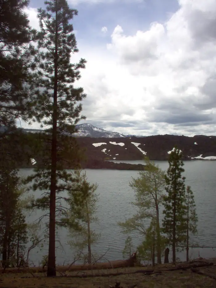
Butte Lake Group Campground (elevation 6,100 feet) is located in the northeastern section of Lassen Volcanic National Park in northern California. It is fairly remote and within walking distance of Butte Lake, which is popular for fishing, canoeing, kayaking and swimming. Several hiking and backpacking trails are located nearby. The facility is 45 minutes from the main park road.Recreation
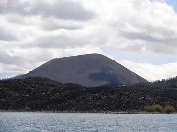
Outdoor enthusiasts stay at Butte Lake Campground for its many recreation opportunities. The lake is popular for trout fishing, as well as non-motorized boating. Within the facility, hikers and backpackers will find the trailhead for the Cinder Cone Trail, one of the most popular trails in the park that ascends a nearby volcanic dome. The Painted Dunes, Snag Lake and Bathtub Lake areas are also nearby.Facilities
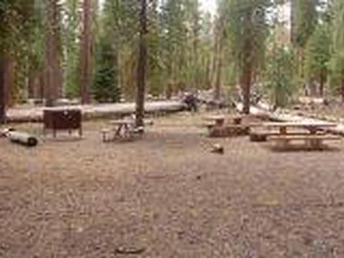
Butte Lake Group Campground is located at the north end of Loop B, adjacent to the main Butte Lake Campground. This facility is more remote than other campgrounds within the park and campers must travel on a six-mile gravel road to get here. For more information visit Campgrounds of Lassen Volcanic.A non-motorized boat launch is convenient for kayaks and canoes. Flush toilets and running water are turned on during summer; vault toilets are available outside of the peak season.
Natural Features
The campground has a pleasant atmosphere dominated by Ponderosa pines. It sits on soft volcanic soils, and several ponds dot the landscape. Butte Lake has a large black lava flow running into it that creates rocky shores and interesting areas for visitors in kayaks and canoes to explore.The national park is known for its volcanic history, as well as its diversity of plants and animals. It contains 300 active volcanic domes and many hydrothermal features, such as mud pots and steam vents. Lassen Peak is the southernmost active volcano in the Cascades, and the second-most recent volcano to erupt in the lower 48 of the United States before Mount Saint Helens in 1980.
Lassen National Park boasts over 700 species of flowering plants and 250 species of vertebrates, including birds, mammals, reptiles and fish. The park is at the junction of the Cascade Mountains, the Sierra Nevada Mountains and the Great Basin, thus providing many unique habitats.
Nearby Attractions
Visitors can explore Subway Cave, an underground tube created by lava flow, in the adjacent Lassen National Forest from late April through November. Free tours are offered every weekend during summer. Subway Cave, Lassen National ForestThe facts
- 6 bookable sites
- Vehicles up to 45 ft
- Up to 25 people per site
- Loops: Butte Lake Group Sites
Site types
- 6 Group Standard Nonelectric
Amenities
- Campfires allowed
- Fire pits
- Picnic tables
- Shade
- Pets allowed
Not recorded upstream: electric hookups, water hookups, sewer hookups, grills.
6 campsites at Butte Lake Group
Check-in 1:00 PM · Check-out 12:00 PM
| Site | Loop | Type | Entry | Surface | Max rig | People | |
|---|---|---|---|---|---|---|---|
| A | Butte Lake Group Sites | Group Standard Nonelectric | Pull Through | Gravel | 45 ft | 25 | 🐾 |
| B | Butte Lake Group Sites | Group Standard Nonelectric | Pull Through | Gravel | 45 ft | 25 | 🐾 |
| C | Butte Lake Group Sites | Group Standard Nonelectric | Pull Through | Gravel | 30 ft | 25 | 🐾 |
| D | Butte Lake Group Sites | Group Standard Nonelectric | Pull Through | Gravel | 25 ft | 25 | 🐾 |
| E | Butte Lake Group Sites | Group Standard Nonelectric | Pull Through | Gravel | 45 ft | 25 | 🐾 |
| F | Butte Lake Group Sites | Group Standard Nonelectric | Pull Through | Gravel | 45 ft | 25 | 🐾 |
Getting there
From Redding, drive 63 miles east on state highway 44 to Old Station. From intersection of state highway 89 and 44, continue east on state highway 44 for 11 miles. Watch for sign to Butte Lake Campground. Turn right and continue for 6 miles on a rough gravel road.
40.56500, -121.30528 · 40°33'54.0"N 121°18'19.0"W
Typical weather
Typically 79°F in Jul, down to 40°F in Dec.
| Jan | Feb | Mar | Apr | May | Jun | Jul | Aug | Sep | Oct | Nov | Dec | |
|---|---|---|---|---|---|---|---|---|---|---|---|---|
| High °F | 41 | 42 | 46 | 50 | 61 | 70 | 79 | 78 | 72 | 59 | 47 | 40 |
| Low °F | 22 | 22 | 24 | 28 | 35 | 41 | 46 | 45 | 41 | 33 | 26 | 22 |
| Precip in | 6.5 | 5.5 | 6.4 | 4.3 | 2.9 | 1.3 | 0.3 | 0.3 | 0.7 | 2.7 | 4.7 | 6.5 |
1991–2020 averages from the nearest NOAA station, 14.3 mi away — not measured at the facility itself, and elevation can make a real difference over that distance.
Map
More photos
Member photos
Common questions about Butte Lake Group
- Can you reserve a site at Butte Lake Group?
- Yes, Butte Lake Group is reservable through Recreation.gov.
- How many campsites does Butte Lake Group have?
- 6 sites.
- What is the maximum RV length at Butte Lake Group?
- 45 ft. That is the longest vehicle the sites here are recorded as taking; individual sites may be shorter.
- Are pets allowed at Butte Lake Group?
- Yes, pets are allowed at Butte Lake Group.
- Are campfires allowed at Butte Lake Group?
- Campfires are allowed at Butte Lake Group. Check for a current fire restriction before you go.
Camping near Butte Lake Group
- Butte Lake Stock Corral less than 0.1 mi · Campground · we watch it
- Butte Lake less than 0.1 mi · Campground · we watch it
- Summit Lake Stock Corral 7.6 mi · Campground · we watch it
- Juniper Lake Stock Corral 7.9 mi · Campground · we watch it
- Juniper Lake Group 7.9 mi · Campground · we watch it
- Summit Lake North 8 mi · Campground · we watch it
- Summit Lake South 8.1 mi · Campground · we watch it
- Butte Creek 3.3 mi · Campground
- Juniper Lake Campground 7.9 mi · Facility
- Silver Bowl Campground 8.7 mi · Campground
- Silver Beach Picnic Area 9.1 mi · Facility
- Big Pine Campground 9.7 mi · Campground
Contact
- Phone 530 595-6121
- Email Michelle_DUlisse@nps.gov
- Book Recreation.gov
Recreation.gov last updated this record on 2026-02-25.
Facility information and photographs from Recreation.gov (RIDB). SpotOpened is not affiliated with Recreation.gov or any federal agency.
Comments