The Redds Day Use Area
Facility · Wyoming ·
Managed by the Bureau of Land Management
Casper Field Office (Bureau of Land Management WY) · Open Access
- 5,319 ft
- Elevation
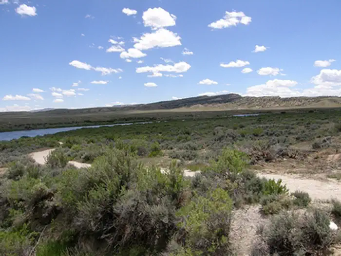
The Redds Day Use Area has an access road, parking area and a one-mile pedestrian trail with interpretive signs. The trail provides access to the riverbank. It's a great area for hiking and bank fishing. There are no restrooms at this location.
Getting there
From Alcova, go east .6 miles on Highway 220 to County Road 412. Turn right on County Road 412 and continue for 1.2 miles to the turnoff on the right.
42.57407, -106.69330 · 42°34'26.7"N 106°41'35.9"W
Typical weather
Typically 86°F in Jul, down to 33°F in Jan.
| Jan | Feb | Mar | Apr | May | Jun | Jul | Aug | Sep | Oct | Nov | Dec | |
|---|---|---|---|---|---|---|---|---|---|---|---|---|
| High °F | 33 | 36 | 46 | 54 | 64 | 77 | 86 | 83 | 73 | 58 | 45 | 33 |
| Low °F | 16 | 17 | 26 | 32 | 41 | 50 | 58 | 57 | 48 | 36 | 27 | 18 |
| Precip in | 0.6 | 0.5 | 0.8 | 1.2 | 1.9 | 1.4 | 0.7 | 1.1 | 0.8 | 1.1 | 0.5 | 0.5 |
1991–2020 averages from the nearest NOAA station, 10.8 mi away — not measured at the facility itself, and elevation can make a real difference over that distance.
Map
Member photos
Common questions about The Redds Day Use Area
- Can you reserve a site at The Redds Day Use Area?
- No. The Redds Day Use Area is not reservable through Recreation.gov, so sites are first-come, first-served or booked elsewhere.
Camping near The Redds Day Use Area
- Pete's Draw Campground 0.5 mi · Campground
- Ledge Creek 1.5 mi · Facility
- Whitetail Day Use Area 6.9 mi · Facility
- Golden Currant Campground 7 mi · Campground
- Chalk Bluffs Campground 7.9 mi · Campground
- Buffaloberry Campground 8.3 mi · Campground
- Bessemer Bend 16 mi · Facility
- Poison Spider OHV Park 20 mi · Facility
- Dome Rock 20 mi · Facility
- Lodgepole Campground 23 mi · Campground
- Rim Campground 23.3 mi · Campground
- Prior Flat Campground 23.6 mi · Campground
Contact
- Phone 307-261-7600
- Email casper_wymail@blm.gov
- Info Recreation.gov
Recreation.gov last updated this record on 2026-02-25.
Facility information and photographs from Recreation.gov (RIDB). SpotOpened is not affiliated with Recreation.gov or any federal agency.
Comments