Split Rock Interpretive Site
Facility · Wyoming ·
Managed by the Bureau of Land Management
Lander Field Office (Bureau of Land Management WY) · Open Access
- 6,295 ft
- Elevation
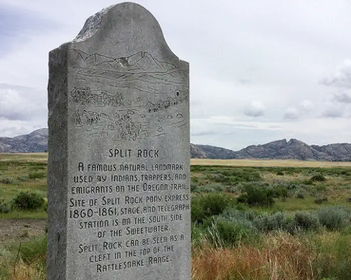
As the dominant landmark of the Sweetwater Valley, the unmistakable "gun sight" notch in the summit of Split Rock aimed the emigrants directly at Great South Pass, still more than 75 miles to the west. A BLM interpretive site is at this location.
A second highway turn-out a few miles west offers a better (although reverse) view of the "split" and also a look at the Old Castle, a smaller landmark south of the Trail and highway.
The site has restrooms, trash collection and the hard-surfaced interpretive trail is ADA accessible.
Getting there
From Jeffrey City, travel east on US Highway 287 approximately 18 miles and turn north following highway signs.
42.45300, -107.54580 · 42°27'10.8"N 107°32'44.9"W
Typical weather
Typically 87°F in Jul, down to 32°F in Jan.
| Jan | Feb | Mar | Apr | May | Jun | Jul | Aug | Sep | Oct | Nov | Dec | |
|---|---|---|---|---|---|---|---|---|---|---|---|---|
| High °F | 32 | 36 | 47 | 57 | 68 | 78 | 87 | 85 | 74 | 60 | 44 | 33 |
| Low °F | 14 | 16 | 23 | 30 | 39 | 46 | 54 | 53 | 45 | 33 | 22 | 14 |
| Precip in | — | — | — | — | — | — | — | — | — | — | — | — |
1991–2020 averages from the nearest NOAA station, 8.1 mi away — not measured at the facility itself, and elevation can make a real difference over that distance.
Map
Member photos
Common questions about Split Rock Interpretive Site
- Can you reserve a site at Split Rock Interpretive Site?
- No. Split Rock Interpretive Site is not reservable through Recreation.gov, so sites are first-come, first-served or booked elsewhere.
Camping near Split Rock Interpretive Site
- Cottonwood Campground 9.4 mi · Campground
- Green Mountain 12.1 mi · Facility
- Martin's Cove 16.6 mi · Facility
- Devil's Gate Interpretive Site 16.6 mi · Facility
- South Pass Summit 38.2 mi · Facility
- Dome Rock 40.8 mi · Facility
- The Redds Day Use Area 44.2 mi · Facility
- Pete's Draw Campground 44.7 mi · Campground
- Ledge Creek 45.7 mi · Facility
- Dugway Campground 48.1 mi · Campground
- Golden Currant Campground 48.7 mi · Campground
- Whitetail Day Use Area 48.8 mi · Facility
Contact
- Phone 307-332-8400
- Email BLM_WY_Lander_WYMail@blm.gov
- Info Recreation.gov
Recreation.gov last updated this record on 2026-02-25.
Facility information and photographs from Recreation.gov (RIDB). SpotOpened is not affiliated with Recreation.gov or any federal agency.
Comments