Andy Martin
Facility · Wyoming ·
Managed by the Bureau of Land Management
Cody Field Office (Bureau of Land Management WY) · Open Access
- 5,531 ft
- Elevation
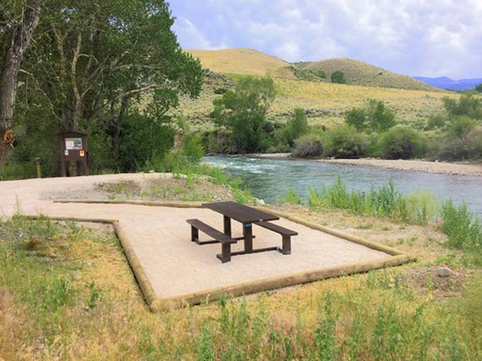
Andy Martin is a BLM-administered parcel of land located along the South Fork of the Shoshone River. The site provides opportunities for fishing, waterfowl and upland bird hunting, and limited big game hunting opportunities.
There is no developed parking or trailhead, so caution is to be used when parking your vehicle to minimize fire risks or accidents along the Lower South Fork Road.
Getting there
Drive west through Cody, Wyoming along Sheridan Ave (US Hwy 14,16,20) to the intersection of South Fork Road (Park County Road 6WX). Merge onto South Fork Road and drive 14 miles south to the intersection of South Fork Road and Lower South Fork Road (County Road 6QS). The parcel surrounds the bridge spanning the South Fork Shoshone River. Use of a surface ownership map is strongly recommended.
44.40677, -109.26953 · 44°24'24.4"N 109°16'10.3"W
Typical weather
| Jan | Feb | Mar | Apr | May | Jun | Jul | Aug | Sep | Oct | Nov | Dec | |
|---|---|---|---|---|---|---|---|---|---|---|---|---|
| High °F | — | — | — | — | — | — | — | — | — | — | — | — |
| Low °F | — | — | — | — | — | — | — | — | — | — | — | — |
| Precip in | 0.9 | 1.1 | 2.2 | 3.4 | 4.6 | 2.6 | 1.4 | 1.4 | 2.1 | 2.3 | 1.4 | 1.2 |
1991–2020 averages from the nearest NOAA station, 7.5 mi away — not measured at the facility itself, and elevation can make a real difference over that distance.
Map
Member photos
Common questions about Andy Martin
- Can you reserve a site at Andy Martin?
- No. Andy Martin is not reservable through Recreation.gov, so sites are first-come, first-served or booked elsewhere.
Camping near Andy Martin
- Big Game Campground 17 mi · Campground · we watch it
- Wapiti Campground 17.9 mi · Campground · we watch it
- Clearwater Campground 20 mi · Campground · we watch it
- Cody Canal 1.3 mi · Facility
- Castle Rock 2.1 mi · Facility
- Twin Creek Trail 8.7 mi · Facility
- North Fork Shoshone R Access 8.8 mi · Facility
- Wapiti Bridge 9 mi · Facility
- Beck Lake Bike Trails 12.4 mi · Facility
- Bobcat-Houlihan Campground 13.3 mi · Campground
- Seven Mountain 16.6 mi · Facility
- Elk Fork Campground 18.1 mi · Campground
Contact
- Phone (307) 578-5900
- Email BLM_WY_Cody_WYMail@blm.gov
- Info Recreation.gov
Recreation.gov last updated this record on 2026-02-25.
Facility information and photographs from Recreation.gov (RIDB). SpotOpened is not affiliated with Recreation.gov or any federal agency.
Comments