Coffeepot Lake Recreation Site
Facility · Washington ·
Managed by the Bureau of Land Management
Spokane Border Field Office (Bureau of Land Management OR) · Open Access
- 1,895 ft
- Elevation
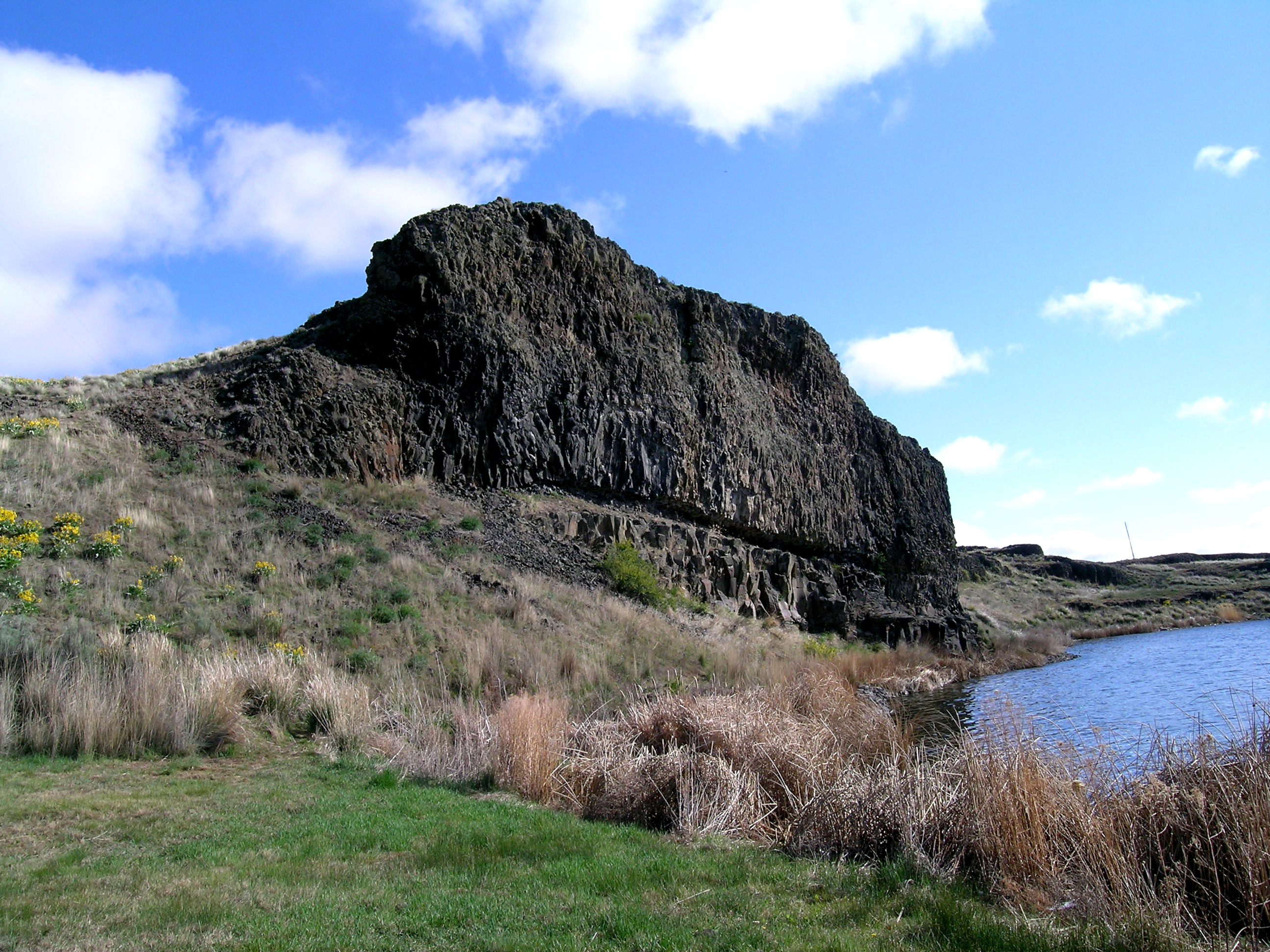
You will find a quiet picnic and camping recreation site surrounded by rocky ledges along the northeast side of Coffeepot Lake. More than 900 acres bordering the lake are managed for wildlife habitat as well as recreational opportunities.
Activities include fishing, boating, picnicking, camping, wildflower viewing, wildlife/waterfowl viewing, photography, and natural history appreciation.
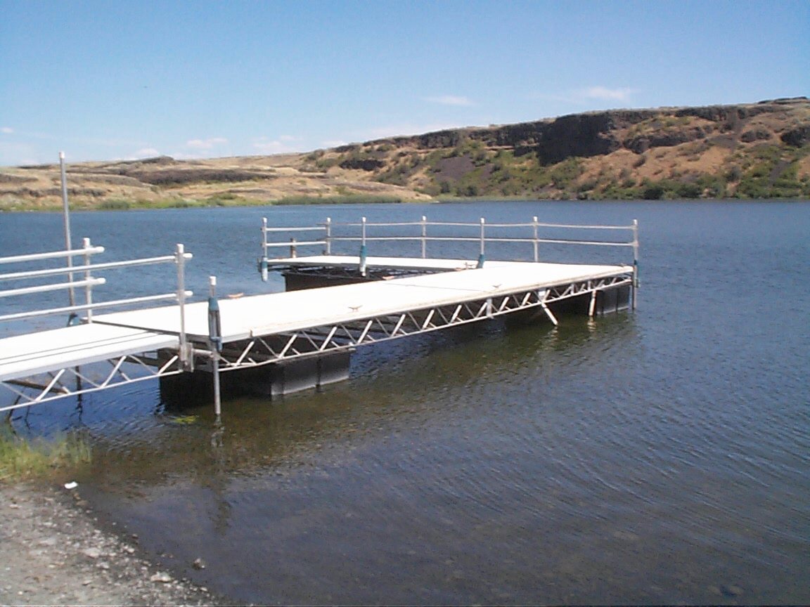
The year-round recreation site has a graveled boat launch, fishing dock, 7 campsites each with a picnic table and a fire ring. One accessible vault toilet is located onsite, but no services are available. Campsites can fill quickly in the spring, especially during weekends March through May.
Know Before You Go
- Coffeepot Lake Recreation Site is open year-round and on a first-come, first-served, no reservation basis.
- There is no potable water nor garbage service available; please pack it in and pack it out.
- Check Washington Department of Fish and Wildlife (WDFW) fishing regulations for fishing season and special gear rules at Coffeepot Lake.
- Beware of rattlesnakes, especially beginning in May through October.
- Due to changeable lake water levels, during any period of drought conditions, boaters can check the Spokane District website, or call (509-536-1200), for updates on availability of the boat launch and dock.
- When recreating on public lands, please practice Leave-No-Trace Principles.
Point of Interest
Fishing enthusiasts at Coffeepot Lake are likely to find rainbow trout, largemouth bass, yellow perch, yellow bullhead, black crappie, and sunfish.
Getting there
From Harrington, Washington: Head west on Coffee Pot Road for 15.5 miles. Turn left at the sign and proceed another 0.2 miles to the site.
47.50107, -118.55511 · 47°30'3.9"N 118°33'18.4"W
Typical weather
Typically 88°F in Jul, down to 36°F in Dec.
| Jan | Feb | Mar | Apr | May | Jun | Jul | Aug | Sep | Oct | Nov | Dec | |
|---|---|---|---|---|---|---|---|---|---|---|---|---|
| High °F | 36 | 43 | 53 | 62 | 71 | 78 | 88 | 87 | 78 | 62 | 46 | 36 |
| Low °F | 23 | 25 | 30 | 34 | 41 | 47 | 52 | 51 | 43 | 34 | 28 | 22 |
| Precip in | 1.5 | 1.0 | 1.1 | 0.8 | 1.0 | 0.8 | 0.4 | 0.2 | 0.3 | 0.9 | 1.4 | 1.7 |
1991–2020 averages from the nearest NOAA station, 13.3 mi away — not measured at the facility itself, and elevation can make a real difference over that distance.
Map
Fees and stay limits
No fees.
Stay limit: 14 days.
From Recreation.gov, which is not always current. The operator's own page is the authority on what you will be charged.
More photos
Member photos
Common questions about Coffeepot Lake Recreation Site
- Can you reserve a site at Coffeepot Lake Recreation Site?
- No. Coffeepot Lake Recreation Site is not reservable through Recreation.gov, so sites are first-come, first-served or booked elsewhere.
- How long can you stay at Coffeepot Lake Recreation Site?
- 14 days.
Camping near Coffeepot Lake Recreation Site
- Hawk Creek Campground 24.5 mi · Campground · we watch it
- Jones Bay Campground 28.9 mi · Campground · we watch it
- Fort Spokane 30.1 mi · Campground · we watch it
- Spring Canyon 34.8 mi · Campground · we watch it
- Spring Canyon Group Site 34.8 mi · Campground · we watch it
- Pacific Lake Recreation Site - Lakeview Ranch 10.2 mi · Facility
- Govan Recreation Site 18.4 mi · Facility
- Crab Creek - Rocky Ford Area 19.7 mi · Facility
- Keller Ferry Group Sites (Concessionaire-operated) 29.9 mi · Campground
- Fort Spokane Visitor Center and Museum 30.1 mi · Facility
- Keller Ferry Campground (Concessionaire-operated) 30.2 mi · Campground
- Camp Na-Bor-Lee (non-profit operated) 38.3 mi · Campground
Contact
- Phone 509-536-1200
- Email BLM_OR_SP_Mail@blm.gov
- Info Recreation.gov
Recreation.gov last updated this record on 2026-07-21.
Facility information and photographs from Recreation.gov (RIDB). SpotOpened is not affiliated with Recreation.gov or any federal agency.
Comments