Miller Flat Reservoir Campground
Campground · Utah · 4 bookable sites ·
Managed by the USDA Forest Service
Manti-La Sal National Forest (NF) · Open Access
- 4
- Bookable sites
- 40 ft
- Max rig length
- up to 50
- People per site
- 8,795 ft
- Elevation
Overview
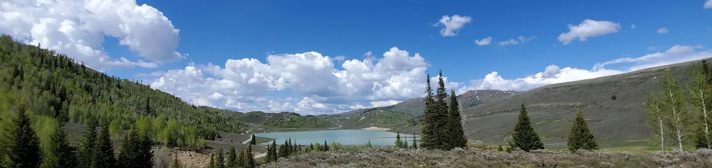
Miller Flat Reservoir Campground is located in a high mountain valley near Miller Flat Reservoir, at an elevation of 8,500 feet. Visitors enjoy fishing, canoeing, horseback riding and exploring the surrounding off-road vehicle trails. The campground rest in a stand of aspen and spruce trees and sites the sites range from having partial to full shade throughout the day.
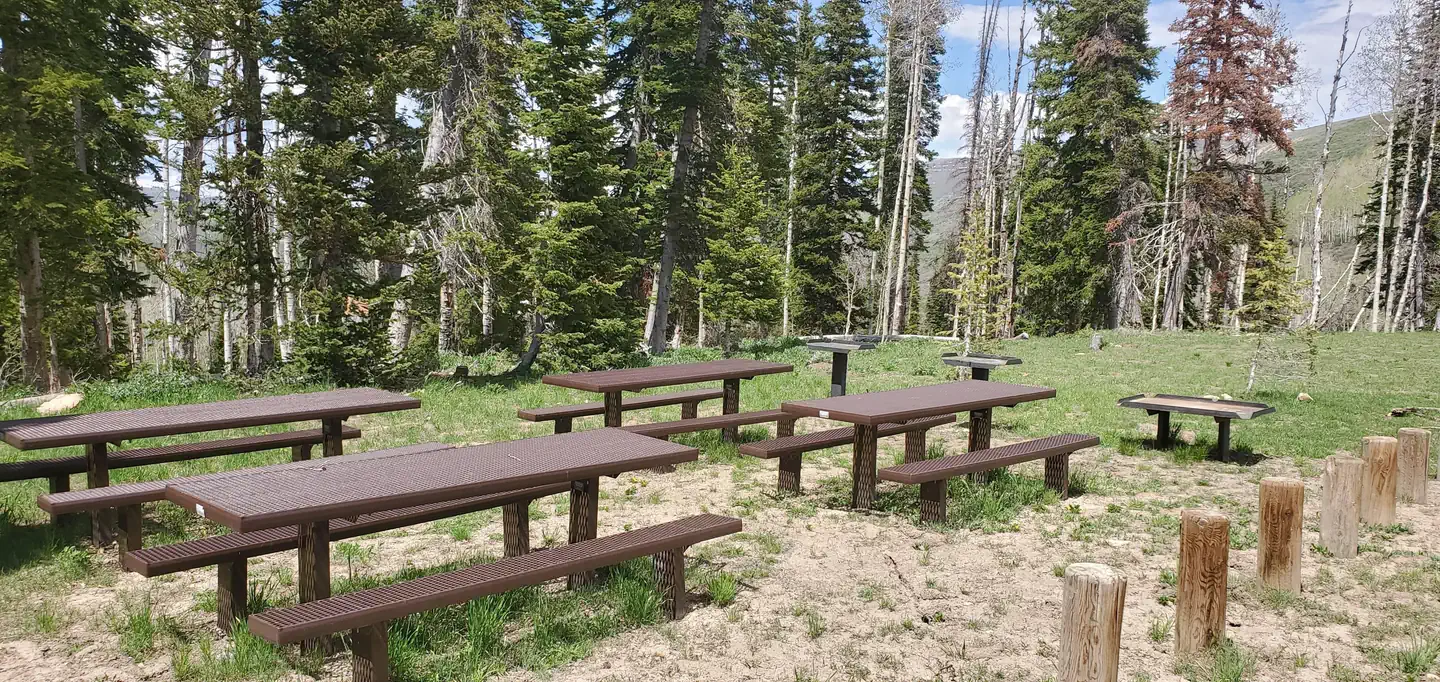
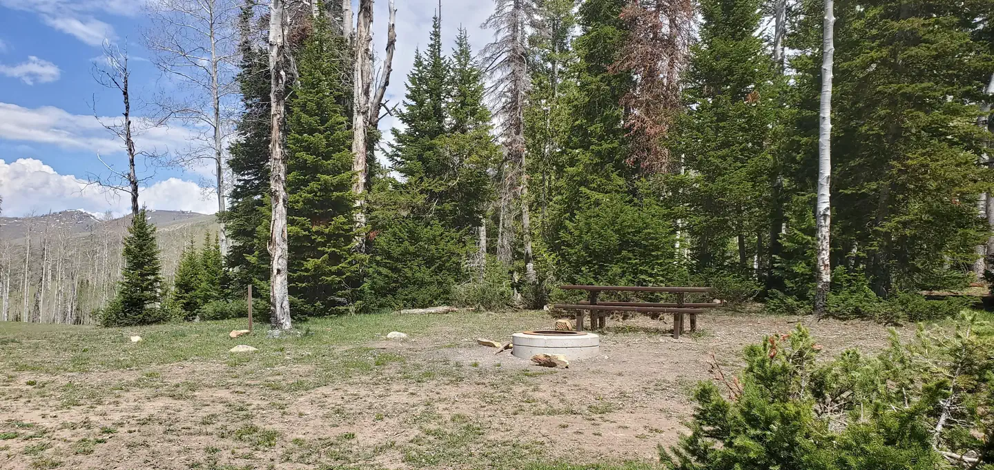
Visitors are allowed to configure their vehicles and trailers as they choose within the site. Group cooking facilities are provided including picnic tables, a fire ring, dutch oven fire pan and utility tables. A vault toilet facility is located about 50 feet from the site. There is no electricity, water, sewer or garbage services. If the group site is not reserved, it is available to visitors on a first-come, first-served basis for $5.00 per vehicle per night. To maintain priority for reservations, first-come, first-served customers may only pay for two nights at a time. The three double family sites in the campground are only available on a first-come, first-served basis for $5.00 per vehicle per night.
Nearby attractions include Miller Flat Reservoir, Potters Pond, Skyline Drive, and the expansive Arapeen OHV Trail System which has more than 350 miles of designated, maintained OHV trails.
Hiking trails near this campground include the Left Fork of Hunting National Recreation Trail which is 1.5 miles north of the campground and various hiking opportunities 2 miles south in Scad Valley.
Recreation
Lake Canyon Recreation Area is located just north of the campground as is the northern trailhead of the Left Fork of Huntington National Recreation Trail. Cleveland and Huntington Reservoirs are located just minutes north of the campground along U31. Each offers trout fishing opportunities, with a boat ramp available at Huntington Reservoir.Facilities
Visitors are allowed to configure their vehicles and trailers as they choose within the site. Group cooking facilities are provided including picnic tables, a fire ring, dutch oven fire pan and utility tables. A vault toilet facility is located about 50 feet from the site. There is no electricity, water, sewer or garbage services.If the group site is not reserved, it is available to visitors on a first-come, first-served basis for $5.00 per vehicle per night. To maintain priority for reservations, first-come, first-served customers may only pay for two nights at a time. The three double family sites in the campground are only available on a first-come, first-served basis for $5.00 per vehicle per night. They are not reservable.
Natural Features
The group site is set in an open meadow with aspen and fir trees bordering the northern perimeter.Nearby Attractions
Potters Ponds, a popular trout fishery is located approximately seven miles south of the campground. The 370-mile Arapeen Off-highway Vehicle Trail System can be accessed directly from the campground by riding north or south along the Miller Flat Road. Maps are available from hosts working in the area.The facts
- 4 bookable sites
- 6 sites in total, including non-bookable
- Vehicles up to 40 ft
- Up to 50 people per site
- Loops: MILLER FLAT RESERVOIR CAMPGROUND, Scan and Pay
Site types
- 3 Standard Nonelectric
- 2 Management
- 1 Group Standard Nonelectric
Amenities
- Campfires allowed
- Fire pits
- Picnic tables
- Shade
- Pets allowed
Not recorded upstream: electric hookups, water hookups, sewer hookups, grills.
6 campsites at Miller Flat Reservoir Campground
| Site | Loop | Type | Entry | Surface | Grade | Max rig | People | |
|---|---|---|---|---|---|---|---|---|
| Group | MILLER FLAT RESERVOIR CAMPGROUND | Group Standard Nonelectric | Pull Through | Gravel | Slight | 40 ft | 50 | 🐾 |
| Site 1 | MILLER FLAT RESERVOIR CAMPGROUND | Standard Nonelectric | Back In | Gravel | Slight | 40 ft | 12 | 🐾 |
| Site 2 | MILLER FLAT RESERVOIR CAMPGROUND | Standard Nonelectric | Back In | Gravel | Slight | 40 ft | 12 | 🐾 |
| Site 3 | MILLER FLAT RESERVOIR CAMPGROUND | Standard Nonelectric | Back In | Gravel | Slight | 30 ft | 12 | 🐾 |
| ScanPay 1 | Scan and Pay | Management | Back In | — | — | — | 0 | |
| ScanPay 2 | Scan and Pay | Management | Back In | — | — | — | 0 |
Getting there
39.52222, -111.25104 · 39°31'20.0"N 111°15'3.7"W
Typical weather
| Jan | Feb | Mar | Apr | May | Jun | Jul | Aug | Sep | Oct | Nov | Dec | |
|---|---|---|---|---|---|---|---|---|---|---|---|---|
| High °F | — | — | — | — | — | — | — | — | — | — | — | — |
| Low °F | — | — | — | — | — | — | — | — | — | — | — | — |
| Precip in | 3.4 | 3.2 | 3.1 | 3.1 | 2.2 | 1.0 | 1.5 | 1.8 | 2.0 | 2.4 | 2.9 | 3.4 |
1991–2020 averages from the nearest NOAA station, 5.1 mi away — not measured at the facility itself, and elevation can make a real difference over that distance.
Map
More photos
Member photos
Common questions about Miller Flat Reservoir Campground
- Can you reserve a site at Miller Flat Reservoir Campground?
- Yes, Miller Flat Reservoir Campground is reservable through Recreation.gov.
- How many campsites does Miller Flat Reservoir Campground have?
- 6 sites in total, of which 4 can be booked.
- What is the maximum RV length at Miller Flat Reservoir Campground?
- 40 ft. That is the longest vehicle the sites here are recorded as taking; individual sites may be shorter.
- Are pets allowed at Miller Flat Reservoir Campground?
- Yes, pets are allowed at Miller Flat Reservoir Campground.
- Are campfires allowed at Miller Flat Reservoir Campground?
- Campfires are allowed at Miller Flat Reservoir Campground. Check for a current fire restriction before you go.
Camping near Miller Flat Reservoir Campground
- Cleveland Reservoir Campground 4 mi · Campground · we watch it
- Lake Canyon Rec Area 4 mi · Campground · we watch it
- Chute Group 4.5 mi · Campground · we watch it
- Little Rock Campground 4.9 mi · Campground · we watch it
- Old Folks Flat 5 mi · Campground · we watch it
- Bridges Campground 5.1 mi · Campground · we watch it
- Forks of Huntington 5.1 mi · Campground · we watch it
- Big Rock Group 5.1 mi · Campground · we watch it
- Miller Flat Reservoir Campground 0.1 mi · Facility
- Lake Canyon Campground 3.9 mi · Campground
- Bridges Campground 4.8 mi · Campground
- Chute Group Campground 4.9 mi · Campground
Contact
- Phone 435-384-2372
- Email r4_m-l_ferron@fs.fed.us
- Book Recreation.gov
Recreation.gov last updated this record on 2026-02-25.
Facility information and photographs from Recreation.gov (RIDB). SpotOpened is not affiliated with Recreation.gov or any federal agency.
Comments