Manti Community
Campground · Utah · 7 bookable sites ·
Managed by the USDA Forest Service
Manti-La Sal National Forest (NF) · Open Access
- 7
- Bookable sites
- 99 ft
- Max rig length
- up to 30
- People per site
- 7,515 ft
- Elevation
Overview
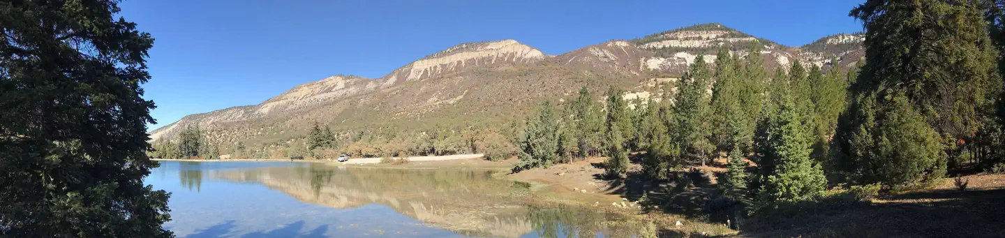
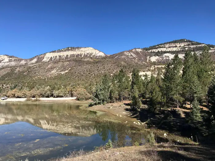
Manti Community Campground is just 7 miles east of Manti, Utah next to Yearns Reservoir at an elevation of 7,400 feet. Visitors enjoy fishing, canoeing and exploring local trails. Accessible by dirt road, no high clearance needed.
Recreation
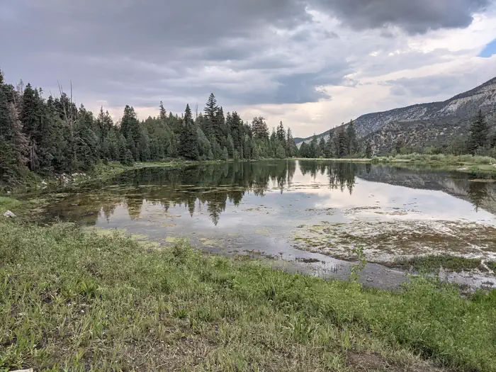
Canoeing and fishing for rainbow and cutthroat trout are popular activities on the small but scenic man-made reservoir. A short, easy trail traverses around Yearns Reservoir with fishing access points on the north, west, and south sides of the lake. The trail includes a wooden bridge, two stream crossings, a set of wooden stairs, and both shaded and exposed areas. Hiking, mountain biking and horseback riding are also favorite activities in the area.
Facilities
The campground contains one group site that can accommodate up to 30 people and six vehicles. Single-family sites are available as well. Multiple vault toilets are provided, along with access footpaths leading down to Yearns Reservoir. Roads and parking spurs are gravel.
Natural Features
A mixed forest of spruce, pinyon, juniper, fir and aspen covers the area, offering partial shade. Wildlife and summer wildflowers are abundant. Situated on a hill above Yearns Reservoir with multiple access trails.
Nearby Attractions
The surrounding area is a haven for ATV enthusiasts. Several trails, primarily for 66-inch OHVs, crisscross the region, making up part of the 350-plus miles of the exciting Arapeen OHV Trail System. In the immediate area is the Burnt Hill Trail that connects with the Patton Trail, beginning at the Manti Loop Patton Trailhead. Milky Falls can also be found nearby.
The facts
- Season: late May – September — USDA Forest Service, Aug 24, 2026
- 7 bookable sites
- 12 sites in total, including non-bookable
- Vehicles up to 99 ft
- Up to 30 people per site
- Loops: FAM, MANAGEMENT SITES, MANT, Scan and Pay
Site types
- 6 Standard Nonelectric
- 5 Management
- 1 Group Standard Nonelectric
Amenities
- Campfires allowed
- Fire pits
- Picnic tables
- Grills
- Pets allowed
Not recorded upstream: electric hookups, water hookups, sewer hookups, shade.
12 campsites at Manti Community
| Site | Loop | Type | Entry | Surface | Max rig | People | |
|---|---|---|---|---|---|---|---|
| 002 | FAM | Standard Nonelectric | Back In | Gravel | 20 ft | 6 | 🐾 |
| 003 | FAM | Standard Nonelectric | Back In | Gravel | 25 ft | 6 | 🐾 |
| 004 | FAM | Standard Nonelectric | Back In | Gravel | 25 ft | 6 | 🐾 |
| 005 | FAM | Standard Nonelectric | Back In | Gravel | 25 ft | 6 | 🐾 |
| 006 | FAM | Standard Nonelectric | Pull Through | Gravel | 30 ft | 6 | 🐾 |
| 008 | FAM | Standard Nonelectric | Back In | Gravel | 30 ft | 6 | 🐾 |
| XXX | MANAGEMENT SITES | Management | Back In | Gravel | 99 ft | 6 | |
| XXX1 | MANAGEMENT SITES | Management | — | — | — | — | |
| XXX3 | MANAGEMENT SITES | Management | — | — | — | — | |
| 007 | MANT | Group Standard Nonelectric | Pull Through | Gravel | 30 ft | 30 | 🐾 |
| ScanPay 1 | Scan and Pay | Management | Back In | — | — | 0 | |
| ScanPay 2 | Scan and Pay | Management | Back In | — | — | 0 |
Getting there
39.25333, -111.54028 · 39°15'12.0"N 111°32'25.0"W
Typical weather
| Jan | Feb | Mar | Apr | May | Jun | Jul | Aug | Sep | Oct | Nov | Dec | |
|---|---|---|---|---|---|---|---|---|---|---|---|---|
| High °F | — | — | — | — | — | — | — | — | — | — | — | — |
| Low °F | — | — | — | — | — | — | — | — | — | — | — | — |
| Precip in | 2.8 | 2.8 | 2.9 | 3.3 | 2.0 | 1.0 | 1.3 | 1.6 | 1.9 | 2.4 | 2.6 | 3.0 |
1991–2020 averages from the nearest NOAA station, 1.4 mi away — not measured at the facility itself, and elevation can make a real difference over that distance.
Map
More photos
Member photos
Common questions about Manti Community
- Can you reserve a site at Manti Community?
- Yes, Manti Community is reservable through Recreation.gov.
- How many campsites does Manti Community have?
- 12 sites in total, of which 7 can be booked.
- What is the maximum RV length at Manti Community?
- 99 ft. That is the longest vehicle the sites here are recorded as taking; individual sites may be shorter.
- Are pets allowed at Manti Community?
- Yes, pets are allowed at Manti Community.
- Are campfires allowed at Manti Community?
- Campfires are allowed at Manti Community. Check for a current fire restriction before you go.
Also listed by
Manti Community also appears in other federal recreation data. Facts below are matched by name and location, not confirmed by Manti Community's operator.
USDA Forest Service — data as of Aug 24, 2026
- $10 per night for a single site, or walk in is $8 - $10. $40 per night for a group site.
Camping near Manti Community
- Lake Hill 5.6 mi · Campground · we watch it
- Seely Creek Guard Station 7.2 mi · Campground · we watch it
- Ferron Reservoir 8.7 mi · Campground · we watch it
- Ferron Reservoir Campground Ferron North 8.9 mi · Campground · we watch it
- Indian Creek Guard Station 8.9 mi · Campground · we watch it
- Twelve Mile Flat 9.4 mi · Campground · we watch it
- Twin Lake Campground 9.7 mi · Campground · we watch it
- Willow Lake 11.8 mi · Campground · we watch it
- Upper Six Mile Ponds Campground 4.5 mi · Campground
- Duck Fork Fishing Site 7.5 mi · Facility
- Gunnison Reservoir Day Use Site 9.1 mi · Facility
- Grassy Lake Fishing Site 12.2 mi · Facility
Contact
- Phone 435-283-4151
- Book Recreation.gov
Recreation.gov last updated this record on 2026-02-25.
Facility information and photographs from Recreation.gov (RIDB). SpotOpened is not affiliated with Recreation.gov or any federal agency.
Comments