Hole-in-the-Wall Foot Trail
Facility ·
Managed by the Bureau of Land Management
State Lands 1111118123 (State Lands) · Open Access
- 5,439 ft
- Elevation
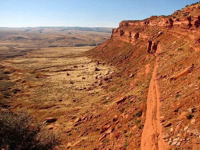
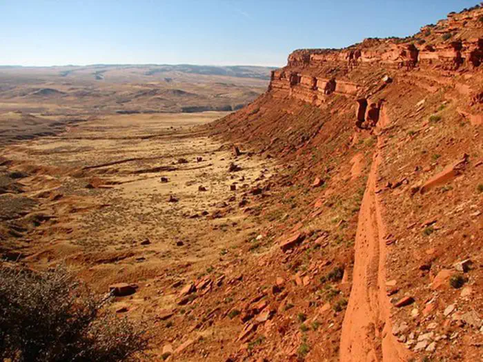
The Hole-in-the-Wall is a colorful and scenic red sandstone escarpment that is rich in legend of outlaw activity from the late 1800s, most notably Butch Cassidy and the Wild Bunch Gang. The "hole" is a gap in the Red Wall that, legend has it, was used secretly by outlaws to move horses and cattle from the area.
The area is primitive in nature, with no services. A three mile trail starts on State land and ends on BLM at the Hole in the Wall.
Backcountry camping is allowed in the recreation area. Visitors should be skilled in cross-country travel and take adequate water, food, and fuel. Please pack trash from the area, and respect private property owners who are working with the BLM to make this an enjoyable recreation opportunity.
Getting there
From I-25 take Exit 249 TTT Road. Head southwest on TTT Road off the interstate. The road then turn southeast. Go about 11 miles and veer right (TTT Ranch is to the left). TTT Road becomes Natrona County Road 112/Lone Bear Road. Veer right at the next Y-intersection onto Willow Creek Road and go about 3.5 miles. Veer right towards Hole in the Wall and go about 4 miles. Veer right at the elevated white grain bins and go another 6 miles. Turn right onto Natrona County Road 105 towards Hole in the Wall. Natrona County Road 105 is a 4WD unmaintained road suitable only for high clearance vehicles during dry conditions. Stay straight on the two-track and go through 6 gates, about 9.5 miles to the trailhead. Please remember to leave the gates as you find them.
43.52956, -106.86487 · 43°31'46.4"N 106°51'53.5"W
Typical weather
Typically 88°F in Jul, down to 37°F in Jan.
| Jan | Feb | Mar | Apr | May | Jun | Jul | Aug | Sep | Oct | Nov | Dec | |
|---|---|---|---|---|---|---|---|---|---|---|---|---|
| High °F | 37 | 39 | 49 | 56 | 66 | 78 | 88 | 86 | 76 | 60 | 47 | 37 |
| Low °F | 10 | 13 | 21 | 29 | 39 | 48 | 55 | 52 | 42 | 30 | 19 | 10 |
| Precip in | 0.3 | 0.4 | 0.7 | 1.5 | 2.8 | 1.6 | 1.2 | 0.7 | 1.0 | 1.0 | 0.5 | 0.3 |
1991–2020 averages from the nearest NOAA station, 17.1 mi away — not measured at the facility itself, and elevation can make a real difference over that distance.
Map
More photos

Member photos
Common questions about Hole-in-the-Wall Foot Trail
- Can you reserve a site at Hole-in-the-Wall Foot Trail?
- No. Hole-in-the-Wall Foot Trail is not reservable through Recreation.gov, so sites are first-come, first-served or booked elsewhere.
Camping near Hole-in-the-Wall Foot Trail
- Doyle Creek Campground 38 mi · Campground · we watch it
- Lost Cabin Campground 43 mi · Campground · we watch it
- Muddy Guard Cabin 43.6 mi · Campground · we watch it
- Leigh Creek Campground 44.2 mi · Campground · we watch it
- Outlaw Cave Campground 5.8 mi · Campground
- Middle Fork of the Powder River Campground 14.2 mi · Campground
- Grave Springs Campground 18.8 mi · Campground
- Buffalo Creek Campground 19 mi · Campground
- Gardner Mountain Trail 21.9 mi · Facility
- Goldeneye Wildlife 36.4 mi · Facility
- Poison Creek Trail 39 mi · Facility
- Powder River Interpretive Site 44.2 mi · Facility
Contact
- Phone 307-684-1100
- Email buffalo_wymail@blm.gov
- Info Recreation.gov
Recreation.gov last updated this record on 2026-02-25.
Facility information and photographs from Recreation.gov (RIDB). SpotOpened is not affiliated with Recreation.gov or any federal agency.
Comments