Gardner Mountain Trail
Facility ·
Managed by the Bureau of Land Management
Buffalo Field Office (Bureau of Land Management WY) · Open Access
- 8,126 ft
- Elevation
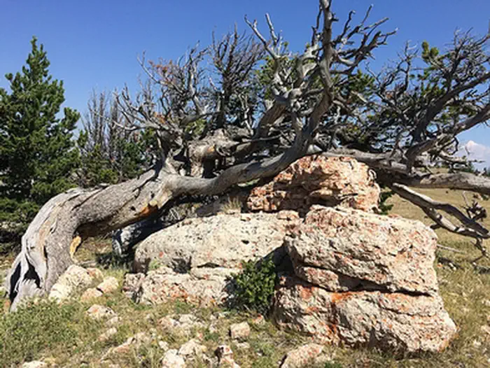
This trail is open to hikers, horseback riders, mountain bikers, and backcountry campers. The route ambles through a mountain meadow and then follows a ridgeline providing spectacular view of the Gardner Mountain Wilderness Study Area. The trail mostly follows old two-tracks and then dips down below the ridge before coming back up. The trail is not well-marked; be sure to carry a map and compass, and please respect private property boundary signs.
Getting there
From Interstate 90, take exit 254 for Kaycee. Head west on WY-191/Mayoworth-Slip Road for approximately 14 miles. Fork left onto Slip Road and continue 6.7 miles up a series of switchbacks. Turn left at a two-track, almost at the top of the hill, and head downhill to the parking area.
43.84198, -106.94398 · 43°50'31.1"N 106°56'38.3"W
Typical weather
| Jan | Feb | Mar | Apr | May | Jun | Jul | Aug | Sep | Oct | Nov | Dec | |
|---|---|---|---|---|---|---|---|---|---|---|---|---|
| High °F | — | — | — | — | — | — | — | — | — | — | — | — |
| Low °F | — | — | — | — | — | — | — | — | — | — | — | — |
| Precip in | 0.8 | 1.1 | 1.9 | 2.5 | 3.5 | 2.2 | 1.5 | 1.0 | 1.7 | 1.9 | 1.3 | 1.1 |
1991–2020 averages from the nearest NOAA station, 6.7 mi away — not measured at the facility itself, and elevation can make a real difference over that distance.
Map
Member photos
Common questions about Gardner Mountain Trail
- Can you reserve a site at Gardner Mountain Trail?
- No. Gardner Mountain Trail is not reservable through Recreation.gov, so sites are first-come, first-served or booked elsewhere.
Camping near Gardner Mountain Trail
- Doyle Creek Campground 16.1 mi · Campground · we watch it
- Lost Cabin Campground 21.2 mi · Campground · we watch it
- Muddy Guard Cabin 22 mi · Campground · we watch it
- Sheep Mountain Fire Lookout 24.2 mi · Campground · we watch it
- Pole Creek Cabin 24.3 mi · Campground · we watch it
- Leigh Creek Campground 24.7 mi · Campground · we watch it
- Outlaw Cave Campground 17.5 mi · Campground
- Poison Creek Trail 18.1 mi · Facility
- Middle Fork of the Powder River Campground 20.7 mi · Campground
- Hole-in-the-Wall Foot Trail 21.9 mi · Facility
- Powder River Interpretive Site 22.3 mi · Facility
- Tensleep Canyon Interpretive Site 24.6 mi · Facility
Contact
- Phone 307-684-1100
- Email buffalo_wymail@blm.gov
- Info Recreation.gov
Recreation.gov last updated this record on 2026-02-25.
Facility information and photographs from Recreation.gov (RIDB). SpotOpened is not affiliated with Recreation.gov or any federal agency.
Comments