Long Branch (Center Hill Lake)
Campground · Tennessee · 56 bookable sites ·
Managed by the US Army Corps of Engineers
Center Hill Recreation Area (Recreation Area) · Open Access
- 56
- Bookable sites
- 156 ft
- Max rig length
- up to 125
- People per site
- 512 ft
- Elevation
Overview
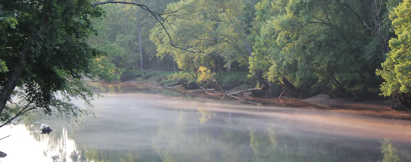
Long Branch Campground is located below Center Hill Dam on the scenic Caney Fork River in central Tennessee's Highland Rim.
Above the dam, the lake stretches 64 miles up the river, where visitors come to enjoy boating, fishing and water sports. The 415 miles of forested shoreline provide excellent hiking, hunting and camping opportunities.
2025 Events: The annual Halloween event will be held Saturday, October 25, 2025.
Recreation
Fishermen come to Long Branch to experience trophy trout fishing on the river, which is stocked with rainbow and brown trout. Fly fishers and spin fishers alike enjoy this beautiful river and its abundant fish. Canoeing and kayaking on the Caney Fork River has become a favorite pastime for campers and sightseers alike. The Buffalo Valley Nature Trail is located just across the river from the campground. It provides access to the Caney Fork and is a very popular area for trout fishermen. The area has great wildlife viewing opportunities. Boating, water skiing and canoeing are popular activities above the dam on Center Hill Lake.Facilities
The campground offers 60 campsites with water and 50-amp electric hookups. A large, day-use group picnic shelter is also available, with water and electric hookup. Amenities like flush toilets, showers and drinking water are provided, creating a comfortable camping experience for guests. A boat ramp, fish cleaning station and playground are all conveniently located within the campground.Natural Features
Long Branch is surrounded by the lush mixed hardwood forests of the hilly Highland Rim region. Whitetail deer, wild turkey, squirrels and rabbits roam the wooded hills in the area.Nearby Attractions
The Center Hill Lake Resource Managers Office is located across the river next to the Buffalo Valley Recreation Area. Edgar Evins State Park sits on the lake shore about 5 minutes from Long Branch. An observation tower at the Visitor Center offers a spectacular view of Center Hill Lake and the surrounding hillsides.The facts
- 56 bookable sites
- 61 sites in total, including non-bookable
- 1 site for day use only
- Vehicles up to 156 ft
- Up to 125 people per site
- Loops: GLOO, LBRA
Site types
- 52 Standard Electric
- 5 Management
- 3 RV Electric
- 1 Group Picnic Area
Amenities
- Electric hookups
- Water hookups
- Sewer hookups
- Campfires allowed
- Fire pits
- Picnic tables
- Grills
- Shade
- Pets allowed
61 campsites at Long Branch (Center Hill Lake)
| Site | Loop | Type | Entry | Surface | Water | Max rig | People | |
|---|---|---|---|---|---|---|---|---|
| 49 | GLOO | Standard Electric | Back In | Gravel | — | 51 ft | 8 | 🐾 |
| 50 | GLOO | Standard Electric | Back In | Gravel | — | 51 ft | 8 | 🐾 |
| 51 | GLOO | Standard Electric | Back In | Gravel | — | 51 ft | 8 | 🐾 |
| 52 | GLOO | Standard Electric | Back In | Gravel | — | 63 ft | 8 | 🐾 |
| 53 | GLOO | Standard Electric | Back In | Gravel | — | 63 ft | 8 | 🐾 |
| 54 | GLOO | Standard Electric | Back In | Gravel | — | 45 ft | 8 | 🐾 |
| 55 | GLOO | Rv Electric | Back In | Paved | — | 48 ft | 8 | 🐾 |
| 56 | GLOO | Rv Electric | Back In | Paved | — | 72 ft | 8 | 🐾 |
| 57 | GLOO | Rv Electric | Back In | Paved | — | 87 ft | 8 | 🐾 |
| 01 | LBRA | Standard Electric | Back In | Gravel | Riverfront | 60 ft | 8 | 🐾 |
| 02 | LBRA | Standard Electric | Back In | Gravel | Riverfront | 67 ft | 8 | 🐾 |
| 03 | LBRA | Standard Electric | Back In | Gravel | — | 75 ft | 8 | 🐾 |
| 04 | LBRA | Management | Back In | Gravel | Riverfront | 48 ft | 6 | 🐾 |
| 05 | LBRA | Standard Electric | Back In | Gravel | — | 96 ft | 8 | 🐾 |
| 06 | LBRA | Standard Electric | Back In | Gravel | Riverfront | 67 ft | 8 | 🐾 |
| 07 | LBRA | Standard Electric | Back In | Gravel | — | 96 ft | 8 | 🐾 |
| 08 | LBRA | Standard Electric | Back In | Gravel | Riverfront | 86 ft | 8 | 🐾 |
| 09 | LBRA | Standard Electric | Back In | Gravel | — | 84 ft | 8 | 🐾 |
| 10 | LBRA | Standard Electric | Back In | Gravel | Riverfront | 92 ft | 8 | 🐾 |
| 11 | LBRA | Standard Electric | Back In | Gravel | — | 53 ft | 8 | 🐾 |
| 12 | LBRA | Management | Back In | Gravel | Riverfront | 76 ft | 8 | 🐾 |
| 13 | LBRA | Standard Electric | Back In | Gravel | — | 76 ft | 8 | 🐾 |
| 14 | LBRA | Standard Electric | Back In | Gravel | Riverfront | 90 ft | 8 | 🐾 |
| 15 | LBRA | Standard Electric | Back In | Gravel | — | 75 ft | 8 | 🐾 |
| 16 | LBRA | Management | Back In | Gravel | Riverfront | 76 ft | 8 | 🐾 |
| 17 | LBRA | Standard Electric | Back In | Gravel | — | 86 ft | 8 | 🐾 |
| 18 | LBRA | Standard Electric | Back In | Gravel | Riverfront | 90 ft | 8 | 🐾 |
| 19 | LBRA | Standard Electric | Back In | Gravel | — | 76 ft | 8 | 🐾 |
| 20 | LBRA | Standard Electric | Back In | Gravel | Riverfront | 65 ft | 8 | 🐾 |
| 21 | LBRA | Standard Electric | Back In | Gravel | — | 103 ft | 8 | 🐾 |
| 22 | LBRA | Standard Electric | Back In | Gravel | Riverfront | 65 ft | 8 | 🐾 |
| 23 | LBRA | Standard Electric | Back In | Gravel | Riverfront | 156 ft | 8 | 🐾 |
| 24 | LBRA | Standard Electric | Back In | Gravel | Riverfront | 66 ft | 8 | 🐾 |
| 25 | LBRA | Standard Electric | Back In | Gravel | Riverfront | 60 ft | 8 | 🐾 |
| 26 | LBRA | Standard Electric | Back In | Gravel | — | 87 ft | 8 | 🐾 |
| 27 | LBRA | Standard Electric | Back In | Gravel | — | 80 ft | 8 | 🐾 |
| 28 | LBRA | Standard Electric | Back In | Gravel | Springs | 51 ft | 8 | 🐾 |
| 29 | LBRA | Standard Electric | Back In | Gravel | — | 78 ft | 8 | 🐾 |
| 30 | LBRA | Standard Electric | Back In | Gravel | — | 90 ft | 8 | 🐾 |
| 31 | LBRA | Standard Electric | Back In | Gravel | — | 72 ft | 8 | 🐾 |
| 32 | LBRA | Standard Electric | Back In | Gravel | — | 84 ft | 8 | 🐾 |
| 33 | LBRA | Standard Electric | Back In | Gravel | — | 60 ft | 8 | 🐾 |
| 34 | LBRA | Standard Electric | Back In | Gravel | — | 78 ft | 8 | 🐾 |
| 35 | LBRA | Standard Electric | Back In | Gravel | — | 69 ft | 8 | 🐾 |
| 36 | LBRA | Standard Electric | Back In | Gravel | — | 81 ft | 8 | 🐾 |
| 37 | LBRA | Standard Electric | Back In | Gravel | — | 63 ft | 8 | 🐾 |
| 38 | LBRA | Standard Electric | Back In | Gravel | — | 78 ft | 8 | 🐾 |
| 39 | LBRA | Standard Electric | Back In | Gravel | — | 75 ft | 8 | 🐾 |
| 40 | LBRA | Standard Electric | Back In | Gravel | — | 75 ft | 8 | 🐾 |
| 41 | LBRA | Standard Electric | Back In | Gravel | — | 63 ft | 8 | 🐾 |
| 42 | LBRA | Standard Electric | Back In | Gravel | — | 84 ft | 8 | 🐾 |
| 43 | LBRA | Standard Electric | Back In | Gravel | — | 63 ft | 8 | 🐾 |
| 44 | LBRA | Standard Electric | Back In | Gravel | — | 90 ft | 8 | 🐾 |
| 45 | LBRA | Standard Electric | Back In | Gravel | — | 72 ft | 8 | 🐾 |
| 46 | LBRA | Standard Electric | Back In | Gravel | — | 69 ft | 8 | 🐾 |
| 47 | LBRA | Standard Electric | Back In | Gravel | — | 87 ft | 8 | 🐾 |
| 48 | LBRA | Standard Electric | Back In | Gravel | — | 63 ft | 8 | 🐾 |
| 58 | LBRA | Standard Electric | Back In | Gravel | — | 65 ft | 8 | 🐾 |
| 59 | LBRA | Management | Back In | Gravel | — | 65 ft | 8 | 🐾 |
| 60 | LBRA | Management | Back In | Gravel | — | 65 ft | 8 | 🐾 |
| P-1 | LBRA | Group Picnic Area | — | Paved | — | — | 125 | 🐾 |
Getting there
36.09925, -85.83180 · 36°5'57.3"N 85°49'54.5"W
Typical weather
Typically 89°F in Jul, down to 48°F in Jan.
| Jan | Feb | Mar | Apr | May | Jun | Jul | Aug | Sep | Oct | Nov | Dec | |
|---|---|---|---|---|---|---|---|---|---|---|---|---|
| High °F | 48 | 52 | 61 | 71 | 79 | 86 | 89 | 89 | 83 | 72 | 61 | 51 |
| Low °F | 29 | 31 | 38 | 47 | 57 | 65 | 68 | 67 | 61 | 50 | 40 | 33 |
| Precip in | 4.8 | 5.1 | 5.3 | 4.8 | 4.8 | 5.2 | 5.4 | 3.9 | 4.0 | 3.5 | 4.0 | 5.9 |
1991–2020 averages from the nearest NOAA station, 1.2 mi away — not measured at the facility itself, and elevation can make a real difference over that distance.
Map
More photos


Member photos
Common questions about Long Branch (Center Hill Lake)
- Can you reserve a site at Long Branch (Center Hill Lake)?
- Yes, Long Branch (Center Hill Lake) is reservable through Recreation.gov.
- How many campsites does Long Branch (Center Hill Lake) have?
- 61 sites in total, of which 56 can be booked.
- What is the maximum RV length at Long Branch (Center Hill Lake)?
- 156 ft. That is the longest vehicle the sites here are recorded as taking; individual sites may be shorter.
- Are pets allowed at Long Branch (Center Hill Lake)?
- Yes, pets are allowed at Long Branch (Center Hill Lake).
- Does Long Branch (Center Hill Lake) have hookups?
- Electric, Water, Sewer.
- Are campfires allowed at Long Branch (Center Hill Lake)?
- Campfires are allowed at Long Branch (Center Hill Lake). Check for a current fire restriction before you go.
Camping near Long Branch (Center Hill Lake)
- Center Hill Lake Primitive Camping Areas 0.2 mi · Campground · we watch it
- Floating Mill Park 5.4 mi · Campground · we watch it
- Hurricane Bridge 6.8 mi · Campground · we watch it
- Ragland Bottom 10.5 mi · Campground · we watch it
- Tailwater Rec Area 13.9 mi · Campground · we watch it
- Defeated Creek Park 14.5 mi · Campground · we watch it
- Salt Lick Creek 15.5 mi · Campground · we watch it
- Wartrace CK Rec Area 18.3 mi · Campground · we watch it
- Roaring River Park 22.3 mi · Campground · we watch it
- Jefferson Springs 36.5 mi · Campground · we watch it
- Laguardo 36.6 mi · Campground · we watch it
- Dale Hollow Damsite 36.8 mi · Campground · we watch it
Contact
- Phone 615-548-8002
- Book Recreation.gov
Recreation.gov last updated this record on 2026-07-25.
Facility information and photographs from Recreation.gov (RIDB). SpotOpened is not affiliated with Recreation.gov or any federal agency.
Comments