Center Hill Lake Primitive Camping Areas
Campground · Tennessee · 21 bookable sites ·
Managed by the US Army Corps of Engineers
Center Hill Recreation Area (Recreation Area) · Open Access
- 21
- Bookable sites
- up to 10
- People per site
- 543 ft
- Elevation
Overview
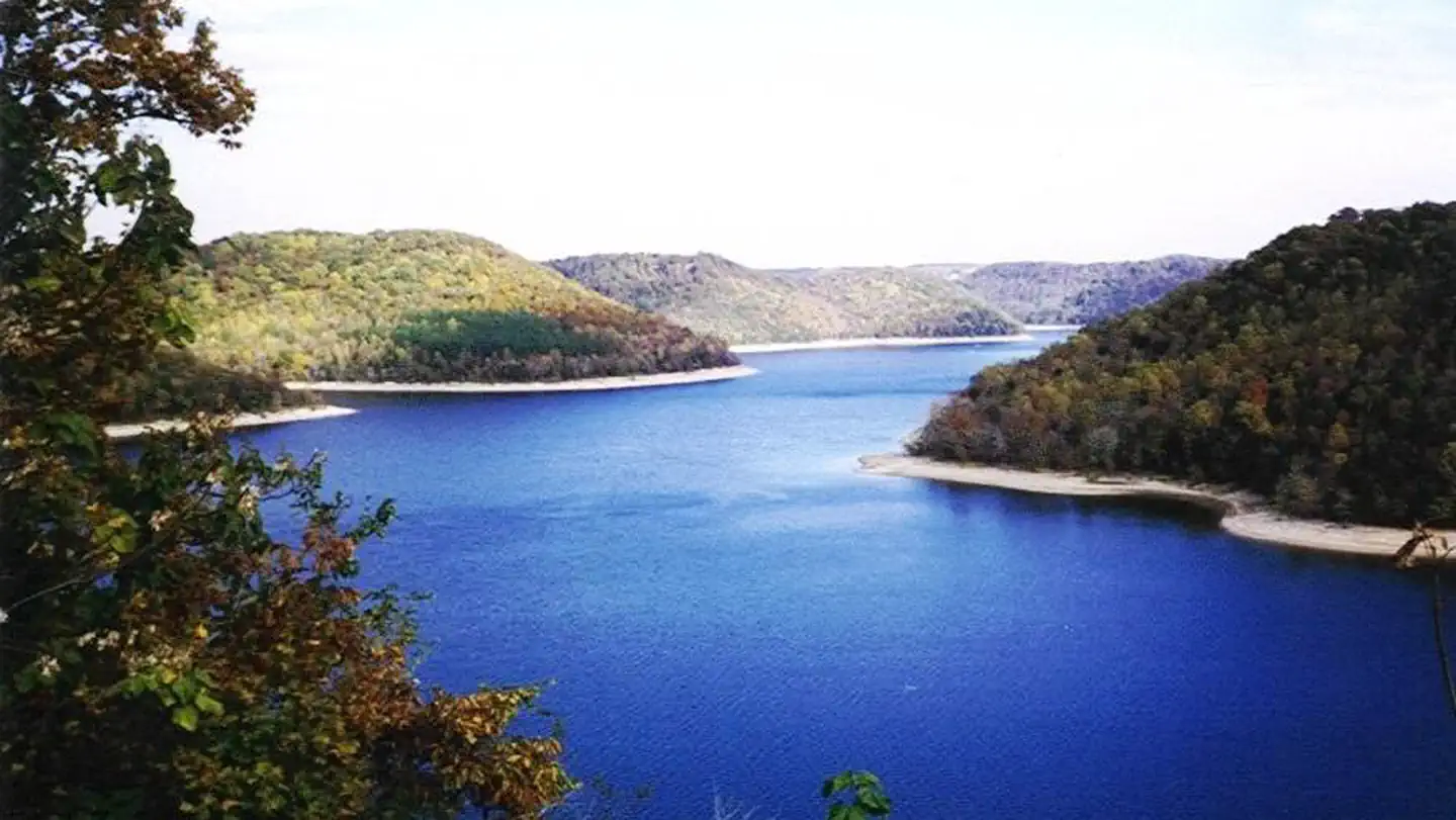
Center Hill Lake Primitive Camping is a unique camping experience at designated areas across Center Hill's 415 miles of shoreline. Primitive camping offers a unique rustic lake front camping experience. Remote locations along the shoreline offer campers a peaceful nature experience. Most designated tent sites are accessible only by boat; while a few can be reached by road.
Campers are advised that these areas are remote, primitive sites. Cellular service may be non-existant or limited. Water or electric including restroom facilities of any kind are not availabile. Campers desiring on-site attendant, security, and law enforcement services are encouraged to use developed campgrounds where such services are provided. These services are not provided for primitive camping.
Recreation
Primitive camping
Center Hill Lake is an outdoor enthusiast's paradise filled with camping, fishing, boating, and hiking experiences. Center Hill Lake is known for its fishing opportunities and host a lot of fishing tournaments.
Facilities
No water, electric, or restroom facilities. Sites have signage and a fire pit.
Natural Features
Lake view rustic camping experience surrounded by mature hardwood trees. Fishing and boating only a few steps from your designated camping site.
Nearby Attractions
Edgar Evins State Park, minutes from Center Hill Dam, sits on the shores of the lake. An observation tower at the Visitor Center offers a spectacular view of Center Hill Lake and the surrounding hillsides.
Burgess Falls State Park is a 35-minute drive from the dam. Here, the Falling Water River drops approximately 250 feet, creating numerous breathtaking waterfalls. Hiking trails and overlooks help visitors enjoy the scenery. The large Native Butterfly Garden is a popular attraction within the park.
Rock Island State Park is approximately one hour from the dam. Rock Island is located near the confluences of three rivers that make up Center Hill Lake; the Caney Fork, the Collins, and Rocky Rivers.
The facts
- 21 bookable sites
- Up to 10 people per site
- Loops: Big Hurricane - Site 1, Britch Creek - Site 2, Cane Hollow - Site 3C, Cane Hollow -Site 3A, Cane Hollow -Site 3B, Cherry Creek - Site 4, Crowder Cove - Site 5, Davies Island East - Site 6, Davies Island North - Site 8, Davies Island West -Site 7, Eagle Creek -Site 9, East Shore - Site 10, Falling Water - Site 11, Fancher Falls -Site 12, Irwin Hollow -Site 13, Pedigo Point - Site 14, Pine Creek -Site 15, Sink Creek - Site 16, South Shore -Site 17, Squirrel Tail - Site 19, White County Access -Site 20
Site types
- 21 Tent Only Nonelectric
Amenities
- Campfires allowed
- Shade
- Pets allowed
- Water hookups — not available
Not recorded upstream: electric hookups, sewer hookups, fire pits, picnic tables, grills.
21 campsites at Center Hill Lake Primitive Camping Areas
Check-in 02:30 PM · Check-out 03:30 PM
| Site | Loop | Type | Entry | Surface | Access | Water | Max rig | People | |
|---|---|---|---|---|---|---|---|---|---|
| Big Hurricane - Site 1 | Big Hurricane - Site 1 | Tent Only Nonelectric | — | — | Boat In | Lakefront | — | 10 | 🐾 |
| Britch Creek - Site 2 | Britch Creek - Site 2 | Tent Only Nonelectric | — | — | Boat In | Lakefront | — | 10 | 🐾 |
| Cane Hollow - Site 3C | Cane Hollow - Site 3C | Tent Only Nonelectric | — | — | Drive In | Lakefront | — | 10 | 🐾 |
| Cane Hollow -Site 3A | Cane Hollow -Site 3A | Tent Only Nonelectric | — | — | Drive In | Lakefront | — | 10 | 🐾 |
| Cane Hollow -Site 3B | Cane Hollow -Site 3B | Tent Only Nonelectric | — | — | Drive In | Lakefront | — | 10 | 🐾 |
| Cherry Creek - Site 4 | Cherry Creek - Site 4 | Tent Only Nonelectric | — | — | Boat In | Lakefront | — | 10 | 🐾 |
| Crowder Cove - Site 5 | Crowder Cove - Site 5 | Tent Only Nonelectric | — | — | Boat In | Lakefront | — | 10 | 🐾 |
| Davies Island East - Site 6 | Davies Island East - Site 6 | Tent Only Nonelectric | — | — | Boat In | Lakefront | — | 10 | 🐾 |
| Davies Island North - Site 8 | Davies Island North - Site 8 | Tent Only Nonelectric | — | — | Boat In | Lakefront | — | 10 | 🐾 |
| Davies Island West -Site 7 | Davies Island West -Site 7 | Tent Only Nonelectric | — | — | Boat In | Lakefront | — | 10 | 🐾 |
| Eagle Creek -Site 9 | Eagle Creek -Site 9 | Tent Only Nonelectric | — | — | Boat In | Lakefront | — | 10 | 🐾 |
| East Shore - Site 10 | East Shore - Site 10 | Tent Only Nonelectric | — | — | Boat In | Lakefront | — | 10 | 🐾 |
| Falling Water - Site 11 | Falling Water - Site 11 | Tent Only Nonelectric | — | — | Boat In | Lakefront | — | 10 | 🐾 |
| Fancher Falls -Site 12 | Fancher Falls -Site 12 | Tent Only Nonelectric | — | — | Boat In | Lakefront | — | 10 | 🐾 |
| Irwin Hollow -Site 13 | Irwin Hollow -Site 13 | Tent Only Nonelectric | — | — | Boat In | Lakefront | — | 10 | 🐾 |
| Pedigo Point - Site 14 | Pedigo Point - Site 14 | Tent Only Nonelectric | — | — | Boat In | Lakefront | — | 10 | 🐾 |
| Pine Creek -Site 15 | Pine Creek -Site 15 | Tent Only Nonelectric | — | — | Boat In | Lakefront | — | 10 | 🐾 |
| Sink Creek - Site 16 | Sink Creek - Site 16 | Tent Only Nonelectric | — | — | Boat In | Lakefront | — | 10 | 🐾 |
| South Shore -Site 17 | South Shore -Site 17 | Tent Only Nonelectric | — | — | Boat In | Lakefront | — | 10 | 🐾 |
| Squirrel Tail - Site 19 | Squirrel Tail - Site 19 | Tent Only Nonelectric | — | — | Boat In | Lakefront | — | 10 | 🐾 |
| White County Access -Site 20 | White County Access -Site 20 | Tent Only Nonelectric | — | — | Drive In | Lakefront | — | 10 | 🐾 |
Getting there
Directions to primitive camp sites start at the nearest USACE facility.
The GPS coordinate "Center Hill Lake Primitive Camping Areas" is for Center Hill Dam. 36°05'52.3"N 85°49'32.4"W or 36.097869, -85.825653
36.10234, -85.82983 · 36°6'8.4"N 85°49'47.4"W
Typical weather
Typically 89°F in Jul, down to 48°F in Jan.
| Jan | Feb | Mar | Apr | May | Jun | Jul | Aug | Sep | Oct | Nov | Dec | |
|---|---|---|---|---|---|---|---|---|---|---|---|---|
| High °F | 48 | 52 | 61 | 71 | 79 | 86 | 89 | 89 | 83 | 72 | 61 | 51 |
| Low °F | 29 | 31 | 38 | 47 | 57 | 65 | 68 | 67 | 61 | 50 | 40 | 33 |
| Precip in | 4.8 | 5.1 | 5.3 | 4.8 | 4.8 | 5.2 | 5.4 | 3.9 | 4.0 | 3.5 | 4.0 | 5.9 |
1991–2020 averages from the nearest NOAA station, 1.4 mi away — not measured at the facility itself, and elevation can make a real difference over that distance.
Map
More photos

Member photos
Common questions about Center Hill Lake Primitive Camping Areas
- Can you reserve a site at Center Hill Lake Primitive Camping Areas?
- Yes, Center Hill Lake Primitive Camping Areas is reservable through Recreation.gov.
- How many campsites does Center Hill Lake Primitive Camping Areas have?
- 21 sites.
- Are pets allowed at Center Hill Lake Primitive Camping Areas?
- Yes, pets are allowed at Center Hill Lake Primitive Camping Areas.
- Does Center Hill Lake Primitive Camping Areas have hookups?
- No hookups are recorded here.
- Are campfires allowed at Center Hill Lake Primitive Camping Areas?
- Campfires are allowed at Center Hill Lake Primitive Camping Areas. Check for a current fire restriction before you go.
Camping near Center Hill Lake Primitive Camping Areas
- Long Branch (Center Hill Lake) 0.2 mi · Campground · we watch it
- Floating Mill Park 5.4 mi · Campground · we watch it
- Hurricane Bridge 6.8 mi · Campground · we watch it
- Ragland Bottom 10.6 mi · Campground · we watch it
- Tailwater Rec Area 13.8 mi · Campground · we watch it
- Defeated Creek Park 14.3 mi · Campground · we watch it
- Salt Lick Creek 15.3 mi · Campground · we watch it
- Wartrace CK Rec Area 18.1 mi · Campground · we watch it
- Roaring River Park 22.1 mi · Campground · we watch it
- Dale Hollow Damsite 36.6 mi · Campground · we watch it
- Jefferson Springs 36.6 mi · Campground · we watch it
- Laguardo 36.7 mi · Campground · we watch it
Contact
- Phone 931-858-3125
- Email centerhilllake@usace.army.mil
- Book Recreation.gov
Recreation.gov last updated this record on 2026-02-25.
Facility information and photographs from Recreation.gov (RIDB). SpotOpened is not affiliated with Recreation.gov or any federal agency.
Comments