Three Forks
Facility · Oregon ·
Managed by the Bureau of Land Management
Vale Malheur Field Office (Bureau of Land Management OR) · Open Access
- 3,976 ft
- Elevation
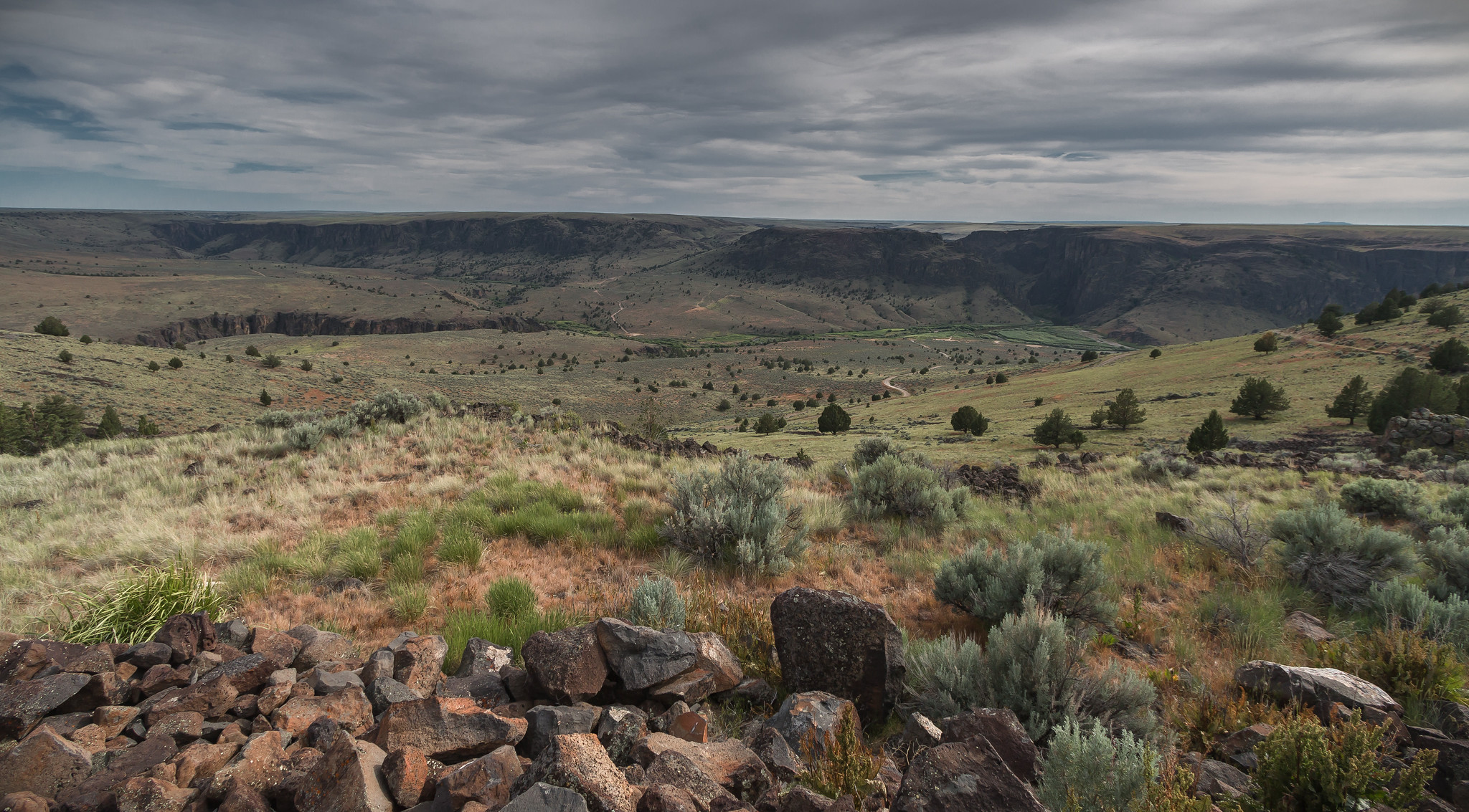
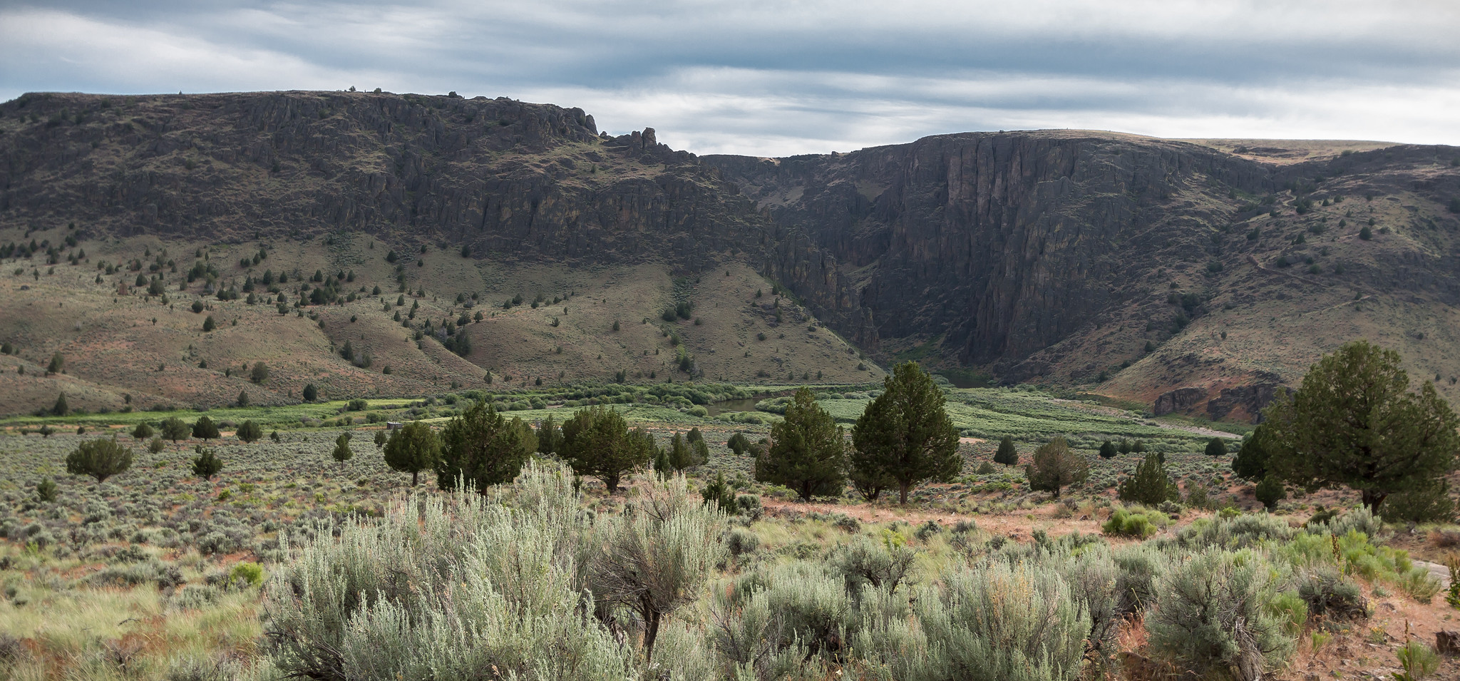
One of the most remote locations in Oregon, the Three Forks Recreation Site offers camping, fishing, swimming, and boating opportunities in the canyonland confluence of the North Fork Owyhee, Middle Fork Owyhee, and Owyhee Rivers.
Know Before You Go
- The Soldier Creek Loop Road can be impassable when wet or muddy, so plan accordingly. It is designated a BLM Watchable Wildlife road, and is enjoyed by a variety of users—including outdoor enthusiasts, birders, ranchers, upland bird and big game hunters, rafters, and campers. Cattle graze on the open range here, too, so be prepared for the occasional cow-in-the-road experience.
- Along the way, plan a stop at the Owyhee Canyon Overlook (22 miles from the highway turn-off) for breathtaking views of the Owyhee Wild and Scenic River far below.
- The last two miles to the site drop quickly into the Three Forks canyon. It is best to stop at the canyon rim and assess the road conditions before attempting the descent with your vehicle, as it’s rocky, steep, and not regularly maintained. Visitors are encouraged to park their cars at the rim and hike down to the site, should driving conditions be too treacherous.
- Once in the canyon, the recreation site features five designated campsites, a boat launch, vehicle parking, and vault restrooms.
- The site is named Three Forks for the three sections of rivers – the Owyhee, the North Fork Owyhee, and the Middle Fork Owyhee—that converge in the area.
- Pronghorn antelope can be found on the rangeland above the canyon, and the canyon interior is particularly important as mule deer winter range habitat. Elk also use this area in the winter and California Bighorn sheep are year-round residents within the Owyhee River corridor.
Point of Interest
Remnants of a historic military road can still be seen today, zig-zagging up the canyon’s west face, and old wagon and ranching roads near the recreation site allow for hiking and walking in the area.
Getting there
Getting there is a challenge, but it’s worth the effort. [Note: high-clearance four-wheel drive is highly recommended.]
From U.S. 95 near Danner, Oregon, approximately 16 miles west of Jordan Valley, Oregon, look for a sign marking the Soldier Creek Loop Road, Owyhee Canyon Overlook, and Three Forks. Turn south onto this dirt road and follow it for 36 miles until you reach the rim of the canyon.
42.54502, -117.16707 · 42°32'42.1"N 117°10'1.4"W
Typical weather
| Jan | Feb | Mar | Apr | May | Jun | Jul | Aug | Sep | Oct | Nov | Dec | |
|---|---|---|---|---|---|---|---|---|---|---|---|---|
| High °F | — | — | — | — | — | — | — | — | — | — | — | — |
| Low °F | — | — | — | — | — | — | — | — | — | — | — | — |
| Precip in | 4.6 | 3.4 | 4.1 | 3.8 | 3.4 | 1.7 | 0.6 | 0.5 | 0.8 | 2.0 | 3.6 | 5.2 |
1991–2020 averages from the nearest NOAA station, 20.1 mi away — not measured at the facility itself, and elevation can make a real difference over that distance.
Map
Fees and stay limits
No fees.
Stay limit: 14 days
From Recreation.gov, which is not always current. The operator's own page is the authority on what you will be charged.
More photos
Member photos
Common questions about Three Forks
- Can you reserve a site at Three Forks?
- No. Three Forks is not reservable through Recreation.gov, so sites are first-come, first-served or booked elsewhere.
- How long can you stay at Three Forks?
- 14 days
Camping near Three Forks
- North Fork Campground 9.9 mi · Campground
- Silver City Campground 39.1 mi · Campground
- Jordan Craters Area of Environmental Concern 44.1 mi · Facility
- Birch Creek Historic Ranch 49.3 mi · Facility
- Slocum Creek Campground 54.2 mi · Facility
Contact
- Phone 541-473-3144
- Email BLM_OR_VL_Mail@blm.gov
- Info Recreation.gov
Recreation.gov last updated this record on 2026-06-12.
Facility information and photographs from Recreation.gov (RIDB). SpotOpened is not affiliated with Recreation.gov or any federal agency.
Comments