Jordan Craters Area of Environmental Concern
Facility · Oregon ·
Managed by the Bureau of Land Management
Vale Malheur Field Office (Bureau of Land Management OR) · Open Access
- 4,632 ft
- Elevation
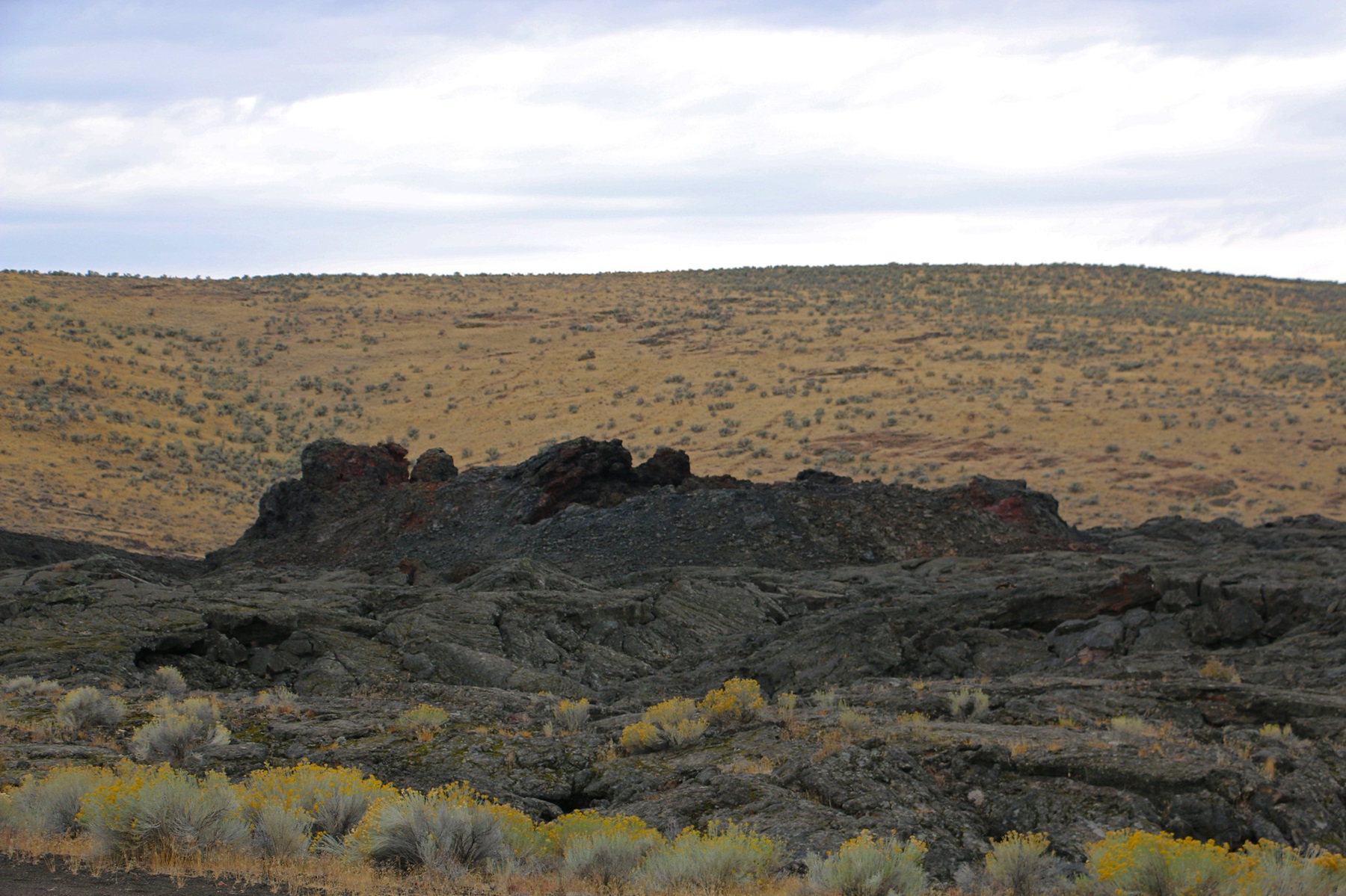
Jordan Craters is a volcanic field, covering 27 square miles with olivine basalt. This otherworldly scene is the result of lava flow that occurred in two main phases, both less than 30,000 years ago. This ancient lava field features craters, lava tubes and pahoehoe (a Hawaiian term meaning "ropy," describing the smooth, billowy lava flows), showing just how mobile a lava flow can be. Drive right up to Coffee Pot Crater, a well-preserved, steep-sided crater that covers two-thirds of a square mile. Hike through or take photos of this alien-like terrain and explore the area's beautiful and geologically violent past.
Know Before You Go
- The area is full of rugged terrain; footing is precarious.
- Lack of trails, sharp lava formations and open pits can be dangerous for the most experienced hiker.
- The lava fields can reach temperatures of more than 120 degrees during the summer. Dehydration is a very real and very dangerous possibility. Bring enough water to remain hydrated.
- Roads become nearly impassable when wet.
- Winter weather can make access difficult.
- High-clearance, four-wheel-drive vehicles are recommended.
Point of Interest
Coffee Pot Crater: the only crater on site to offer vehicle access. This area also features roughly aligned spatter cones—blocks of lava that have welded together, forming cones.
Getting there
Jordan Craters is located in the southeast corner of Oregon in Malheur County. From Highway 95, 8 miles north of Jordan Valley, turn west at the Jordan Craters sign onto Cow Creek Road. Follow BLM Jordan Craters access signs for 25 miles to the site.
43.14615, -117.46103 · 43°8'46.1"N 117°27'39.7"W
Typical weather
Typically 90°F in Jul, down to 38°F in Dec.
| Jan | Feb | Mar | Apr | May | Jun | Jul | Aug | Sep | Oct | Nov | Dec | |
|---|---|---|---|---|---|---|---|---|---|---|---|---|
| High °F | 38 | 44 | 52 | 58 | 67 | 78 | 90 | 89 | 79 | 63 | 49 | 38 |
| Low °F | 20 | 23 | 28 | 32 | 39 | 46 | 54 | 53 | 44 | 34 | 24 | 19 |
| Precip in | 1.5 | 1.2 | 1.4 | 1.5 | 1.9 | 1.3 | 0.3 | 0.3 | 0.3 | 0.9 | 1.3 | 1.8 |
1991–2020 averages from the nearest NOAA station, 21.3 mi away — not measured at the facility itself, and elevation can make a real difference over that distance.
Map
Fees and stay limits
Contact the field office for more information about fees and permits.
From Recreation.gov, which is not always current. The operator's own page is the authority on what you will be charged.
More photos


Member photos
Common questions about Jordan Craters Area of Environmental Concern
- Can you reserve a site at Jordan Craters Area of Environmental Concern?
- No. Jordan Craters Area of Environmental Concern is not reservable through Recreation.gov, so sites are first-come, first-served or booked elsewhere.
Camping near Jordan Craters Area of Environmental Concern
- Birch Creek Historic Ranch 5.2 mi · Facility
- Slocum Creek Campground 14.1 mi · Facility
- Silver City Campground 38.4 mi · Campground
- Snively Hot Springs Recreation Site 42.4 mi · Facility
- Hemingway Butte OHV Trailhead 43 mi · Facility
- Three Forks 44.1 mi · Facility
- North Fork Campground 45.4 mi · Campground
- Halverson Bar/Lake 49.7 mi · Facility
- Dedication Point Overlook 54.5 mi · Facility
- Swan Falls Picnic Area 55 mi · Facility
- Mickey Hot Springs 55.3 mi · Facility
- Chukar Park Campground 57.2 mi · Facility
Contact
- Phone 541-473-3144
- Email BLM_OR_VL_Mail@blm.gov
- Info Recreation.gov
Recreation.gov last updated this record on 2026-05-20.
Facility information and photographs from Recreation.gov (RIDB). SpotOpened is not affiliated with Recreation.gov or any federal agency.
Comments