Sunshine Guard Station
Campground · Oregon · 1 bookable site ·
Managed by the USDA Forest Service
Malheur National Forest (NF) · Open Access
- 1
- Bookable site
- 30 ft
- Max rig length
- up to 7
- People per site
- 3,647 ft
- Elevation
Overview
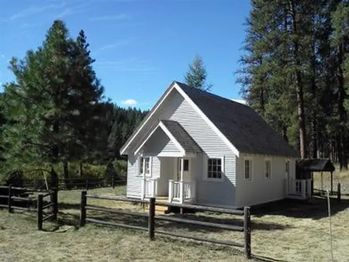
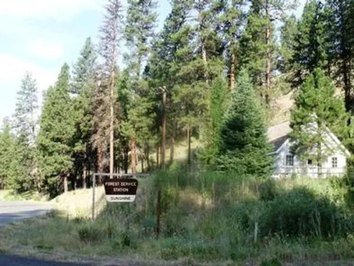
Sunshine Guard Station is situated along John Day River in the Malheur National Forest at an elevation of 3,700 feet, about 43 miles northeast of John Day, Oregon. The former guard station was built in 1936 and until the 1990s was used alternatively as a bunkhouse or a work station for fireguards.The guard station can be accessed by vehicle. Guests are responsible for their own travel arrangements and safety, and must bring several of their own amenities.
Recreation
Recreational options include fishing for steelhead and rainbow trout in the John Day River. Restrictions apply; visitors should refer to Oregon State regulations.
There are hiking trails and back roads to the north of the guard station that lead into the nearby Vinegar Hill / Indian Rock Scenic Area.
Wildlife viewing is popular, as is scenic driving.
Facilities
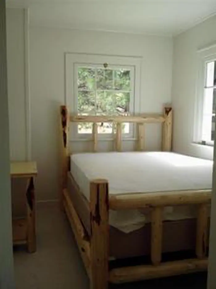
This rustic four-room cabin sleeps up to six and has a kitchen, living room, and two bedrooms. The living room is furnished with a futon, two chairs, a coffee table and an end table. The larger bedroom is furnished with a queen-sized bed and a closet, while the smaller bedroom offers a queen-sized bed and a chair.
The kitchen is furnished with a table and four chairs, electric refrigerator, and stove. Electric heat and lights are provided, and a vault toilet is located next to the cabin.
There is no water in the cabin. Guests must bring their own water for drinking, cooking and washing.
Roads to the guard station are paved and maintained for summer and winter access.
No pets allowed in the Guard Station.
Natural Features
The guard station has a view of the Middle Fork of the John Day River. The Vinegar Hill Forest/Indian Rock Scenic Area is nearby. The 25,000-acre area includes a 10 mile ridgeline that comprises the summit of the Greenhorn Range in the Blue Mountains of eastern Oregon. Outcrops of serpentine, rhyolite, basalt, granite, and shale can be seen. Agates can also be found on some of the rocky slopes.
Wildlife includes elk and deer, songbirds and, in the river, steelhead and trout. Nearly every type of alpine wildflower found west of the Rockies can be blooming at different times in this area.
Magone Lake is about 20 miles west of the guard station.
Contact Info
For facility specific information, please call (541) 575-3000.The facts
- Season: Open year round. — USDA Forest Service, Aug 24, 2026
- 1 bookable site
- Vehicles up to 30 ft
- Up to 7 people per site
- Loops: LOOP A
Site types
- 1 Cabin Electric
Amenities
- Campfires allowed
- Fire pits
- Shade
- Pets allowed — not available
Not recorded upstream: electric hookups, water hookups, sewer hookups, picnic tables, grills.
1 campsite at Sunshine Guard Station
Check-in 4:00 PM · Check-out 12:00 PM
| Site | Loop | Type | Entry | Surface | Grade | Water | Max rig | People | |
|---|---|---|---|---|---|---|---|---|---|
| 001 | LOOP A | Cabin Electric | Parallel | Gravel | Moderate | Riverfront | 30 ft | 7 |
Getting there
44.66593, -118.70010 · 44°39'57.4"N 118°42'0.4"W
Typical weather
Typically 83°F in Jul, down to 34°F in Dec.
| Jan | Feb | Mar | Apr | May | Jun | Jul | Aug | Sep | Oct | Nov | Dec | |
|---|---|---|---|---|---|---|---|---|---|---|---|---|
| High °F | 34 | 39 | 46 | 53 | 62 | 71 | 83 | 83 | 73 | 59 | 42 | 34 |
| Low °F | 15 | 19 | 23 | 28 | 34 | 39 | 43 | 42 | 35 | 28 | 22 | 16 |
| Precip in | 2.6 | 1.7 | 1.9 | 1.7 | 1.8 | 1.6 | 0.7 | 0.7 | 0.8 | 1.3 | 2.7 | 3.3 |
1991–2020 averages from the nearest NOAA station, 12 mi away — not measured at the facility itself, and elevation can make a real difference over that distance.
Map
More photos
Member photos
Common questions about Sunshine Guard Station
- Can you reserve a site at Sunshine Guard Station?
- Yes, Sunshine Guard Station is reservable through Recreation.gov.
- How many campsites does Sunshine Guard Station have?
- 1 site.
- What is the maximum RV length at Sunshine Guard Station?
- 30 ft. That is the longest vehicle the sites here are recorded as taking; individual sites may be shorter.
- Are pets allowed at Sunshine Guard Station?
- No, pets are not allowed at Sunshine Guard Station.
- Are campfires allowed at Sunshine Guard Station?
- Campfires are allowed at Sunshine Guard Station. Check for a current fire restriction before you go.
Also listed by
Sunshine Guard Station also appears in other federal recreation data. Facts below are matched by name and location, not confirmed by Sunshine Guard Station's operator.
USDA Forest Service — data as of Aug 24, 2026
- Price and Capacity: $60 per night per group, with a maximum of six occupants. Fees are used directly for the maintenance and preservation of the work station.
Camping near Sunshine Guard Station
- Middle Fork Campground 5.3 mi · Campground · we watch it
- Olive Lake Campground (OR) 9.6 mi · Campground · we watch it
- Magone Lake 13.2 mi · Campground · we watch it
- Hilltop Hideaway - Umatilla NF (OR) 13.4 mi · Campground · we watch it
- Miners Retreat 13.4 mi · Campground · we watch it
- Davis Creek West Trailhead 3 mi · Facility
- Lower Camp Creek Campground 4.9 mi · Campground
- Head O' Boulder Forest Camp 6.2 mi · Facility
- Deerhorn Campground 6.6 mi · Campground
- Vinegar Hill Indian Rock Scenic Area 7.2 mi · Facility
- Dixie Campground 10.6 mi · Campground
- Fremont Hilltop Hideaway Cabin 13.4 mi · Campground
Contact
- Phone 541-820-3800
- Email SM.FS.malpubinfo@usda.gov
- Book Recreation.gov
Recreation.gov last updated this record on 2026-07-22.
Facility information and photographs from Recreation.gov (RIDB). SpotOpened is not affiliated with Recreation.gov or any federal agency.
Comments