Middle Fork Campground
Campground · Oregon · 10 bookable sites ·
Managed by the USDA Forest Service
Malheur National Forest (NF) · Open Access
- 10
- Bookable sites
- up to 8
- People per site
- 3,846 ft
- Elevation
Overview
This small campground along the Scenic Middle Fork of the John Day River set back amongst beautiful ponderosa pine trees is a great spot for fishing and viewing spawning steelhead in the fall. The campground is a good starting point for hunters, hikers and those wishing to see beautiful scenery, wildlife and wildflowers. The campground sets just off of the county road allowing for easy access to all variety of vehicles and bicycles.
Recreation
This campground offers excellent fishing access along the Middle Fork John Day River, along with a unique chance to view spawning steelhead during the fall months. Visitors can enjoy nearby hikes and wildlife and wildflower viewing. It also provides a great base camp for hunters.
Facilities
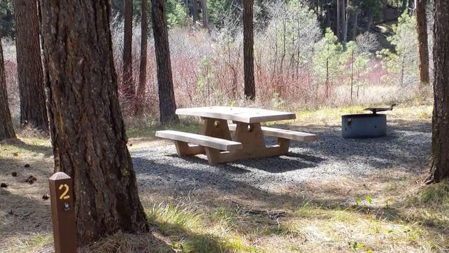
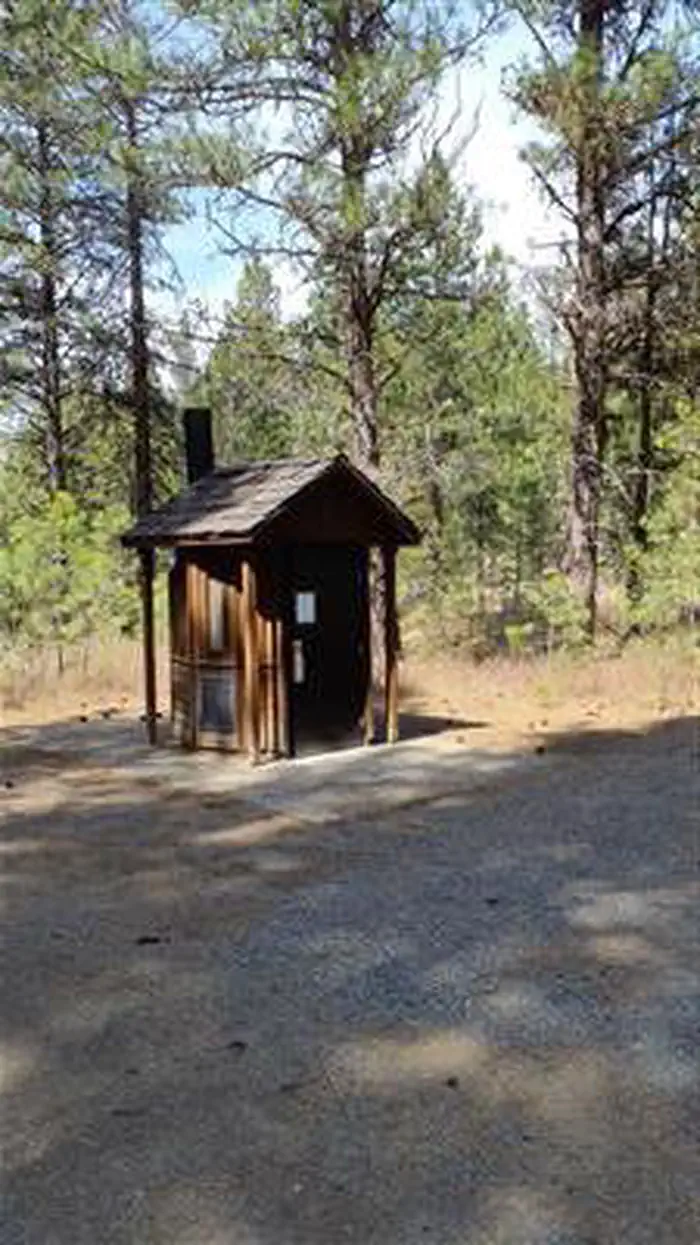
Each campsite has a picnic table, fire ring and parking for camp trailers. Accessible vault toilets are conveniently located in the middle of the campground.
Natural Features
Middle Fork John Day River
Contact Info
For facility specific information, please call (541) 575-3000.Nearby Attractions
The facts
- 10 bookable sites
- Up to 8 people per site
- Loops: Middle Fork
Site types
- 10 Standard Nonelectric
Amenities
- Fire pits
- Picnic tables
- Shade
- Pets allowed
- Water hookups — not available
- Sewer hookups — not available
Not recorded upstream: electric hookups, campfires allowed, grills.
10 campsites at Middle Fork Campground
| Site | Loop | Type | Entry | Surface | Max rig | People | |
|---|---|---|---|---|---|---|---|
| 1 | Middle Fork | Standard Nonelectric | Back In | Gravel | — | 8 | 🐾 |
| 10 | Middle Fork | Standard Nonelectric | Back In | Gravel | — | 8 | 🐾 |
| 2 | Middle Fork | Standard Nonelectric | Back In | Gravel | — | 8 | 🐾 |
| 3 | Middle Fork | Standard Nonelectric | Back In | Gravel | — | 8 | 🐾 |
| 4 | Middle Fork | Standard Nonelectric | Back In | Gravel | — | 8 | 🐾 |
| 5 | Middle Fork | Standard Nonelectric | Back In | Gravel | — | 8 | 🐾 |
| 6 | Middle Fork | Standard Nonelectric | Back In | Gravel | — | 8 | 🐾 |
| 7 | Middle Fork | Standard Nonelectric | Back In | Gravel | — | 8 | 🐾 |
| 8 | Middle Fork | Standard Nonelectric | Back In | Gravel | — | 8 | 🐾 |
| 9 | Middle Fork | Standard Nonelectric | Back In | Gravel | — | 8 | 🐾 |
Getting there
From the town of Prairie City, OR, travel east on US Highway 26 approximately 11 miles to the junction of US Highway 7, follow US Highway 7 for approximately 1 mile to the junction with County Road 20, junction will be on the left. Follow County Road 20 for approximately 5 miles, the campground will be on the left.
44.63006, -118.60561 · 44°37'48.2"N 118°36'20.2"W
Typical weather
Typically 83°F in Jul, down to 34°F in Dec.
| Jan | Feb | Mar | Apr | May | Jun | Jul | Aug | Sep | Oct | Nov | Dec | |
|---|---|---|---|---|---|---|---|---|---|---|---|---|
| High °F | 34 | 39 | 46 | 53 | 62 | 71 | 83 | 83 | 73 | 59 | 42 | 34 |
| Low °F | 15 | 19 | 23 | 28 | 34 | 39 | 43 | 42 | 35 | 28 | 22 | 16 |
| Precip in | 2.6 | 1.7 | 1.9 | 1.7 | 1.8 | 1.6 | 0.7 | 0.7 | 0.8 | 1.3 | 2.7 | 3.3 |
1991–2020 averages from the nearest NOAA station, 6.8 mi away — not measured at the facility itself, and elevation can make a real difference over that distance.
Map
More photos
Member photos
Common questions about Middle Fork Campground
- Can you reserve a site at Middle Fork Campground?
- Yes, Middle Fork Campground is reservable through Recreation.gov.
- How many campsites does Middle Fork Campground have?
- 10 sites.
- Are pets allowed at Middle Fork Campground?
- Yes, pets are allowed at Middle Fork Campground.
- Does Middle Fork Campground have hookups?
- No hookups are recorded here.
Camping near Middle Fork Campground
- Sunshine Guard Station 5.3 mi · Campground · we watch it
- Olive Lake Campground (OR) 10.6 mi · Campground · we watch it
- Hilltop Hideaway - Umatilla NF (OR) 12.6 mi · Campground · we watch it
- Miners Retreat 12.7 mi · Campground · we watch it
- Congo Gulch 12.7 mi · Campground · we watch it
- Deerhorn Campground 1.3 mi · Campground
- Davis Creek West Trailhead 2.3 mi · Facility
- Vinegar Hill Indian Rock Scenic Area 6.3 mi · Facility
- Dixie Campground 6.6 mi · Campground
- Head O' Boulder Forest Camp 9.6 mi · Facility
- Lower Camp Creek Campground 10 mi · Campground
- Fremont Hilltop Hideaway Cabin 12.6 mi · Campground
Contact
- Email SM.FS.malpubinfo@usda.gov
- Book Recreation.gov
Recreation.gov last updated this record on 2026-03-11.
Facility information and photographs from Recreation.gov (RIDB). SpotOpened is not affiliated with Recreation.gov or any federal agency.
Comments