Black Hills Area of Critical Environmental Concern
Facility · Oregon ·
Managed by the Bureau of Land Management
Lakeview District Lakeview Field Office (Bureau of Land Management OR) · Open Access
- 4,892 ft
- Elevation
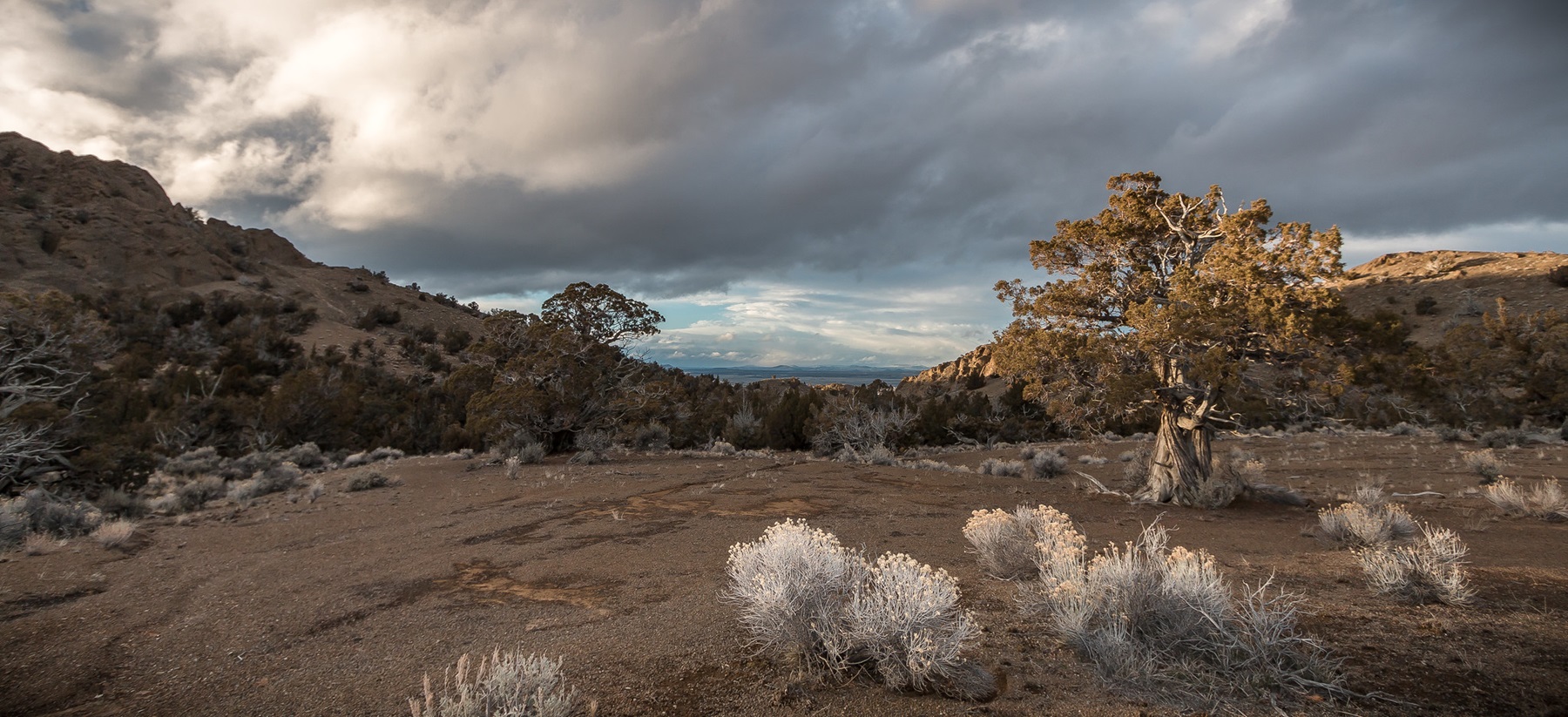
The rocky outcrops that define the Black Hills Area of Environmental Concern (ACEC) are all that remains of an eroded dome of volcanic tuff, formed 4-7 million years ago near today's Christmas Valley, Oregon. Covered with hardy, low-growing plants, this high desert ecosystem hosts three BLM Special Status Species of plants: Cusick’s buckwheat, Warner Mountain bedstraw, and snowline cymopterus. The site offers great hiking, wildflower hunting, photography, and wildlife viewing. Watch for bobcats, coyotes, golden eagles, pronghorn antelope, and many other large and small mammals, birds, and reptiles who call the Black Hills home.
Know Before You Go
- Open season: Black Hills ACEC is open YEAR ROUND.
- Day use only.
- The access road should only be used by 4-wheel drive vehicles.
- No water or restrooms available.
- No camping allowed.
- Rock and boulder climbing and rappelling are PROHIBITED.
- The area is closed to wood and plant collecting, though scientific plant collection and research permits are available at the Lakeview BLM Office.
- The nearest services are in Christmas Valley, Oregon.
Point of Interest
The Black Hills interpretive site is a popular starting point for day hiking and photography. Accessible by foot or 4WD vehicle, it includes a parking area, fencing, and an interpretive sign.
Getting there
From Christmas Valley, Oregon, take County Road 5-14F south. When the main roads turns west, continue south on the dirt road to the sign at the north edge of the site. To enter the site, turn east (left) and travel for .25 mile, then turn south up a rough jeep trail to the visitor information sign. This road should only be used by 4-wheel drive vehicles.
43.16894, -120.67710 · 43°10'8.2"N 120°40'37.6"W
Typical weather
Typically 85°F in Jul, down to 38°F in Dec.
| Jan | Feb | Mar | Apr | May | Jun | Jul | Aug | Sep | Oct | Nov | Dec | |
|---|---|---|---|---|---|---|---|---|---|---|---|---|
| High °F | 39 | 43 | 51 | 57 | 66 | 74 | 85 | 83 | 76 | 61 | 46 | 38 |
| Low °F | 21 | 22 | 25 | 27 | 34 | 40 | 45 | 43 | 35 | 28 | 23 | 18 |
| Precip in | 1.3 | 0.9 | 1.4 | 0.8 | 1.3 | 0.7 | 0.4 | 0.5 | 0.5 | 0.8 | 1.2 | 1.4 |
1991–2020 averages from the nearest NOAA station, 15 mi away — not measured at the facility itself, and elevation can make a real difference over that distance.
Map
Fees and stay limits
No Fees.
From Recreation.gov, which is not always current. The operator's own page is the authority on what you will be charged.
Member photos
Common questions about Black Hills Area of Critical Environmental Concern
- Can you reserve a site at Black Hills Area of Critical Environmental Concern?
- No. Black Hills Area of Critical Environmental Concern is not reservable through Recreation.gov, so sites are first-come, first-served or booked elsewhere.
Camping near Black Hills Area of Critical Environmental Concern
- Hager Mountain Lookout 21 mi · Campground · we watch it
- Fremont Point Cabin 22.3 mi · Campground · we watch it
- Crack-In-The-Ground 11.3 mi · Facility
- Duncan Reservoir Campground 15.1 mi · Campground
- Green Mountain Campground 15.2 mi · Facility
- Lost Forest/Dunes/Fossil ACEC 20.1 mi · Facility
- Eastbay Campground 24.9 mi · Campground
- Thompson Reservoir Campground 25.4 mi · Campground
- Silver Creek Marsh Campground 25.7 mi · Campground
- Derrick Cave 26 mi · Facility
- Lower Buck Creek Campground 29.5 mi · Campground
- Upper Buck Creek Campground 30.8 mi · Campground
Contact
- Phone 541-947-6100
- Email BLM_OR_LV_Mailbox@blm.gov
- Info Recreation.gov
Recreation.gov last updated this record on 2026-07-06.
Facility information and photographs from Recreation.gov (RIDB). SpotOpened is not affiliated with Recreation.gov or any federal agency.
Comments