Washington Irving South
Campground · Oklahoma · 21 bookable sites ·
Managed by the US Army Corps of Engineers
Pawnee Oklahoma Tribal Statistical Area (D6)
- 21
- Bookable sites
- 62 ft
- Max rig length
- up to 25
- People per site
- 774 ft
- Elevation
Overview
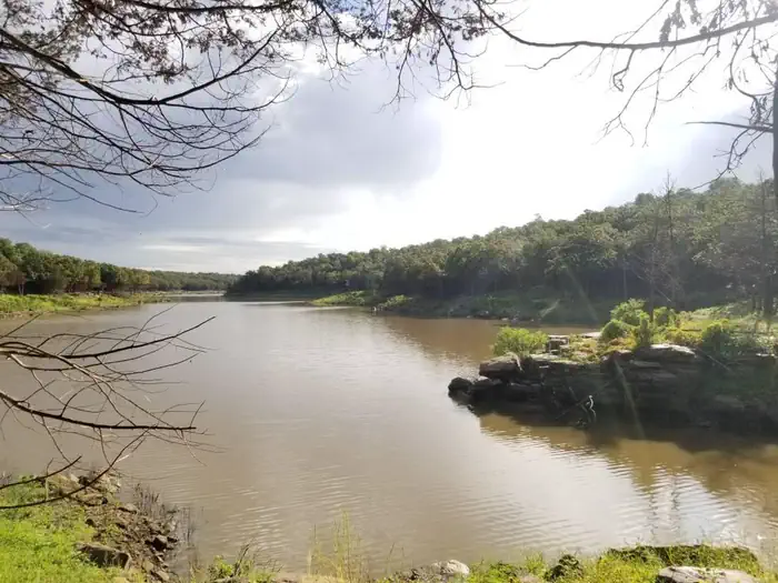
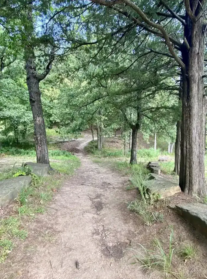
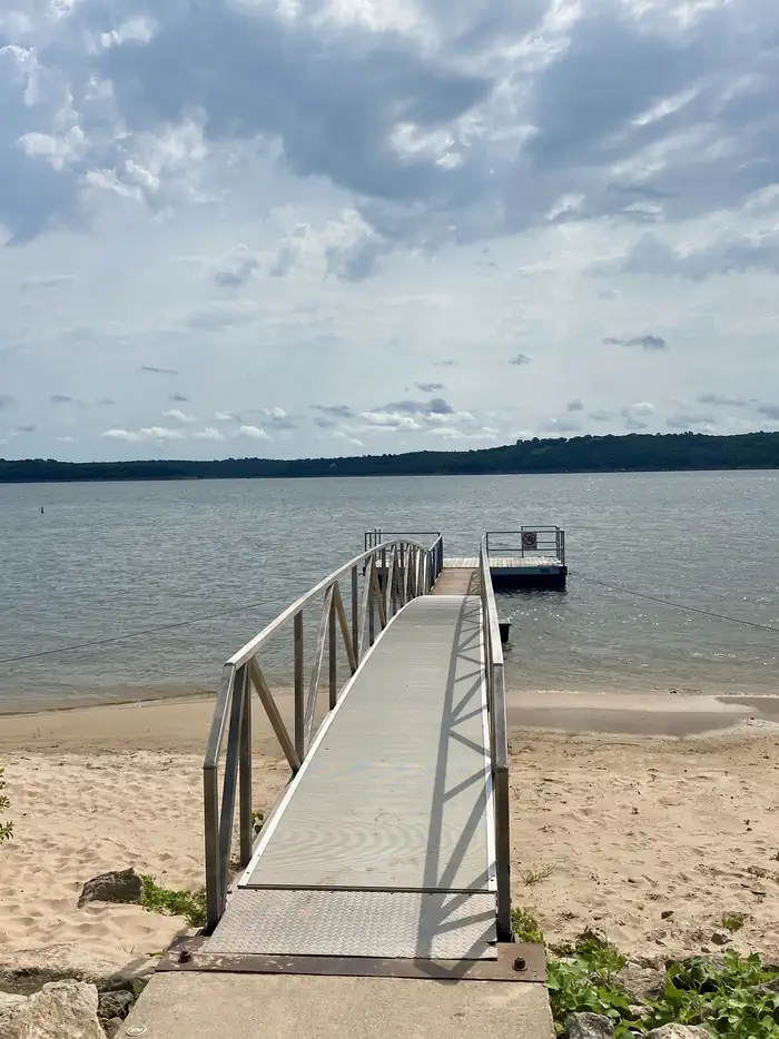
Washington Irving South is located on the Arkansas arm of Keystone Lake, just 30 minutes from Tulsa. In Washington Irving's book, "A Tour of the Prairies," he mentions the area as where he crossed the Arkansas River during his travels. The park features a one-mile nature trail, boat ramp, courtesy dock, playground, and multiple areas along the shores ideal for fishing. The lake's blue-green water, beautiful natural surroundings and wide variety of recreational opportunities make it a popular location for year-round fun.
Recreation
Keystone Lake is a prime location for boating, water skiing, swimming and fishing. The lake is noted for its striped, sand, black and smallmouth bass, crappie and catfish. Downstream fisheries are accessible at nearby Whitewater and Brush Creek Parks.
The park features a boat ramp, dock, playground, swimming beach and a one-mile nature trail.
Facilities
This well-shaded campground features 20 reservable campsites, all with 30 amp electrical services, water hookups (seasonal), picnic tables, fire rings, and grills. This park also offers a restroom/shower facility, drinking water, and dump station.
Natural Features
Keystone Lake is settled into many small valleys and contains almost 26,000 surface acres. Its 330 miles of shoreline are covered with bottomland timber and post oak, blackjack oak and prairie fields, which provide habitat for a variety of wildlife, including squirrel, rabbit, quail, dove and waterfowl.Nearby Attractions
The 400-acre Appalachia Bay Recreation Area, locally referred to as Motorcycle Island, is just 10 minutes from the campground and is popular with off-road vehicle enthusiasts. Sandy trails crisscross the area's beaches and wooded sections. Whitewater Park is an 80-acre off-road vehicle area next to the dam, about 15 minutes from the campground.The facts
- 21 bookable sites
- 1 site for day use only
- Vehicles up to 62 ft
- Up to 25 people per site
- Loops: WASHINGTON IRVING SOUTH, WIRS
Site types
- 20 Standard Electric
- 1 Group Shelter Nonelectric
Amenities
- Electric hookups
- Water hookups
- Campfires allowed
- Fire pits
- Picnic tables
- Grills
- Shade
- Pets allowed
Not recorded upstream: sewer hookups.
21 campsites at Washington Irving South
| Site | Loop | Type | Entry | Surface | Grade | Max rig | People | |
|---|---|---|---|---|---|---|---|---|
| GS1 | WASHINGTON IRVING SOUTH | Group Shelter Nonelectric | — | Paved | — | — | 25 | |
| 01 | WIRS | Standard Electric | Back In | Gravel | — | 35 ft | 8 | 🐾 |
| 02 | WIRS | Standard Electric | Back In | Gravel | Moderate | 31 ft | 8 | 🐾 |
| 03 | WIRS | Standard Electric | Back In | Gravel | — | 45 ft | 8 | 🐾 |
| 04 | WIRS | Standard Electric | Back In | Gravel | — | 32 ft | 8 | 🐾 |
| 05 | WIRS | Standard Electric | Back In | Gravel | — | 32 ft | 8 | 🐾 |
| 06 | WIRS | Standard Electric | Back In | Gravel | — | 45 ft | 8 | 🐾 |
| 07 | WIRS | Standard Electric | Back In | Gravel | — | 32 ft | 8 | 🐾 |
| 08 | WIRS | Standard Electric | Back In | Gravel | — | 39 ft | 8 | 🐾 |
| 09 | WIRS | Standard Electric | Back In | Gravel | — | 33 ft | 8 | 🐾 |
| 10 | WIRS | Standard Electric | Back In | Gravel | — | 31 ft | 8 | 🐾 |
| 11 | WIRS | Standard Electric | Back In | Gravel | — | 54 ft | 8 | 🐾 |
| 12 | WIRS | Standard Electric | Back In | Gravel | — | 55 ft | 8 | 🐾 |
| 13 | WIRS | Standard Electric | Pull Through | Gravel | — | 62 ft | 8 | 🐾 |
| 14 | WIRS | Standard Electric | Back In | Gravel | — | 38 ft | 8 | 🐾 |
| 15 | WIRS | Standard Electric | Back In | Gravel | — | 60 ft | 8 | 🐾 |
| 16 | WIRS | Standard Electric | Back In | Gravel | — | 40 ft | 8 | 🐾 |
| 17 | WIRS | Standard Electric | Back In | Gravel | — | 53 ft | 8 | 🐾 |
| 18 | WIRS | Standard Electric | Back In | Gravel | — | 26 ft | 8 | 🐾 |
| 19 | WIRS | Standard Electric | Back In | Gravel | — | 30 ft | 8 | 🐾 |
| 20 | WIRS | Standard Electric | Back In | Gravel | — | 36 ft | 8 | 🐾 |
Getting there
36.19853, -96.25903 · 36°11'54.7"N 96°15'32.5"W
Typical weather
Typically 93°F in Aug, down to 50°F in Jan.
| Jan | Feb | Mar | Apr | May | Jun | Jul | Aug | Sep | Oct | Nov | Dec | |
|---|---|---|---|---|---|---|---|---|---|---|---|---|
| High °F | 50 | 55 | 65 | 74 | 79 | 87 | 93 | 93 | 85 | 74 | 62 | 51 |
| Low °F | 28 | 31 | 40 | 48 | 58 | 67 | 71 | 69 | 61 | 50 | 39 | 30 |
| Precip in | 1.8 | 1.7 | 3.1 | 4.5 | 6.0 | 5.2 | 3.7 | 3.8 | 3.8 | 3.5 | 2.6 | 2.2 |
1991–2020 averages from the nearest NOAA station, 10.4 mi away — not measured at the facility itself, and elevation can make a real difference over that distance.
Map
More photos
Member photos
Common questions about Washington Irving South
- Can you reserve a site at Washington Irving South?
- Yes, Washington Irving South is reservable through Recreation.gov.
- How many campsites does Washington Irving South have?
- 21 sites.
- What is the maximum RV length at Washington Irving South?
- 62 ft. That is the longest vehicle the sites here are recorded as taking; individual sites may be shorter.
- Are pets allowed at Washington Irving South?
- Yes, pets are allowed at Washington Irving South.
- Does Washington Irving South have hookups?
- Electric, Water.
- Are campfires allowed at Washington Irving South?
- Campfires are allowed at Washington Irving South. Check for a current fire restriction before you go.
Camping near Washington Irving South
- Appalachia Bay Recreation Area 1.9 mi · Campground · we watch it
- Brush Creek Public Use Area 3.4 mi · Campground · we watch it
- Walnut Creek 3.9 mi · Campground · we watch it
- Tall Chief Cove 11.5 mi · Campground · we watch it
- Twin Points 13 mi · Campground · we watch it
- Sheppard Point 17 mi · Campground · we watch it
- Heyburn Park 17.7 mi · Campground · we watch it
- Birch Cove 23.8 mi · Campground · we watch it
- Twin Cove Point 24.2 mi · Campground · we watch it
- Hawthorn Bluff 36 mi · Campground · we watch it
- Blue Creek 41 mi · Campground · we watch it
- The Inn at Price Tower 41.1 mi · Facility
Contact
- Phone 918-865-2621
- Book Recreation.gov
Recreation.gov last updated this record on 2026-02-25.
Facility information and photographs from Recreation.gov (RIDB). SpotOpened is not affiliated with Recreation.gov or any federal agency.
Comments