Brush Creek Public Use Area
Campground · Oklahoma · 18 bookable sites ·
Managed by the US Army Corps of Engineers
Creek Oklahoma Tribal Statistical Area (D6)
- 18
- Bookable sites
- 70 ft
- Max rig length
- up to 10
- People per site
- 687 ft
- Elevation
Overview
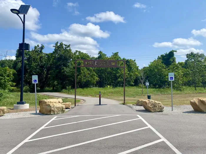
Brush Creek is located downstream of Keystone Dam, just 10 minutes from Tulsa, Oklahoma. This park features campground provided activities such as horseshoes, cornhole, a basketball court, a sand volleyball court, a mile-long fitness trail, and quick access to nearby multi-purpose trails. This is a popular destination for fishermen as they have the ability to cross along the pedestrian bridge from the campground to the fishing berm below the dam. In additon to fishing, this area offers prime opportunities to observe multiple wildlife species. Please note when camping here, while typically quiet, water releases from the dam are preceded by several warning signals from a horn. This is a brief safety measure for anyone in or near the water below the dam, and there is no danger to the campground.
Recreation
This park features fishing opportunities with disabled access, a pedestrian bridge, playground, horseshoe, cornhole, basketball court, volleyball court, and a fitness trail. Recreation opportunities that are offered nearby include the Two Rivers Trail, Keystone Singletrack Trail, and White Water Off Road Vehicle Area.
Facilities
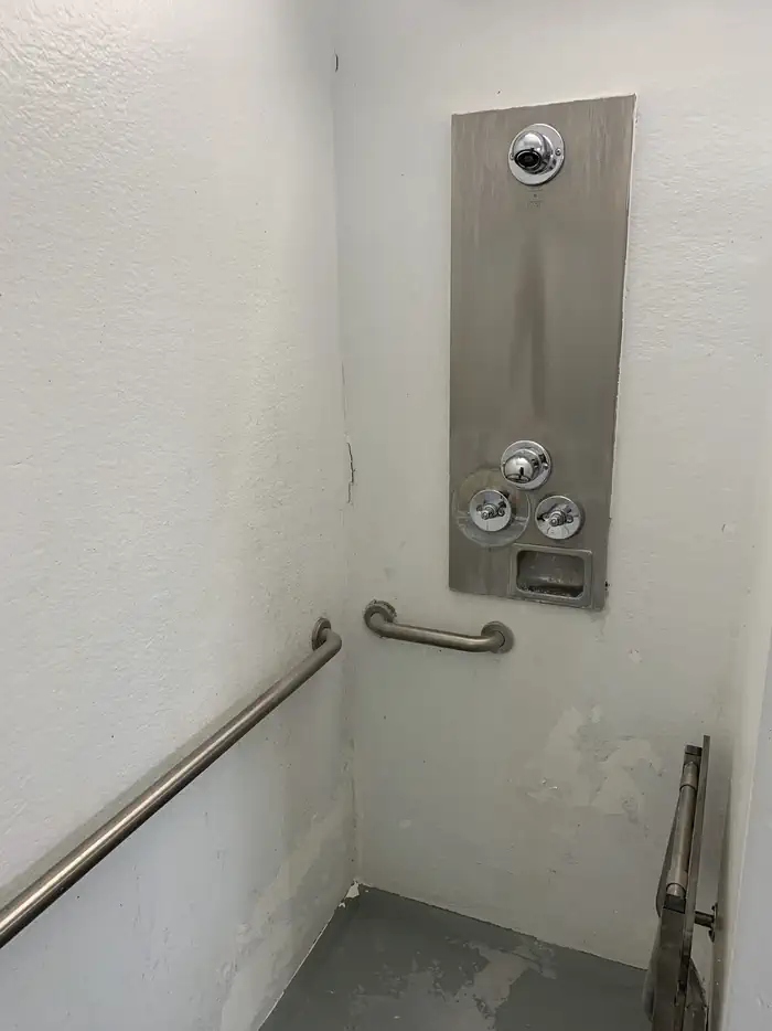
This popular, quaint campground features 50 amp electrical service, water hookups, picnic tables, fire rings, grills, and lantern hooks at all sites. Additionally, sewer hookups are included at sites 1-14. This park also offers a restroom/shower facility.
Natural Features
The park is nestled along the Arkansas River, downstream from Keystone Dam. This location is popular for striped bass, white bass, white crappie, and various catfish species.
Nearby Attractions
BOK Center
The Gathering Place
Tulsa Zoo
Jenks Aquarium
White Water and Appalachia Bay Off Road Vehicle Areas
Multi-purpose trails
OneOK Field
Downtown Tulsa
Turkey Mountain Urban Wilderness Area
Various casinos, malls and shopping centers
The facts
- 18 bookable sites
- 1 site for day use only
- Vehicles up to 70 ft
- Up to 10 people per site
- Loops: Brush Creek
Site types
- 17 RV Electric
- 1 Group Shelter Nonelectric
Amenities
- Electric hookups
- Water hookups
- Sewer hookups
- Campfires allowed
- Fire pits
- Picnic tables
- Grills
- Shade
- Pets allowed
18 campsites at Brush Creek Public Use Area
| Site | Loop | Type | Entry | Surface | Max rig | People | |
|---|---|---|---|---|---|---|---|
| 1 | — | Rv Electric | Back In | Gravel | 35 ft | 8 | 🐾 |
| 10 | — | Rv Electric | Back In | Gravel | 65 ft | 8 | 🐾 |
| 11 | — | Rv Electric | Back In | Gravel | 60 ft | 8 | 🐾 |
| 15 | — | Rv Electric | Back In | Gravel | 65 ft | 8 | 🐾 |
| 16 | — | Rv Electric | Back In | Gravel | 65 ft | 8 | 🐾 |
| 17 | — | Rv Electric | Back In | Gravel | 70 ft | 8 | 🐾 |
| 18 | — | Rv Electric | Back In | Gravel | 60 ft | 8 | 🐾 |
| 19 | — | Rv Electric | Back In | Gravel | 55 ft | 8 | 🐾 |
| 2 | — | Rv Electric | Back In | Gravel | 45 ft | 8 | 🐾 |
| 20 | — | Rv Electric | Back In | Gravel | 50 ft | 8 | 🐾 |
| 3 | — | Rv Electric | Back In | Gravel | 40 ft | 8 | 🐾 |
| 4 | — | Rv Electric | Back In | Gravel | 35 ft | 8 | 🐾 |
| 5 | — | Rv Electric | Back In | Gravel | 45 ft | 8 | 🐾 |
| 6 | — | Rv Electric | Back In | Gravel | 40 ft | 8 | 🐾 |
| 7 | — | Rv Electric | Back In | Gravel | 50 ft | 8 | 🐾 |
| 8 | — | Rv Electric | Back In | Gravel | 55 ft | 8 | 🐾 |
| 9 | — | Rv Electric | Back In | Gravel | 50 ft | 8 | 🐾 |
| GS1 | Brush Creek | Group Shelter Nonelectric | — | — | — | 10 | 🐾 |
Getting there
From Highway 412 take the Keystone Dam Exit on to Highway 151 and take the first left before you cross the Dam. At the stop sign you will travel straight and take the second right turn to the park entrance.
36.15087, -96.24699 · 36°9'3.1"N 96°14'49.2"W
Typical weather
Typically 93°F in Aug, down to 50°F in Jan.
| Jan | Feb | Mar | Apr | May | Jun | Jul | Aug | Sep | Oct | Nov | Dec | |
|---|---|---|---|---|---|---|---|---|---|---|---|---|
| High °F | 50 | 55 | 65 | 74 | 79 | 87 | 93 | 93 | 85 | 74 | 62 | 51 |
| Low °F | 28 | 31 | 40 | 48 | 58 | 67 | 71 | 69 | 61 | 50 | 39 | 30 |
| Precip in | 1.8 | 1.7 | 3.1 | 4.5 | 6.0 | 5.2 | 3.7 | 3.8 | 3.8 | 3.5 | 2.6 | 2.2 |
1991–2020 averages from the nearest NOAA station, 11.1 mi away — not measured at the facility itself, and elevation can make a real difference over that distance.
Map
Fees and stay limits
Camping is $25 per night.
From Recreation.gov, which is not always current. The operator's own page is the authority on what you will be charged.
More photos
Member photos
Common questions about Brush Creek Public Use Area
- Can you reserve a site at Brush Creek Public Use Area?
- Yes, Brush Creek Public Use Area is reservable through Recreation.gov.
- How many campsites does Brush Creek Public Use Area have?
- 18 sites.
- What is the maximum RV length at Brush Creek Public Use Area?
- 70 ft. That is the longest vehicle the sites here are recorded as taking; individual sites may be shorter.
- Are pets allowed at Brush Creek Public Use Area?
- Yes, pets are allowed at Brush Creek Public Use Area.
- Does Brush Creek Public Use Area have hookups?
- Electric, Water, Sewer.
- Are campfires allowed at Brush Creek Public Use Area?
- Campfires are allowed at Brush Creek Public Use Area. Check for a current fire restriction before you go.
Camping near Brush Creek Public Use Area
- Washington Irving South 3.4 mi · Campground · we watch it
- Appalachia Bay Recreation Area 3.5 mi · Campground · we watch it
- Walnut Creek 7.3 mi · Campground · we watch it
- Tall Chief Cove 13.8 mi · Campground · we watch it
- Sheppard Point 13.9 mi · Campground · we watch it
- Heyburn Park 14.6 mi · Campground · we watch it
- Twin Points 16.2 mi · Campground · we watch it
- Birch Cove 26.9 mi · Campground · we watch it
- Twin Cove Point 27.3 mi · Campground · we watch it
- Hawthorn Bluff 37 mi · Campground · we watch it
- Blue Creek 42 mi · Campground · we watch it
- The Inn at Price Tower 43.9 mi · Facility
Contact
- Phone 918-865-2621
- Book Recreation.gov
Recreation.gov last updated this record on 2026-04-17.
Facility information and photographs from Recreation.gov (RIDB). SpotOpened is not affiliated with Recreation.gov or any federal agency.
Comments