Valley of Fires Recreation Area
Campground · New Mexico · 27 bookable sites ·
Managed by the Bureau of Land Management
Roswell Field Office (Bureau of Land Management NM) · Open Access
- 27
- Bookable sites
- 40 ft
- Max rig length
- up to 30
- People per site
- 4
- Accessible sites
- 5,238 ft
- Elevation
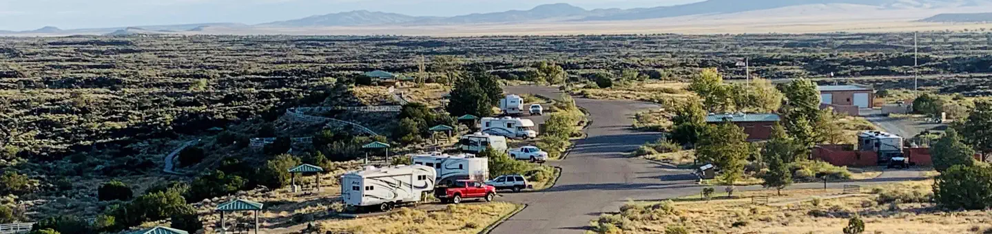
Overview
Valley of Fires recreation area is located immediately adjacent to the Malpais Lava Flow. Approximately 5,000 years ago, Little Black Peak erupted and flowed 44 miles into the Tularosa Basin, filling the basin with molten rock. The resulting lava flow is four to six miles wide, 160 feet thick and covers 125 square miles. The lava flow is considered to be one of the youngest lava flows in the continental United States.
The Bureau of Land Management maintains and manages the Valley of Fires Recreation area, which is located four miles west of Carrizozo, NM, on US Highway 380. Valley of Fires offers both camping and day use. 13 of the campsites have 30- and 50-amp electrical hookups and water hookups, all sites have picnic shelters, tables, trashcans and barbeque grills. Two of the RV sites are accessible, as are the restrooms. Showers are provided in the main restroom/shower house. An RV dump station is also available. Two group shelters are accessible and available for rental. The 3/4-mile Malpais Nature Trail offers a close-up look of the lava surface.
Recreation
Camping:
Valley of Fires Recreation area offers opportunities for RV Camping (both full-service and primitive camp sites), tent camping and day use. Each campsite and group shelter is equipped with picnic shelter and picnic table(s) for the public's enjoyment. Some of the campsites offer online reservations through Recreation.gov - Camping, Cabins, RVs, Permits, Passes & More.
Malpais Nature Trail:
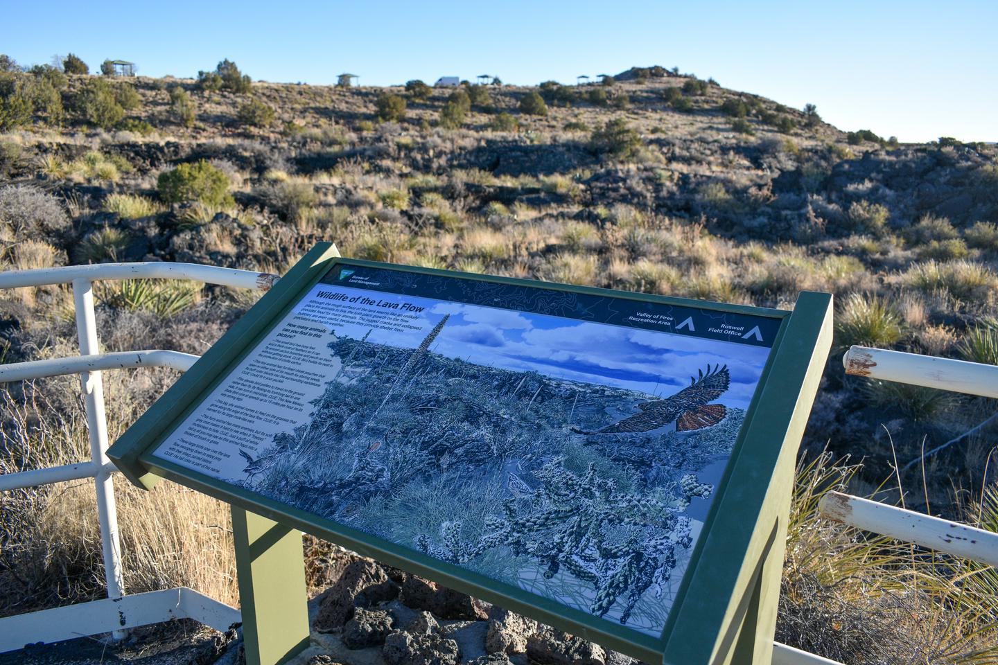
The Malpais Nature trail offers a unique experience of getting trail users out into the lava. The trail is paved and accessible. Wildlife is commonly seen on or from the trail during the warm months, especially in the early morning and late evening hours. The interpretive signage along this trail and the hilltop vista at the Valley of Fires Recreation Area has been updated. These new signs provide updated information, including photos and artwork, about the lava flow, its inhabitants, and the surrounding area.
Kipuka Trail:
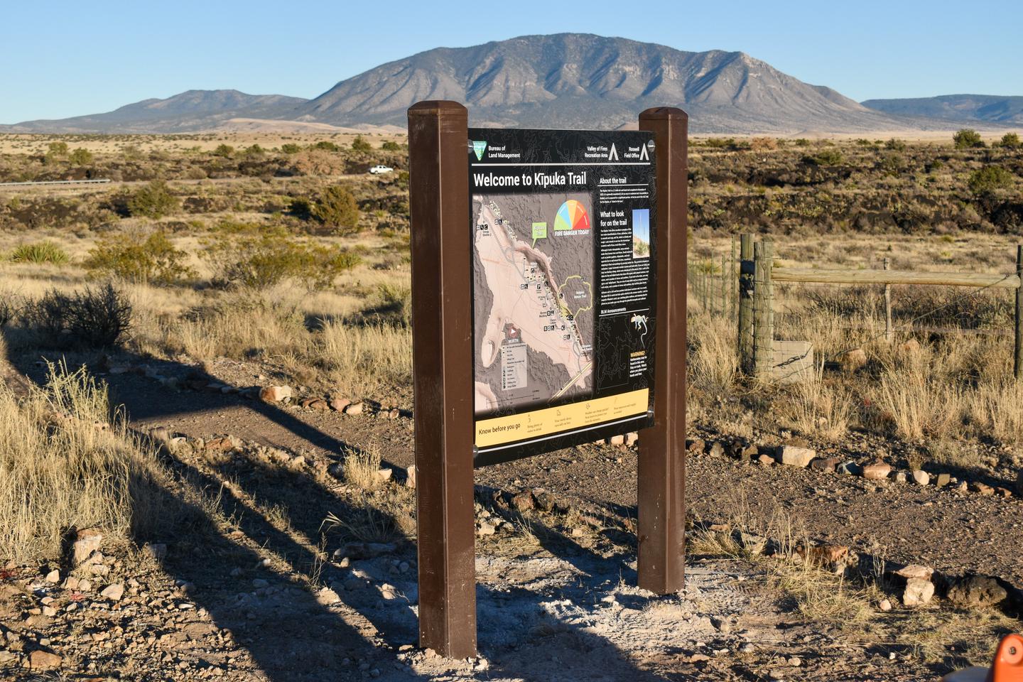
The Kipuka Trail is the latest addition to the Valley of Fires Recreation Area. This gentle dirt path meanders through the interior of the "Kipuka," an island of soil and vegetation encircled by the lava flow. Starting at the Visitor Center and ending at the southern edge of the recreation area, this out-and-back trail spans over a mile, or 2 ¼ miles if you walk the trail back to the starting point. While the Malpais Nature Trail offers an up-close view of the ecosystems flourishing in volcanic rock, the Kipuka Trail provides a unique experience as it takes visitors off the concrete path and into the diverse wildlife of the Chihuahuan Desert. Take sunscreen, plenty of water and watch for rattlesnakes which are sometimes seen along the path during the warmer months of the year.
Valley of Fires Junior Ranger Program:
The Junior Ranger Program offers young adventurers an exciting way to explore the lands and resources managed by the Bureau of Land Management. Children and their families can embark on a learning adventure with the Valley of Fires Junior Ranger activity book. Visit the bookstore to start your journey and get acquainted with these remarkable public lands! To call the Visitor Center ahead of time, please call 575-648-2241. For more information visit: Junior Ranger | Bureau of Land Management
Facilities
Each camp site features picnic shelter and picnic tables, tent pads (tent camping area), pedestal grills, campfire rings (most sites) as well as a trash can.
There is a shower house with flush toilets centrally located within the campground, as well as accessible vault toilets and water spigots scattered throughout the area. Showers are included in your camping fee, or can be used by non-campers for a fee of $6.
The on-site dump station charge is included in camping fees * or it can be utilized by non-campers for a $30 fee. Dump Station open from 7 AM to 7PM. To dump at other times please make arrangements with Camp Host.
* One dump allowed per visit. Additional dumps will be charged $30/dump. Please be able to provide proof of payment to Camp Host or other BLM staff to be permitted to utilize dump station.
The bookstore and gift shop offers information on the recreation area, wildlife and other nearby activities as well as offering the opportunity to purchase a wide variety of stuffed animals, books and other recreation area keepsakes.
Natural Features
From a distance, Valley of Fires appears as barren rock but when you walk through the nature trail there are many varieties of flowers, cactus, trees and bushes typical of the Chihuahuan desert. Animals include bats, roadrunners, quail, cottontails, mule deer, barbary sheep, and lizards. It's also a virtual birdwatcher's paradise with great horned owls, burrowing owls, turkey vultures, hawks, gnat catchers, cactus wrens, sparrows and golden eagles.
Nearby Attractions
Carrizozo Land Partnership
**The Carrizozo Land Partnership vehicle pass page is temporarily unavailable and the Roswell Field Office is currently unable to issue vehicle passes to cross private lands while collection policies for personal identifiable information are updated. All other open BLM lands remain accessible during this time. For more information, please contact the Roswell Field Office at 575-627-0272.**
The Carrizozo Land Partnership provides access to recreators wishing to enter public lands managed by the BLM, between the Carrizozo Lava Flow and the White Sands Missile Range which can only be reached by crossing private land. The CLP, a partnership between the BLM, private landowners and ranchers of this area, has arranged for public access to BLM lands in this area by a vehicle pass process.
Once on the BLM lands in the area, the public is allowed to hunt, camp, hike, observe wildlife and other appropriate recreational activities. This partnership provides access to many miles of roads and thousands of acres of public lands for recreational enjoyment.
Terrain is from flat to rolling, with some bluffy/hilly country overlooking the lava flows. High desert plant species inhabit this area, ranging from desert shrubs, multiple varieties of cactus and cedar/juniper trees.
Other nearby camping/recreation opportunities:
Other nearby fee areas include campgrounds in the Lincoln National Forest, and the BLM Rob Jagger's Campground Rob Jagger's Campground | Bureau of Land Management. There are numerous private RV Campgrounds in the area as well.
Additional nearby attractions include Capitan, Lincoln, and Ruidoso. Capitan, located 24 miles east of the Valley of Fires on U.S. Highway 380, is known as the birthplace of Smokey Bear, and features a popular visitor center. Lincoln, located 37 miles east on U.S. Highway 380, is famous as the site of the historic Lincoln County Wars as well as the exploits of Billy the Kid and Sheriff Pat Garrett. Ruidoso is a popular resort town that features a horse racetrack, the Ski Apache skiing resort, and the Inn of the Mountain Gods casino.
The BLM's Fort Stanton National Conservation Area, located approximately 27 miles east of the Valley of Fires on U.S. Highway 380, has 93 miles of sustainable horseback, mountain biking, and hiking trails that wind through open meadows and canyons. Trails are marked with flexible fiberglass markers with the trail name or an arrow attached to the marker. Cross-country horse and foot travel is allowed. Mountain bikes are strongly encouraged to stay on established trails to protect the rider as well as the landscape. The trails offer great views of the surrounding Sacramento and Capitan Mountains. The majority of the trails start at the Rob Jaggers Campground on NM 220 where you will find excellent camping opportunities, water for your animals, and vault toilets. Fort Stanton-Snowy River Cave National Conservation Area | Bureau of Land Management
The facts
- 27 bookable sites
- 1 site for day use only
- 4 accessible sites
- Vehicles up to 40 ft
- Up to 30 people per site
- Loops: Valley of Fires
Site types
- 13 RV Electric
- 7 Tent Only Nonelectric
- 6 RV Nonelectric
- 1 Group Shelter Electric
Amenities
- Electric hookups
- Water hookups
- Campfires allowed
- Fire pits
- Picnic tables
- Grills
- Shade
- Pets allowed
Not recorded upstream: sewer hookups.
27 campsites at Valley of Fires Recreation Area
Check-in 11:00 AM · Check-out 02:00 PM
| Site | Loop | Type | Entry | Surface | Grade | Max rig | People | |
|---|---|---|---|---|---|---|---|---|
| Group Shelter 1 | Valley of Fires | Group Shelter Electric | — | — | — | — | 30 | ♿ 🐾 |
| Group Shelter 2 | Valley of Fires | Tent Only Nonelectric | — | — | — | — | 30 | ♿ 🐾 |
| Site 1 | Valley of Fires | Rv Nonelectric | Pull Through | Paved | — | 20 ft | — | 🐾 |
| Site 10 | Valley of Fires | Rv Electric | Back In | Paved | Slight | 40 ft | — | 🐾 |
| Site 11 | Valley of Fires | Rv Electric | Back In | Paved | Slight | 40 ft | — | 🐾 |
| Site 12 | Valley of Fires | Rv Electric | Back In | Paved | Slight | 40 ft | — | ♿ 🐾 |
| Site 13 | Valley of Fires | Rv Electric | Back In | Paved | Slight | 40 ft | — | 🐾 |
| Site 14 | Valley of Fires | Rv Nonelectric | Pull Through | Paved | — | 20 ft | — | 🐾 |
| Site 15 | Valley of Fires | Rv Electric | Pull Through | Paved | — | 40 ft | — | 🐾 |
| Site 16 | Valley of Fires | Rv Nonelectric | Back In | Gravel | — | 20 ft | — | 🐾 |
| Site 17 | Valley of Fires | Rv Nonelectric | Pull Through | Gravel | — | 40 ft | — | 🐾 |
| Site 18 | Valley of Fires | Rv Nonelectric | Back In | Gravel | Moderate | 20 ft | — | 🐾 |
| Site 19 | Valley of Fires | Rv Nonelectric | Pull Through | Paved | — | 40 ft | — | 🐾 |
| Site 2 | Valley of Fires | Rv Electric | Pull Through | Paved | Slight | 40 ft | — | 🐾 |
| Site 20 | Valley of Fires | Tent Only Nonelectric | — | — | — | — | — | 🐾 |
| Site 21 | Valley of Fires | Tent Only Nonelectric | — | — | — | — | — | 🐾 |
| Site 22 | Valley of Fires | Tent Only Nonelectric | — | — | — | — | — | 🐾 |
| Site 23 | Valley of Fires | Tent Only Nonelectric | — | — | — | — | — | 🐾 |
| Site 24 | Valley of Fires | Tent Only Nonelectric | — | — | — | — | — | 🐾 |
| Site 25 | Valley of Fires | Tent Only Nonelectric | — | — | — | — | — | 🐾 |
| Site 3 | Valley of Fires | Rv Electric | Pull Through | Paved | Slight | 40 ft | — | 🐾 |
| Site 4 | Valley of Fires | Rv Electric | Back In | Paved | — | 40 ft | — | ♿ 🐾 |
| Site 5 | Valley of Fires | Rv Electric | Pull Through | Paved | Slight | 40 ft | — | 🐾 |
| Site 6 | Valley of Fires | Rv Electric | Pull Through | Paved | Slight | 40 ft | — | 🐾 |
| Site 7 | Valley of Fires | Rv Electric | Pull Through | Paved | Slight | 40 ft | — | 🐾 |
| Site 8 | Valley of Fires | Rv Electric | Back In | Paved | Slight | 40 ft | — | 🐾 |
| Site 9 | Valley of Fires | Rv Electric | Back In | Paved | Slight | 40 ft | — | 🐾 |
Getting there
Travel four miles west of the town of Carrizozo on U.S. Highway 380. Valley of Fires recreation area is on the left.
33.68480, -105.92001 · 33°41'5.3"N 105°55'12.0"W
Typical weather
Typically 91°F in Jun, down to 51°F in Dec.
| Jan | Feb | Mar | Apr | May | Jun | Jul | Aug | Sep | Oct | Nov | Dec | |
|---|---|---|---|---|---|---|---|---|---|---|---|---|
| High °F | 52 | 58 | 65 | 73 | 82 | 91 | 90 | 88 | 83 | 73 | 60 | 51 |
| Low °F | 23 | 26 | 32 | 38 | 47 | 55 | 60 | 58 | 52 | 41 | 29 | 23 |
| Precip in | 0.8 | 0.6 | 0.6 | 0.5 | 0.5 | 0.9 | 2.9 | 2.2 | 1.6 | 1.3 | 0.5 | 1.0 |
1991–2020 averages from the nearest NOAA station, 4 mi away — not measured at the facility itself, and elevation can make a real difference over that distance.
Map
More photos
Member photos
Common questions about Valley of Fires Recreation Area
- Can you reserve a site at Valley of Fires Recreation Area?
- Yes, Valley of Fires Recreation Area is reservable through Recreation.gov.
- How many campsites does Valley of Fires Recreation Area have?
- 27 sites.
- What is the maximum RV length at Valley of Fires Recreation Area?
- 40 ft. That is the longest vehicle the sites here are recorded as taking; individual sites may be shorter.
- Are pets allowed at Valley of Fires Recreation Area?
- Yes, pets are allowed at Valley of Fires Recreation Area.
- Does Valley of Fires Recreation Area have hookups?
- Electric, Water.
- Are campfires allowed at Valley of Fires Recreation Area?
- Campfires are allowed at Valley of Fires Recreation Area. Check for a current fire restriction before you go.
Camping near Valley of Fires Recreation Area
- CEDAR CREEK (Sam Tobias) 26.1 mi · Campground · we watch it
- Rob Jagger's Campground 26.3 mi · Campground · we watch it
- South Fork Campground 18.9 mi · Campground
- Three Rivers Campground 19.7 mi · Campground
- Monjeau Lookout 20.6 mi · Facility
- Skyline Campground 21.2 mi · Campground
- Windy Point Vista 21.9 mi · Facility
- Oak Grove Campground 22.3 mi · Campground
- Smokey Bear RD 23.1 mi · Facility
- Sam Tobias Memorial Group Campground 26.1 mi · Campground
- Cedar Creek Picnic Shelter 26.4 mi · Facility
- Fort Stanton Cave Campground 27.5 mi · Facility
Contact
- Phone 575-648-2241
- Book Recreation.gov
Recreation.gov last updated this record on 2026-04-15.
Facility information and photographs from Recreation.gov (RIDB). SpotOpened is not affiliated with Recreation.gov or any federal agency.
Comments