Jemez Falls Campground
Campground · New Mexico · 50 bookable sites ·
Managed by the USDA Forest Service
Jemez National Recreation Area (National Recreation Area) · Open Access
- 50
- Bookable sites
- 47 ft
- Max rig length
- up to 10
- People per site
- 5
- Accessible sites
- 7,942 ft
- Elevation
Overview
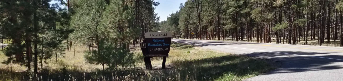
Jemez Falls Campground is located in a stunning Ponderosa Pine and forest meadow environment. The campground elevation is 7,880 feet above sea level. Come prepared for warm days and cool nights.
The Cerro Pelado Area closure prohibits members of the public from entering Trail 137 from access points South of the East Fork Trailhead. Entry is allowed North from the East Fork Trailhead to Las Conchas Trailhead.
Please remember that this campground is special. Help keep it clean and beautiful by using the trash dumpsters. Campground has 52 camp sites with picnic table and fire ring. Paved access which allows trailers and RV's up to 40 feet.
Loop 4 sites are non-generator use areas. Loops 1-3 may use generators from 7:00 AM to 10:00 PM.
There is paved access from the highway and paved internal roads to individual campsites. There are no RV hook-ups. Drinking water is provided from spigots conveniently located throughout the campground. Vault toilets provide basic sanitation needs. A campground host is on duty.
Recreation
Overnight camping, fishing, and hiking are main attractions. Other recreational activities include outdoor photography and nature viewing. The campground is within the heart of the Jemez National Recreation Area.Facilities
The campground contains 51 overnight tent and RV/trailer campsites. Loop 4 has been designated as a (quiet area), generator use is not permitted. Please be aware of the size specifications for your trailer/RV/tent, ensure your equipment will fit in the sizes that are stated for each site. There is paved access from the highway and paved internal roads to individual campsites. There are no RV/trailer hook-ups at the campground. Drinking water is provided from spigots conveniently located throughout the campground. Vault toilets provide basic sanitation needs. A campground host is on duty during the summer camping season.
Natural Features
The East Fork Jemez Wild and Scenic River runs close to the campground. The campground is situated on rolling terrain shaded by pines and sunny in open meadows.Nearby Attractions
Jemez Falls, the largest waterfall in the Jemez Mountains, is a half mile hike from the campground. The Valles Caldera National Preserve and Bandelier National Monument are within short driving distance along the Jemez Mountain Trail National Scenic Byway.Charges & Cancellations
The facts
- 50 bookable sites
- 51 sites in total, including non-bookable
- 5 accessible sites
- Vehicles up to 47 ft
- Up to 10 people per site
- Loops: Loop 1, Loop 2, Loop 3, Loop 4
Site types
- 50 Standard Nonelectric
- 1 Management
Amenities
- Campfires allowed
- Fire pits
- Picnic tables
- Grills
- Shade
- Pets allowed
Not recorded upstream: electric hookups, water hookups, sewer hookups.
51 campsites at Jemez Falls Campground
Check-in 3:00 PM · Check-out 12:00 PM
| Site | Loop | Type | Entry | Surface | Grade | Max rig | People | |
|---|---|---|---|---|---|---|---|---|
| 02 | Loop 1 | Standard Nonelectric | Back In | Paved | Slight | 47 ft | 5 | ♿ 🐾 |
| 03 | Loop 1 | Standard Nonelectric | Back In | Paved | Slight | 47 ft | 5 | ♿ 🐾 |
| 04 | Loop 1 | Standard Nonelectric | Back In | Paved | Slight | 47 ft | 5 | 🐾 |
| 05 | Loop 1 | Standard Nonelectric | Back In | Paved | Slight | 47 ft | 5 | 🐾 |
| 06 | Loop 1 | Standard Nonelectric | Pull Through | Paved | Slight | 40 ft | 5 | ♿ 🐾 |
| 07 | Loop 1 | Standard Nonelectric | Back In | Paved | Slight | 47 ft | 5 | 🐾 |
| 08 | Loop 1 | Standard Nonelectric | Back In | Paved | Slight | 37 ft | 5 | 🐾 |
| 09 | Loop 1 | Standard Nonelectric | Back In | Paved | Slight | 37 ft | 5 | 🐾 |
| 10 | Loop 1 | Standard Nonelectric | Back In | Paved | Slight | 37 ft | 5 | 🐾 |
| 11 | Loop 1 | Standard Nonelectric | Back In | Paved | Slight | 47 ft | 5 | 🐾 |
| 12 | Loop 1 | Standard Nonelectric | Pull Through | Paved | Slight | 47 ft | 5 | 🐾 |
| 13 | Loop 1 | Standard Nonelectric | Back In | Paved | Slight | 37 ft | 5 | 🐾 |
| 14 | Loop 1 | Standard Nonelectric | Back In | Paved | Slight | 37 ft | 5 | 🐾 |
| 15 | Loop 1 | Standard Nonelectric | Back In | Paved | Slight | 42 ft | 5 | 🐾 |
| 16 | Loop 1 | Standard Nonelectric | Back In | Paved | Slight | 42 ft | 5 | 🐾 |
| 17 | Loop 1 | Standard Nonelectric | Back In | Paved | Slight | 42 ft | 5 | 🐾 |
| 18 | Loop 1 | Standard Nonelectric | Back In | Paved | Slight | 42 ft | 5 | 🐾 |
| 19 | Loop 1 | Standard Nonelectric | Back In | Paved | Slight | 42 ft | 5 | 🐾 |
| 20 | Loop 2 | Standard Nonelectric | Back In | Paved | Slight | 37 ft | 5 | 🐾 |
| 21 | Loop 2 | Standard Nonelectric | Back In | Paved | Slight | 37 ft | 5 | 🐾 |
| 22 | Loop 2 | Standard Nonelectric | Back In | Gravel | Slight | 22 ft | 5 | 🐾 |
| 23 | Loop 2 | Standard Nonelectric | Back In | Paved | Slight | 22 ft | 10 | 🐾 |
| 24 | Loop 2 | Standard Nonelectric | Back In | Gravel | Slight | 37 ft | 5 | 🐾 |
| 25 | Loop 2 | Standard Nonelectric | Back In | Paved | Slight | 47 ft | 5 | 🐾 |
| 26 | Loop 2 | Standard Nonelectric | Back In | Paved | Slight | 37 ft | 5 | 🐾 |
| 27 | Loop 2 | Standard Nonelectric | Back In | Paved | Slight | 37 ft | 5 | 🐾 |
| 28 | Loop 2 | Standard Nonelectric | Back In | Paved | Slight | 37 ft | 10 | 🐾 |
| 29 | Loop 2 | Standard Nonelectric | Back In | Paved | Slight | 37 ft | 8 | ♿ 🐾 |
| 30 | Loop 2 | Standard Nonelectric | Back In | Paved | Slight | 37 ft | 5 | 🐾 |
| 31 | Loop 2 | Standard Nonelectric | Back In | Paved | Slight | 37 ft | 5 | 🐾 |
| 32 | Loop 2 | Standard Nonelectric | Back In | Paved | Slight | 37 ft | 5 | 🐾 |
| 33 | Loop 3 | Standard Nonelectric | Pull Through | Paved | Slight | 37 ft | 5 | 🐾 |
| 34 | Loop 3 | Standard Nonelectric | Back In | Paved | Slight | 37 ft | 5 | 🐾 |
| 35 | Loop 3 | Standard Nonelectric | Back In | Paved | Slight | 37 ft | 5 | 🐾 |
| 36 | Loop 3 | Standard Nonelectric | Back In | Paved | Slight | 37 ft | 5 | 🐾 |
| 37 | Loop 3 | Standard Nonelectric | Back In | Paved | Slight | 37 ft | 5 | 🐾 |
| 38 | Loop 3 | Standard Nonelectric | Back In | Paved | Slight | 37 ft | 5 | 🐾 |
| 39 | Loop 3 | Standard Nonelectric | Back In | Paved | Slight | 37 ft | 5 | 🐾 |
| 40 | Loop 3 | Standard Nonelectric | Back In | Paved | Slight | 37 ft | 5 | 🐾 |
| 41 | Loop 3 | Standard Nonelectric | Back In | Paved | Slight | 47 ft | 5 | 🐾 |
| 42 | Loop 4 | Standard Nonelectric | Back In | Paved | Slight | 37 ft | 5 | 🐾 |
| 43 | Loop 4 | Standard Nonelectric | Pull Through | Paved | Slight | 37 ft | 5 | 🐾 |
| 44 | Loop 4 | Standard Nonelectric | Back In | Paved | Slight | 37 ft | 5 | 🐾 |
| 45 | Loop 4 | Standard Nonelectric | Back In | Paved | Slight | 37 ft | 5 | 🐾 |
| 46 | Loop 4 | Standard Nonelectric | Back In | Paved | Slight | 37 ft | 5 | 🐾 |
| 47 | Loop 4 | Standard Nonelectric | Back In | Paved | Slight | 37 ft | 5 | 🐾 |
| 48 | Loop 4 | Standard Nonelectric | Back In | Paved | Slight | 37 ft | 5 | 🐾 |
| 49 | Loop 4 | Standard Nonelectric | Back In | Paved | Slight | 28 ft | 5 | 🐾 |
| 50 | Loop 4 | Standard Nonelectric | Back In | Paved | Slight | 37 ft | 5 | 🐾 |
| 51 | Loop 4 | Standard Nonelectric | Pull Through | Paved | Slight | 37 ft | 5 | 🐾 |
| 52 | Loop 4 | Management | Back In | Gravel | Slight | 20 ft | 8 | ♿ 🐾 |
Getting there
35.81639, -106.60639 · 35°48'59.0"N 106°36'23.0"W
Typical weather
Typically 89°F in Jul, down to 47°F in Dec.
| Jan | Feb | Mar | Apr | May | Jun | Jul | Aug | Sep | Oct | Nov | Dec | |
|---|---|---|---|---|---|---|---|---|---|---|---|---|
| High °F | 48 | 52 | 60 | 68 | 76 | 87 | 89 | 86 | 80 | 70 | 56 | 47 |
| Low °F | 19 | 22 | 28 | 33 | 41 | 50 | 55 | 54 | 47 | 36 | 26 | 19 |
| Precip in | 1.0 | 0.8 | 1.0 | 0.9 | 0.8 | 0.7 | 2.6 | 2.6 | 1.6 | 1.4 | 0.9 | 0.9 |
1991–2020 averages from the nearest NOAA station, 5.2 mi away — not measured at the facility itself, and elevation can make a real difference over that distance.
Map
Fees and stay limits
Standard Nonelectric sites are $20.00 for the Season.
From Recreation.gov, which is not always current. The operator's own page is the authority on what you will be charged.
More photos


Member photos
Common questions about Jemez Falls Campground
- Can you reserve a site at Jemez Falls Campground?
- Yes, Jemez Falls Campground is reservable through Recreation.gov.
- How many campsites does Jemez Falls Campground have?
- 51 sites in total, of which 50 can be booked.
- What is the maximum RV length at Jemez Falls Campground?
- 47 ft. That is the longest vehicle the sites here are recorded as taking; individual sites may be shorter.
- Are pets allowed at Jemez Falls Campground?
- Yes, pets are allowed at Jemez Falls Campground.
- Are campfires allowed at Jemez Falls Campground?
- Campfires are allowed at Jemez Falls Campground. Check for a current fire restriction before you go.
Camping near Jemez Falls Campground
- Jemez Falls (NM) Picnic Area less than 0.1 mi · Campground · we watch it
- Redondo Campground 3.3 mi · Campground · we watch it
- Jemez Falls Trailhead 0.1 mi · Facility
- Jemez Falls Group Picnic Site 0.1 mi · Facility
- East Fork Trailhead #137 1 mi · Facility
- Battleship Rock Trailhead 2.2 mi · Facility
- Battleship Rock Picnic Site 2.3 mi · Facility
- Rincon Fishing Site 2.5 mi · Facility
- Spence Hot Spring Trailhead 2.7 mi · Facility
- Dark Canyon Fishing Site 2.9 mi · Facility
- San Diego Canyon Overlook Overlook Site 3.2 mi · Facility
- La Cueva Picnic Site 3.8 mi · Facility
Contact
- Phone (575) 829-3535
- Email john.hennard@usda.gov
- Book Recreation.gov
Recreation.gov last updated this record on 2026-07-21.
Facility information and photographs from Recreation.gov (RIDB). SpotOpened is not affiliated with Recreation.gov or any federal agency.
Comments