West Fork Butte Lookout
Campground · Montana · 1 bookable site ·
Managed by the USDA Forest Service
Lolo National Forest (NF) · Open Access
- 1
- Bookable site
- up to 4
- People per site
- 5,274 ft
- Elevation

Overview
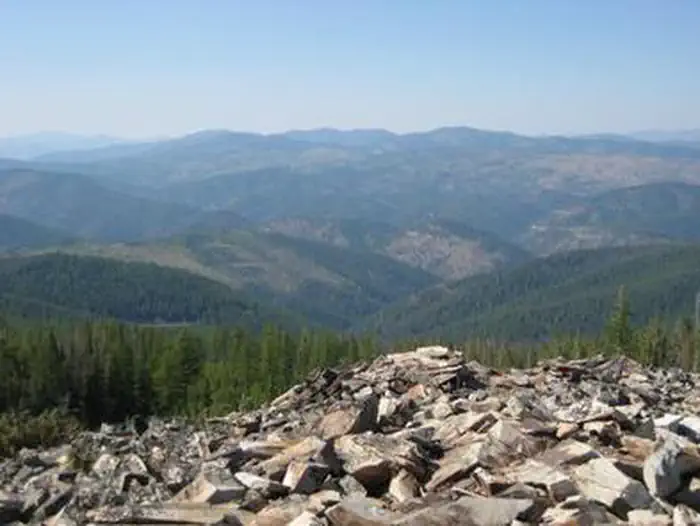
West Fork Butte Lookout is an ideal place for guests to experience the mountains south of Missoula from a unique vantage point. The facility provides near-360-degree views of the surrounding area. It is equipped with basic supplies and provides guests a base camp location from which to explore the area. Access by vehicle is available for a relatively short time during the summer months and is variable during the spring and fall. From December 1 - May 1 Forest Road 37 is closed, requiring hiking, skiing or snowmobiling roughly 7.5 miles to the facility. Outside of these dates the road may be muddy, snowy or icy - guests are responsible for their own travel arrangements and safety and must bring several of their own amenities.
Recreation
Hiking trails are available in the area. Visitors often bring cross-country skis or snowshoes for wintertime fun. Snowmobiles are often used to reach the lookout in the winter, and there is a system of groomed trails to explore nearby.Fishing is available in Lolo Creek.
Facilities
The lookout can sleep up to four people and is equipped with bunk beds and mattress pads. The lookout also has a table and chairs, a propane cook stove and lantern, as well as a wood stove for heat. Cleaning supplies, kitchen utensils, cookware and other amenities may be available, but are not always guaranteed; call for availability, (406) 329-3814. A vault toilet is provided.Guests should bring their own water for drinking, cooking and cleaning purposes. Bedding and towels, propane fuel canisters, flashlights, matches, lighters, garbage bags, toilet paper and cleaning supplies are not supplied at the facility. Guests are responsible for cleaning the lookout prior to departure.
Natural Features
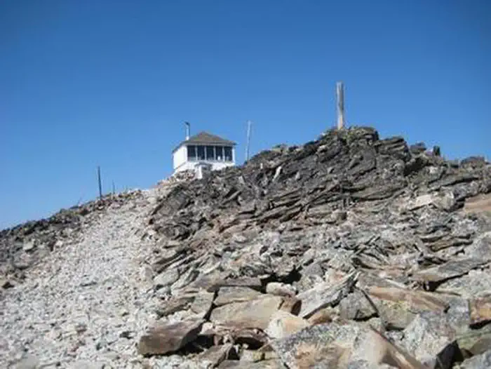
The 14-by-14' lookout is situated on a rocky knob with spectacular views of the surrounding area, including Lolo Peak, the Bitterroot Mountains and the Lolo Creek drainage. The lookout is close to the Montana-Idaho border and Lolo Pass.The surrounding forest is comprised primarily of lodgepole pine and larch. The area is home to elk, moose, deer and black bears.
The facts
- 1 bookable site
- Up to 4 people per site
- Loops: AREA WEST FORK BUTTE LOOKOUT
Site types
- 1 Cabin Nonelectric
1 campsite at West Fork Butte Lookout
Check-in 3:00 PM · Check-out 12:00 PM
| Site | Loop | Type | Entry | Surface | Max rig | People | |
|---|---|---|---|---|---|---|---|
| 001 | AREA WEST FORK BUTTE LOOKOUT | Cabin Nonelectric | — | Gravel | — | 4 |
Getting there
During the winter and early spring months the gate near the beginning of Forest Road 37 is closed and locked to provide skiing and snowmobiling opportunities and to protect roadbed surfaces during spring break-up conditions. When the gate is locked, visitors can park at the parking area below the gate, and follow the route via snowmobile, skis or foot 7.5 miles to the lookout. Maps are available online or for purchase by calling the Missoula Ranger District.
46.73361, -114.40028 · 46°44'1.0"N 114°24'1.0"W
Typical weather
| Jan | Feb | Mar | Apr | May | Jun | Jul | Aug | Sep | Oct | Nov | Dec | |
|---|---|---|---|---|---|---|---|---|---|---|---|---|
| High °F | — | — | — | — | — | — | — | — | — | — | — | — |
| Low °F | — | — | — | — | — | — | — | — | — | — | — | — |
| Precip in | 6.6 | 5.1 | 5.0 | 3.8 | 3.1 | 3.0 | 1.2 | 1.3 | 2.0 | 4.1 | 6.0 | 6.4 |
1991–2020 averages from the nearest NOAA station, 11.1 mi away — not measured at the facility itself, and elevation can make a real difference over that distance.
Map
More photos
Member photos
Common questions about West Fork Butte Lookout
- Can you reserve a site at West Fork Butte Lookout?
- Yes, West Fork Butte Lookout is reservable through Recreation.gov.
- How many campsites does West Fork Butte Lookout have?
- 1 site.
Camping near West Fork Butte Lookout
- Larry Creek Group Camp 16.5 mi · Campground · we watch it
- Pattee Canyon Picnic Area 18.3 mi · Campground · we watch it
- Powell Campground 21.4 mi · Campground · we watch it
- West Fork Butte Lookout 0.7 mi · Campground
- Lolo Creek Campground and Picnic Area 3 mi · Campground
- Lee Creek Campground 6.7 mi · Campground
- Lolo Pass Visitor Center 10.9 mi · Facility
- Charles Waters Campground 16.5 mi · Campground
- Devoto Grove Picnic Area & Trailhead 18.7 mi · Facility
- White Sands Campground 20.7 mi · Campground
- Colt Creek Trailhead 21.8 mi · Facility
- Clearwater Crossing Campground 22.6 mi · Campground
Contact
- Phone 406-329-3814
- Book Recreation.gov
Recreation.gov last updated this record on 2026-02-25.
Facility information and photographs from Recreation.gov (RIDB). SpotOpened is not affiliated with Recreation.gov or any federal agency.
Comments