Long Branch Campground
Campground · Mississippi · 13 bookable sites ·
Managed by the US Army Corps of Engineers
- 13
- Bookable sites
- up to 8
- People per site
- 288 ft
- Elevation
Overview
Long Branch Campgroundis located on the south side of Enid Lake. This campground is designed for individuals to camp without utilities. The campground features fourteen campsites with no hook-ups. A comfort station, playground, five picnic sites, a beach and a boat ramp are located in this area. This area is popular among individuals that enjoy a quite camping experience. It is a quiet, family oriented campground situated along the banks of Enid Lake in forests of northern Mississippi.
Recreation
Enid Lake offers access to the lake for boating, fishing, and designated swimming areas.
Enid Lake has been recognized as one of America's Top 10 Fishing Spots, with white crappie, bass and catfish available in abundance. The lake is the home of the world record white crappie, which weighed an impressive 5 pounds, 3 ounces. Fishing tournaments are held annually at the lake.
Boating is a popular pastime on the lake, and boat ramp is provided at the campground.
Facilities
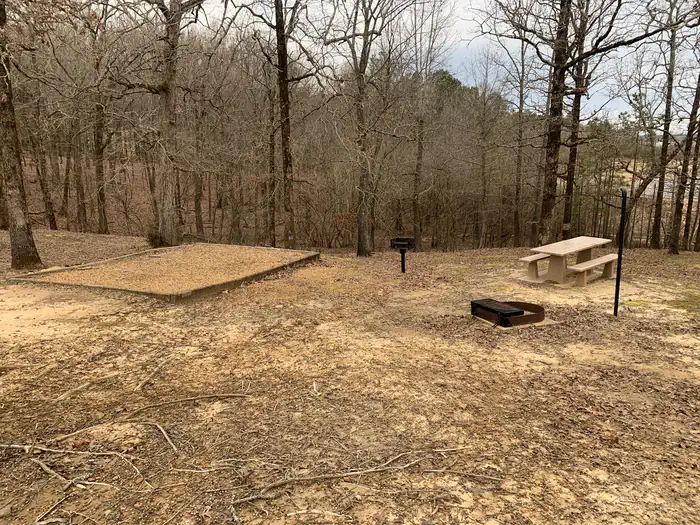
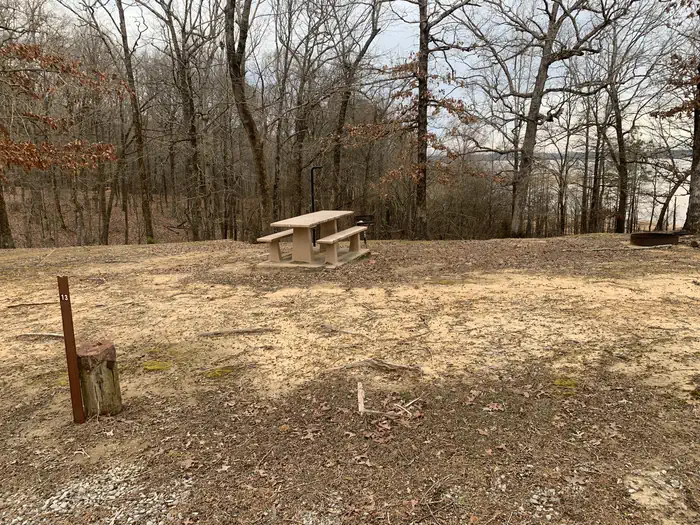
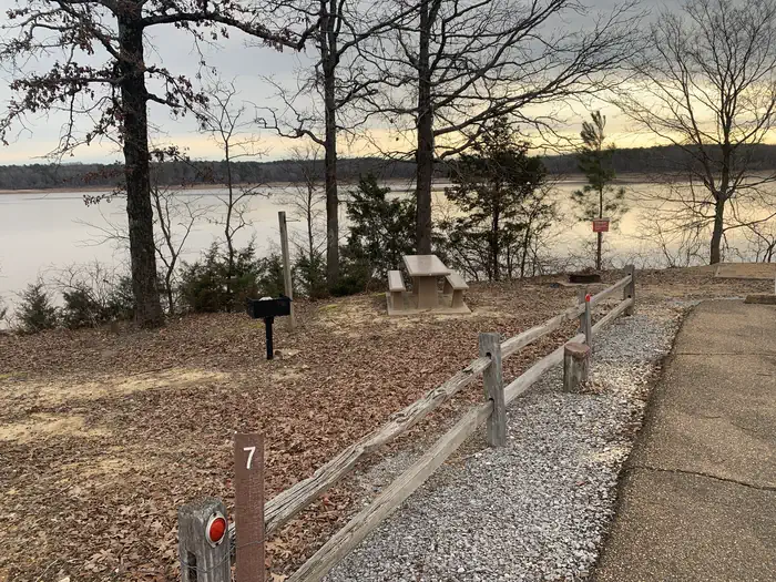
This family friendly campground has 14 campsites, each with charcoal grill, picnic table, lantern holder, and fire ring. An accessible comfort station with flush toilets is located in the middle of the campground. Other amenities in the campground include: playground, beach and boat ramp.
Natural Features
Enid Lake is part of a dam project on the Yocona River. The dam creates almost 16,000 acres of water for millions of annual visitors to enjoy. An additional 44,000 acres of thick, green forests surrounding the lake offer countless recreational opportunities for campers, equestrians, hikers and more. Some sites ofter a view of the lake. The surrounding woods provide habitat for squirrels, raccoons, chipmunks, deer, butterflies, and variety of birds.
Contact Info
For facility specific information, please call (662) 563-4571.Nearby Attractions
The nearby towns of Water Valley and Batesville, Mississippi offers shopping, hotels, restaurants and emergency care facilities if needed. Memphis, Tennessee, approximately 60 miles, offers tours of Graceland, Elvis Presley home. His birthplace is located in nearby Tupelo, Mississippi.
The facts
- 13 bookable sites
- Up to 8 people per site
- Loops: Main Loop
Site types
- 13 Tent Only Nonelectric
Amenities
- Campfires allowed
- Fire pits
- Picnic tables
- Grills
- Shade
- Pets allowed
Not recorded upstream: electric hookups, water hookups, sewer hookups.
13 campsites at Long Branch Campground
Check-in 4:00 PM · Check-out 2:00 PM
| Site | Loop | Type | Entry | Surface | Max rig | People | |
|---|---|---|---|---|---|---|---|
| 1 | Main Loop | Tent Only Nonelectric | — | — | — | 8 | 🐾 |
| 10 | Main Loop | Tent Only Nonelectric | — | — | — | 8 | 🐾 |
| 11 | Main Loop | Tent Only Nonelectric | — | — | — | 8 | 🐾 |
| 12 | Main Loop | Tent Only Nonelectric | — | — | — | 8 | 🐾 |
| 13 | Main Loop | Tent Only Nonelectric | — | — | — | 8 | 🐾 |
| 2 | Main Loop | Tent Only Nonelectric | — | — | — | 8 | 🐾 |
| 3 | Main Loop | Tent Only Nonelectric | — | — | — | 8 | 🐾 |
| 4 | Main Loop | Tent Only Nonelectric | — | — | — | 8 | 🐾 |
| 5 | Main Loop | Tent Only Nonelectric | — | — | — | 8 | 🐾 |
| 6 | Main Loop | Tent Only Nonelectric | — | — | — | 8 | 🐾 |
| 7 | Main Loop | Tent Only Nonelectric | — | — | — | 8 | 🐾 |
| 8 | Main Loop | Tent Only Nonelectric | — | — | — | 8 | 🐾 |
| 9 | Main Loop | Tent Only Nonelectric | — | — | — | 8 | 🐾 |
Getting there
Take Exit 227 off of U.S. Interstate 55 Highway toward Water Valley, MS. Go east on Mississippi Highway 32 for 3.5 miles. Turn left onto County Road 26 in Long Branch Recreation Area.
34.12656, -89.84447 · 34°7'35.6"N 89°50'40.1"W
Typical weather
| Jan | Feb | Mar | Apr | May | Jun | Jul | Aug | Sep | Oct | Nov | Dec | |
|---|---|---|---|---|---|---|---|---|---|---|---|---|
| High °F | — | — | — | — | — | — | — | — | — | — | — | — |
| Low °F | — | — | — | — | — | — | — | — | — | — | — | — |
| Precip in | 4.9 | 5.4 | 5.1 | 5.8 | 4.9 | 4.4 | 4.2 | 3.1 | 3.3 | 4.0 | 4.3 | 6.0 |
1991–2020 averages from the nearest NOAA station, 4 mi away — not measured at the facility itself, and elevation can make a real difference over that distance.
Map
More photos
Member photos
Common questions about Long Branch Campground
- Can you reserve a site at Long Branch Campground?
- Yes, Long Branch Campground is reservable through Recreation.gov.
- How many campsites does Long Branch Campground have?
- 13 sites.
- Are pets allowed at Long Branch Campground?
- Yes, pets are allowed at Long Branch Campground.
- Are campfires allowed at Long Branch Campground?
- Campfires are allowed at Long Branch Campground. Check for a current fire restriction before you go.
Camping near Long Branch Campground
- Plum Point Campground 2.4 mi · Campground · we watch it
- Persimmon Hill(enid Lake) 2.5 mi · Campground · we watch it
- Chickasaw Hill Day Use Area 2.8 mi · Campground · we watch it
- Chickasaw Hill 2.9 mi · Campground · we watch it
- Ford's Well Day Use Area 3.2 mi · Campground · we watch it
- Persimmon Hill Day Use Area 3.4 mi · Campground · we watch it
- Wallace Creek Day Use Area 3.5 mi · Campground · we watch it
- Wallace Creek 3.6 mi · Campground · we watch it
- Hickory Ridge 3.8 mi · Campground · we watch it
- McCurdy Point 3.9 mi · Campground · we watch it
- Riverview 4 mi · Campground · we watch it
- Outlet Channel (Enid Lake) 4.1 mi · Campground · we watch it
Contact
- Book Recreation.gov
Recreation.gov last updated this record on 2026-03-11.
Facility information and photographs from Recreation.gov (RIDB). SpotOpened is not affiliated with Recreation.gov or any federal agency.
Comments