Ford's Well Day Use Area
Campground · Mississippi · 1 bookable site ·
Managed by the US Army Corps of Engineers
- 1
- Bookable site
- up to 150
- People per site
- 268 ft
- Elevation
Overview
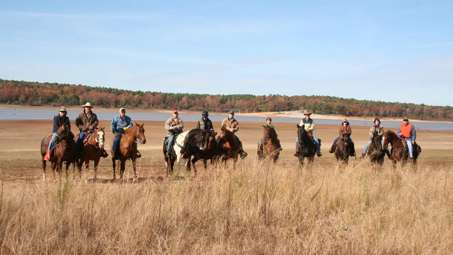
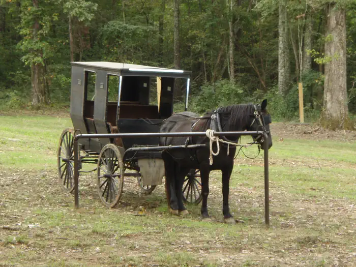
Ford's Well Recreation Area is located on the south side of Enid Lake. This recreation area is designed for horse enthusiasts to be able to camp with their horses and to ride a 20.8 mile horse trail. The campground features eighteen campsites with full hook-ups, a shower house, dump station, picnic shelter, playground, six picnic sites, five interpretive buildings that date back to the early 1900s, and a 20.8 mile equestrian trail. The Ford's Well Recreation Area is a point of historical significance as an early 1900s site where many visitors came to either drink or bathe in the therapeutic waters that were produced by Mr. W. B. Ford's water well. It was also a way station for a major stage coach route through North Mississippi. This area is popular among equestrian riders and historians.
Recreation
Spyglass Hill Trail offers outdoor enthusiasts 20.8 miles of moderately hilly terrain with rock outcrops and scenic views of Enid Lake. Interpretive programs and guided tours of the buildings are provide on request. Nearby recreation areas on Enid Lake offers access to the lake for boating, fishing, and designated swimming areas.
Facilities
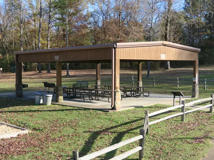
The horse-friendly campground has 18 sites, each with a 70 foot RV pad with parking apron, water, electric and sewage hook-ups, charcoal grill, grill table, picnic table, lantern holder, fire ring, and hitching rail for horses. An accessible shower house with flush toilets is located in the middle of the campground. Other amenities in the campground include: A picnic shelter, playground, dump station, horse shower station, horse waste deposit bin, mounting block, and historical interpretive buildings that includes: a water well with gazebo, log cabin, blacksmith shop, outhouse, and barn are located in the campground. Spyglass Hill equestrian trail offers 20.8 miles to ride or walk. Rest stops along the trail includes picnic tables, grills, service tables, swing bench and a prominent peak to provide a view of the lake.
Natural Features
There is a distance view of the lake from campsites but they are nestled among towering native pine and oak trees. The surrounding woods provide habitat for squirrels, raccoons, chipmunks, deer, butterflies, and variety of birds. Spyglass Hill Trail offers outdoor enthusiasts 20.8 miles of moderately hilly terrain with rock outcrops and scenic views of Enid Lake. Visitors hiking, horseback riding, or mountain biking along this trail will find numerous locations for viewing the local plants and animal species found in this northern Mississippi Hill County. It a perfect location for capturing a sunset or a rock sculpture made from some of the largest sandstone outcrops in the area.
Nearby Attractions
The nearby towns of Water Valley and Batesville, Mississippi offers shopping, hotels, restaurants and emergency care facilities if needed. Memphis, Tennessee, approximately 60 miles, offers tours of Graceland, Elvis Presley home. His birthplace is located in nearby Tupelo, Mississippi.
The facts
- 1 bookable site
- 1 site for day use only
- Up to 150 people per site
- Loops: Ford's Well
Site types
- 1 Group Shelter Electric
Amenities
- Picnic tables
- Grills
- Pets allowed
Not recorded upstream: electric hookups, water hookups, sewer hookups, campfires allowed, fire pits, shade.
1 campsite at Ford's Well Day Use Area
Check-in 8:00 AM · Check-out 10:00 PM
| Site | Loop | Type | Entry | Surface | Max rig | People | |
|---|---|---|---|---|---|---|---|
| Picnic Shelter 665 | Ford's Well | Group Shelter Electric | — | — | — | 150 | 🐾 |
Getting there
Take Exit 227 off of U.S. Interstate 55 Highway toward Water Valley, MS. Go east on Mississippi Highway 32 for 6.9 miles. Turn left onto County Road 41 which will turn into County Road 557 for .8 miles and the destination is on the right.
34.12831, -89.78849 · 34°7'41.9"N 89°47'18.6"W
Typical weather
| Jan | Feb | Mar | Apr | May | Jun | Jul | Aug | Sep | Oct | Nov | Dec | |
|---|---|---|---|---|---|---|---|---|---|---|---|---|
| High °F | — | — | — | — | — | — | — | — | — | — | — | — |
| Low °F | — | — | — | — | — | — | — | — | — | — | — | — |
| Precip in | 4.9 | 5.4 | 5.1 | 5.8 | 4.9 | 4.4 | 4.2 | 3.1 | 3.3 | 4.0 | 4.3 | 6.0 |
1991–2020 averages from the nearest NOAA station, 6.9 mi away — not measured at the facility itself, and elevation can make a real difference over that distance.
Map
Fees and stay limits
Picnic shelter - $50.00/day
From Recreation.gov, which is not always current. The operator's own page is the authority on what you will be charged.
More photos
Member photos
Common questions about Ford's Well Day Use Area
- Can you reserve a site at Ford's Well Day Use Area?
- Yes, Ford's Well Day Use Area is reservable through Recreation.gov.
- How many campsites does Ford's Well Day Use Area have?
- 1 site.
- Are pets allowed at Ford's Well Day Use Area?
- Yes, pets are allowed at Ford's Well Day Use Area.
Camping near Ford's Well Day Use Area
- Water Valley Landing Day Use Area 1.7 mi · Campground · we watch it
- Water Valley Landing 1.7 mi · Campground · we watch it
- Chickasaw Hill 3.1 mi · Campground · we watch it
- Long Branch Campground 3.2 mi · Campground · we watch it
- Chickasaw Hill Day Use Area 3.3 mi · Campground · we watch it
- Plum Point Campground 4.4 mi · Campground · we watch it
- Persimmon Hill(enid Lake) 5.6 mi · Campground · we watch it
- Wallace Creek Day Use Area 6.1 mi · Campground · we watch it
- Wallace Creek 6.3 mi · Campground · we watch it
- Hickory Ridge 6.5 mi · Campground · we watch it
- Persimmon Hill Day Use Area 6.6 mi · Campground · we watch it
- McCurdy Point 6.7 mi · Campground · we watch it
Contact
- Phone 662-563-4571
- Email enid.lake@usace.army.mil
- Book Recreation.gov
Recreation.gov last updated this record on 2026-03-11.
Facility information and photographs from Recreation.gov (RIDB). SpotOpened is not affiliated with Recreation.gov or any federal agency.
Comments