John Spalding Rec Ar
Campground · Missouri · 3 bookable sites ·
Managed by the US Army Corps of Engineers
- 3
- Bookable sites
- up to 100
- People per site
- 3
- Accessible sites
- 663 ft
- Elevation
Overview
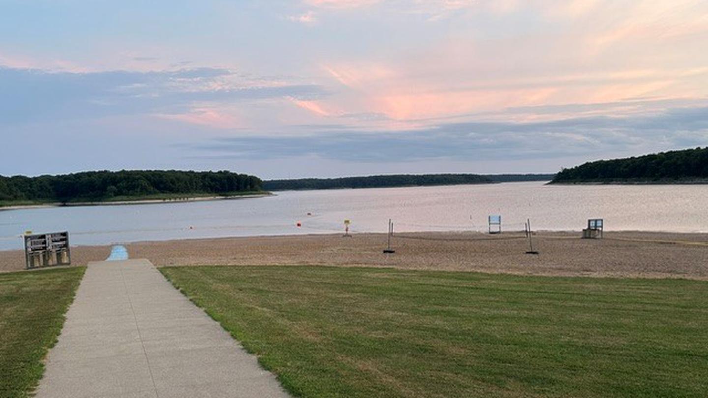
Visitors at John Spalding are in the perfect location for recreation on Mark Twain Lake. The day-use area is the only facility within reach of the sandy public beach. It's also directly connected to the Joanna Trail, a 32-mile multi-purpose trail for hiking, mountain biking and horseback riding.Tour the birthplace of world-famous humorist and writer, Mark Twain and explore the region that inspired his most beloved stories, such as "The Adventures of Tom Sawyer."
Recreation
Swim and enjoy the beach all day, or take a boat out for water skiing and fishing. For hikers and bikers, the lengthy Joanna Trail lines the northern banks of the lake.Facilities
The day-use area is equipped with a swimming beach, showers and picnic shelters. Shelters have electric hookups.Natural Features
The Salt River of north-central Missouri feeds Mark Twain Lake, the regions largest body of water, spanning 18,000 acres. A variety of recreation areas surround the lake, including the Mark Twain State Park.Nearby Attractions
Visit Mark Twain's birthplace in Florida, Missouri or his boyhood home in Hannibal.The David C. Berti Shooting Range is below the dam and M.W. Boudreaux Visitor Center is above the dam.
The facts
- 3 bookable sites
- 3 sites for day use only
- 3 accessible sites
- Up to 100 people per site
- Loops: JOHN SPALDING REC AR
Site types
- 3 Group Shelter Electric
Amenities
- Electric hookups
- Fire pits
- Picnic tables
- Grills
- Shade
- Pets allowed
Not recorded upstream: water hookups, sewer hookups, campfires allowed.
3 campsites at John Spalding Rec Ar
Check-in 8:00 AM · Check-out 10:00 PM
| Site | Loop | Type | Entry | Surface | Max rig | People | |
|---|---|---|---|---|---|---|---|
| 1 | JOHN SPALDING REC AR | Group Shelter Electric | — | Paved | — | 100 | ♿ 🐾 |
| 2 | JOHN SPALDING REC AR | Group Shelter Electric | — | Paved | — | 100 | ♿ 🐾 |
| 3 | JOHN SPALDING REC AR | Group Shelter Electric | — | Paved | — | 100 | ♿ 🐾 |
Getting there
From Hannibal, MO, travel west on Highway 36 for 17 miles. Turn south on Route
J, and travel 6 miles. Turn west on Oakland Drive and travel for 2 miles.
39.55417, -91.65889 · 39°33'15.0"N 91°39'32.0"W
Typical weather
| Jan | Feb | Mar | Apr | May | Jun | Jul | Aug | Sep | Oct | Nov | Dec | |
|---|---|---|---|---|---|---|---|---|---|---|---|---|
| High °F | — | — | — | — | — | — | — | — | — | — | — | — |
| Low °F | — | — | — | — | — | — | — | — | — | — | — | — |
| Precip in | 1.9 | 2.1 | 2.7 | 4.3 | 5.1 | 4.9 | 4.4 | 4.0 | 4.0 | 3.5 | 2.6 | 2.0 |
1991–2020 averages from the nearest NOAA station, 1.6 mi away — not measured at the facility itself, and elevation can make a real difference over that distance.
Map
More photos

Member photos
Common questions about John Spalding Rec Ar
- Can you reserve a site at John Spalding Rec Ar?
- Yes, John Spalding Rec Ar is reservable through Recreation.gov.
- How many campsites does John Spalding Rec Ar have?
- 3 sites.
- Are pets allowed at John Spalding Rec Ar?
- Yes, pets are allowed at John Spalding Rec Ar.
- Does John Spalding Rec Ar have hookups?
- Electric.
Camping near John Spalding Rec Ar
- Frank Russell 1.4 mi · Campground · we watch it
- John C. Briscoe Group Use 2.5 mi · Campground · we watch it
- Ray Behrens 2.7 mi · Campground · we watch it
- Indian Creek (Mo) 4.1 mi · Campground · we watch it
- Bluffview (Mark Twain Lake) 4.8 mi · Campground · we watch it
- Dry Fork Recreation Area 58.8 mi · Campground
Contact
- Phone 573-735-4097
- Email marktwaininfo@usace.army.mil
- Book Recreation.gov
Recreation.gov last updated this record on 2026-02-25.
Facility information and photographs from Recreation.gov (RIDB). SpotOpened is not affiliated with Recreation.gov or any federal agency.
Comments